Burnham Market

Last updated

Burnham Market
St Mary, Burnham Market, Norfolk - geograph.org.uk - 321235.jpg
St Mary's parish church
Norfolk UK location map.svg
Red pog.svg
Burnham Market
Location within Norfolk
Area18.43 km2 (7.12 sq mi)
Population877 (2011 Census)
  Density 48/km2 (120/sq mi)
OS grid reference TF834422
Civil parish
  • Burnham Market
District
Shire county
Region
Country England
Sovereign state United Kingdom
Post town King's Lynn
Postcode district PE31
Dialling code 01328
Police Norfolk
Fire Norfolk
Ambulance East of England
UK Parliament
List of places
UK
England
Norfolk
52°56′45″N0°43′41″E / 52.94584°N 0.72815°E / 52.94584; 0.72815
The village green Burnham Market 1.jpg
The village green
The Hoste Arms Burnham Market 2.jpg
The Hoste Arms

Burnham Market is an English village and civil parish near the north coast of Norfolk. It is one of the Burnhams, a group of three adjacent villages that were merged: Burnham Sutton, Burnham Ulph and Burnham Westgate. In 2022, Burnham Market was rated among the "20 most beautiful villages in the UK and Ireland" by Condé Nast Traveler in 2020. [1]

Contents

Geography

According to the 2011 census, Burnham Market had a population of 877 people, [2] which fell to 724 people by the 2021 census. [3]

The parish belongs to the district of King's Lynn and West Norfolk. [4]

History

Burnham Market in the district of King's Lynn and West Norfolk Burnham Market, Norfolk.jpg
Burnham Market in the district of King's Lynn and West Norfolk

Burnham Market's name is of Anglo-Saxon origin and derives from the Old English for settlement on the River Burn where there is a market. [5]

A map of Burnham from 1946 Burnham marketmap 1946.png
A map of Burnham from 1946

In 1952, the West Norfolk Junction Railway, which ran through the village, was closed. This railway had linked with Holkham, Wells-next-the-Sea, Hunstanton and Kings Lynn. The station still stands on the road to North Creake.

St Henry Walpole Catholic Church, Burnham Market in the Diocese of East Anglia St Henry Walpole Catholic Church, Burnham Market.jpg
St Henry Walpole Catholic Church, Burnham Market in the Diocese of East Anglia
Burnham Market Burnham Market.jpg
Burnham Market

Burnham Westgate Hall is a Grade II listed country house built in the 1780s by Sir John Soane for Thomas Pitt, 1st Baron Camelford. The Hall was built on the existing Polstede Hall, which had been built in the 1750s by Matthew Brettingham for Pinckney Wilkinson MP. [6]

In 1933, the Hall passed to the Royal British Legion and after the Second World War it was used as an old people's home. From 1990 onwards, it has become the private residence of Baroness Rawlings. [7]

Churches

Burnham Market is home to several churches.

St. Mary's Church is of Norman origin and is dedicated to Mary, mother of Jesus. St. Mary's was significantly remodelled in the 14th, 15th and 19th centuries and is currently a listed building. The church bells date to the 17th century. [8]

All Saints' Church is of Norman origin and was heavily remodelled in the 14th century, with further minor alterations in the 19th century. [9]

St. Henry Walpole Catholic Church, Burnham Market's Catholic Church, was constructed in 1959 and is dedicated to Saint Henry Walpole, an Elizabethan Catholic martyr. [10] The church conducts weekly Mass on a Friday and Sunday. [11]

Notable residents

Related Research Articles

<span class="mw-page-title-main">King's Lynn and West Norfolk</span> Borough and non-metropolitan district in England

King's Lynn and West Norfolk is a local government district with borough status in Norfolk, England. Its council is based in the town of King's Lynn. The district also includes the towns of Downham Market and Hunstanton, along with numerous villages and surrounding rural areas. The population of the district at the 2021 census was 154,325.

<span class="mw-page-title-main">Diss, Norfolk</span> English town in Norfolk

Diss is a market town and electoral ward in South Norfolk, England, near the boundary with Suffolk, with a population of 7,572 in 2011. Diss railway station is on the Great Eastern Main Line between London and Norwich. It lies in the valley of the River Waveney, round a mere covering 6 acres (2.4 ha) and up to 18 feet (5.5 m) deep, although there is another 51 feet (16 m) of mud.

The Norfolk Burnhams are a group of adjacent villages on the north coast of Norfolk, England. The villages are located near a large natural bay named Brancaster Bay and the Scolt Head Island National Nature Reserve.

<span class="mw-page-title-main">Docking, Norfolk</span> Human settlement in England

Docking is a village and ancient civil parish in the King's Lynn and West Norfolk borough of Norfolk, England. It is near the North Norfolk Coast Site of Special Scientific Interest.

<span class="mw-page-title-main">Ashby St Mary</span> Human settlement in England

Ashby St Mary, historically Ascebei, is a small village and civil parish in the English county of Norfolk. The civil parish has an area of 2.03 square kilometres (0.78 sq mi) and in the 2001 census had a population of 297 in 115 households, the population increasing to 316 in 120 households at the 2011 Census. For the purposes of local government, the parish falls within the district of South Norfolk.

<span class="mw-page-title-main">Field Dalling</span> Human settlement in England

Field Dalling is a village and civil parish in the English county of Norfolk. The village is located 4.5 miles (7.2 km) west of Holt and 23 miles (37 km) north-west of Norwich.

<span class="mw-page-title-main">Fincham</span> Human settlement in England

Fincham is a village and civil parish in the English county of Norfolk. The village is located 9.4 miles (15.1 km) south of King's Lynn and 34 miles (55 km) west of Norwich, along the A1122 between Outwell and Swaffham.

<span class="mw-page-title-main">Burnham Deepdale</span> Human settlement in England

Burnham Deepdale is a village and former civil parish, now in the parish of Brancaster, in the King's Lynn and West Norfolk district, on the north coast of the county of Norfolk, England. Burnham Deepdale, Brancaster and Brancaster Staithe form a more or less continuous settlement along the A149, at the edge of the Brancaster Manor marshland and the Scolt Head Island National Nature Reserve. In 1931 the parish had a population of 81.

<span class="mw-page-title-main">Erpingham</span> Village in Norfolk, England

Erpingham is a village and civil parish in the English county of Norfolk. The village is located 3.1 miles (5.0 km) north of Aylsham and 15 miles (24 km) north of Norwich, along the Scarrow Beck. In 1935, Erpingham parish was merged with Calthorpe to form the parish of Erpingham with Calthorpe.

<span class="mw-page-title-main">Castle Acre</span> Human settlement in England

Castle Acre is a village and civil parish in the English county of Norfolk. The village is situated on the River Nar some 4 miles (6.4 km) north of the town of Swaffham. It is 15 miles (24 km) east of the town of King's Lynn, 33 miles (53 km) west of the city of Norwich, and 103 miles (166 km) from London.

<span class="mw-page-title-main">Feltwell</span> Human settlement in England

Feltwell is a village and civil parish in the English county of Norfolk. The village is located 11 miles (18 km) north-west of Thetford and 34 miles (55 km) south-west of Norwich.

Patricia Elizabeth Rawlings, Baroness Rawlings is a Conservative Party politician and former frontbencher in the House of Lords. She was also a Member of the European Parliament (MEP) from 1989 to 1994. She was Chairman of King's College London Council from 1998 to 2007, and was made a Fellow of King's College (FKC) in 2003. She was President of the National Council for Voluntary Organisations from 2002 to 2007, and President of the British Antique Dealers' Association 2005–2013. She is also a trustee of the Chevening Estate.

<span class="mw-page-title-main">East Walton</span> Human settlement in England

East Walton is a village in the English county of Norfolk. The village is located 7.8 miles (12.6 km) south-east of King's Lynn and 31 miles (50 km) north-west of Norwich. East Walton constitutes part of the civil parish of West Acre.

<span class="mw-page-title-main">Hevingham</span> Human settlement in England

Hevingham is a village and civil parish in the Broadland district of the English county of Norfolk. Situated between the A140 road Norwich to Cromer road and the B1149 road Norwich to Holt road. It is 7 miles (11 km) north from the city of Norwich and 4 miles (6.4 km) south from the market town of Aylsham.

<span class="mw-page-title-main">Wacton, Norfolk</span> Human settlement in England

Wacton is a village in the English county of Norfolk. It is located about one mile south-west of Long Stratton and 13 miles (21 km) south west of Norwich. It covers an area of 4.54 km2 (1.75 sq mi) and has a population of 343 people as of the last census in 2021.

<span class="mw-page-title-main">Roman Catholic Diocese of East Anglia</span> Catholic diocese in England

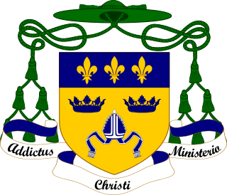
The Diocese of East Anglia is a Latin diocese of the Catholic Church covering the counties of Cambridgeshire, Norfolk, Suffolk, and Peterborough in eastern England. The diocese makes up part of the Catholic Association Pilgrimage.

<span class="mw-page-title-main">Elsing</span> Human settlement in England

Elsing is a village and civil parish in the English county of Norfolk. The village is located 4.2 miles (6.8 km) north-east of Dereham and 12 miles (19 km) north-west of Norwich, close to the River Wensum.

<span class="mw-page-title-main">Felthorpe</span> Human settlement in England

Felthorpe is a village and civil parish in the English county of Norfolk. The village is located 11 miles (18 km) east of Dereham and 7.1 miles (11.4 km) north-west of Norwich.

<span class="mw-page-title-main">Sir Mordaunt Martin, 4th Baronet</span>

Sir Mordaunt Martin, 4th Baronet was son of Sir Roger Martin, 3rd Baronet and Sophia Mordaunt. He inherited his baronetcy from his father, who was the third Martin Baronet, upon his death in 1762. He lived in Burnham Market in Norfolk

<span class="mw-page-title-main">Burnham Westgate Hall</span> Country house in Norfolk, England

Burnham Westgate Hall is a Georgian country house near Burnham Market, Norfolk, about 2 mi (3.2 km) south of the north Norfolk coast. It was remodelled in Palladian style in the 1780s by John Soane: it was Soane's first substantial country house commission, immediately before he started Letton Hall in 1784.

References

  1. "The 20 most beautiful villages in the UK and Ireland". CN Traveller. 20 October 2020. Retrieved 11 January 2024.
  2. City Population. (2022). Retrieved November 14, 2022. https://www.citypopulation.de/en/uk/eastofengland/norfolk/E34001083__burnham_market/
  3. Ibid
  4. Office for National Statistics & Norfolk County Council (2001) Census population and household counts for unparished urban areas and all parishes. Retrieved 18 October 2005.
  5. "Key to English Place-names". kepn.nottingham.ac.uk. Retrieved 8 May 2024.
  6. Zoopla. (2022). Retrieved November 14, 2022. http://content.zoopla.co.uk/8d868de37420be36aa190e87943429e002edea82.pdf
  7. "An exceptional country estate in Norfolk". Country Life. 2 June 2011. Retrieved 8 May 2024.
  8. "St-Mary's-Church-Burnham-Westgate - Norfolk Heritage Explorer". www.heritage.norfolk.gov.uk. Retrieved 8 May 2024.
  9. "All-Saints'-Church-Burnham-Ulph - Norfolk Heritage Explorer". www.heritage.norfolk.gov.uk. Retrieved 8 May 2024.
  10. "Norfolk Churches". www.norfolkchurches.co.uk. Retrieved 8 May 2024.
  11. "St Henry Walpole - Burnham Market". Catholic Parish of Walsingham. Retrieved 8 May 2024.
  12. "Author: Anne Elliot". www.victorianresearch.org. Retrieved 8 May 2024.