California State Route 111

Last updated

California 111.svg

State Route 111

California State Route 111.svg
SR 111 highlighted in red, with relinquished portions in pink.
Route information
Maintained by Caltrans
Length130.175 mi [1]  (209.496 km)
SR 111 is broken into pieces, and the length does not reflect the SR 86 overlap that would be required to make the route continuous. Portions of SR 111 have been relinquished to or are otherwise maintained by local or other governments, and are not included in the length.
Major junctions
South endImperial Avenue and 1st Street in Calexico, east of the 2018 upgraded Calexico West Port of Entry
Major intersections
North endI-10 (1961).svg I-10 near Palm Springs
Location
Country United States
State California
Counties Imperial, Riverside
Highway system
California 110.svg SR 110 California 112.svg SR 112

State Route 111 (SR 111) is a state highway in the U.S. state of California. It is the main north-south route and retail corridor through the Coachella Valley, a part of the Colorado Desert in the southeastern corner of the state and a famous resort destination. It also runs through the Imperial Valley, and along the eastern shore of the Salton Sea. Its southern terminus is at Imperial Avenue and 1st Street in Calexico, at the former entrance to the Calexico West Port of Entry (the state has not yet officially rerouted the highway to the current entrance to the Mexican border at 2nd Street and Cesar Chavez Boulevard since its opening in 2018). SR 111's northern terminus is at Interstate 10 at the northwestern corner of the Palm Springs city limits, near the unincorporated community of Whitewater.

Contents

Route description

SR 111 north in Niland CA 111 north Niland.jpg
SR 111 north in Niland

The highway begins near the Calexico West Port of Entry, where Calexico connects with the Mexican city Mexicali. Prior to the port of entry's 2018 realignment, SR 111 directly connected to the border crossing, with northbound traffic entering from Mexican side of the border via Avenida Cristóbal Colón, and southbound traffic exiting onto Mexican Federal Highway 5. Since then, traffic heading to the border diverts from SR 111 onto westbound East Second Street to the port of entry's new facilities at Cesar Chavez Boulevard. [2] The segment of the highway from East Second Street south to the site of the former border crossing at East First Street remains under state control, pending any relinquishment by Caltrans.

SR 111 then intersects with SR 98 in Calexico before heading north to SR 86 in Heber. As SR 111 continues further north through Imperial County, it enters El Centro. There, it intersects with Interstate 8 (I-8), which runs east to Yuma and west to San Diego, before passing through the agricultural communities of Holtville, Brawley, Calipatria and Niland.

A nearly 40-mile (64 km) length of the highway dotted with date and citrus groves follows both the old Southern Pacific "Sunset Route" (now the main Union Pacific line between Los Angeles and Yuma, Arizona) and the eastern shore of the Salton Sea. Though some small settlements and a California state park line the shore, the area is eerily empty due to the sea's rapidly declining water quality. The small town of North Shore is all but abandoned as a tourist destination, though more than 3,400 residents were counted at the 2010 census.

SR 111 enters the southeast corner of the Coachella Valley as a two-lane highway. It used to run concurrently with SR 86 in Coachella, but SR 86 has since been moved to a newer expressway alignment. SR 111 continues northwest as a major arterial road, four lanes or wider, through Indio, La Quinta, Indian Wells, Palm Desert, Rancho Mirage, and Cathedral City. As it approaches this area, the northbound traffic is on Indian Canyon Drive, and the southbound is on Palm Canyon Drive. An alternate route runs on Gene Autry Trail while mainline SR 111 continues west on Vista Chino. Continuing west from Cathedral City, the highway enters Palm Springs, then swings north and then west to bypass downtown, while SR 111 Business passes through the congested downtown area. The highway transitions from an arterial road to a divided expressway as it exits Palm Springs just northwest of San Rafael Drive. It ends at an interchange with I-10 near the foot of San Jacinto Peak, just east of the San Gorgonio Pass.

SR 111 is part of the California Freeway and Expressway System [3] and the portions south of SR 78, and in the city of Indio are part of the National Highway System, [4] a network of highways that are considered essential to the country's economy, defense, and mobility by the Federal Highway Administration. [5] SR 111 is eligible to be included in the State Scenic Highway System, [6] but it is not officially designated as a scenic highway by the California Department of Transportation. [7]

History

SR 111 was first proposed in the early 1930s due to the area's growth bought on by the Southern Pacific Railroad.[ citation needed ]

A 1993 rerouting of the highway takes drivers away from the historic center of Palm Springs, but meets with its original alignment as Business Route 111 a few miles further south.

The northern terminus was so busy in the 1950s before the construction of the freeway that visitors returning home to Los Angeles might have waited as long as two hours to make the left turn on the two-lane road that was once multiplexed as US Highways 60, 70 and 99. [ citation needed ]

In 1995, Caltrans was allowed to relinquish any portion of Route 111 through a city for that city to maintain. The legislature opted to make the act an "urgency statute", effective immediately, so that the local governments could improve traffic bottlenecks along the route as soon as possible. [8] The legislative definition of the route was amended in 1996 to exclude the portions in Rancho Mirage and Cathedral City, which had both been relinquished. [9] Cathedral City completed a pedestrian-friendly redesign in 1998. [10] The stretch through Rancho Mirage, which the city still calls "Highway 111" regardless of the relinquishment, has the Coachella Valley's only synchronized traffic lights; they are set to 45 mph (70 km/h).

A 2003 law did not change the route, but clarified that the former highway through those cities could not be taken back by the state, and repealed the section added in 1995 allowing relinquishment to any city. [11] Subsequently, in 2005, the legislature allowed relinquishment within Indian Wells, Indio, and Palm Desert, subject to the same conditions, and to the condition that the cities must maintain signs for the route. [12] La Quinta was added to the list of eligible cities in 2007. [13] As of late 2007, none of these four cities have taken over maintenance of Route 111.[ citation needed ]

In November 2005, signs on Verbenia Avenue at the highway's northern terminus and along Interstate 10 were replaced to reflect the street's name change to "Haugen-Lehmann Way", honoring two Riverside County sheriff's deputies gunned down by a sniper on that street in 1997. [14] [15] [16]

In a similar move in December 2005, the stretch of SR 111 through La Quinta was named the "Deputy Bruce Lee Memorial Highway". Lee was a Riverside County deputy sheriff in the city for many years and was killed in 2003 during an altercation with a mentally disturbed suspect. The suspect was able to take Lee's baton during the altercation and used it to bludgeon the officer. [17]

In September 2019 Caltrans began a three-phase $19 [18] -21.5 [19] million mitigation project to protect SR-111 from a moving mud pot called the Niland Geyser, southeast of the Salton Sea near the junction with Davis and Gillespie Roads. [20] The plans included using steel walls to divert water into a gravel wash, digging drainage under the road to direct subsurface water to a wash west of the road, and building a five-mile [21] temporary road 50 feet to the west to divert around the geyser, with the original road being rebuilt once the geyser had passed. [20] [18] Work continued into 2021. [22]

After being Imperial Avenue in Calexico, the road is known as the Imperial Pioneers Expressway and the Victor Veysey Expressway in Imperial County. Several parts of the route are at or under sea level, similar to SR 86 outside of Brawley.

Major intersections

Except where prefixed with a letter, postmiles were measured on the road as it was in 1964, based on the alignment that existed at the time, and do not necessarily reflect current mileage. R reflects a realignment in the route since then, M indicates a second realignment, L refers to an overlap due to a correction or change, and T indicates postmiles classified as temporary (for a full list of prefixes, see California postmile § Official postmile definitions ). [1] Segments that remain unconstructed or have been relinquished to local control may be omitted. The numbers reset at county lines; the start and end postmiles in each county are given in the county column.

CountyLocationPostmile
[1] [23] [24]
DestinationsNotes
Imperial
IMP R0.00-65.40
Calexico R0.00Carretera federal 5.svg Fed. 5 south (Boulevard Adolfo López Mateos) Mexicali Former continuation beyond the Mexico–United States border; former border crossing, with its northbound entrance accessible from Avenida Cristóbal Colón
R0.01First StreetDe facto southern terminus following the 2018 closing of the former border crossing; no southbound access from Second Street
R0.20Second Street International border, Mexicali Serves the Calexico West Port of Entry since 2018
R1.18California 98.svg SR 98 (Birch Street) San Diego, Yuma
Heber R4.74North plate California.svg
California 86.svg
SR 86 north (Heber Road) Heber, El Centro
Former US 99 north
R7.71I-8 (1961).svg I-8  Yuma, San Diego, El Centro Cloverleaf interchange; I-8 exits 118A-B
CR S80 jct.svg CR S80 (Evan Hewes Highway) El Centro, Holtville Former US 80
CR S28 jct.svg CR S28 (Worthington Road) Imperial
CR S27 jct.svg CR S27 (Keystone Road)
Brawley 22.14
15.04 [N 1]
East plate California.svg
California 78.svg
SR 78 east / Main Street Holtville, Blythe
South end of SR 78 overlap; Main Street was former SR 78 east / SR 111 north
23.67West plate California.svg
California 78.svg
SR 78 west / Old Highway 111
Interchange; north end of SR 78 overlap; Old Highway 111 was former SR 111 south
CR S26 jct.svg CR S26 (Rutherford Road) Wiest Lake
29.40Two Rivers Rest AreaClosed permanently in September 2015
Calipatria 32.51California 115.svgCR S30 jct.svg SR 115  / CR S30 (Main Street) Holtville
Riverside
RIV 0.00-R63.38
Mecca 18.43To plate California.svg
California 86.svg
66th Avenue to SR 86
22.14California 86.svg SR 86 overpass; no direct access; north end of state maintenance
Thermal 24.51To plate California.svg
California 86.svg
Airport Boulevard to SR 86
Serves Jacqueline Cochran Regional Airport
CoachellaIndio lineEast plate California.svg
Business Loop 10 (CA).svg
To plate blue 1961.svg
I-10 (1961).svg
I-10 BL east (Dillon Road) to I-10  / Avenue 48 Blythe, Phoenix
South end of I-10 Bus. overlap; former US 60 east / US 70 east
Indio 28.53West plate California.svg
Business Loop 10 (CA).svg
I-10 BL west (Indio Boulevard)
North end of I-10 Bus. overlap; former US 99 north / SR 86 north
28.73To plate blue 1961.svg
I-10 (1961).svg
Golf Center Parkway to I-10
Palm Desert 39.57West plate California.svg
California 74.svg
SR 74 west (Palms to Palms Highway) / Monterey Avenue Hemet, San Diego
Cathedral City To plate blue 1961.svg
I-10 (1961).svg
Date Palm Drive to I-10
Cathedral CityPalm Springs line47.20South end of state maintenance
Palm Springs 47.80
T47.80
North plate California.svg
Business plate California.svg
California 111.svg
SR 111 Bus. north (Palm Canyon Drive)
T51.59To plate blue 1961.svg
I-10 (1961).svg
Gene Autry Trail to I-10
T53.94
53.82
South plate California.svg
Business plate California.svg
California 111.svg
SR 111 Bus. south (Palm Canyon Drive)
R63.38West plate blue 1961.svg
I-10 (1961).svg
I-10 west Los Angeles
Northern terminus; no access to I-10 east; former US 99; exit 111 on I-10
1.000 mi = 1.609 km; 1.000 km = 0.621 mi
  1. Indicates that the postmile represents the distance along SR 78 rather than SR 111.

Business plate California.svg

California 111.svg

State Route 111 Business

Location Palm Springs
Existed1993 [25] –present

State Route 111 Business (SR 111 Bus.) is a business route of SR 111 in Palm Springs. It follows the original routing of SR 111 through Palm Springs. The route is almost unsigned. There is only two business route signs on the southern and northern termini. [26] [27]

The sign at the southern terminus of SR 111 Bus. California State Route 111 Business sign.jpg
The sign at the southern terminus of SR 111 Bus.

Like many other business routes, it follows the original routing of the parent route. In 1993, SR 111 was rerouted out of Palm Springs and onto the current alignment. [25]

Except where prefixed with a letter, postmiles were measured on the road as it was in 1964, based on the alignment that existed at the time, and do not necessarily reflect current mileage. R reflects a realignment in the route since then, M indicates a second realignment, L refers to an overlap due to a correction or change, and T indicates postmiles classified as temporary (for a full list of prefixes, see California postmile § Official postmile definitions ). [1] Segments that remain unconstructed or have been relinquished to local control may be omitted. The entire route is in Palm Springs, Riverside County.

Postmile [28] DestinationsNotes
47.8California 111.svg SR 111 Calexico, Palm Springs Southern terminus
53.9California 111.svg SR 111 Calexico, Palm Springs Northern terminus
1.000 mi = 1.609 km; 1.000 km = 0.621 mi

See also

Related Research Articles

<span class="mw-page-title-main">California State Route 74</span> Highway in California

State Route 74, part of which forms the Palms to Pines Scenic Byway or Pines to Palms Highway, and the Ortega Highway, is a state highway in the U.S. state of California. It runs from Interstate 5 in San Juan Capistrano in Orange County to the city limits of Palm Desert in Riverside County. Stretching about 111 miles (179 km), it passes through several parks and National Forests between the Pacific coast and the Coachella Valley.

<span class="mw-page-title-main">California State Route 3</span> State highway in California, United States

State Route 3 is a state highway in the U.S. state of California that serves Trinity and Siskiyou counties. It runs from SR 36 north along the shore of Trinity Lake, Fort Jones and Etna. The route then approaches Yreka, intersecting with Interstate 5 (I-5), and turns east to Montague. The road was numbered SR 3 in 1964, and most of it has been part of the state highway system since 1933.

<span class="mw-page-title-main">California State Route 275</span> Highway in California

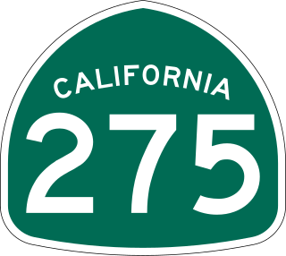
State Route 275 is an unsigned state highway connecting West Sacramento, California and Downtown Sacramento. Since 1996, the highway has been legally defined to be the length of the Tower Bridge crossing the Sacramento River. Prior to that year, SR 275 was also known as the West Sacramento Freeway, and was a short spur connecting Interstate 80 Business / U.S. Route 50 in West Sacramento, and the Tower Bridge. SR 275 also extended east into Sacramento along the Capitol Mall from the bridge to 9th Street, just west of the California State Capitol. West Sacramento completed a project to replace the freeway with a pedestrian-friendly street named Tower Bridge Gateway.

<span class="mw-page-title-main">California State Route 19</span> State highway in Los Angeles County, California, United States

State Route 19 is a state highway in the U.S. state of California, running along Lakewood Boulevard and Rosemead Boulevard in the Los Angeles area. An additional "hidden" state highway, State Route 164, is also signed as part of SR 19, despite having a legal description separate from Route 19. The combined route is a north–south four-to-six lane suburban roadway, lying east of the Long Beach Freeway and west of the San Gabriel River Freeway, and connecting the eastern parts of Long Beach and Pasadena via the Whittier Narrows. Under their legal descriptions, SR 19 runs north to Gallatin Road in Pico Rivera, then SR 164 goes from Gallatin Road to Pasadena. Since 1998, several pieces have been relinquished to local governments, and more transfers are authorized by state law.

<span class="mw-page-title-main">California State Route 66</span> Highway in California

State Route 66 is a state highway in the U.S. state of California that runs along a section of old U.S. Route 66 in Los Angeles and San Bernardino counties. It goes from State Route 210 in La Verne east to Interstate 215 in San Bernardino, passing through Claremont, Upland, Rancho Cucamonga, Fontana and Rialto along Foothill Boulevard. In San Bernardino, it is the part of Fifth Street west of H Street.

<span class="mw-page-title-main">California State Route 7</span> State highway in Imperial County, California, United States

State Route 7 is a state highway in the U.S. state of California, running from the Calexico East Port of Entry on the U.S.-Mexico border east of Calexico north to its terminus at Interstate 8 (I-8), where Orchard Road continues the route north towards Holtville. The route provides convenient access to the country of Mexico from I-8. The southern portion of the route opened in 1996, and the rest of the route connecting to I-8 opened in 2005.

<span class="mw-page-title-main">California State Route 142</span> Highway in California

State Route 142, also known as Carbon Canyon Road for most of its length, is a state highway in the U.S. state of California that connects Brea in Orange County with Chino Hills in San Bernardino County. The eastern portion of the route is known as Chino Hills Parkway.

<span class="mw-page-title-main">California State Route 34</span> Highway in California

State Route 34 is a state highway in the U.S. state of California. It runs through Ventura County from Rice Avenue in Oxnard to State Route 118 in Somis.

<span class="mw-page-title-main">California State Route 232</span> Highway in California

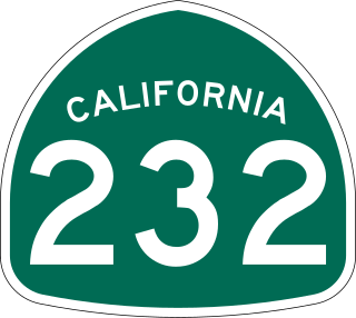
State Route 232 is a state highway in the U.S. state of California that runs along Vineyard Avenue in Ventura County, serving as a connector between US 101 in Oxnard and SR 118 near Saticoy.

<span class="mw-page-title-main">Topanga Canyon Boulevard</span> Highway in California

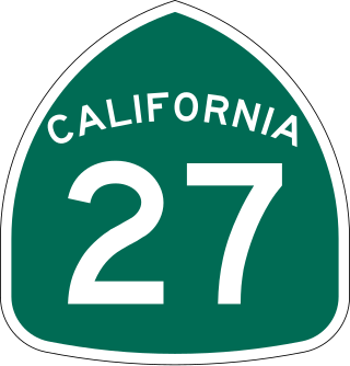
State Route 27, commonly known by its street name Topanga Canyon Boulevard, is a state highway in the U.S. state of California that runs from the Pacific Coast Highway at Topanga State Beach near Pacific Palisades, through the Topanga Canyon in Topanga, and continuing through Woodland Hills, Canoga Park, West Hills, and Chatsworth to the Ronald Reagan Freeway.

<span class="mw-page-title-main">California State Route 246</span> Highway in California

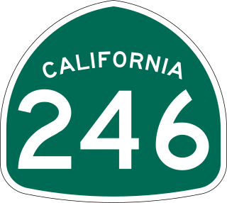
State Route 246 is a state highway in the U.S. state of California that runs from Lompoc east to Solvang and Santa Ynez, cutting through the Santa Ynez Valley and the Santa Barbara Wine Country. Its western terminus is at the western city limits of Lompoc, and its eastern terminus is at State Route 154 near Santa Ynez.

<span class="mw-page-title-main">California State Route 225</span> Highway in California

State Route 225 was a state highway in the U.S. state of California that was a loop route of U.S. Route 101 that served the beach areas of the Santa Barbara area. The route was originally defined in 1963. In 2014, control of the highway was transferred from the state to the city of Santa Barbara. As of 2023, however, the California State Legislature has neither deleted nor even amended the legal definition of SR 225 in the California Streets and Highways Code since 2011 when they authorized Caltrans to transfer control of the highway to the city.

<span class="mw-page-title-main">California State Route 371</span> State highway in Riverside County, California, United States

State Route 371 is a state highway in Riverside County, California, serving as a 20.75-mile (33.39 km) connector from SR 79 near Aguanga to SR 74 near Anza. The highway crosses through the private community of Lake Riverside, as well as Cahuilla and the Cahuilla Indian Reservation. It is the primary road running through Anza but mostly serves rural areas.

<span class="mw-page-title-main">California State Route 62</span> Highway in California

State Route 62 is a state highway in the U.S. state of California that cuts across the Little San Bernardino Mountains in Riverside and San Bernardino counties. It runs from Interstate 10 near Whitewater to the Arizona state line, passing through the city of Twentynine Palms and along the northern boundary of the Joshua Tree National Park.

<span class="mw-page-title-main">California State Route 177</span> Highway in California

State Route 177 is a state highway in the U.S. state of California in Riverside County. The route runs along Rice Road, linking Interstate 10 (I-10) midway between the Coachella Valley and Blythe on the California–Arizona border, to SR 62 near Rice. SR 177 travels along the eastern portion of the Joshua Tree National Park; like the eastern 100 miles (160 km) of SR 62, it passes through some of the most desolate areas of the Mojave Desert.

<span class="mw-page-title-main">California State Route 98</span> Highway in California

State Route 98 is a state highway in the U.S. state of California. It is a loop of Interstate 8 (I-8) running west to east south of the Interstate through the border city of Calexico. It passes through the city of Calexico and ends east of Holtville. The highway was added to the state highway system in 1933, and signed as Route 98 by 1938. The highway was paved and rerouted to its current path during the 1950s.

<span class="mw-page-title-main">California State Route 195</span> Highway in California

State Route 195 was a state highway in the U.S. state of California, branching westward from SR 111 to SR 86 near the town of Mecca and the Salton Sea. The route formerly extended east to Interstate 10 (I-10) near Joshua Tree National Park as a longer route extending to Blythe and points further east. After the main route was shifted north, the older route remained as an alternate known as Box Canyon Road. The route was designated in the 1964 state highway renumbering, although the Box Canyon Road portion was removed as a state highway in 1972. Following the construction of the SR 86 expressway, SR 195 was curtailed in 2009, and removed entirely in 2014.

<span class="mw-page-title-main">California State Route 115</span> Highway in California

State Route 115 is a state highway in the U.S. state of California. It runs in Imperial County from Interstate 8 (I-8) southeast of Holtville to SR 111 in Calipatria. The routing was added to the state highway system in 1933, and was constructed by 1934; SR 115 was officially designated in the 1964 state highway renumbering.

<span class="mw-page-title-main">California State Route 187</span> Highway in California

State Route 187 is a state highway in the U.S. state of California that runs along Venice Boulevard in Los Angeles from Lincoln Boulevard in Venice to Interstate 10 in the South Robertson district.

<span class="mw-page-title-main">U.S. Route 95 in California</span> Highway in California

U.S. Route 95 (US 95) is a United States Numbered Highway, stretching from the Mexican border in San Luis, Arizona to the Canadian border near Eastport, Idaho. The California portion of US 95 traverses through the far eastern edges of both Riverside and San Bernardino counties. US 95 serves Blythe and Needles and junctions with SR 62 at Vidal Junction.

References

  1. 1 2 3 4 California Department of Transportation. "State Truck Route List". Sacramento: California Department of Transportation. Archived from the original (XLS file) on June 30, 2015. Retrieved June 30, 2015.
  2. Calexico West Land Port Of Entry Opening Day (CWLPOE 07 10 2018). Darco Productions. Retrieved June 5, 2022 via YouTube.
  3. "Article 2 of Chapter 2 of Division 1". California Streets and Highways Code. Sacramento: California Office of Legislative Counsel. Retrieved February 6, 2019.
  4. Federal Highway Administration (March 25, 2015). National Highway System: Indio–Cathedral City, CA (PDF) (Map). Scale not given. Washington, DC: Federal Highway Administration. Retrieved October 1, 2017.
    Federal Highway Administration (March 25, 2015). National Highway System: California (South) (PDF) (Map). Scale not given. Washington, DC: Federal Highway Administration. Retrieved September 30, 2017.
  5. Natzke, Stefan; Neathery, Mike & Adderly, Kevin (June 20, 2012). "What is the National Highway System?". National Highway System. Washington, DC: Federal Highway Administration. Retrieved July 1, 2012.
  6. "Article 2.5 of Chapter 2 of Division 1". California Streets & Highways Code. Sacramento: California Office of Legislative Counsel. Retrieved February 6, 2019.
  7. California Department of Transportation (August 2019). "Officially Designated State Scenic Highways and Historic Parkways" (XLSX). Sacramento: California Department of Transportation. Retrieved October 1, 2017.
  8. California State Assembly. "An act to add Sections 100 and 411.5 to the Streets and Highways Code, relating to highways, and declaring the urgency thereof, to take effect immediately". 1995–1996 Session of the Legislature. Statutes of California. State of California. Ch. 20.
  9. California State Assembly. "An act to amend Section 564 of the Code of Civil Procedure, to amend Section 19993.7 of, and to add Section 65088.5 to, the Government Code, and to amend Sections 11474, 44013.5, and 44521 of, and to repeal Sections 39047.4..." 1995–1996 Session of the Legislature. Statutes of California. State of California. Ch. 1154.
  10. Pedestrian and Bicycle Information Center, Pedestrian-Friendly Redesign: Cathedral City, CA Archived 2005-07-30 at the Wayback Machine , accessed December 2007
  11. California State Assembly. "An act to amend Sections 8879.1, 14070.4, 14076.4, 14524.2, and 65082 of, and to repeal Sections 8879.17 and 14524.15 of, the Government Code, to amend Sections 21602, 21702, 21704, 21707, and 102015 of, and to repeal Section 21604 of, and..." Session of the Legislature. Statutes of California. State of California. Ch. 525.
  12. California State Assembly. "An act to amend Sections 374 and 411 of the Streets and Highways Code, relating to highways". Session of the Legislature. Statutes of California. State of California. Ch. 594.
  13. California State Assembly. "An act to amend Sections 379 and 411 of the Streets and Highways Code, relating to highways". Session of the Legislature. Statutes of California. State of California. Ch. 718.
  14. "Riverside County Sheriff Medal of Honor - Deputy James W. Lehmann, Jr". Archived from the original on November 1, 2014. Retrieved November 1, 2014.
  15. "Riverside County Sheriff - Deputy Michael P. Haugen". Archived from the original on November 1, 2014. Retrieved November 1, 2014.
  16. "DeCarlo, Paul, The Press-Enterprise "Signs honor fallen heroes" December 3, 2005" . Retrieved November 1, 2014.[ permanent dead link ]
  17. "Riverside County Sheriff Medal of Honor - Deputy Bruce K. Lee". Archived from the original on November 1, 2014. Retrieved November 1, 2014.
  18. 1 2 Handy, Shannon (March 18, 2021). "Moving geyser impacting major roadway in Imperial County". CBS8. Archived from the original on 2021-03-19.
  19. Yousif, Arlette (April 29, 2021). "SPECIAL REPORT: A world-known phenomenon in our backyard". KYMA.
  20. 1 2 "Caltrans Builds Niland SR-111 Detour to Bypass Moving Mud Pot". The Desert Review. September 6, 2019.
  21. Rapoport, Irwin (March 9, 2020). "S&B Construction Battles Mud Pots Near San Diego". Construction Equipment Guide.
  22. "SR-111 lane closures north of Niland through Friday". The Desert Review. April 12, 2021.
  23. California Department of Transportation (July 2007). "Log of Bridges on State Highways". Sacramento: California Department of Transportation.
  24. California Department of Transportation, All Traffic Volumes on CSHS Archived July 21, 2011, at the Wayback Machine , 2006
  25. 1 2 Faigin, Daniel P. (January 1, 2021). "State Route 111". California Highways. Retrieved February 5, 2021.[ self-published source ]
  26. "Image of Southern Terminus". Google Streetview . June 2019. Retrieved February 13, 2021.
  27. "Image of Northern Terminus". Google Streetview . April 2019. Retrieved April 1, 2021.
  28. Google (February 13, 2021). "Overview Map of SR 111 Business (Palm Springs)" (Map). Google Maps. Google. Retrieved February 13, 2021.
Template:Attached KML/California State Route 111
KML is from Wikidata