El Centro, California

Last updated

El Centro, California
City of El Centro
U.S. Post Office Building, El Centro, California.jpg
Imperial County Superior Courthouse El Centro Night.jpg
Top: U.S. Post Office;
Bottom: Imperial County Superior Courthouse
Seal of El Centro, California.png
Imperial County California Incorporated and Unincorporated areas El Centro Highlighted 0621782.svg
Location of El Centro in Imperial County, California
USA California Southern location map.svg
Red pog.svg
El Centro
Location in the United States
Relief map of California.png
Red pog.svg
El Centro
El Centro (California)
Usa edcp relief location map.png
Red pog.svg
El Centro
El Centro (the United States)
Coordinates: 32°48′N115°34′W / 32.800°N 115.567°W / 32.800; -115.567
Country Flag of the United States.svg United States
State Flag of California.svg  California
County Flag of Imperial County, California.svg Imperial
Incorporated April 16, 1908 [1]
Government
  MayorSylvia Marroquin [2]
Area
[3]
  Total11.86 sq mi (30.72 km2)
  Land11.84 sq mi (30.67 km2)
  Water0.02 sq mi (0.05 km2)  0.16%
Elevation
[4]
−42 ft (−12 m)
Population
 (2020)
  Total44,322
  Density3,722.26/sq mi (1,437.12/km2)
Time zone UTC-8 (Pacific (PST))
  Summer (DST) UTC-7 (PDT)
ZIP codes
92243-92244
Area codes 442/760
FIPS code 06-21782
GNIS feature IDs 1656501, 2410409
Website www.cityofelcentro.org

El Centro (Spanish for "The Center") is a city and county seat of Imperial County, California, United States. El Centro is the largest city in the Imperial Valley, the east anchor of the Southern California Border Region, and the core urban area and principal city of the El Centro metropolitan area which encompasses all of Imperial County. El Centro is also the largest U.S. city to lie entirely below sea level (−42 feet or −13 meters).[ citation needed ] The city, located in southeastern California, is 113 miles (182 km) from San Diego and less than 20 miles (32 km) from the Mexican city of Mexicali.

Contents

The city was founded in 1906 by W. F. Holt and C.A. Barker, who purchased the land on which El Centro was eventually built for about $40 per acre ($100 per hectare) and invested $100,000 ($3,400,000 in 2023 dollars [5] ) in improvements. The modern city is home to retail, transportation, wholesale, and agricultural industries. There are also two international border crossings nearby for commercial and noncommercial vehicles. El Centro's census population as of 2020 was 44,322, up from 42,598 at the 2010 Census.

History

Juan Bautista de Anza's famous expedition into Alta California passed through the area in 1775. Portrait of Juan Bautista de Anza (Painted by Fray Orci; 1774, Mexico City).jpg
Juan Bautista de Anza's famous expedition into Alta California passed through the area in 1775.

Spanish explorer Melchor Díaz was one of the first Europeans to visit the area around El Centro and Imperial Valley in 1540. The explorer Juan Bautista de Anza also explored the area in 1776 [6] (an elementary school in El Centro now bears his name). Years later, after the Mexican–American War, the northern half of the valley was annexed by the U.S., while the southern half remained under Mexican rule. Small scale settlement in natural aquifer areas occurred in the early 19th century (the present-day site of Mexicali), but most permanent settlement (Anglo Americans on the U.S. side, Mexicans on the other side) was after 1900. [7]

Originally part of San Diego County, the Imperial Valley was settled by farmers once water from the Colorado River was diverted via canals to irrigate the desert valley floor. [7] [8]

In 1906, the land on which El Centro was later built was purchased by W. F. Holt and C.A. Barker. [9]

In 1907 Imperial County was split off from San Diego County; by then much of the valley was successfully irrigated. [7]

Before the town began, the railroad had established a station and named the place Cabarker. [10] The name honored C.A. Barker, a friend of the landowner. [10] The first post office in El Centro opened in 1905. [10]

Early growth was rapid with the city's population reaching 1,610 by 1910 and more than tripling by 1920 to 5,646 people. One reason for this rapid early growth was El Centro's successful battle with the City of Imperial to become the county seat. In these early days, relationships among the cities of the Imperial Valley were often intensely competitive, reflecting the particular frontier character of the area and the fact that six cities within a twenty-mile radius were all established within one generation. These cities were in a horse race to win the prize of being the Valley's leading city and the intense competition is measured by the fact that it took twenty years to get a county fair started because of strong local loyalties on the County Board of Supervisors.

The City of El Centro was incorporated on April 16, 1908. One reason for this rapid growth was El Centro's becoming the county seat of Imperial County. [9]

In 1940, El Centro experienced a 7.1 earthquake, [11] and population growth accelerated through the 1940s. [12] By the mid-1940s, El Centro had become the second largest city in the Imperial Valley, with a population of about 11,000 people. El Centro had also become the location of the Imperial Irrigation District (IID) administrative offices. [9]

Agriculture has been an important industry within El Centro since the 1940s, because of its strategic location near rail lines and U.S. Highways 80 and 99 – more than 35 growers and shippers still operate in El Centro. However, by the early 1980s the two largest employment sectors in El Centro were government and wholesale/retail trade, reflecting El Centro's emerging role as a regional administrative and commercial center. [9]

Imperial Valley Mall opened on the southeast side of the city in 2005.

Sites of interest

The Algodones Dunes Imperial sand dunes.jpg
The Algodones Dunes

The nearby Algodones Dunes, the largest dune field in the US, draws thousands of visitors each year, mainly for off-road driving. The Salton Sea lies 30 miles (48 km) north of El Centro, but water sport enthusiasts head to the Colorado River, 50 miles (80 km) to the east near Yuma, Arizona. The El Centro Naval Air Facility 10 miles (16 km) to the west is home to the annual Blue Angels flight maneuvering event. Stark Field is home of a minor league baseball team El Centro Imperials of the Arizona Summer League. Mexico (the border city of Mexicali, Baja California) is 10 miles (16 km) away, which offers big city amenities like museums, a zoo and a sports/convention center.

Geography

The Imperial Valley, as seen from the Space Shuttle. North is to the upper right. The Salton Sea is at the center. The US-Mexican border is a diagonal in the lower left. Salton Sea from Space.jpg
The Imperial Valley, as seen from the Space Shuttle. North is to the upper right. The Salton Sea is at the center. The US-Mexican border is a diagonal in the lower left.
Aerial view of Imperial Valley and Salton Sea. SaltonSeaArielFromSouth.jpg
Aerial view of Imperial Valley and Salton Sea.

According to the United States Census Bureau, the city has a total area of 11.1 square miles (29 km2), of which over 99% is land.

El Centro is located in the Imperial Valley (considered locally as synonymous with Imperial County). The city is 50 feet (15 m) below sea level and the largest city in the United States below sea level. The Imperial Valley is in the Colorado Desert, an extension of the larger Sonoran Desert.

The agriculture industry's demand for water is supplied by canals diverting water from the nearby Colorado River. The Salton Sea was created after a 1905 flood from the Colorado River. [13]

The El Centro earthquake of 1940 had a moment magnitude of 6.9 and a maximum perceived intensity of X (Extreme) on the Mercalli intensity scale. It was the first major earthquake to be recorded by a strong-motion seismograph located next to a fault rupture. It was intensely studied by structural engineers and assumed to be typical until the Northridge earthquake of 1994. In this region, the geology is dominated by the transition of the tectonic plate boundary from rift to transverse fault. The southernmost strands of the San Andreas Fault connect the northernmost extensions of the East Pacific Rise. Consequently, the region is subject to earthquakes, and the crust is being stretched, resulting in a sinking of the terrain over time.

Climate

El Centro has a hot desert climate (Köppen climate classification: BWh) and is the southernmost desert city below sea level in the continental United States. It features long, extremely hot summers, and mild winters. El Centro has over 350 days of sunshine and under 3 inches (76 mm) of rain annually. Winter temperatures are in the mid to high 60s °F (mid to high 10s °C) with over-night lows in the low 40s °F (mid +0s °C) . During summer days of June; typically the driest month of the year with no precipitation, the dry, desert heat can push temperatures well above 100 °F (38 °C), while the nights stay in the high 70s °F (high 20s °C). The North American Monsoon typically increases moisture. At times, the climate can resemble that of tropical areas in the Caribbean. This leads to daily thunderstorms that can bring hail, downpours, lightning, and dust storms, more commonly known as Haboob. During the Eastern Pacific hurricane season, remnants of hurricanes or tropical storms may track through the desert and can result in heavy thunderstorms. This can lead to significantly higher than normal precipitation, at times bringing heavy rain.

The precipitation in the winter months is predominantly rain showers from the occasional winter storms. At times these storms bring cold temperatures to El Centro and surrounding cities, and mountain snowfall to the nearby Mountains. El Niño and La Niña play a large role in how much rain falls in the winter, La Nina typically brings drier and cooler conditions to El Centro and surrounding areas. El Niño tends to being wetter and average temperatures.

Snow is almost totally unknown in the area. However, on December 12, 1934, a very powerful winter storm brought record cold and snowfall to El Centro and surrounding areas of the Imperial Valley. Snow began falling at 8:45 p.m. December 11 and by 5 a.m. the next day (December 12) 1 to 4 inches (25 to 102 mm) of snow had blanketed the desert floor.

Another instance of freezing precipitation was observed in December 1967 as a mix of sleet hail. On average there are about 15 days that dip into the mid to lower 30s °F (mid to lower +0s °C).

Being below sea level, El Centro has warm days and cool nights in winter. The coldest daily maximum on record is 44 °F (7 °C) on December 14, 1967, and the mean for the coldest day is at 56.1 °F (13.4 °C) for the reference period between 1991 and 2020. [14] The warmest low temperature on record is 98 °F (37 °C), recorded on August 30, 1976. [14] The mean for the hottest night annually is at 87.2 °F (30.7 °C). [14]

Climate data for El Centro, California, 1991–2020 normals, extremes 1932–present
MonthJanFebMarAprMayJunJulAugSepOctNovDecYear
Record high °F (°C)90
(32)
93
(34)
102
(39)
109
(43)
116
(47)
121
(49)
122
(50)
122
(50)
120
(49)
112
(44)
98
(37)
95
(35)
122
(50)
Mean maximum °F (°C)80.1
(26.7)
83.7
(28.7)
91.9
(33.3)
98.9
(37.2)
104.7
(40.4)
111.8
(44.3)
115.0
(46.1)
114.2
(45.7)
110.6
(43.7)
102.6
(39.2)
90.8
(32.7)
79.6
(26.4)
116.4
(46.9)
Mean daily maximum °F (°C)71.0
(21.7)
74.0
(23.3)
80.3
(26.8)
86.4
(30.2)
93.8
(34.3)
102.9
(39.4)
106.9
(41.6)
106.7
(41.5)
102.2
(39.0)
91.7
(33.2)
79.2
(26.2)
69.6
(20.9)
88.7
(31.5)
Daily mean °F (°C)57.2
(14.0)
60.3
(15.7)
65.9
(18.8)
71.5
(21.9)
78.6
(25.9)
86.8
(30.4)
92.5
(33.6)
93.0
(33.9)
87.6
(30.9)
76.7
(24.8)
64.9
(18.3)
56.2
(13.4)
74.3
(23.5)
Mean daily minimum °F (°C)43.4
(6.3)
46.7
(8.2)
51.6
(10.9)
56.7
(13.7)
63.3
(17.4)
70.7
(21.5)
78.0
(25.6)
79.3
(26.3)
73.0
(22.8)
61.7
(16.5)
50.7
(10.4)
42.8
(6.0)
59.8
(15.4)
Mean minimum °F (°C)34.5
(1.4)
37.6
(3.1)
41.9
(5.5)
47.7
(8.7)
53.7
(12.1)
61.4
(16.3)
70.2
(21.2)
70.1
(21.2)
63.4
(17.4)
51.1
(10.6)
40.2
(4.6)
33.6
(0.9)
32.2
(0.1)
Record low °F (°C)14
(−10)
22
(−6)
21
(−6)
33
(1)
36
(2)
42
(6)
52
(11)
54
(12)
48
(9)
33
(1)
24
(−4)
22
(−6)
14
(−10)
Average precipitation inches (mm)0.39
(9.9)
0.43
(11)
0.29
(7.4)
0.07
(1.8)
0.04
(1.0)
0.00
(0.00)
0.08
(2.0)
0.23
(5.8)
0.25
(6.4)
0.21
(5.3)
0.17
(4.3)
0.37
(9.4)
2.53
(64)
Average precipitation days (≥ 0.01 in)1.72.51.70.60.30.10.61.10.90.70.91.913.0
Source 1: NOAA [15]
Source 2: National Weather Service [14]

Economy

Aerial photo of fields, with Mount Signal in background (2017) Mount Signal.jpg
Aerial photo of fields, with Mount Signal in background (2017)

As of 2009 the employment of El Centro residents is dominated by the local government, California state government, and federal government. Two nearby prisons (Centinela and Calipatria) and a U.S. Border Patrol station provide employment; The Economist states that the prisons and border patrol were "relatively untouched" by the late-2000s recession. The El Centro area has many farming plots, where carrots, lettuce, and other crops are produced, and therefore the El Centro economy is subject to seasonal variations like other farming areas. Between November and March in winter periods, El Centro-area farmers harvest lettuce for $8–10 per hour. During March the harvest moves to the north and is no longer in El Centro; in previous eras farmers migrated, while in the first decade of the 21st century many collect unemployment benefits during the summer. [16]

El Centro is surrounded by thousands of acres of farmland that has transformed the desert into one of the most productive farming regions in California with an annual crop production of over $1 billion. Agriculture is still the largest industry in Imperial County and accounts for 48% of all employment. [17]

Being the commercial center of Imperial County, fifty percent of the jobs in the El Centro come from the service and retail sector. [17]

A recent growth in the interest of Imperial County as a filming location, has spurred growth in servicing this industry. [17] Due to its desert environment and proximity to Los Angeles, California, movies are sometimes filmed in the sand dunes outside the agricultural portions of the Imperial County. These have included Return of the Jedi , Stargate , The Scorpion King , Jarhead , Into the Wild , and American Sniper .

During the late-2000s recession

According to the Bureau of Labor Statistics, as of April 30, 2009, the El Centro area had a 25.0% unemployment rate, the highest for a Metropolitan Area in the country. [18] By August of that year, El Centro's unemployment rate was 27.5%, three times the overall United States unemployment rate of 9.7%. The Economist stated that the city is not the "centre of the Great Recession" like the figure would appear to indicate. While El Centro has a seasonal farming economy, there is still a fixed "baseline" unemployment at 12%. Timothy Kelly, the head of the Imperial Valley Economic Development Corporation, estimated that between 40,000 and 60,000 residents of Mexicali work in El Centro. The Economist added that there are likely many El Centro residents who work in Mexicali and collect unemployment benefits in El Centro; Ruben Duran, the city manager of El Centro, said that if the Mexicali jobs were factored into the employment rate, El Centro would have a normal employment rate. The manager of a job search agency called One Stop, said that about 3,000 people per month come into her agency; she says that some make a genuine effort to find jobs, while many do not have motivation to actually find a job, but to instead show proof that they tried to find a job. Kelly stated that unemployment fraud does not account for all of the issues with the El Centro area; he said that many residents have a lack of education and a lack of English language proficiency, so some of them cannot find jobs. The Economist added that the collapse of the housing market eliminated some construction jobs; the magazine countered that the scenario is true in many places in the United States. [16] In December 2008 listed as No. 5 on Forbes.com's list of "The Top 10 Places in America Where Homes are Losing their Value Fastest" with 31.4% of homeowners owing more on their mortgages than their homes are worth. [19] A national report on the effects of the "Great recession" of 2008/09 has found El Centro and the Imperial Valley in the top 5 poorest medium-sized cities in the U.S. in poverty and unemployment rates. [20]

Parks and recreation

City parks

  • City parks include: [21]
    • Bucklin Park
    • Swarthout Field
    • Stark Field
    • Countryside Park
    • Legacy Park
    • Farmers Park
    • Lotus Park
    • Plank Park
    • First Responders Park
    • Sunflower Park
    • Carlos Aguilar Park
    • Debbie Pitman Park
    • Gomez Park
    • McGee Park

Culture

El Centro, seen here from the International Space Station, lies just north of Calexico and Mexicali and the Mexico-US border. Calexico&MexicaliFromTheISS.jpg
El Centro, seen here from the International Space Station, lies just north of Calexico and Mexicali and the Mexico-US border.

While the majority of the residents in this community are Hispanic, there is a diverse population with a wide array of interests. In the winter, residents race on nearby sand dunes using four-wheel-drive buggies. During the summer, residents spend time indoors instead of outside. Spanish is a dominant language among residents and over the radio. Many area residents live in both the United States and Mexico and go across the border frequently. [16]

Demographics

Historical population
CensusPop.Note
1910 1,618
1920 5,790257.8%
1930 8,43745.7%
1940 10,17420.6%
1950 12,54823.3%
1960 16,83034.1%
1970 19,97318.7%
1980 24,82924.3%
1990 32,19229.7%
2000 37,29415.8%
2010 42,59814.2%
2020 44,3224.0%
U.S. Decennial Census [22] [23]

2010

The 2010 United States Census [24] reported that El Centro had a population of 42,598. The population density was 3,838.1 inhabitants per square mile (1,481.9/km2). The racial makeup of El Centro was 25,376 (59.6%) White, 1,081 (2.5%) African American, 554 (1.3%) Native American. Hispanic or Latino of any race were 34,751 persons (81.6%), 965 (2.3%) Asian, 34 (0.1%) Pacific Islander, 12,356 (29.0%) from other races, and 2,232 (5.2%) from two or more races.

The Census reported that 41,782 people (98.1% of the population) lived in households, 296 (0.7%) lived in non-institutionalized group quarters, and 520 (1.2%) were institutionalized.

There were 13,108 households, out of which 6,257 (47.7%) had children under the age of 18 living in them, 6,550 (50.0%) were opposite-sex married couples living together, 2,845 (21.7%) had a female householder with no husband present, 815 (6.2%) had a male householder with no wife present. There were 804 (6.1%) unmarried opposite-sex partnerships, and 58 (0.4%) same-sex married couples or partnerships. Of the households, 2,458 (18.8%) were made up of individuals, and 1,004 (7.7%) had someone living alone who was 65 years of age or older. The average household size was 3.19. There were 10,210 families (77.9% of all households); the average family size was 3.64.

The population was spread out, with 12,671 people (29.7%) under the age of 18, 4,803 people (11.3%) aged 18 to 24, 10,661 people (25.0%) aged 25 to 44, 9,907 people (23.3%) aged 45 to 64, and 4,556 people (10.7%) who were 65 years of age or older. The median age was 31.8 years. For every 100 females, there were 94.7 males. For every 100 females age 18 and over, there were 90.3 males.

There were 14,476 housing units at an average density of 1,304.3 per square mile (503.6/km2), of which 13,108 were occupied, of which 6,488 (49.5%) were owner-occupied, and 6,620 (50.5%) were occupied by renters. The homeowner vacancy rate was 2.8%; the rental vacancy rate was 7.2%. 21,429 people (50.3% of the population) lived in owner-occupied housing units and 20,353 people (47.8%) lived in rental housing units.

2000

As of the census [25] of 2000, there were 37,835 people, 11,439 households, and 8,910 families residing in the city. The population density was 3,950.2 inhabitants per square mile (1,525.2/km2). There were 12,263 housing units at an average density of 1,280.3 per square mile (494.3/km2). The racial makeup of the city was 46.9% White, 3.2% Black or African American, 1.0% Native American, 3.5% Asian, 0.1% Pacific Islander, 41.7% from other races, and 3.7% from two or more races. 74.6% of the population were Hispanic or Latino of any race.

There were 11,439 households, out of which 47.4% had children under the age of 18 living with them, 53.9% were married couples living together, 18.7% had a female householder with no husband present, and 22.1% were non-families. Of all households, 18.8% were made up of individuals, and 7.3% had someone living alone who was 65 years of age or older. The average household size was 3.2 and the average family size was 3.7.

In the city, the population was spread out, with 33.6% under the age of 18, 9.7% from 18 to 24, 28.9% from 25 to 44, 18.5% from 45 to 64, and 9.3% who were 65 years of age or older. The median age was 30 years. For every 100 females, there were 96.6 males. For every 100 females age 18 and over, there were 93.5 males.

The median income for a household in the city was $33,161, and the median income for a family was $36,910. Males had a median income of $36,753 versus $24,514 for females. The per capita income for the city was $13,874. About 20.6% of families and 22.8% of the population were below the poverty line, including 29.5% of those under age 18 and 14.8% of those age 65 or over.

In 2009 the Latinos in El Centro mainly consisted of dual citizens and permanent resident card (green card) holders. Illegal immigrants tended to go through Imperial County instead of staying in Imperial County. [16]

Education

Within its boundary, there are three school districts – McCabe Union Elementary School District, El Centro School District and Central Union High School District. [26]

El Centro has 11 elementary schools, four middle/junior high schools and three high schools:

Elementary schools

Middle and junior high schools

High schools

The Central Union High School District includes two four-year comprehensive high schools (Central Union and Southwest) and one alternative education school (Desert Oasis). The school district's 3,450 students are supported by more than 350 certified and classified staff. The District is governed by a five-member Board of Trustees. [17]

Colleges and universities

Opportunities to attend college are available through Imperial Valley College, a local 2-year college, and an extension of San Diego State University located in the nearby city of Calexico. San Diego State University's Calexico Campus offers a variety of bachelor's and master's degrees.

Transportation

Freeways and highways

Dogwood Bridge over Interstate 8 in El Centro Interstate 8.jpg
Dogwood Bridge over Interstate 8 in El Centro

There are three major highways that serve El Centro. Interstate 8 connects San Diego to the west and Yuma, Arizona to the east. State Route 86 and State Route 111 parallel each other as they go north to Brawley before running along the west and east shores of the Salton Sea, respectively, on their way to the Coachella Valley. Going south from El Centro, State Route 86 terminates at State Route 111, which runs to Calexico and Mexicali, Mexico.

Public transportation

Imperial Valley Transit bus ImperialValleyTransit.jpg
Imperial Valley Transit bus

Imperial Valley Transit is the primary provider of mass transportation in the Imperial Valley. Formed in 1989 with just 3 buses and serving just 3,000 people per month, the agency now currently serves more than 73,000 riders within the area per month.

Through a partnership between the Imperial County Transportation Commission (ICTC), the Yuma County Intergovernmental Public Transportation Authority (YCIPTA), and the Quechan Indian Tribe, Yuma County Area Transit Turquoise Route 10 buses stop at El Centro locations and connects the city to Winterhaven, California and Yuma, Arizona.

Greyhound Lines provides intercity bus service to El Centro.

Airports

Politics

El Centro operates under a council–manager form of government. The members of the City Council also sit as the Community Development Commission (Commission) and Redevelopment Agency (Agency) governing boards. The City Manager is empowered as the executive director of the Commission and Agency. [17]

In the state legislature, El Centro is in the 40th Senate District , represented by Republican Brian Jones, [32] and the 56th Assembly District , represented by Democrat Lisa Calderon. [33]

Federally, El Centro is in California's 25th congressional district , represented by Democrat Raul Ruiz. [34]

Government

The City of El Centro Public Works operates water, sewer, and trash services for the city. [35]

Notable people

Notable people from El Centro or who lived in El Centro for an extended period of time.

Related Research Articles

<span class="mw-page-title-main">Imperial County, California</span> County in California, United States

Imperial County is a county located on the southeast border of the U.S. state of California. As of the 2020 census, the population was 179,702, making it the least populous county in Southern California. The county seat and largest city is El Centro. Imperial is the most recent California county to be established, as it was created in 1907 out of portions of San Diego County.

<span class="mw-page-title-main">San Bernardino County, California</span> County in southern California, United States

San Bernardino County, officially the County of San Bernardino, is a county located in the southern portion of the U.S. state of California, and is located within the Inland Empire area. As of the 2020 U.S. Census, the population was 2,181,654, making it the fifth-most populous county in California and the 14th-most populous in the United States. The county seat is San Bernardino.

<span class="mw-page-title-main">Brawley, California</span> City in California, United States

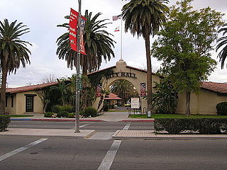
Brawley is a city in Imperial County, California, United States within the Imperial Valley.

<span class="mw-page-title-main">Calexico, California</span> City in California, United States

Calexico is a city in southern Imperial County, California. Situated on the Mexican border, it is linked economically with the much larger city of Mexicali, the capital of the Mexican state of Baja California. It is about 122 miles (196 km) east of San Diego and 62 miles (100 km) west of Yuma, Arizona. Calexico, along with six other incorporated Imperial County cities, forms part of the larger populated area known as the Imperial Valley.

<span class="mw-page-title-main">Desert Shores, California</span> Census-designated place in California, United States

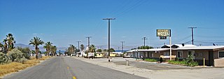
Desert Shores is a census-designated place (CDP) in Imperial County, California, US. It is part of the El Centro Metropolitan Statistical Area.

<span class="mw-page-title-main">Holtville, California</span> City in California, United States

Holtville is a city in Imperial County, California. Holtville is located 10.5 miles (17 km) east of El Centro. The population was 5,939 at the 2010 census, up from 5,612 in 2000.

<span class="mw-page-title-main">Imperial, California</span> City in California, United States

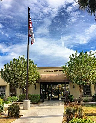
Imperial is a city in Imperial County, California, 4 miles (6.4 km) north of El Centro.

<span class="mw-page-title-main">Ocotillo, California</span> Census-designated place in California, United States

Ocotillo is a census-designated place (CDP) in Imperial County, California. Ocotillo is located 26 miles (42 km) west of El Centro, The population was 215 at the 2020 census, down from 266 at the 2010 census and 296 at the 2000 census. It is part of the El Centro, California Metropolitan Statistical Area.

<span class="mw-page-title-main">Westmorland, California</span> City in California, United States

Westmorland is a city in Imperial County, California. Westmorland is located 8.5 miles (14 km) southwest of Calipatria. The population was 2,014 at the 2020 census, down from 2,225 at the 2010 census, up from 2,131 in 2000. It is part of the El Centro Metropolitan Area. The mayor of Westmorland is Ana Beltran.

<span class="mw-page-title-main">Ridgecrest, California</span> City in California, United States

Ridgecrest is a city in Kern County, California, United States, along U.S. Route 395 in the Indian Wells Valley in northeastern Kern County, adjacent to the Naval Air Weapons Station China Lake. It was incorporated as a city in 1963. The population was 27,959 at the 2020 census, up slightly from 27,616 at the 2010 census.

<span class="mw-page-title-main">Coachella, California</span> City in California, United States

Coachella is a city in Riverside County, California, United States. It is the namesake and easternmost city of the Coachella Valley, in Southern California's Colorado Desert. Originally a railroad town, Coachella is a prominent hub for agriculture and shipping across Southern California and the Western United States.

<span class="mw-page-title-main">Indio, California</span> City in California, United States

Indio is a city in Riverside County, California, United States, in the Coachella Valley of Southern California's Colorado Desert region. It lies 23 miles (37 km) east of Palm Springs, 75 miles (121 km) east of Riverside, 127 miles (204 km) east of Los Angeles, 148 miles (238 km) northeast of San Diego, 250 miles (400 km) west of Phoenix, and 102 miles (164 km) north of Mexicali, Mexico.

<span class="mw-page-title-main">La Quinta, California</span> City in California, United States

La Quinta is a desert resort city in Riverside County, California, United States. Located between Indian Wells and Indio, it is one of the nine cities of the Coachella Valley. The population was 37,467 at the 2010 census, up from 23,694 at the 2000 census.

<span class="mw-page-title-main">Yucca Valley, California</span> City in California, United States

Yucca Valley is an incorporated town in San Bernardino County, California, United States. The population was 21,738 as of the 2020 census. Yucca Valley lies 20 miles (32 km) north of Palm Springs, and 103 miles (166 km) east of Los Angeles. Bordered to the south by the Joshua Tree National Park and to the west by the San Bernardino Mountains, the town of Yucca Valley is located in the Mojave Desert at roughly 3,300 feet (1,000 m) above sea level.

<span class="mw-page-title-main">Mexicali</span> Capital city of Baja California, Mexico

Mexicali is the capital city of the Mexican state of Baja California. The city, which is the seat of the Mexicali Municipality, has a population of 689,775, according to the 2010 census, while the Calexico–Mexicali metropolitan area is home to 1,000,000 inhabitants on both sides of the Mexico–United States border. Mexicali is a regional economic and cultural hub for the border region of The Californias.

<span class="mw-page-title-main">Imperial Valley</span> Valley in California, United States

The Imperial Valley of Southern California lies in Imperial and Riverside counties, with an urban area centered on the city of El Centro. The Valley is bordered by the Colorado River to the east and, in part, the Salton Sea to the west. Farther west lies the San Diego and Imperial County border. To the north is the Coachella Valley region of Riverside County, which together with Imperial Valley form the Salton Trough, or the Cahuilla Basin, also the county line of Imperial and Riverside counties, and to the south the international boundary with Mexico.

<span class="mw-page-title-main">San Luis, Arizona</span> City in Arizona, United States

San Luis is a city in Yuma County, Arizona, United States. The population was 35,257 at the 2020 census. It is part of the Yuma Metropolitan Statistical Area. San Luis, located in the southwest corner of the state directly adjacent to Mexico's Federal Highway 2 at San Luis Rio Colorado, was the second fastest-growing city or town in Arizona from 1990 to 2000. According to 2022 Census Bureau estimates, the population of the city is 35,770.

<span class="mw-page-title-main">Thermal, California</span> Resort community in Riverside County, southern California, United States

Thermal is an unincorporated community within the Coachella Valley in Riverside County, California, United States, located approximately 25 miles (40 km) southeast of Palm Springs and about 9.5 miles (15.3 km) north of the Salton Sea. The community's elevation is 138 feet (42 m) below mean sea level. It is served by area codes 760 and 442 and is in ZIP Code 92274. The population was 2,865 at the 2010 census. For statistical purposes, the United States Census Bureau has defined Thermal a census-designated place (CDP), which does not precisely correspond to the historical community.

<span class="mw-page-title-main">Riverside County, California</span> County in California, United States

Riverside County is a county located in the southern portion of the U.S. state of California. As of the 2020 census, the population was 2,418,185, making it the fourth-most populous county in California and the 10th-most populous in the United States. The name was derived from the city of Riverside, which is the county seat.

<span class="mw-page-title-main">San Diego County, California</span> County in California, United States

San Diego County, officially the County of San Diego, is a county in the southwestern corner of the U.S. state of California. As of the 2020 census, the population was 3,298,634, making it California's second-most populous county and the fifth-most populous in the United States. Its county seat is San Diego, the second-most populous city in California and the eighth-most populous city in the United States. It is the southwesternmost county in the 48 contiguous United States, and is a border county. It is also home to 18 Native American tribal reservations, the most of any county in the United States.

References

  1. "California Cities by Incorporation Date". California Association of Local Agency Formation Commissions. Archived from the original (Word) on November 3, 2014. Retrieved April 8, 2013.
  2. "El Centro City Council". City of El Centro. Archived from the original on September 22, 2023. Retrieved September 16, 2023.
  3. "2019 U.S. Gazetteer Files". United States Census Bureau. Archived from the original on January 16, 2020. Retrieved July 1, 2020.
  4. "El Centro". Geographic Names Information System . United States Geological Survey, United States Department of the Interior.
  5. 1634–1699: McCusker, J. J. (1997). How Much Is That in Real Money? A Historical Price Index for Use as a Deflator of Money Values in the Economy of the United States: Addenda et Corrigenda (PDF). American Antiquarian Society. 1700–1799: McCusker, J. J. (1992). How Much Is That in Real Money? A Historical Price Index for Use as a Deflator of Money Values in the Economy of the United States (PDF). American Antiquarian Society. 1800–present: Federal Reserve Bank of Minneapolis. "Consumer Price Index (estimate) 1800–" . Retrieved February 29, 2024.
  6. "De Anza Trail". Archived from the original on July 5, 2008. Retrieved August 3, 2009.
  7. 1 2 3 Stevens, Joseph E. (1990). Hoover Dam: An American Adventure. University of Oklahoma Press. pp. 12–16. ISBN   978-0-8061-2283-0 . Retrieved May 26, 2010.
  8. Sperry, Robert L. "When the Imperial Valley Fought for its Life". The Journal of San Diego History. San Diego Historical Society. Archived from the original on June 28, 2011. Retrieved June 2, 2010.
  9. 1 2 3 4 "History of the City of El Centro". City of El Centro. Archived from the original on May 11, 2009. Retrieved July 13, 2009.
  10. 1 2 3 Durham, David L. (1998). California's Geographic Names: A Gazetteer of Historic and Modern Names of the State. Clovis, Calif.: Word Dancer Press. p. 1416. ISBN   1-884995-14-4.
  11. "Imperial Valley, California 1940 05 19 04:36 UTC (local 05/18) Magnitude 7.1". Historic Earthquakes. USGS. Archived from the original on November 8, 2010. Retrieved November 18, 2010.
  12. "Population of Counties by Decennial Census: 1900 to 1990". US Bureau of the Census. Archived from the original on September 24, 2015. Retrieved November 18, 2010.
  13. "An Unbelievable Man-Made Disaster That Almost Could Not Be Undone". Archived from the original on August 9, 2009. Retrieved August 3, 2009.
  14. 1 2 3 4 "NOAA Online Weather Data – NWS Phoenix". National Weather Service. Archived from the original on July 7, 2022. Retrieved March 26, 2023.
  15. "U.S. Climate Normals Quick Access – Station: El Centro 2 SSW, CA". National Oceanic and Atmospheric Administration. Archived from the original on March 26, 2023. Retrieved March 26, 2023.
  16. 1 2 3 4 "Benefits and the border." The Economist . August 20, 2009. Retrieved on September 12, 2009.
  17. 1 2 3 4 5 "El Centro Chamber of Commerce". Archived from the original on November 3, 2010. Retrieved July 31, 2009.
  18. "Best and Worst Markets to Find a Job". CareerBuilder.com. October 31, 2008. Archived from the original on July 8, 2011. Retrieved November 1, 2008.
  19. Woolsey, Matt (December 12, 2008). "In Depth: Where U.S. Homeowners Are Losing Value Fastest". Forbes. Archived from the original on August 11, 2009. Retrieved July 13, 2009.
  20. Zumbrun, Joshua (October 21, 2009). "America's most impoverished cities". Forbes. Archived from the original on October 25, 2009. Retrieved September 27, 2021 via Yahoo! Real Estate.
  21. "Park List - City of El Centro Parks, Facilities & Fields Map". Archived from the original on January 28, 2012. Retrieved August 19, 2023.
  22. "Census of Population and Housing". Census.gov. Archived from the original on April 26, 2015. Retrieved June 4, 2015.
  23. US Census Bureau, 2020 Census, El Centro, California profile
  24. "2010 Census Interactive Population Search: CA – El Centro city". U.S. Census Bureau. Archived from the original on July 15, 2014. Retrieved July 12, 2014.
  25. "U.S. Census website". United States Census Bureau. Archived from the original on December 18, 2014. Retrieved January 31, 2008.
  26. 1 2 "El Centro Chamber of Commerce – Education". Archived from the original on November 3, 2010. Retrieved July 13, 2009.
  27. 1 2 3 4 5 6 7 8 9 10 11 "El Centro Elementary School District". Archived from the original on March 28, 2009. Retrieved July 13, 2009.
  28. "Hedrick School – Who was Margaret Hedrick?". Archived from the original on July 16, 2011. Retrieved July 13, 2009.
  29. 1 2 "McCabe Union School District". Archived from the original on November 19, 2008. Retrieved July 13, 2009.
  30. 1 2 3 "Central Union High School District". Archived from the original on June 13, 2009. Retrieved July 13, 2009.
  31. "ipl". Archived from the original on January 30, 2007. Retrieved July 31, 2009.
  32. "Senators". State of California. Archived from the original on January 6, 2019. Retrieved April 8, 2013.
  33. "Members Assembly". State of California. Archived from the original on January 6, 2019. Retrieved April 8, 2013.
  34. "California's 25th Congressional District - Representatives & District Map". Civic Impulse, LLC. Retrieved April 8, 2013.
  35. "Divisions & Programs | Public Works Department". Archived from the original on September 20, 2022. Retrieved September 18, 2022.