Cameron, Wisconsin | |
---|---|
![]() Location of Cameron in Barron County, Wisconsin | |
Country | ![]() |
State | ![]() |
County | Barron |
Area | |
• Total | 2.66 sq mi (6.90 km2) |
• Land | 2.62 sq mi (6.79 km2) |
• Water | 0.04 sq mi (0.11 km2) |
Population | |
• Total | 1,783 |
• Estimate (2019) [3] | 1,788 |
• Density | 682.18/sq mi (263.37/km2) |
Time zone | UTC-6 (Central (CST)) |
• Summer (DST) | UTC-5 (CDT) |
Zip Code | 54822 |
FIPS code | 55-12250 |
GNIS feature ID | 1582910 |
Website | Official website |
Cameron is a village in Barron County in the U.S. state of Wisconsin. The population was 1,872 at the 2020 census, [4] and 1,783 at the 2010 census.
A post office called Cameron has been in operation since 1882. [5]
The village was named for Angus Cameron, a United States Senator from Wisconsin. [6]
Cameron is located at 45°24′32″N91°44′33″W / 45.408807°N 91.742489°W . [7]
According to the United States Census Bureau, the village has a total area of 2.51 square miles (6.50 km2), of which, 2.47 square miles (6.40 km2) is land and 0.04 square miles (0.10 km2) is water. [8]
Cameron is located along U.S. Highways 8 and 53; and also County Road SS (1st Street), and County Road W (Main Street).
Census | Pop. | Note | %± |
---|---|---|---|
1900 | 394 | — | |
1910 | 562 | 42.6% | |
1920 | 572 | 1.8% | |
1930 | 760 | 32.9% | |
1940 | 807 | 6.2% | |
1950 | 963 | 19.3% | |
1960 | 982 | 2.0% | |
1970 | 893 | −9.1% | |
1980 | 1,115 | 24.9% | |
1990 | 1,273 | 14.2% | |
2000 | 1,546 | 21.4% | |
2010 | 1,783 | 15.3% | |
2019 (est.) | 1,788 | [3] | 0.3% |
U.S. Decennial Census [9] |
As of the census [2] of 2010, there were 1,783 people, 744 households, and 488 families living in the village. The population density was 721.9 inhabitants per square mile (278.7/km2). There were 797 housing units at an average density of 322.7 per square mile (124.6/km2). The racial makeup of the village was 97.0% White, 0.4% African American, 0.2% Native American, 0.5% Asian, 0.2% from other races, and 1.7% from two or more races. Hispanic or Latino people of any race were 2.0% of the population.
There were 744 households, of which 35.5% had children under the age of 18 living with them, 46.8% were married couples living together, 13.6% had a female householder with no husband present, 5.2% had a male householder with no wife present, and 34.4% were non-families. 27.0% of all households were made up of individuals, and 9.6% had someone living alone who was 65 years of age or older. The average household size was 2.40 and the average family size was 2.89.
The median age in the village was 34.5 years. 26.9% of residents were under the age of 18; 7.8% were between the ages of 18 and 24; 28.6% were from 25 to 44; 23.7% were from 45 to 64; and 13.1% were 65 years of age or older. The gender makeup of the village was 48.9% male and 51.1% female.
As of the census [10] of 2000, there were 1,546 people, 640 households, and 414 families living in the village. The population density was 641.3 people per square mile (247.7/km2). There were 661 housing units at an average density of 274.2/sq mi (105.9/km2). The racial makeup of the village was 97.74% White, 0.84% Native American, 0.19% Asian, 0.32% from other races, and 0.91% from two or more races. Hispanic or Latino people of any race were 1.81% of the population.
There were 640 households, out of which 33.9% had children under the age of 18 living with them, 50.6% were married couples living together, 9.1% had a female householder with no husband present, and 35.2% were non-families. 28.3% of all households were made up of individuals, and 13.3% had someone living alone who was 65 years of age or older. The average household size was 2.41 and the average family size was 2.94.
In the village, the population was spread out, with 25.9% under the age of 18, 9.5% from 18 to 24, 29.4% from 25 to 44, 20.8% from 45 to 64, and 14.3% who were 65 years of age or older. The median age was 36 years. For every 100 females, there were 96.4 males. For every 100 females age 18 and over, there were 92.1 males.
The median income for a household in the village was $34,167, and the median income for a family was $40,625. Males had a median income of $30,069 versus $20,885 for females. The per capita income for the village was $16,470. About 8.4% of families and 10.3% of the population were below the poverty line, including 10.1% of those under age 18 and 16.3% of those age 65 or over.
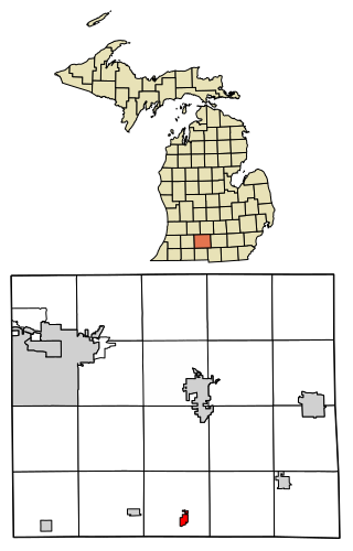
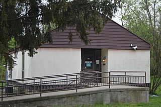
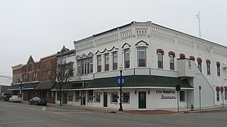
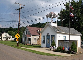
Tekonsha is a village in Tekonsha Township, Calhoun County in the U.S. state of Michigan. It is part of the Battle Creek, Michigan Metropolitan Statistical Area. The population was 653 at the 2020 census.
Trommald is a city in Crow Wing County, Minnesota, United States. The population was 99 at the 2020 census. It is part of the Brainerd Micropolitan Statistical Area.
Marlborough is a village in St. Louis County, Missouri, United States. The population was 2,179 at the 2010 census.
Pleasant Garden is a town in Guilford County, North Carolina, United States.
North Kingsville is a village in Ashtabula County, Ohio, United States. The population was 2,742 at the 2020 census.
Walton Hills is a village in Cuyahoga County, Ohio, United States. The population was 2,033 at the 2020 census. A suburb of Cleveland, it is a part of the Cleveland metropolitan area.
Valleyview is a village in Franklin County, Ohio, United States. The population was 669 at the 2020 census.
Cleves is a village in Miami Township, Hamilton County, Ohio, United States. Located along the Ohio River, it is a western suburb of Cincinnati. The population was 3,414 at the 2020 census.
Ada is a village in Hardin County, Ohio, United States, located about 69 miles (111 km) southwest of Toledo. The population was 5,334 at the 2020 census. It is the home of Ohio Northern University.
Mowrystown is a village in Highland County, Ohio, United States. The population was 385 at the 2020 census.
Spencer is a village in Spencer Township located in Medina County, Ohio, United States. The population was 684 at the 2020 census.
Cloverdale is a village in Perry Township, Putnam County, Ohio, United States. The population was 170 at the 2020 census.
Attica is a village in Seneca County, Ohio, United States. The population was 873 at the 2020 census.
Barnhill is a village in Tuscarawas County, Ohio, United States. The population was 383 at the 2020 census.
McArthur is a village in and the county seat of Vinton County, Ohio, United States. It is located 27 miles (43 km) southeast of Chillicothe. The population was 1,783 at the 2020 census.
Lower Mifflin Township is a township in Cumberland County, Pennsylvania, United States. The population was 1,783 at the 2010 census.
Wickerham Manor-Fisher is a census-designated place (CDP) in Washington County, Pennsylvania, United States. The population was 1,728 at the 2010 census.
Rewey is a village in Iowa County, Wisconsin, United States. The population was 292 at the 2010 census. It is part of the Madison Metropolitan Statistical Area.
Wilson is a village in Belmont and Monroe counties in the U.S. state of Ohio. The population was 129 at the 2020 census. It is part of the Wheeling metropolitan area.
Dorchester is a village in Clark and Marathon counties in the U.S. state of Wisconsin, along the 45th parallel. It is part of the Wausau, Wisconsin Metropolitan Statistical Area. The population was 876 at the 2010 census. Of this, 871 were in Clark County, and only 5 were in Marathon County.