Rice Lake, Wisconsin

Last updated

Rice Lake, Wisconsin
Rice Lake Wisconsin Looking north WIS48.jpg
Looking north in Rice Lake on WIS 48
Wirlwlogo.png
Motto: 
You'll love our friendly nature
Barron County Wisconsin Incorporated and Unincorporated areas Rice Lake Highlighted.svg
Location of Rice Lake
in Barron County, Wisconsin
USA Wisconsin location map.svg
Red pog.svg
Rice Lake
Location within Wisconsin
Usa edcp location map.svg
Red pog.svg
Rice Lake
Location within the United States
North America laea location map.svg
Red pog.svg
Rice Lake
Rice Lake (North America)
Coordinates: 45°29′54″N91°44′20″W / 45.49833°N 91.73889°W / 45.49833; -91.73889
Country Flag of the United States.svg  United States
State Flag of Wisconsin.svg  Wisconsin
County Barron
IncorporatedApril 1, 1887
Government
   Mayor Justin Fonfara
  • Elected April 12, 2022
  • Inaugurated May 1, 2022
Area
[1]
  Total9.75 sq mi (25.25 km2)
  Land8.64 sq mi (22.37 km2)
  Water1.11 sq mi (2.88 km2)
Elevation
[2]
1,135 ft (346 m)
Population
 (2020) [3]
  Total9,040
  Density930/sq mi (360/km2)
Time zone UTC-6 (Central)
  Summer (DST) UTC-5 (CDT)
ZIP Code
54868
Area code(s) 715 & 534
FIPS code 55-67350 [4]
GNIS feature ID1584019 [2]
Website www.ci.rice-lake.wi.us

Rice Lake is a city in Barron County in northwest Wisconsin, United States, on the shore of the lake with the same name. The city is a commercial and tourist center for the surrounding rural areas. [5] As of the 2020 census, the city had a total population of 9,040. The city is located mostly within the Town of Rice Lake.

Contents

History

Indian Mounds Park Rice Lake Mounds (47 BN-90).JPG
Indian Mounds Park

American Indians lived around Rice Lake for millennia, some of whom made mounds like those that remain in Indian Mounds Park along the shore of the lake. [6] In later years before white settlers, Chippewa people occupied the area, and they had a strong cultural attachment to the wild rice that grew on the lake. [7]

In the mid-1860s Knapp, Stout & Co., the growing lumber company downstream at Menomonie, bought tracts of forest around Rice Lake. [5] [8] Around 1868 the company started a logging camp in the area [9] and in 1870 the company dammed the Red Cedar to raise the level of Rice Lake to make a better holding pond for their logs. The higher water disrupted the existing wild rice beds, angering the Chippewa. As compensation, Knapp-Stout gave them food, but it was settlers' food like pork and flour - not wild rice. [5]

Knapp-Stout platted the village in 1870, naming it for the lake, and naming many streets after officers of the company, including Knapp, Stout, Tainter and Wilson. The company built a small water-powered sawmill for sawing local lumber and a gristmill. Permanent settlers began arriving about that time. The first houses were built around 1874. Saloons and hotels followed. [9] Rice Lake's first school opened in a Knapp-Stout building in 1874. Regular mail service began that year, with the mail arriving by stage from Menomonie and Chippewa Falls, initially once a week. The first newspaper, the Chronotype, started the same year. [10]

Many employees of the early Knapp-Stout were Norwegian and in 1875 a Norwegian Lutheran congregation was organized. A local brewery was also started in 1875. Episcopalian families began worshiping intermittently in 1879. Roman Catholics began meeting the following year, building a church the same year - the first brick building in the village. Knapp-Stout added a flour mill in 1879. A Methodist Episcopal congregation also formed in 1880, and a Presbyterian congregation in 1882. [9]

In 1882 the first railroad reached Rice Lake - the Chippewa Falls and Northern Railroad, [9] and the four-year high school was started. [10] The following year the first bank opened - the Barron County Bank. A barrel factory opened in 1885, employing 40 men, and a hub and spoke factory in 1886, employing 50 in summer and 125 during logging season. In 1887 the Rice Lake Lumber Company opened, owned by Orrin Henry Ingram of Eau Claire. It expanded Knapp-Stout's sawmill, added two planing mills, and employed 200. [9]

Rice Lake incorporated as a city in 1887. A volunteer fire department was formed in 1889, which was equipped with a hook and ladder wagon, a hand hose cart, and 1,300 feet of hose. The city's population was 2,130 in the 1890 census. [9] A city library opened in 1897. The lumber companies set up electric lights and a water utility in 1892, which were taken over by the city in 1910. [10]

In 1907 the Barron County Normal School opened. In 1938 WJMC, the area's first radio station, began broadcasting. In 1940 the forerunner of Indianhead Tech College was established. In 1966 UW-Stout opened a branch campus in Barron County, which has since developed into UW-Eau Claire - Barron County. [10]

Geography

Rice Lake is located at 45°29′54″N91°44′20″W / 45.49833°N 91.73889°W / 45.49833; -91.73889 (45.498408, -91.738844). [11]

According to the United States Census Bureau, the city has a total area of 9.70 square miles (25.12 km2), of which, 8.60 square miles (22.27 km2) is land and 1.10 square miles (2.85 km2) is water. [12]

Rice Lake is along the Red Cedar River.

Climate

Climate data for Rice Lake, Wisconsin, 1991–2020 normals, extremes 19822022
MonthJanFebMarAprMayJunJulAugSepOctNovDecYear
Record high °F (°C)50
(10)
56
(13)
80
(27)
88
(31)
94
(34)
98
(37)
100
(38)
101
(38)
92
(33)
85
(29)
73
(23)
60
(16)
101
(38)
Mean maximum °F (°C)39.2
(4.0)
45.4
(7.4)
60.6
(15.9)
75.9
(24.4)
84.8
(29.3)
89.6
(32.0)
90.8
(32.7)
90.0
(32.2)
85.7
(29.8)
76.6
(24.8)
59.6
(15.3)
43.9
(6.6)
93.1
(33.9)
Mean daily maximum °F (°C)21.6
(−5.8)
27.2
(−2.7)
39.6
(4.2)
54.3
(12.4)
67.8
(19.9)
77.3
(25.2)
81.4
(27.4)
79.5
(26.4)
71.4
(21.9)
56.8
(13.8)
40.4
(4.7)
27.1
(−2.7)
53.7
(12.1)
Daily mean °F (°C)11.6
(−11.3)
16.0
(−8.9)
28.9
(−1.7)
43.0
(6.1)
56.2
(13.4)
66.0
(18.9)
70.1
(21.2)
67.9
(19.9)
59.6
(15.3)
46.1
(7.8)
31.7
(−0.2)
18.5
(−7.5)
43.0
(6.1)
Mean daily minimum °F (°C)1.7
(−16.8)
4.8
(−15.1)
18.1
(−7.7)
31.6
(−0.2)
44.7
(7.1)
54.7
(12.6)
58.8
(14.9)
56.3
(13.5)
47.8
(8.8)
35.3
(1.8)
22.9
(−5.1)
10.0
(−12.2)
32.2
(0.1)
Mean minimum °F (°C)−21.4
(−29.7)
−17.7
(−27.6)
−6.1
(−21.2)
16.5
(−8.6)
29.9
(−1.2)
40.1
(4.5)
48.1
(8.9)
45.1
(7.3)
33.0
(0.6)
21.4
(−5.9)
5.5
(−14.7)
−14.2
(−25.7)
−23.9
(−31.1)
Record low °F (°C)−38
(−39)
−37
(−38)
−26
(−32)
−2
(−19)
20
(−7)
32
(0)
41
(5)
34
(1)
26
(−3)
11
(−12)
−17
(−27)
−40
(−40)
−40
(−40)
Average precipitation inches (mm)0.89
(23)
0.82
(21)
1.47
(37)
2.77
(70)
3.85
(98)
4.17
(106)
3.98
(101)
4.21
(107)
3.34
(85)
3.03
(77)
1.68
(43)
1.22
(31)
31.43
(799)
Average snowfall inches (cm)10.5
(27)
10.7
(27)
8.9
(23)
3.5
(8.9)
0.5
(1.3)
0.0
(0.0)
0.0
(0.0)
0.0
(0.0)
0.0
(0.0)
0.8
(2.0)
5.7
(14)
11.9
(30)
52.5
(133.2)
Average precipitation days (≥ 0.01 in)7.65.97.110.112.012.410.710.510.59.87.07.7111.3
Average snowy days (≥ 0.1 in)6.85.43.51.60.10.00.00.00.00.42.86.427.0
Source 1: NOAA [13]
Source 2: National Weather Service [14]

Demographics

Historical population
CensusPop.Note
1880 362
1890 2,130488.4%
1900 3,00240.9%
1910 3,96832.2%
1920 4,45712.3%
1930 5,17716.2%
1940 5,71910.5%
1950 6,89820.6%
1960 7,3035.9%
1970 7,278−0.3%
1980 7,6915.7%
1990 7,9984.0%
2000 8,3204.0%
2010 8,4381.4%
2019 (est.)8,509 [15] 0.8%
U.S. Decennial Census [16]

As of 2000, the median income for a household in the city was $34,637, and the median income for a family was $53,056. Males had a median income of $40,450 versus $30,211 for females. The per capita income for the city was $22,354. About 6.9% of families and 13.3% of the population were below the poverty line, including 13.4% of those under age 18 and 13.1% of those age 65 or over.

2010 census

Looking east at the sign for Rice Lake on WIS 48 Rice Lake Wisconsin Sign WIS48 Looking East.jpg
Looking east at the sign for Rice Lake on WIS 48

As of the census [3] of 2010, there were 8,438 people, 3,936 households, and 2,065 families residing in the city. The population density was 981.2 inhabitants per square mile (378.8/km2). There were 4,239 housing units at an average density of 492.9 per square mile (190.3/km2). The racial makeup of the city was 96.2% White, 0.3% African American, 0.9% Native American, 0.8% Asian, 0.5% from other races, and 1.3% from two or more races. Hispanic or Latino people of any race were 2.4% of the population.

There were 3,936 households, of which 24.3% had children under the age of 18 living with them, 37.6% were married couples living together, 10.9% had a female householder with no husband present, 4.0% had a male householder with no wife present, and 47.5% were non-families. 39.3% of all households were made up of individuals, and 17.6% had someone living alone who was 65 years of age or older. The average household size was 2.09 and the average family size was 2.79.

The median age in the city was 41.2 years. 20.6% of residents were under the age of 18; 10.1% were between the ages of 18 and 24; 23.5% were from 25 to 44; 24.5% were from 45 to 64; and 21.2% were 65 years of age or older. The gender makeup of the city was 46.8% male and 53.2% female.

Infrastructure

U.S. Highway 53, Wisconsin Highway 48, County Road SS (Main Street), and County Road O (South Access Road) are the main routes in the city.

The area is served by Rice Lake Regional Airport - Carl's Field (KRPD), which is located south of Rice Lake.

Rice Lake formerly had passenger rail service at the Rice Lake station. The town spends 325,000 USD annually on infrastructure.

Education

Lakeview Medical Center in Rice Lake Lakeview Medical Center Rice Lake WI.jpg
Lakeview Medical Center in Rice Lake

Public schools

Rice Lake Area School District operates public schools:

Private schools

Post-secondary education

Economy

Rice Lake serves as a shopping, industrial, educational, and medical hub for the surrounding rural communities of Barron, Cameron, Chetek, Shell Lake, Cumberland, Spooner, and Ladysmith. The city budget annually is 915,000 USD . The largest source of revenue for the city is property taxes with 430,000 dollars of income and the largest expenditure of the city is infrastructure with the town budget for infrastructure of 325,000 dollars in 2022.

Notable people

Sister cities

Rice Lake has two sister cities: [19]

Local media

Related Research Articles

<span class="mw-page-title-main">Eagle Lake, Texas</span> City in Colorado County, Texas, U.S.

Eagle Lake is a city in southeastern Colorado County, Texas, United States. The population was 3,442 at the 2020 census. It is home to a golf course, the largest private lake in Texas, and the Eagle Lake Regional Airport, which serves light aircraft.

<span class="mw-page-title-main">Cedar Lake, Wisconsin</span> Town in Wisconsin, United States

Cedar Lake is a town in Barron County in the U.S. state of Wisconsin. The population was 1,076 at the 2020 census. The unincorporated communities of Angus and Mikana are located in the town.

<span class="mw-page-title-main">Crystal Lake, Barron County, Wisconsin</span> Town in Wisconsin, United States

Crystal Lake is a town in Barron County in the U.S. state of Wisconsin. The population was 757 at the 2010 census. The unincorporated community of Comstock is located in the town.

<span class="mw-page-title-main">Prairie Lake, Wisconsin</span> Town in Wisconsin, United States

Prairie Lake is a town in Barron County in the U.S. state of Wisconsin. The population was 1,532 at the 2010 census. The unincorporated community of Wickware is located partially in the town.

<span class="mw-page-title-main">Chippewa Falls, Wisconsin</span> City in Wisconsin, United States

Chippewa Falls is a city located on the Chippewa River in Chippewa County in the northwestern part of the U.S. state of Wisconsin. The population was 14,778 in the 2021 census. Incorporated as a city in 1869, it is the county seat of Chippewa County.

<span class="mw-page-title-main">Colburn, Chippewa County, Wisconsin</span> Town in Wisconsin, United States

Colburn is a town in Chippewa County in the U.S. state of Wisconsin. The population was 856 at the 2010 census, up from 727 at the 2000 census. The unincorporated communities of Colburn and Huron are located in the town. The unincorporated community of Brownville is located partially in the town.

<span class="mw-page-title-main">Delmar, Wisconsin</span> Town in Wisconsin, United States

The Town of Delmar is located in Chippewa County in the U.S. state of Wisconsin. The population was 936 at the 2010 census.

<span class="mw-page-title-main">Stanley, Wisconsin</span> City in Wisconsin, United States

Stanley is a city in Chippewa and Clark counties in the U.S. state of Wisconsin. The population was 3,608 at the 2010 census. Of this, 3,602 were in Chippewa County, and 6 in Clark County.

<span class="mw-page-title-main">Ojibwa, Wisconsin</span> Town in Wisconsin, United States

Ojibwa is a town in Sawyer County, Wisconsin, United States. The population was 267 at the 2000 census. The unincorporated community of Ojibwa is located in the town.

<span class="mw-page-title-main">Roosevelt, Taylor County, Wisconsin</span> Town in Wisconsin, United States

Roosevelt is a town in Taylor County, Wisconsin, United States. The population was 444 at the 2000 census. The village of Lublin lies within the town of Roosevelt. The unincorporated community of Bellinger is also located partially in the town.

<span class="mw-page-title-main">New Auburn, Wisconsin</span> Village in Wisconsin, United States

New Auburn is a village in Barron and Chippewa counties in the U.S. state of Wisconsin. The population was 548 at the 2010 census. Of this, 528 were in Chippewa County, and 20 were in Barron County. The village is located mostly within the Town of Auburn in Chippewa County. Small portions extend east into the adjacent Town of Bloomer, Chippewa County and north into the Town of Dovre in Barron County.

<span class="mw-page-title-main">Barron, Wisconsin</span> City in Wisconsin, United States

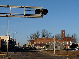
Barron is a city in Barron County, in the U.S. state of Wisconsin. The population was 3,733 at the 2020 census. The city is surrounded by the Town of Barron.

<span class="mw-page-title-main">Turtle Lake, Wisconsin</span> Village in Wisconsin, United States

Turtle Lake is a village in Barron and Polk counties in the U.S. state of Wisconsin. Its population was 1,064 at the 2010 census. Of these, 972 were in Barron County and 93 were in Polk County. The village is located between the towns of Almena, in Barron County, and Beaver, in Polk County.

Bloomer is a town in Chippewa County in the U.S. state of Wisconsin. The population was 1,050 at the 2010 census, up from 926 at the 2000 census. The city of Bloomer is also located in Chippewa County, but to the south of the town within the adjacent town of Woodmohr.

<span class="mw-page-title-main">Menomonie, Wisconsin</span> City in Wisconsin, United States

Menomonie is a city in and the county seat of Dunn County in the western part of the U.S. state of Wisconsin. The city's population was 16,843 as of the 2020 census.

<span class="mw-page-title-main">Tomahawk, Wisconsin</span> City in Wisconsin, United States

Tomahawk is a city in Lincoln County, Wisconsin, United States. The population was 3,441 at the 2020 census. The city is located to the northeast of the Town of Tomahawk and is not contiguous with it.

<span class="mw-page-title-main">Lac du Flambeau, Wisconsin</span> Town in Wisconsin, United States

The Town of Lac du Flambeau is located in Vilas County, Wisconsin, United States. The population was 3,004 at the 2000 census. The land base of the Lac du Flambeau Band of Lake Superior Chippewa is located within the town and also consists of a large portion of the town. The Lac du Flambeau census-designated place is located within the town. The unincorporated community of Marlands is also located in the town. Lac du Flambeau, situated around Flambeau Lake, is a year-round vacation destination.

<span class="mw-page-title-main">Birchwood, Wisconsin</span> Village in Wisconsin, United States

Birchwood is a village in Washburn County, Wisconsin, United States. The population was 402 at the 2020 census. The village is located within the Town of Birchwood.

<span class="mw-page-title-main">Lake Hallie, Wisconsin</span> Village in Wisconsin, United States

Lake Hallie is a village in Chippewa County, Wisconsin, United States. It was incorporated from part of the Town of Hallie on February 18, 2003. The 2010 census put the village's population at 6,448.

Knapp, Stout & Co. was a lumber company based in Menomonie, Wisconsin in the 19th and early 20th centuries. The company was established in 1846, when John Holly Knapp and William Wilson purchased half of interest in a lumber mill on the Red Cedar River from David Black; it was originally known as Black & Knapp. Later Andrew Tainter acquired a quarter-interest, and the company has become Knapp-Tainter Lumber Company. Henry Stout bought a quarter interest in the company in 1853, and its name became Knapp, Stout & Company. The company's location allowed it to control the lumber industry in the region, and by 1870 it controlled the logging industry in the Red Cedar River valley. In 1878, the company incorporated, and its official name became the Knapp, Stout & Co., Company. The company employed over 2,000 workers in the Menomonie area and produced 85 million board feet of lumber on average yearly from 1871 to 1896; its output made it the largest lumber company in the world. In the 1880s, the company expanded to sites along the Mississippi River, opening offices in Dubuque, Iowa, Read's Landing, Minnesota, and St. Louis. By the 1900s, the company had largely depleted its lumber supply; it closed many of its camps and dissolved early in the 20th century. The company sent out its last shipment of lumber on August 12, 1901.

References

  1. "2019 U.S. Gazetteer Files". United States Census Bureau. Retrieved August 7, 2020.
  2. 1 2 U.S. Geological Survey Geographic Names Information System: Rice Lake, Wisconsin
  3. 1 2 "U.S. Census website". United States Census Bureau . Retrieved November 18, 2012.
  4. "U.S. Census website". United States Census Bureau . Retrieved January 31, 2008.
  5. 1 2 3 "Rice Lake, Wisconsin - A Brief History". Wisconsin Historical Society. Retrieved August 25, 2023.
  6. Birmingham, Robert A.; Leslie E. Eisenberg (2000). Indian Mounds of Wisconsin . Madison, WI: University of Wisconsin Press. p.  193. ISBN   9780299168742.
  7. Dell'Orto, Giovanna (September 30, 2022). "Minnesota Ojibwe harvest sacred, climate-imperiled wild rice". Associated Press. Retrieved August 24, 2023.
  8. "Logging and Lumbering in the Rice Lake Area - A Chronology". National Lumbering Hall of Fame. Retrieved August 25, 2023.
  9. 1 2 3 4 5 6 Forrester, George (1891). Historical and Biographical Album of the Chippewa Valley Wisconsin. Chicago, Ill.: A. Warner. pp. 341–347. Retrieved August 25, 2023.
  10. 1 2 3 4 "History". Rice Lake Chamber of Commerce. Retrieved August 25, 2023.
  11. "US Gazetteer files: 2010, 2000, and 1990". United States Census Bureau. February 12, 2011. Retrieved April 23, 2011.
  12. "US Gazetteer files 2010". United States Census Bureau. Archived from the original on January 25, 2012. Retrieved November 18, 2012.
  13. "U.S. Climate Normals Quick Access – Station: Rice Lake, WI". National Oceanic and Atmospheric Administration. Retrieved March 5, 2023.
  14. "NOAA Online Weather Data – NWS Minneapolis". National Weather Service. Retrieved March 5, 2023.
  15. "Population and Housing Unit Estimates". United States Census Bureau. May 24, 2020. Retrieved May 27, 2020.
  16. "Census of Population and Housing". Census.gov. Retrieved June 4, 2015.
  17. "Knicks Are Taking a Flyer on Another 1st-Round 'Bust'". February 28, 2019.
  18. "Military Sealift Command - Medal of Honor Recipient". Washington Navy Yard, DC: Military Sealift Command. Retrieved July 3, 2011.
  19. "Sister Cities Rice Lake and Žamberk mark quarter century of partnership". Rice Lake Chronotype. July 10, 2019. Retrieved September 6, 2020.