Related Research Articles

Portage County is a county in the U.S. state of Ohio. As of the 2020 census, the population was 161,791. Located in Northeast Ohio, Portage County is part of the Akron Metropolitan Statistical Area, which is also included in the Cleveland–Akron–Canton Combined Statistical Area. Its county seat is Ravenna and its largest city is Kent.

Brady Lake is an unincorporated census-designated place and former village in Portage County, Ohio, United States. The population was 1,222 at the 2020 census. Incorporated in 1927, it originally developed as an amusement park and summer resort that opened in 1891. It was formed from a small portion of Franklin Township and became fully independent of the township in 1993. The village was named after the lake it borders, Brady Lake, which in turn was named for Captain Samuel Brady, who hid in the lake around 1780 while being pursued by a band of local Native Americans.

Ravenna is a city in and the county seat of Portage County, Ohio, United States. The population was 11,323 in the 2020 census. It is located 15 miles (24 km) east of Akron. Formed from portions of Ravenna Township in the Connecticut Western Reserve, Ravenna was founded in 1799 and is named after the city of Ravenna, Italy. It is part of the Akron metropolitan area.

Portage Lakes is a census-designated place in Summit County, Ohio, United States. The population was 6,407 at the 2020 census. A suburb directly south of Akron, the community takes its name from the encompassing Portage Lakes.

Freedom Township is one of the eighteen townships of Portage County, Ohio, United States. The 2020 census found 2,649 people in the township.

Charlestown Township is one of the eighteen townships of Portage County, Ohio, United States. The 2020 census found 1,735 people in the township.

Edinburg Township is one of the eighteen townships of Portage County, Ohio, United States. The 2020 census found 2,351 people in the township.
Atwater is a census-designated place (CDP) in Portage County, Ohio, United States. As of the 2020 census, the CDP had a population of 776. It is located in the central part of Atwater Township, of which it is a part.
Tinker's Creek, in Cuyahoga, Summit and Portage counties, is the largest tributary of the Cuyahoga River, providing about a third of its flow into Lake Erie.
Diamond is an unincorporated community in eastern Palmyra Township, Portage County, Ohio, United States. It has a post office with the ZIP code 44412. The community is part of the Akron Metropolitan Statistical Area. Interstate 76 travels near Diamond. The town used to be a stop on the New York Central Railroad, but the stop was abandoned in the early 1970s.

The Akron, OH Metropolitan Statistical Area, sometimes referred to as Greater Akron, is defined by the United States Office of Management and Budget as an area consisting of two counties, Summit and Portage, in Northeast Ohio and anchored by the city of Akron. As of the 2020 census, the MSA had a population of 702,219. The Akron MSA is also part of the larger Cleveland–Akron–Canton, OH Combined Statistical Area, which has a population of 3,633,962 people as of the 2020 census, the largest metropolitan area in Ohio.
Portage Center is an unincorporated community in Hancock County, in the U.S. state of Ohio.
Eagleville is an unincorporated community in Wood County, in the U.S. state of Ohio.
Cobbs Corners is a former settlement in Portage County, in the U.S. state of Ohio. It was located in Mantua Township.
Mahoning is a former settlement in Portage County, in the U.S. state of Ohio. It was located at the present-day intersection of North Main Street and Ohio State Route 82 in northern Windham Township, north of the village of Windham.
Mishler is a former settlement in Portage County, in the U.S. state of Ohio. It was located in the southern part of Suffield Township along Mishler Road, east of present-day Ohio State Route 43.
Hiram Rapids is an unincorporated community in Portage County, in the U.S. state of Ohio.
Yale is an unincorporated community in Portage County, in the U.S. state of Ohio. It centered at the intersection of Alliance Road and Yale Road along Ohio State Route 14 where the townships of Edinburg, Palmyra, Atwater, and Deerfield meet.
Abbeyville is an unincorporated community in Medina County, in the U.S. state of Ohio.
Drakesburg is an unincorporated community in Portage County, in the U.S. state of Ohio. It is located in Freedom Township at the intersection of Nichols Road and state routes 303 and 88.
References
- ↑ U.S. Geological Survey Geographic Names Information System: Campbellsport, Ohio
- ↑ "Portage County". Jim Forte Postal History. Archived from the original on March 4, 2016. Retrieved January 13, 2016.
- ↑ Brown, Robert C.; Norris, J. E. (1885). History of Portage County, Ohio: Containing a History of the County, Its Townships, Towns, Villages, Schools, Churches, Industries, Etc. Warner, Beers & Company. p. 514.
Municipalities and communities of Portage County, Ohio, United States | ||
|---|---|---|
| Cities |  | |
| Villages | ||
| Townships | ||
| CDPs | ||
| Unincorporated communities | ||
| Historical places | ||
| Footnotes | ‡This populated place also has portions in an adjacent county or counties | |
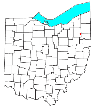
41°08′09″N81°11′50″W / 41.13583°N 81.19722°W
| | This Portage County, Ohio state location article is a stub. You can help Wikipedia by expanding it. |