Brimfield (CDP), Ohio

Last updated
Brimfield, Ohio
CDP
OHMap-doton-Brimfield.png
Location of Brimfield in the state of Ohio
Portage County Brimfield CDP.png
Location within Brimfield Township and Portage County
Coordinates: 41°05′39″N81°20′54″W / 41.09417°N 81.34833°W / 41.09417; -81.34833
Country United States
State Ohio
County Portage
Area
[1]
  Total4.01 sq mi (10.38 km2)
  Land3.97 sq mi (10.29 km2)
  Water0.03 sq mi (0.09 km2)
Elevation
[2]
1,102 ft (336 m)
Population
 (2020)
  Total3,365
  Density846.97/sq mi (327.04/km2)
Time zone UTC-5 (Eastern (EST))
  Summer (DST) UTC-4 (EDT)
ZIP Code
44240
Area code(s) 330, 234
FIPS code 39-08826 [3]
GNIS feature ID2393350 [2]

Brimfield is a census-designated place (CDP) in Portage County, Ohio, United States. As of the 2020 census, the CDP had a population of 3,365. It is located in the central part of Brimfield Township (of which it is a part), a rural area between the Ohio cities of Akron and Kent with light industry, strip-malls, subdivisions, and farms.

Contents

Brimfield is part of the Akron Metropolitan Statistical Area.

History

Brimfield Township was originally known by several different names, before being named Thorndike from 1818 to 1830. [4] The present name is for Brimfield, Massachusetts, the hometown of John Wyles Jr., one of the early land owners. [5] A post office called Brimfield was established in 1834, and remained in operation until 1907. [6]

Geography

According to the United States Census Bureau, the CDP has a total area of 4.0 square miles (10.4 km2), of which 4.0 square miles (10.3 km2) is land and 0.04 square mile (0.1 km2) (0.75%) is water.

Demographics

Historical population
CensusPop.Note
2020 3,365
U.S. Decennial Census [7]

As of the census [3] of 2000, there were 3,248 people, 1,139 households, and 912 families residing in the CDP. The population density was 817.1 inhabitants per square mile (315.5/km2). There were 1,158 housing units at an average density of 291.3 per square mile (112.5/km2). The racial makeup of the CDP was 96.40% White, 1.75% African American, 0.37% Native American, 0.18% Asian, 0.03% Pacific Islander, 0.28% from other races, and 0.99% from two or more races. Hispanic or Latino of any race were 0.62% of the population.

There were 1,139 households, out of which 38.5% had children under the age of 18 living with them, 64.4% were married couples living together, 12.1% had a female householder with no husband present, and 19.9% were non-families. 14.0% of all households were made up of individuals, and 4.9% had someone living alone who was 65 years of age or older. The average household size was 2.85 and the average family size was 3.14.

In the CDP the population was spread out, with 27.7% under the age of 18, 8.4% from 18 to 24, 29.2% from 25 to 44, 24.4% from 45 to 64, and 10.3% who were 65 years of age or older. The median age was 36 years. For every 100 females there were 96.3 males. For every 100 females age 18 and over, there were 95.1 males.

The median income for a household in the CDP was $40,476, and the median income for a family was $43,558. Males had a median income of $36,830 versus $22,262 for females. The per capita income for the CDP was $19,844. About 7.3% of families and 9.1% of the population were below the poverty line, including 17.0% of those under age 18 and 3.9% of those age 65 or over.

Related Research Articles

<span class="mw-page-title-main">Portage County, Ohio</span> County in Ohio, United States

Portage County is a county in the U.S. state of Ohio. As of the 2020 census, the population was 161,791. Located in Northeast Ohio, Portage County is part of the Akron Metropolitan Statistical Area, which is also included in the Cleveland–Akron–Canton Combined Statistical Area. Its county seat is Ravenna and its largest city is Kent.

<span class="mw-page-title-main">South Haven, Indiana</span> Census-designated place in Indiana, United States

South Haven is a census-designated place in Portage Township, Porter County, in the U.S. state of Indiana. The population was 5,282 at the 2010 census.

<span class="mw-page-title-main">Selby-on-the-Bay, Maryland</span> Former census-designated place in Maryland, United States

Selby-on-the-Bay is a census-designated place (CDP) in Anne Arundel County, Maryland, United States, for the 2000 census, at which time its population was 3,674. It was added to the Mayo CDP for the 2010 census.

<span class="mw-page-title-main">Ross, Ohio</span> Census-designated place in Ohio, United States

Ross is a census-designated place (CDP) in Ross Township, Butler County, Ohio, United States. The population was 3,478 at the 2020 census. Ross sits along U.S. Route 27 between Cincinnati, Ohio and Oxford, Ohio. Ross is part of the Cincinnati metropolitan area.

<span class="mw-page-title-main">Brady Lake, Ohio</span> Census-designated place in Ohio, United States

Brady Lake is an unincorporated census-designated place and former village in Portage County, Ohio, United States. The population was 1,222 at the 2020 census. Incorporated in 1927, it originally developed as an amusement park and summer resort that opened in 1891. It was formed from a small portion of Franklin Township and became fully independent of the township in 1993. The village was named after the lake it borders, Brady Lake, which in turn was named for Captain Samuel Brady, who hid in the lake around 1780 while being pursued by a band of local Native Americans.

<span class="mw-page-title-main">Hiram, Ohio</span> Village in Ohio, United States

Hiram is a village in northern Portage County, Ohio, United States. It was formed from portions of Hiram Township in the Connecticut Western Reserve. The population was 996 at the 2020 census. Hiram is part of the Akron metropolitan area. It is the home of Hiram College, a small, private liberal arts college.

<span class="mw-page-title-main">Ballville, Ohio</span> CDP in Ohio, United States

Ballville is a census-designated place (CDP) in Sandusky County, Ohio, United States, adjacent to Fremont. The population was 3,823 at the 2020 census.

<span class="mw-page-title-main">Franklin Furnace, Ohio</span> Census-designated place in Ohio, United States

Franklin Furnace is a census-designated place (CDP) in Scioto County, Ohio, United States, along the Ohio River. The population was 1,525 at the 2020 census.

<span class="mw-page-title-main">Montrose-Ghent, Ohio</span> CDP in Ohio, United States

Montrose-Ghent is a census-designated place (CDP) in Summit County, Ohio, United States, composed of the unincorporated communities of Montrose and Ghent. The population was 5,254 at the 2020 census. It is part of the Akron Metropolitan Statistical Area.

<span class="mw-page-title-main">Pigeon Creek, Ohio</span> CDP in Ohio, United States

Pigeon Creek is a census-designated place (CDP) in Summit County, Ohio, United States. The population was 886 at the 2020 census. It is part of the Akron metropolitan statistical area.

<span class="mw-page-title-main">Portage Lakes, Ohio</span> Census-designated place in Ohio, United States

Portage Lakes is a census-designated place in Summit County, Ohio, United States. The population was 6,407 at the 2020 census. A suburb directly south of Akron, the community takes its name from the encompassing Portage Lakes.

<span class="mw-page-title-main">Churchill, Ohio</span> Census-designated place in Ohio, United States

Churchill is a census-designated place in Liberty Township, Trumbull County, Ohio, United States. The population was 2,176 at the 2020 census. It is part of Youngstown–Warren metropolitan area. The community was named for a hilltop church near the original townsite.

<span class="mw-page-title-main">Masury, Ohio</span> Census-designated place in Ohio, United States

Masury is an unincorporated community and census-designated place in eastern Trumbull County, Ohio, United States. The population was 2,001 at the 2020 census. It is part of the Youngstown–Warren metropolitan area.

<span class="mw-page-title-main">Portage, Ohio</span> Village in Ohio, United States

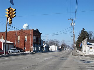
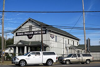
Portage is a village in Wood County, Ohio, United States. The population was 398 at the 2020 census.

<span class="mw-page-title-main">Spring Hill, Pennsylvania</span>

Spring Hill is a census-designated place (CDP) in Cambria County, Pennsylvania, United States. The population was 839 at the 2010 census, down from 970 at the 2000 census.

<span class="mw-page-title-main">Chesterfield Court House, Virginia</span> Unincorporated community in Virginia, United States

Chesterfield Court House is an unincorporated community and census-designated place that is the county seat of Chesterfield County, Virginia, United States. It was a census-designated place (CDP) at the 2020 census. It was not delineated as a CDP for the 2010 census. The Chesterfield County Courthouse and Courthouse Square are listed in the National Register of Historic Places. The area is also home of the Chesterfield County Government Complex.

<span class="mw-page-title-main">Loveland Park, Ohio</span> Census-designated place in Ohio, United States

Loveland Park is a census-designated place (CDP) located in Symmes Township, Hamilton County and Deerfield Township, Warren County, in the southwestern part of the U.S. state of Ohio. The CDP is named after the city of Loveland. The population was 1,737 at the 2020 census.

<span class="mw-page-title-main">Mineral Ridge, Ohio</span> Census-designated place in Ohio, United States

Mineral Ridge is an unincorporated community and census-designated place in southern Trumbull and northern Mahoning counties in the U.S. state of Ohio. The population was 3,951 at the 2020 census. It is a suburb of the Youngstown–Warren metropolitan area. Mineral Ridge was named for valuable coal deposits near the original town site.

<span class="mw-page-title-main">Mogadore, Ohio</span> Village in Ohio, United States

Mogadore is a village in Portage and Summit counties in the U.S. state of Ohio. The population was 3,811 at the 2020 census. A suburb of Akron, it is part of the Akron metropolitan area.

<span class="mw-page-title-main">Tallmadge, Ohio</span> City in Ohio, United States

Tallmadge is a city in eastern Summit County, Ohio, United States, with a small district in neighboring Portage County. It is a suburb of Akron and part of the Akron metropolitan area. The population was 18,394 at the 2020 census. Tallmadge was founded in 1807 and is the second-oldest city in Summit County, following Hudson, which was founded in 1799.

References

  1. "ArcGIS REST Services Directory". United States Census Bureau. Retrieved September 20, 2022.
  2. 1 2 U.S. Geological Survey Geographic Names Information System: Brimfield (CDP), Ohio
  3. 1 2 "U.S. Census website". United States Census Bureau . Retrieved 2008-01-31.
  4. Kilbourn, John (1833). The Ohio Gazetteer, or, a Topographical Dictionary. Scott and Wright. p. 104. Retrieved 12 December 2013.
  5. Overman, William Daniel (1958). Ohio Town Names. Akron, OH: Atlantic Press. p. 19.
  6. "Portage County". Jim Forte Postal History. Retrieved 13 January 2016.
  7. "Census of Population and Housing". Census.gov. Retrieved June 4, 2016.