Dewar is an unincorporated town in eastern Black Hawk County, Iowa, United States. It lies northeast of the city of Waterloo, the county seat of Black Hawk County. Its elevation is 889 feet (271 m). Although Dewar is unincorporated, it has a post office with the ZIP code of 50623, which opened on 25 October 1887.
Sperry is an unincorporated community in central Des Moines County, Iowa, United States. It lies along local roads north of the city of Burlington, the county seat of Des Moines County. Its elevation is 751 feet (229 m). Although Sperry is unincorporated, it has a post office with the ZIP code of 52650, which opened on 5 February 1870.
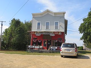
Killduff is an unincorporated community in southeastern Jasper County, Iowa, United States. It lies along local roads southeast of the city of Newton, the county seat of Jasper County.

Austinville is an unincorporated community in southwestern Butler County, Iowa, United States. It lies along Iowa Highway 57 southwest of the city of Allison, the county seat of Butler County. Its elevation is 1,001 feet (305 m). Although Austinville is unincorporated, it has a post office with the ZIP code of 50608, which opened on 3 October 1892. In 2022, the population was 100 in town and the surrounding area.
Prole is an unincorporated rural village in northwestern Warren County, Iowa, United States. It lies along Iowa Highway 28 northwest of the city of Indianola, the county seat of Warren County. Its elevation is 978 feet (298 m). Prole has a post office, with the ZIP code of 50229, a cafe, a floral shop and an auto repair shop by way of businesses and services.
Teeds Grove is an unincorporated community in northeastern Clinton County, Iowa, United States. It lies at the intersection of Clinton County Routes E44 and Z50, north of the city of Clinton, the county seat of Clinton County. Its elevation is 692 feet (211 m).

Toeterville is an unincorporated community and census-designated place in northwestern Mitchell County, Iowa, United States. As of the 2020 census it had a population of 53.
Froelich is an unincorporated community in Clayton County, Iowa, United States.
Arbor Hill is an unincorporated community or ghost town in Adair County, Iowa, United States.
Avon is an unincorporated community in Polk County, Iowa, United States.
Quincy is an unincorporated community in Adams County, Iowa, United States.
Walnut City is an unincorporated community in Appanoose County, Iowa, United States.
Crocker is an unincorporated community in Polk County in the U.S. state of Iowa.
Lawn Hill is an unincorporated community in Hardin County, in the U.S. state of Iowa.
Vernon is an unincorporated community in Van Buren County, in the U.S. state of Iowa.
Zion and Leith City are former unincorporated communities in Adair County, in the U.S. state of Iowa.
Fairmount is an unincorporated community in Jasper County, in the U.S. state of Iowa. Fairmount lies along the junction of Iowa Highway 163 and West 70th Street South. The community has also been known as Fairmont.
Little Turkey is an unincorporated community in eastern Chickasaw County, in the U.S. state of Iowa.
Saude is an unincorporated community in northern Chickasaw County, in the U.S. state of Iowa.
Astor was an unincorporated community in Crawford County, in the U.S. state of Iowa.

