Caney City, Texas

Last updated

Caney City, Texas
TXMap-doton-CaneyCity.PNG
Location of Caney City, Texas
Henderson County CaneyCity.svg
Coordinates: 32°12′52″N96°2′5″W / 32.21444°N 96.03472°W / 32.21444; -96.03472
Country United States
State Texas
County Henderson
Area
[1]
  Total1.15 sq mi (2.98 km2)
  Land1.15 sq mi (2.98 km2)
  Water0.00 sq mi (0.00 km2)
Elevation
[2]
354 ft (108 m)
Population
 (2010)
  Total217
  Estimate 
(2019) [3]
220
  Density190.97/sq mi (73.71/km2)
Time zone UTC-6 (Central (CST))
  Summer (DST) UTC-5 (CDT)
FIPS code 48-12472 [4]
GNIS feature ID1378089 [2]

Caney City is a town in Henderson County, Texas, United States. The population was 217 at the 2010 census. [5]

Contents

Geography

Caney City is located in western Henderson County at 32°12′52″N96°2′5″W / 32.21444°N 96.03472°W / 32.21444; -96.03472 (32.214575, –96.034837). [6] It occupies a peninsula on the eastern side of Cedar Creek Reservoir, between two arms of the lake: Clear Creek to the north and Caney Creek to the south. The city of Log Cabin borders Caney City to the northeast. Texas State Highway 198 passes through the eastern side of the city, leading north 14 miles (23 km) to Mabank and south 3 miles (5 km) to Malakoff. Athens, the Henderson county seat, is 12 miles (19 km) east of Caney City.

According to the U.S. Census Bureau, the city has a total area of 1.2 square miles (3.0 km2), all land. [5]

Demographics

Historical population
CensusPop.Note
1970 117
1980 312166.7%
1990 170−45.5%
2000 23638.8%
2010 217−8.1%
2019 (est.)220 [3] 1.4%
U.S. Decennial Census [7]

As of the census [4] of 2000, there were 236 people, 99 households, and 70 families residing in the town. The population density was 202.8 inhabitants per square mile (78.3/km2). There were 176 housing units at an average density of 151.3 per square mile (58.4/km2). The racial makeup of the town was 72.46% White, 25.85% African American, 1.27% from other races, and 0.42% from two or more races. Hispanic or Latino of any race were 0.85% of the population.

There were 99 households, out of which 24.2% had children under the age of 18 living with them, 60.6% were married couples living together, 6.1% had a female householder with no husband present, and 28.3% were non-families. 25.3% of all households were made up of individuals, and 8.1% had someone living alone who was 65 years of age or older. The average household size was 2.38 and the average family size was 2.77.

In the town, the population was spread out, with 20.8% under the age of 18, 2.5% from 18 to 24, 23.3% from 25 to 44, 33.1% from 45 to 64, and 20.3% who were 65 years of age or older. The median age was 46 years. For every 100 females, there were 105.2 males. For every 100 females age 18 and over, there were 114.9 males.

The median income for a household in the town was $9,079, and the median income for a family was $21,250. Males had a median income of $26,250 versus $22,778 for females. The per capita income for the town was $7,980. None of the families and 36.8% of the population were living below the poverty line, including no under eighteens and 16.9% of those over 64.

Politics

Caney City is currently led by Mayor Travis Lamar Matthews Jr.[ citation needed ]

Education

The town is served by the Malakoff Independent School District.[ citation needed ]

Related Research Articles

<span class="mw-page-title-main">Caney, Kansas</span> City in Montgomery County, Kansas

Caney is a city in Montgomery County, Kansas, United States. As of the 2020 census, the population of the city was 1,788.

<span class="mw-page-title-main">Pippa Passes, Kentucky</span> City in Kentucky, United States

Pippa Passes is a home rule-class city located along Caney Fork in Knott County, eastern Kentucky, United States. Its formal name was chosen to honor benefactors of Alice Lloyd College. Residents commonly call the community "Caney" or "Caney Creek". The population was 533 at the 2010 census, up from 297 at the 2000 census. The small city is located in the mountainous Appalachia region, an area of coal mining.

<span class="mw-page-title-main">Coates, Minnesota</span> Town in Minnesota

Coates is a town in the U.S. state of Minnesota located west of the Upper Mississippi River on the exurban fringe in central Dakota County.

<span class="mw-page-title-main">Caney, Oklahoma</span> Town in Oklahoma, United States

Caney is a town in Atoka County, Oklahoma, United States. The population was 205 at the 2010 census.

<span class="mw-page-title-main">Henderson Township, Jefferson County, Pennsylvania</span> Township in Pennsylvania, United States

Henderson Township is a township in Jefferson County, Pennsylvania, United States. The population was 1,941 at the 2020 census. It was named for Jefferson County Associate Judge Joseph Henderson.

<span class="mw-page-title-main">Ector, Texas</span> City in Texas, United States

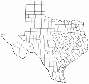
Ector is a city in Fannin County, Texas, United States. The population was 695 at the 2010 census, up from 600 at the 2000 census.

<span class="mw-page-title-main">Brownsboro, Texas</span> City in Texas, United States

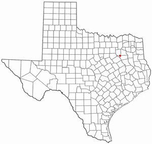
Brownsboro is a city in Henderson County, Texas, United States. The population was 1,212 at the 2020 census, up from 1,039 at the 2010 census. The city is on Texas State Highway 31.

<span class="mw-page-title-main">Chandler, Texas</span> City in Texas, United States

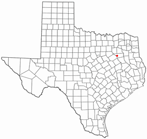
Chandler is a city in Henderson County, Texas, United States, at the northern end of Lake Palestine. Its population was 3,275 at the 2020 census, up from 2,734 at the 2010 census.

<span class="mw-page-title-main">Coffee City, Texas</span> Town in Texas, United States

Coffee City is a small town in southeastern Henderson County, Texas, United States. The population was 278 at the 2010 census, up from 193 at the 2000 census.

<span class="mw-page-title-main">Enchanted Oaks, Texas</span> Town in Texas, United States

Enchanted Oaks is a town in Henderson County, Texas, United States. The population was 326 at the 2010 census, down from 357 at the 2000 census.

<span class="mw-page-title-main">Eustace, Texas</span> City in Texas, United States

Eustace is a city in Henderson County, Texas, United States. The population was 991 at the 2010 census, up from 798 at the 2000 census.

<span class="mw-page-title-main">Gun Barrel City, Texas</span> Town in Texas, United States

Gun Barrel City is a town in Henderson County, Texas, United States. Its population was 6,190 at the 2020 census, an increase over the figure of 5,672 tabulated in 2010.

<span class="mw-page-title-main">Log Cabin, Texas</span> City in Texas, United States

Log Cabin is a city in Henderson County, Texas, United States. The population was 714 at the 2010 census.

<span class="mw-page-title-main">Malakoff, Texas</span> City in Texas, United States

Malakoff is a city in Henderson County, Texas, United States. The population was 2,179 at the 2020 census. The city is named after a Russian fort of Malakoff, which played a pivotal role during the siege of Sevastopol during the Crimean War.

<span class="mw-page-title-main">Payne Springs, Texas</span> Town in Texas, United States

Payne Springs is a town in Henderson County, Texas, United States. The population was 767 at the 2010 census, up from 683 at the 2000 census.

<span class="mw-page-title-main">Poynor, Texas</span> Town in United States

Poynor is a town in Henderson County, Texas, United States. The population was 305 at the 2010 census.

<span class="mw-page-title-main">Star Harbor, Texas</span> City in Texas, United States

Star Harbor is a city in Henderson County, Texas, United States. The population was 482 at the 2020 census.

<span class="mw-page-title-main">Tool, Texas</span> City in Texas, United States

Tool is a city in Henderson County, Texas, United States. The population was 2,175 at the 2020 census. Located on the west side of Cedar Creek Lake, it is a popular second home and retiree destination.

<span class="mw-page-title-main">Trinidad, Texas</span> City in Texas, United States

Trinidad is a city in Henderson County, Texas, United States, near the Trinity River from which the town's name was derived. The population was 860 at the 2020 census, down from 886 at the 2010 census.

<span class="mw-page-title-main">Porter Heights, Texas</span> Populated place in Texas, United States

Porter Heights is a census-designated place (CDP) in Montgomery County, Texas, United States. The population was 1,903 at the 2020 census.

References

  1. "2019 U.S. Gazetteer Files". United States Census Bureau. Retrieved August 7, 2020.
  2. 1 2 U.S. Geological Survey Geographic Names Information System: Caney City, Texas
  3. 1 2 "Population and Housing Unit Estimates". United States Census Bureau. May 24, 2020. Retrieved May 27, 2020.
  4. 1 2 "U.S. Census website". United States Census Bureau . Retrieved January 31, 2008.
  5. 1 2 "Geographic Identifiers: 2010 Census Summary File 1 (G001): Caney City town, Texas". American Factfinder. U.S. Census Bureau. Archived from the original on February 13, 2020. Retrieved February 13, 2018.
  6. "US Gazetteer files: 2010, 2000, and 1990". United States Census Bureau. February 12, 2011. Retrieved April 23, 2011.
  7. "Census of Population and Housing". Census.gov. Retrieved June 4, 2015.