Canoe Island is a 47-acre (19-hectare) island located in the center of the San Juan Islands, an archipelago in the U.S. state of Washington.[1] The island is situated in Upright Channel between Shaw and Lopez Islands. Canoe Island's surface is mostly forested with second-growth cedar, fir, hemlock, and madrona, with some old-growth trees, too. Its maximum elevation is 127.7 feet (38.9 metres). The rocky shoreline is bordered by dense forests of bull kelp.[2]
While Canoe Island is only accessible by boat, several Washington State Ferry routes pass between the southern tip of the island and Flat Point on Lopez Island, docking at Friday Harbor, and Lopez Ferry Landing. Canoe Island is privately owned by Canoe Island French Camp, a 501(c)(3) nonprofit that runs an overnight summer camp for children.
History
Indigenous Presence
Prior to European settlement, Canoe Island may have been occupied or visited by Indigenous Coast Salish peoples. Specifically, Canoe Island may have been part of the territory of the Lhaq'temish (Lummi), Tulalip, S'Klallam, and Samish Nations.[3] The Samish name for the island is Skwsá7 snéxwlh.[4] The island has several shell middens from this era.
Early European Exploration
The name Canoe Island first appears on the British Admiralty Chart 2840, Richards, 1858–1860.[5] Additional surveys by Captain George Henry in the 1850s and 1860s describe the channel surrounding Canoe Island as a safe passage with mild tides.[6]
Military Reserve
Canoe Island coastline.
In 1872, the San Juan Islands were declared property of the U.S. following the Pig War.[7] Shortly thereafter, the U.S. government sent a team of Army Engineers under the command of General Nathaniel Michler to determine the most favorable sites for military fortifications within the San Juan Islands. By September 1874, Michler and his team had selected the locations of seven large government military reservations, one of which was located on Canoe Island.[8] The other reserves were located on San Juan, Lopez, and Shaw Islands.[9]
In 1902, the San Juan Islander critiqued this use of land for military purposes, arguing that less than 1/10th of the land in military reserves would ever be needed by the U.S. government. It's unclear exactly why these reserves were so large, though it's possible that the government overestimated the value of the islands for military defense. The San Juan Islander also reported that the military reserves presented a barrier to settlement in the county.[10]
During this era, individuals could obtain leases of the military reservations in the archipelago. In 1898, I. J. Lichtenberg obtained the lease of Canoe Island for $1, with the stipulation that he be prepared to leave the reserve at any time the government deemed it necessary for military operations. Lichtenberg also held the lease for the military reservation on the North end of Lopez Island.[11]
Ultimately, the military reserves in the San Juan Islands were never used; artillery was never mounted on the sites, no military buildings were constructed, nor were troops ever housed on the reserves.[8]
1913 Manhunt
In 1913, Canoe Island briefly became the location of a manhunt that involved a criminal chase across multiple islands.
Welcome sign on Canoe Island.
The search began on Orcas, where two men arrived by skiff before boarding a ship for Bellingham. When their boat was found adrift, a search turned up a pocketbook with several documents related to bank robberies and other crimes committed in Canada. The sheriff and deputy summoned the British authorities, who confirmed that the two men were wanted for several crimes.
A few days later, one of the men returned to Orcas Island seeking his pocketbook on the boat. The sheriff was notified of man's return and a shootout on the porch of the Orcas Hotel ensued. The criminal escaped to the woods and later that night he escaped unharmed from an additional exchange of shots.
The following morning, the criminal, under the disguise of a carefree fisherman, stole a boat and departed for Shaw Island. The man ate breakfast there before stealing another boat to escape Shaw. This boat was later found on Canoe Island, though the outlaw was nowhere to be found.[12]
Le Colombier, Canoe Island.
In the following days, rumors spread that the man was eating his meals on Shaw. The authorities failed to capture the man despite a $1500 reward, though his camp on Shaw was found and it contained bloody bandages. The sheriff and Canadian authorities eventually gave up after a two-week search, believing that the man was still hiding on Shaw and receiving help from local residents.[13]
French Camp
In 1965, Dr. Warren and Florence Heath “Bunny” Horton Austin purchased Canoe Island for $95,000. Bunny Austin was the daughter of Horace E. Horton, founder of the Chicago Bridge & Iron Company. Three years after purchasing the island, the Austins established the “Institut Francile” and Canoe Island Camps, Inc. with help from Le Lycée Francais de Los Angeles. At first, the camp operated on Orcas Island at the Madrona Inn in Eastsound.[14]
Dock on Canoe Island.
The Austins chose to establish a French camp because no other French camp existed on the West coast at the time, and they sought to create one for their daughter, Dorothy Austin. Dr. Austin held a deep appreciation for French language and culture that sparked when he was a child. He also served in France with General Patton's Third Army in the 49th Field Hospital during World War II.[15]
The Austins continued to hold the camp on Orcas while developing buildings and infrastructure on Canoe Island. Architect Paul Gray of California oversaw the building plans. When the buildings were completed in 1975, all camp operations moved to Canoe Island.[14]
In 1992, Dr. Austin established the camp as a 501(c)(3) non-profit and renamed the organization Canoe Island French Camp. This change also established a board of directors, who continue to run the camp today in conjunction with the camp directors.[14][16]
Canoe Island trail.
Canoe Island French Camp
Currently, the camp welcomes 200 children each summer and additionally hosts school and family programs. Programming emphasizes French language and culture, as well as outdoor education. French language classes are offered, and campers participate in other activities including art, archery, fencing, kayaking, and theater. The curriculum promotes youth development, intercultural understanding, and environmental stewardship. Canoe Island French Camp seeks to give campers the tools they need to lead meaningful and successful lives resulting in positive impacts on their communities and the world.[17][18][19]
Canoe Island French Camp is one of four overnight camps for children in the San Juan Islands; the others include YMCA Camp Orkila, Camp Nor’Wester, and Camp Four Winds Westward Ho. Canoe Island French Camp is accredited by the American Camp Association and is a member of the Western Association of Independent Camps, which means that it meets the highest standards of camp excellence.[20]
In fiction
Canoe Island is a locale in the novel, The Boy Book: A Study of Habits and Behaviors, Plus Techniques for Taming Them.[21] The fictional story follows a teenager growing of age using life experiences, including those drawn from a visit to Canoe Island.
↑ Great Britain. Hydrographic Office., Bedwell, E. P., & Richards, George Henry, Sir. (n.d.). The Vancouver Island pilot : containing sailing directions for the coasts of Vancouver Island, and part of British Columbia : compiled from the surveys made by Captain George Henry Richards, R.N., in H.M. ships Plumper and Hecate, between the years 1858 and 1864. (pp. 1–280) [Government Documents]. London : Printed for the Hydrographic Office, Admiralty, 1864. https://jstor.org/stable/10.2307/community.29756231.
The San Juan Islands is an archipelago in the Pacific Northwest of the United States between the U.S. state of Washington and Vancouver Island, British Columbia, Canada. The San Juan Islands are part of Washington state, and form the core of San Juan County.
San Juan County is a county located in the Salish Sea in the far northwestern corner of the U.S. state of Washington. As of the 2020 census, its population was 17,788. The county seat and only incorporated town is Friday Harbor, located on San Juan Island. The county was formed on October 31, 1873, from Whatcom County and is named for the San Juan Islands, which are in turn named for Juan Vicente de Güemes, 2nd Count of Revillagigedo, the Viceroy of New Spain.
San Juan Island is the second-largest and most populous of the San Juan Islands in northwestern Washington, United States. It has a land area of 142.59 km2 and a population of 8,632 as of the 2020 census.
San Juan Airlines is a commuter airline operating scheduled and charter flights in the U.S. state of Washington and the Canadian province of British Columbia. Its main base of operations is Bellingham near the San Juan Islands. The airline's fleet consists of Cessna 172, 206 and 207 aircraft. In 1981, San Juan Airlines acquired Pearson Aircraft which was based in Port Angeles, Washington.
Moran State Park is a public recreation area on Orcas Island in Puget Sound's San Juan Islands in the state of Washington, United States. The state park encompasses over 5,000 acres of various terrain including forests, wetlands, bogs, hills, and lakes. It is the largest public recreation area in the San Juan Islands and the fourth largest state park in the state. A park focal point is the observation tower atop Mount Constitution, the highest point in San Juan County at 2,407 feet.
Ruggs is an unincorporated community located in the southern portion of Morrow County, Oregon, United States. Ruggs lies at the junction of Oregon Route 206, Oregon Route 207, Rhea Creek Road, and Upper Rhea Creek Road. The community is situated at an elevation of 2,136 feet (651 m).
Charlotte May Pierstorff, American girl who was shipped alive through the United States postal system by parcel post on February 19, 1914. After the incident, parcel post regulations were changed to prohibit the shipment of humans.
Roche Harbor is a sheltered harbor on the northwest side of San Juan Island in San Juan County, Washington, United States, and the site of a resort of the same name. Roche Harbor faces Haro Strait and the Canada–United States border. The harbor itself provides one of the better protected anchorages in the islands. The harbor is surrounded on the east side by San Juan Island, on the north side by Pearl Island, and on the west and south sides by Henry Island. Most of the harbor is 35 to 45 feet deep. Roche Harbor has a small airport used primarily by local residents.
The Samish Indian Nation is a Coast Salish nation and a signatory to the Treaty of Point Elliott of 1855. Samish has a government-to-government relationship with the United States of America. The Samish are a Northern Straits branch of Central Coast Salish peoples. The Samish Nation is headquartered in Anacortes, Fidalgo Island, in Washington, north of Puget Sound.
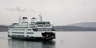
The MV Samish is the second vessel of the Olympic-class auto ferries built by Vigor Industrial for the Washington State Ferries system. The vessel started service with her maiden voyage to Friday Harbor as the #3 Boat in the San Juans on June 14, 2015.
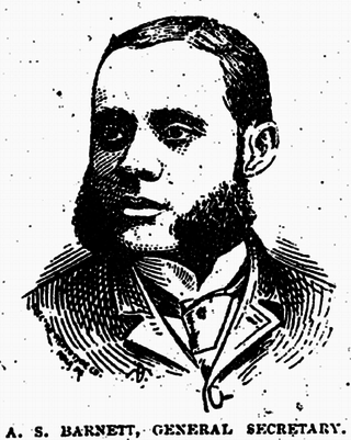
Alfred S. Barnett was an American journalist and civil rights activist in Omaha, Nebraska, Des Moines, Iowa, and Chicago, Illinois. In Des Moines, Barnett created and ran the newspaper, The Weekly Avalanche from 1891 to 1894. Before moving to Des Moines, he contributed to his brother, Ferdinand L. Barnett's Omaha paper, The Progress. He worked for civil rights also a member and an officer of numerous civil rights organizations, including the Nebraska branch of the National Afro-American League and the Afro-American Protective Association of Iowa. Barnett was described as a "pleasing speaker".
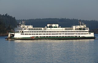
The Anacortes–San Juan Islands ferry is a system of ferry route operated by Washington State Ferries. The routes serve Anacortes, Lopez Island, Shaw Island, Orcas Island, San Juan Island, and Sidney on Vancouver Island in Canada. The ferry routes are part of State Route 20 Spur.
The Committee on Woman Suffrage was a committee of the United States House of Representatives between 1917 and 1927. The committee was influential in shepherding through the ratification of the 19th Amendment to the United States Constitution giving women the right to vote.
Friends of the San Juans ("Friends") is an environmental advocacy Nonprofit based in Friday Harbor, Washington. Founded in 1979, Friends is dedicated to preservation, both locally and internationally. Its mission is "Protecting and restoring the San Juan Islands and the Salish Sea for people and nature."
The Islands' Sounder is a newspaper published in Eastsound in the U.S. state of Washington. It was founded as The Orcas Sounder in 1964 by Al and Nickee Magnuson. It was expanded from 15 issues per year to a weekly publishing schedule, and its name was changed to encompass the entire San Juan Islands archipelago. The editor is Colleen Smith Armstrong.
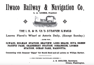
Ilwaco was a small riverine and coastal steamship built in 1890 which was operated as a passenger vessel for the Ilwaco Railway and Navigation Company, and later served in other roles, including tow and freight boat, cannery tender and fish packing vessel. Ilwaco was originally named Suomi.
Merritt Horace Day, sometimes called Col. M.H. Day, was an early pioneer, rancher, mine owner, and legislator in the Dakota Territory. Merritt Day was a "pronounced advocate for the division of Dakota," into the separate U.S. states of North Dakota and South Dakota, and Day County, South Dakota, is named in his honor. Day was commander of an irregular state militia in South Dakota during the Ghost Dance War. During the lead-up to what is now known as the Wounded Knee Massacre, "Col. Day" was issued hundreds of rifles and thousands of rounds of ammunition by the state governor, which he distributed to the 60 to 200 men of the Spring Creek Volunteers. These civilians are estimated to have killed between 12 and 18 Lakota in mid-December 1890, "kinsmen, brothers, or sons of the Lakota seeking refuge on Stronghold."
Henry Cayou was a Coast Salish businessman and politician who was one of the first Native elected officials in Washington state. He was a County Commissioner for San Juan County for 29 years and served one term in the Washington House of Representatives.
The First National Jamboree of the Boy Scouts of America took place in 1937. Originally scheduled to take place in 1935 to celebrate their silver jubilee, an outbreak of polio in Washington, D.C. and the neighboring states, caused it to be canceled and pushed back, finally taking place from June 30 to July 9, 1937. Twenty-five thousand scouts attended the event taking place on the National Mall at the foot of the Washington Monument using equipment loaned by the United States Army. Scouts from all around the United States arrived by train, while representatives of several foreign countries' scouting groups traveled by boat and even by foot. The event was celebrated by the entire city with Federal buildings being opened for visits, Mount Vernon offering daily visits, and many local residents volunteering their time. U.S. President Roosevelt took part in the celebration and a special message from Lord Baden-Powell was broadcast from London to the scouts during the jamboree calling for International Friendship. It was a display of American patriotism with American flags on display; the event took place in the American capital in front of the White House during the week of the 4th of July.
This page is based on this Wikipedia article Text is available under the CC BY-SA 4.0 license; additional terms may apply. Images, videos and audio are available under their respective licenses.