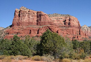
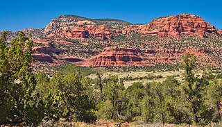
Courthouse Butte is a butte just north of the Village of Oak Creek, Arizona, south of Sedona in Yavapai County. Summit elevation is 5,454 feet (1,662 m). It is just east of Bell Rock.

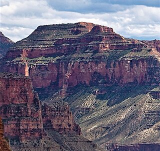
Brahma Temple is a 7,551-foot-elevation summit located in the Grand Canyon, in Coconino County of Arizona, US. It is situated six miles (9.7 km) north-northeast of the Yavapai Point overlook on the canyon's South Rim, and 4.5 miles south of the North Rim's Bright Angel Point. It towers 5,000 feet above Phantom Ranch in Bright Angel Canyon. Its nearest higher neighbor is Oza Butte, four miles to the north-northwest. Other neighbors include Zoroaster Temple one mile to the south, and Deva Temple, 1.5 miles to the north. Brahma Temple is named for Brahma, the Hindu creator of the universe. This name was applied by Clarence Dutton who began the tradition of naming geographical features in the Grand Canyon after mythological deities. This geographical feature's name was officially adopted in 1906 by the U.S. Board on Geographic Names.
Vishnu Temple is a 7,533-foot-elevation (2,296-meter) summit located in the Grand Canyon, in Coconino County of Arizona, US.

Buddha Temple is a 7,212-foot-elevation (2,198-meter) summit located in the Grand Canyon, in Coconino County of northern Arizona, in the Southwestern United States. It is situated 6.5 miles (10.5 km) due north of the Mather Point overlook on the canyon's South Rim, and four miles southwest of the North Rim's Bright Angel Point. Topographic relief is significant as it rises over 3,800 feet in two miles above Bright Angel Canyon to the east, and 3,000 feet in less than one mile above Haunted Canyon to the immediate west. Its neighbors include Manu Temple 1.5 miles (2.4 km) to the northeast, Isis Temple 2.3 miles to the southwest, Zoroaster Temple 3.8 miles to the southeast, and Deva Temple, 3.5 miles to the east. Buddha Temple was named by Henry Gannett, a geographer for Clarence Dutton, in following Dutton's practice of naming features in the Grand Canyon after mythological deities, in this case Buddha. This geographical feature's name was officially adopted in 1906 by the U.S. Board on Geographic Names. The first ascent of this butte was made in 1973 by Bruce Grubbs, Chauncey Parker, and Mark Brown via the Northwest Arete. According to the Köppen climate classification system, Buddha Temple is located in a Cold semi-arid climate zone.

Dox Castle is a 4,780-foot-elevation (1,460-meter) summit located in the Grand Canyon, in Coconino County of northern Arizona, US. It is situated four miles north-northeast of Havasupai Point, two miles northwest of Evans Butte, and 2.5 miles southwest of Holy Grail Temple, where it towers 2,500 feet above the Colorado River.

Holy Grail Temple is a 6,711-foot-elevation (2,046-meter) summit located in the Grand Canyon, in Coconino County of northern Arizona, US. It is situated seven miles north-northeast of Havasupai Point, and two miles west-northwest of King Arthur Castle, within the Shinumo Amphitheater. Topographic relief is significant as it rises over 4,500 feet above the Colorado River in three miles. According to the Köppen climate classification system, Holy Grail Temple is located in a cold semi-arid climate zone, with precipitation runoff draining south to Shinumo Creek, which flows west to the Colorado River.

Mount Huethawali is a 6,281-foot-elevation (1,914-meter) summit located in the Grand Canyon, in Coconino County of northern Arizona, US. It is situated 3.5 miles due east of Explorers Monument, 1.5 mile west of Grand Scenic Divide, and immediately southwest of Huxley Terrace. Surrounded by Garnet, Evolution, and Bass Canyons, Huethawali rises over 800 feet above Darwin Plateau, and over 4,000 feet higher than the nearby Colorado River.

Coronado Butte is a 7,162-foot (2,183 m)-elevation summit located in the Grand Canyon, in Coconino County of Arizona, United States. It is situated one mile (1.6 km) west of the Moran Point overlook on the canyon's South Rim, and one mile northeast of Sinking Ship, its nearest higher neighbor. Topographic relief is significant as this butte rises 4,600 feet (1,400 m) above the Colorado River in 2.5 miles (4.0 km). Coronado Butte is named for Francisco Vázquez de Coronado (1510–1554), the explorer whose 1540 expedition was the first European sighting of the Grand Canyon, among other landmarks. This geographical feature's name was officially adopted in 1906 by the U.S. Board on Geographic Names. The first ascent was made by John Hance and tourist prior to 1900, in the 1890s. According to the Köppen climate classification system, Coronado Butte is located in a cold semi-arid climate zone.

Chuar Butte is a prominent 6,500-foot-elevation (2,000-meter) summit located in the Grand Canyon, in Coconino County of northern Arizona, US. It is situated 1.5 miles northwest of Cape Solitude on the canyon's East Rim, three miles southeast of Gunther Castle, and immediately west of the confluence of the Colorado River and Little Colorado River. This position also places it where Marble Canyon ends, and the Grand Canyon begins. Topographic relief is significant as it rises nearly 3,800 feet above the river in less than one mile. According to the Köppen climate classification system, Chuar Butte is located in a cold semi-arid climate zone.

Gunther Castle is a 7,199-foot-elevation (2,194-meter) summit located in the Grand Canyon, in Coconino County of northern Arizona, US. It is situated three miles northwest of Chuar Butte, between Kwagunt Valley to the north, and Chuar Valley to the south. Topographic relief is significant as it rises nearly 4,500 feet above the Colorado River in three miles.

Brady Peak is an 8,121-foot (2,475 m)-elevation summit located in the Grand Canyon, in Coconino County of northern Arizona, United States. It is situated one mile (1.6 km) northeast of the Vista Encantada viewpoint on the canyon's North Rim, where it towers 4,800 feet (1,500 m) above the bottom of Nankoweap Canyon. Its nearest higher neighbor is Mount Hayden, two miles (3.2 km) to the north, Kibbey Butte is one mile to northwest, and Alsap Butte lies one mile to the northeast. Brady Peak is named after Peter Rainsford Brady (1825–1902), a pioneer and politician of the Arizona Territory. This geographical feature's name was officially adopted in 1932 by the U.S. Board on Geographic Names. According to the Köppen climate classification system, Brady Peak is located in a cold semi-arid climate zone.

Steamboat Mountain is a 7,410-foot-elevation (2,260-meter) summit located in the Grand Canyon, in Coconino County of northern Arizona, US. It is situated four miles northwest of Holy Grail Temple, and 2.5 miles west-southwest of Timp Point on the North Rim. George Wharton James described it as a "majestic butte", nearly encircled by Galloway and Saddle Canyons. Topographic relief is significant as it rises over 5,400 feet above the Colorado River in three miles. According to the Köppen climate classification system, Steamboat Mountain is located in a Cold semi-arid climate zone, with precipitation runoff draining west to the Colorado River via Tapeats Creek and Stone Creek. This feature's name was officially adopted in 1932 by the U.S. Board on Geographic Names.

O'Neill Butte is a 6,071-foot (1,850 m)-elevation summit located in the Grand Canyon, in Coconino County of northern Arizona, United States. It is situated 2.5 miles (4.0 km) east-northeast of Grand Canyon Village, one mile (1.6 km) northeast of Mather Point, and one mile immediately northwest of Yaki Point. Cedar Ridge connects O'Neill Butte with Yaki Point on the South Rim. Topographic relief is significant as O'Neill Butte rises 3,600 feet (1,100 m) above the Colorado River in two miles (3.2 km). Access to this prominence is via the South Kaibab Trail which traverses the east slope of the peak. According to the Köppen climate classification system, O'Neill Butte is located in a cold semi-arid climate zone.

Alsap Butte is a 7,494-foot-elevation (2,284-meter) summit located in the Grand Canyon in Coconino County of northern Arizona, Southwestern United States. It is situated two miles north of the Roosevelt Point on the canyon's North Rim, where it towers 3,700 feet above Nankoweap Canyon. Its nearest higher neighbor is Brady Peak, one mile to the southwest, with Hancock Butte and Mount Hayden set to the northwest, and Colter Butte two miles to southeast. Alsap Butte is named after John T. Alsap, a pioneer and politician of the Arizona Territory who served as the first mayor of Phoenix, and is known as "Father of Maricopa County". The geographical feature's name was officially adopted in 1932 by the United States Board on Geographic Names. According to the Köppen climate classification system, Alsap Butte is located in a cold semi-arid climate zone. Alsap Butte is composed of Pennsylvanian-Permian Supai Group overlaying cliff-forming Mississippian Redwall Limestone, which in turn overlays slope-forming Cambrian Tonto Group. Precipitation runoff from this feature drains northeast into the Colorado River via Nankoweap Creek.
Evans Butte is a 6,379-foot-elevation (1,944-meter) summit located in the Grand Canyon, in Coconino County of northern Arizona, US. It is situated at the north end of Sagittarius Ridge, three miles south-southwest of King Arthur Castle, and two miles southeast of Dox Castle. Topographic relief is significant as it rises over 4,100 feet above the Colorado River in 2.5 miles (4.0 km), and the north aspect rises 2,700 feet above Flint Creek in one mile. According to the Köppen climate classification system, Evans Butte is located in a cold semi-arid climate zone, with precipitation runoff draining west to the Colorado River via Shinumo Creek, Hotauta Canyon, and Monadnock Amphitheater. The butte is composed of Pennsylvanian-Permian Supai Group overlaying the cliff-forming Mississippian Redwall Limestone, and Cambrian Tonto Group. Evans Butte was climbed solo by Harvey Butchart on October 11, 1976, thereby making it the 76th of the 83 summits which he climbed in the Grand Canyon.

Guinevere Castle is a 7,281-foot-elevation (2,219 meter) summit located in the Grand Canyon, in Coconino County of northern Arizona, US. It is situated one-half mile southeast of King Arthur Castle, one mile west of Excalibur, and 2.5 miles northeast of Evans Butte, within the Shinumo Amphitheater. Topographic relief is significant as it rises 5,000 feet above the Colorado River in 4.5 miles, and 2,600 feet above Gawain Abyss in one mile. According to the Köppen climate classification system, Guinevere Castle is located in a cold semi-arid climate zone.

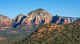
Wilson Mountain is a 7,122-foot-elevation (2,171-meter) summit in Coconino County, Arizona, United States.
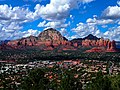
Bear Mountain is a 6,572-foot-elevation (2,003-meter) summit in Yavapai County, Arizona, United States.

Lost Wilson Mountain is a 6,762-foot-elevation (2,061-meter) summit in Yavapai County, Arizona, United States.

East Pocket Knob is a 7,196-foot-elevation (2,193-meter) summit in Coconino County, Arizona, United States.