
Sausthorpe is a small village and civil parish in the East Lindsey district of Lincolnshire, England, 8 miles (13 km) east of Horncastle and 3 miles (4.8 km) north-west of Spilsby. It lies on the southern edge of the Lincolnshire Wolds – a designated Area of Outstanding Natural Beauty – in the valley of the River Lymn. Farming remains the dominant economic activity in the area. The population was 305 in the 2011 census and estimated at 306 in 2019.

Fremington is a large village, civil parish and former manor in North Devon, England, the historic centre of which is situated three miles (5 km) west of Barnstaple. The village lies between the south bank of the tidal estuary of the River Taw and a small inlet of that river known as Fremington Pill. The parish is surrounded clockwise from the north by the parishes of Heanton Punchardon, Ashford, West Pilton, Barnstaple, Tawstock, Horwood, Lovacott and Newton Tracey, and Instow.

Lustleigh is a small village and civil parish in the Wray Valley, inside the Dartmoor National Park in Devon, England. It is between the towns of Bovey Tracey and Moretonhampstead. The village has often been named amongst the best or prettiest villages in the country in various publications, particularly due to the traditional thatched buildings in the village centre, and local activities such as the Lustleigh Show. This has also led to it being noted as the most expensive rural location to buy a house.

Calstock is a civil parish and a large village in south east Cornwall, England, United Kingdom, on the border with Devon. The village is situated on the River Tamar 6 miles (9.7 km) south west of Tavistock and 10 miles (16 km) north of Plymouth.
Buckland Brewer is a village and civil parish in the Torridge district of Devon, England, 4.7 miles south of Bideford. Historically the parish formed part of Shebbear Hundred. According to the 2001 census it had a population of 777, increasing to 794 at the 2011 census The village is part of Waldon electoral ward. The population for this at the same census was 1,679.

Zeal Monachorum is a village and civil parish in the Mid Devon district of Devon, England, about 18 miles (29 km) north-west of Exeter, situated on the River Yeo. According to the 2001 census, it had a population of 398. The village is in the electoral ward of Taw whose population at the 2011 Census was 1,660.

Thurgarton is a small village in rural Nottinghamshire, England. The village is close to Southwell, and Newark-on-Trent and still within commuting distance to Nottingham. It is served by Thurgarton railway station. According to the 2001 census it had a population of 412, increasing to 440 at the 2011 census and marginally to 445 at the 2021 census.

Oakford is a village and civil parish in the Mid Devon district of Devon, England. It is located three miles (5 km) south west of Bampton and eight miles (13 km) north north west of Tiverton. Oakford is near the river Exe.
Feniton is a village and civil parish in East Devon in the English county of Devon. The village lies about 4 miles (6.4 km) west of Honiton, 3 miles (4.8 km) north of Ottery St Mary, and 2 miles (3.2 km) east of Talaton.

Stoke Climsland is a village in the valley of the River Tamar, Cornwall, England, United Kingdom within the civil parish of Stokeclimsland. The population of the parish including Luckett at the 2011 census was 1,703. An electoral ward of the same name also exists. At the same census the population was 3,703.

Cruwys Morchard is an ecclesiastical and civil parish in the Mid Devon district of the county of Devon in England. It is located about four to five miles west of Tiverton along the road to Witheridge. The parish covers about 5,765 acres (23.33 km2) of land, and comprises a number of scattered houses and farms, and three small hamlets, Pennymoor, Way Village and Nomansland. The church and the manor house are in the centre of the parish. The population at the time of the 2000 census was 461. The parish takes its name from the Cruwys family who have been Lords of the Manor here since the reign of King John (1199–1216).

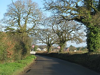
Wellingore is a village and civil parish in the North Kesteven district of Lincolnshire, England. The population of the civil parish at the 2011 census was 356. It is situated on the A607 road, approximately 12 miles (19 km) south from Lincoln. It conjoins the village of Navenby to the north. The Viking Way traverses through the village, passing from the side of the cliff edge to Ermine Street.
Hawkchurch is a village and civil parish in Devon, England, 3 miles (5 km) north east of Axminster on the border of Devon and Dorset, and about 6 miles (10 km) south of Somerset. It is 4 miles (6 km) north of the tourist and fishing town of Lyme Regis.

Chulmleigh is a small Saxon hilltop market town and civil parish located in North Devon in the heart of the English county of Devon. It is located 20 miles (32 km) north west of Exeter, just north of the Mid Devon boundary, linked by the A377 and B3096 roads.
Sandford is a village and civil parish in the Mid Devon district, within Devon, England. Sandford is part of the electoral ward named Sandford and Creedy. The ward population at the 2011 Census was 3,429.

Week St Mary is a village and civil parish in northeast Cornwall, England, United Kingdom. It is situated south of Bude close to the River Tamar and the border between Cornwall and Devon in the Hundred of Stratton. The parish population at the 2011 census is 657.

Lawhitton is a village in the civil parish of Lawhitton Rural, in east Cornwall, England, United Kingdom. The village is situated two miles (3 km) southwest of Launceston and half-a-mile west of Cornwall's border with Devon at the River Tamar.

Chevington is a village and civil parish in the West Suffolk district of Suffolk in East Anglia, England. Located around 10 km south-west of Bury St Edmunds, in 2005 its population was 630, reducing to 602 at the 2011 Census. The parish also contains the hamlets of Broad Green and Tan Office Green.

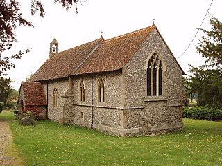
Molland is a small village, civil parish, dual ecclesiastical parish with Knowstone, located in the foothills of Exmoor in Devon, England. It lies within the North Devon local government district. At the time of the 2001 Census, the village had 203 inhabitants. Molland was first referenced as the Manor of Molland in the Domesday Book. The village contains a church dating back to the 1400s.
Crowell is a village and civil parish in Oxfordshire, about 4 miles (6.4 km) southeast of the market town of Thame and 1 mile (1.6 km) southwest of the village of Chinnor. The 2001 Census recorded the parish's population as 100. Crowell village is a spring line settlement at the source of a stream called the Pleck at the foot of the Chiltern Hills escarpment. The toponym "Crowell" is derived from the Old English for "crow's spring" or "crow's stream".

