Hatherleigh

Last updated

Hatherleigh
Devon UK location map.svg
Red pog.svg
Hatherleigh
Location within Devon
Population1,306 (Parish, 2001)
OS grid reference SS5404
District
Shire county
Region
Country England
Sovereign state United Kingdom
Post town Okehampton
Postcode district EX20
Dialling code 01837
Website Community page website
List of places
UK
England
Devon
50°49′00″N4°04′00″W / 50.8167°N 4.0667°W / 50.8167; -4.0667

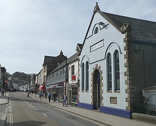
Hatherleigh is a small market town in west Devon, England.

Hatherleigh church St John the Baptist's Church, Hatherleigh - geograph.org.uk - 80166.jpg
Hatherleigh church
Churchyard in Hatherleigh Churchyard, Hatherleigh.jpg
Churchyard in Hatherleigh

It hosts an arts festival in July, [1] and a carnival in November featuring two flaming tar barrel runs. [2] The Walruses meet on New Year's Day to jump into the River Lew to raise money for local good causes, this tradition which started in the 1980s came to end on January 1, 2018. An annual half-marathon called the Ruby Run takes place usually in June between Holsworthy and Hatherleigh, starting from each town in alternate years.

Hatherleigh Market has weekly sales of sheep, cattle and poultry with increased sales on Tuesdays. It is the smallest town in Devon. The market formally closed in February 2018 due to the site being sold to make way for a new housing development, the Tuesday pannier market continues and there will be provision and a new building in the development. In September 2019 the demolition of the site began as of March 2020 only one building of the market remains to temporary house the pannier market, the new development is moving at pace with many of the new buildings now rising from the ground.

Hatherleigh is home to two pubs, The Tally Ho and The George. The George was burned down in an arson attack on 23 December 2008 and has subsequently been rebuilt and re-opened in 2010. More than 100 firefighters from across the county were drafted in to help fight the blaze which was still burning well into the early hours of Christmas Eve. Hatherleigh also has a cafe, two hairdressers, craft shops, a beauty salon, a butcher, a newsagency, a vets, medical centre, a convenience shop and a petrol station.

The parish church is dedicated to St John the Baptist and has a western tower topped by a shingled spire. The spire was destroyed in the Burns' Day Storm of 1990 and a replica of the original now stands in its place. The nave and aisles are divided by granite arcades. The font is Norman and the original wagon roofs remain. [3]

An impressive obelisk one mile (1.6 km) east of the town commemorates Lt Col. William Morris (d. 1858 in India): it was built in 1860. [4] [5]

Hatherleigh was the beginning of the 7th stage of the Tour of Britain in September 2009 and record numbers turned out to watch the famous race begin. Hatherleigh had often been on the course of the Tour but this was the first time a stage had started in the town.

Hatherleigh saw the Olympic torch pass through the town on 21 May 2012. [6]

There is an electoral ward with the same name. The population at the 2011 census was 2,218. [7]

There is no railway station within Hatherleigh's boundaries. However residents can use the nearby railway station in Okehampton now that the Dartmoor Line has reopened with regular services to Exeter.

The village is part of the Ruby Country which covers 45 parishes around the market towns of Holsworthy and Hatherleigh. These two towns were at the centre of the 2001 Foot and Mouth Disease outbreak, and although agriculture was directly affected, most local businesses suffered considerable financial hardship. As a result, the Ruby Country Initiative was established, a not for profit partnership, to help create a more robust and sustainable local economy, and to create an identity for the area. [8]

Related Research Articles

<span class="mw-page-title-main">Barnstaple</span> Town in Devon, England

Barnstaple is a river-port town and civil parish in the North Devon district of Devon, England. The town lies at the River Taw's lowest crossing point before the Bristol Channel. From the 14th century, it was licensed to export wool from which it earned great wealth. Later it imported Irish wool, but its harbour silted up and other trades developed such as shipbuilding, foundries and sawmills. A Victorian market building survives, with a high glass and timber roof on iron columns.

<span class="mw-page-title-main">Okehampton</span> Town in Devon, England

Okehampton is a town and civil parish in West Devon in the English county of Devon. It is situated at the northern edge of Dartmoor, and had a population of 5,922 at the 2011 census. Two electoral wards are based in the town. Their joint population at the same census was 7,500.

<span class="mw-page-title-main">Moretonhampstead</span> Town in Devon, England

Moretonhampstead is a market town, parish and ancient manor in Devon, situated on the north-eastern edge of Dartmoor, within the Dartmoor National Park. The parish now includes the hamlet of Doccombe, and it is surrounded clockwise from the north by the parishes of Drewsteignton, Dunsford, Bridford, Bovey Tracey, Lustleigh, North Bovey and Chagford.

<span class="mw-page-title-main">Tavistock</span> Town in Devon, England

Tavistock is an ancient stannary and market town within West Devon, England. It is situated on the River Tavy from which its name derives. At the 2011 census the three electoral wards had a population of 13,028. It traces its recorded history back to at least 961 when Tavistock Abbey, whose ruins lie in the centre of the town, was founded. Its most famous son is Sir Francis Drake.

<span class="mw-page-title-main">West Devon</span> Non-metropolitan district and borough in England

West Devon is a local government district with borough status in Devon, England. Its council is based in Tavistock, the borough's largest town. The borough also includes the towns of Hatherleigh, North Tawton and Okehampton, along with numerous villages and surrounding rural areas.

Honiton is a market town and civil parish in East Devon, situated close to the River Otter, 17 miles (27 km) north east of Exeter in the county of Devon. Honiton has a population estimated at 11,822.

<span class="mw-page-title-main">Holsworthy</span> Town in Devon, England

Holsworthy is a market town and civil parish in the Torridge district of Devon, England, 36 miles (58 km) west of Exeter. The River Deer, a tributary of the River Tamar, forms the western boundary of the parish, which includes the village of Brandis Corner. According to the 2011 census the population of Holsworthy was 2,641; it was estimated at 3,287 in 2019.

<span class="mw-page-title-main">Topsham, Devon</span> Town in Devon, England

Topsham is a town in Devon, England, located on the east side of the River Exe, immediately north of its confluence with the River Clyst and the former's estuary, between Exeter and Exmouth. Topsham is a historic port and was designated a town by a 1300 royal charter granted by Edward I; it was formally amalgamated into the City of Exeter in 1966. The population of the town, recorded at the 2021 census, is 4,146.

<span class="mw-page-title-main">Bovey Tracey</span> Town in Devon, England

Bovey Tracey is a small town and civil parish in Devon, England, on the edge of Dartmoor, its proximity to which gives rise to the slogan used on the town's boundary signs, "The Gateway to the Moor". It is often known locally as "Bovey". It is about 10 miles south-west of Exeter and lies on the A382 road, about halfway between Newton Abbot and Moretonhampstead. The village is at the centre of the electoral ward of Bovey. At the 2011 census the population of this ward was 7,721.

<span class="mw-page-title-main">North Tawton</span> Town in Devon, England

North Tawton is a small town in Devon, England, situated on the river Taw. It is administered by West Devon Council. The population of the electoral ward at the census 2011 was 2,026.

<span class="mw-page-title-main">Halwill Junction railway station</span> Former railway station in Devon, England

Halwill Junction Railway Station was a railway station in Halwill Junction, near the villages of Halwill and Beaworthy in Devon, England. It opened in 1879 and formed an important junction between the now-closed Bude Branch and North Cornwall line. It closed in 1966 along with the lines which it served, a casualty of the Beeching Report.

<span class="mw-page-title-main">Holsworthy railway station</span> Former railway station in Devon, England

Holsworthy was a railway station in Devon, England, on the now-closed railway line from Okehampton to Bude. It opened in 1879 to serve the market town of Holsworthy and closed in 1966, a victim of the Beeching Axe.

<span class="mw-page-title-main">Ruby Country</span>

Ruby Country is the name given to the rural inland hinterland of north-west Devon, UK. It covers 45 parishes around the market towns of Holsworthy and Hatherleigh. These two towns were at the centre of the 2001 Foot and Mouth Disease outbreak, and although agriculture was directly affected, most local businesses suffered considerable financial hardship.

<span class="mw-page-title-main">Clawton</span> Village and civil parish in Devon, England

Clawton is a village and civil parish in the far west of Devon, England. It forms part of the local government district of Torridge. The village lies about three miles south of the town of Holsworthy on the A388 road. The parish is surrounded clockwise from the north-west by the parishes of Pyworthy, Holsworthy Hamlets, Ashwater, and Tetcott. Its western border follows the River Tamar which forms the county boundary with Cornwall. In 2001 its population was 326, slightly down from 389 in 1901.

<span class="mw-page-title-main">Hollacombe</span> Village and civil parish in Devon, England

Hollacombe is a village and small civil parish in the local government district of Torridge, Devon, England. It lies about 3 miles south east of the town of Holsworthy and is surrounded clockwise from the north by the parishes of Cookbury, Ashwater, and Holsworthy Hamlets. In 2001 its population was 59, compared to 69 in 1901.

<span class="mw-page-title-main">Pancrasweek</span> Hamlet and civil parish in Devon, England

Pancrasweek is a village and civil parish and hamlet in the far west of Devon, England forming part of the local government district of Torridge and lying about three miles north west of the town of Holsworthy.

<span class="mw-page-title-main">Pannier market</span> British indoor market hall

A pannier market is a form of indoor market especially popular in Devon in the West Country of the United Kingdom where they can be found in various cities and towns. They take their name from the panniers once used to carry goods to market on the back of pack animals.

<span class="mw-page-title-main">Guildhall, Barnstaple</span> Guildhall in Devon, England

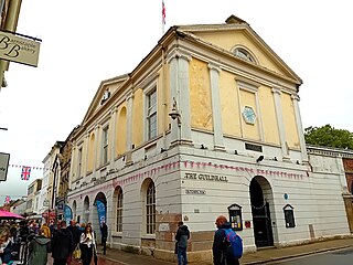
The Guildhall in Barnstaple in Devon in the United Kingdom is the Guildhall for the town and was completed in 1828, replacing an earlier Guildhall. Beneath and behind the Guildhall is the Pannier Market; completed in 1855, the building has been a Grade II* listed building since 19 January 1951.

<span class="mw-page-title-main">Pannier Market, Bideford</span> Historic market in North Devon, England

The Pannier Market in Bideford in North Devon is a large covered Victorian pannier market together with the Butcher's Row of small artisan stalls running along the lower level of the Market. There has been a market on the site since 1675. Since 1989 it has been a Grade II listed building on the register of Historic England.

<span class="mw-page-title-main">Pannier Market, Torrington</span>

The Pannier Market in Great Torrington in Devon is a Victorian pannier market of 12 small indoor shops - six either side of a narrow cobbled lane built in 1842 and restored in 1999. The Market House building at the front of the complex has been a Grade II* listed building on the Historic England Register since 1951.

References

  1. "Welcome to the Hatherleigh Festival Website". Hatherleigh Festival Website. Retrieved 16 December 2008.
  2. "Carnival Index Page". Hatherleigh.net. Retrieved 16 December 2008.
  3. Pevsner, N. (1952) North Devon. Harmondsworth: Penguin Books; p. 96
  4. Pevsner, N. (1952)
  5. "William Morris Monument, Hatherleigh, Devon, UK". Waymarking. Retrieved 18 April 2010.
  6. "Olympic Torch Blazes Way Through North Devon". Express and Echo. 17 May 2012. Retrieved 16 October 2016.[ permanent dead link ]
  7. "Ward population 2011" . Retrieved 17 February 2015.
  8. "Welcome to the Ruby Country". Ruby Country. Retrieved 5 July 2016.