Chesapeake Western Railway

Last updated
A Norfolk Southern Railway grain train on the Chesapeake Western Railway in Linville, Virginia in 2012. A Hard Push (6799118741).jpg
A Norfolk Southern Railway grain train on the Chesapeake Western Railway in Linville, Virginia in 2012.

The Chesapeake Western Railway( reporting mark CHW) is an intrastate railroad in west-central Virginia and it is an operating subsidiary of the Norfolk Southern Railway.

Reporting mark alphabetic code ID used on the North American railroad network

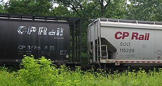
A reporting mark is an alphabetic code of two to four letters used to identify owners or lessees of rolling stock and other equipment used on certain railroad networks.

Virginia State in the United States

Virginia, officially the Commonwealth of Virginia, is a state in the Southeastern and Mid-Atlantic regions of the United States located between the Atlantic Coast and the Appalachian Mountains. The geography and climate of the Commonwealth are shaped by the Blue Ridge Mountains and the Chesapeake Bay, which provide habitat for much of its flora and fauna. The capital of the Commonwealth is Richmond; Virginia Beach is the most populous city, and Fairfax County is the most populous political subdivision. The Commonwealth's estimated population as of 2018 is over 8.5 million.

An operating subsidiary is a subsidiary of a corporation through which the parent company indirectly conducts some portion of its business. Usually, an operating subsidiary can be distinguished in that even if its board of directors and officers overlap with those of other entities in the same corporate group, it has at least some officers and employees who conduct business operations primarily on behalf of the subsidiary alone. The term carries slightly different meanings depending upon the specific context and industry.

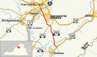
It extended from Elkton, Virginia on the South Fork of the Shenandoah River in Rockingham County to Stokesville, Virginia in Augusta County at the foot of the Allegheny Mountains. At Elkton, it interchanged with the Norfolk and Western Railway. At Harrisonburg, Virginia it interchanged with the Southern Railway.

Elkton, Virginia Town in Virginia, United States

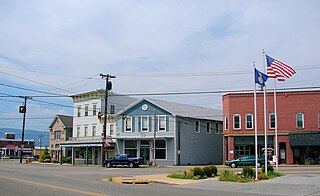
Elkton is an incorporated town in Rockingham County, Virginia, United States. It is included in the Harrisonburg Metropolitan Statistical Area. The population was 2,762 at the 2010 census. Elkton was named for the Elk Run stream.

Shenandoah River river in Virginia and West Virginia, United States

The Shenandoah River is a tributary of the Potomac River, 55.6 miles (89.5 km) long with two forks approximately 100 miles (160 km) long each, in the U.S. states of Virginia and West Virginia. The principal tributary of the Potomac, the river and its tributaries drain the central and lower Shenandoah Valley and the Page Valley in the Appalachians on the west side of the Blue Ridge Mountains, in northwestern Virginia and the Eastern Panhandle of West Virginia.

Rockingham County, Virginia U.S. county in Virginia

Rockingham County is a county located in the U.S. state of Virginia. As of the 2010 census, the population was 76,314. Its county seat is the independent city of Harrisonburg.

Construction began in 1895 in Harrisonburg by the Chesapeake and Western Railroad, and proceed both east and west. To the west, Bridgewater, Virginia was the original terminus, but the line was extended to Stokesville by 1901 by the newly reorganized Chesapeake Western Railway. In 1933 the line was cut back to Bridgewater, and later to Dayton, Virginia. To the east the line reached Elkton by 1896, where the line's main yard and shops were constructed.

Bridgewater, Virginia Town in Virginia, United States

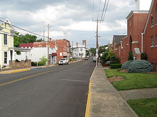
Bridgewater is an incorporated town in Rockingham County, Virginia, United States. The population was 5,644 at the 2010 census. It is included in the Harrisonburg, Virginia Metropolitan Statistical Area. Bridgewater is also home to Bridgewater College.

Dayton, Virginia Town in Virginia, United States

Dayton is a town in Rockingham County, Virginia, United States. The population is 1,530 as of the 2010 census. It is included in the Harrisonburg, Virginia Metropolitan Statistical Area.

In 1938 the line was bought by the line's general manager, Don Thomas, with the help of Norfolk and Western, which assumed direct control in 1954. In 1942, the Baltimore and Ohio's Valley Road of Virginia line, which ran between Harrisonburg and Lexington, Virginia was purchased, though the portion from Staunton, Virginia to Lexington was promptly dismantled. Later, a portion of the same line to the north of Harrisonburg as far as Mount Jackson, Virginia was added.

Lexington, Virginia Independent city in Virginia, United States

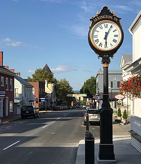
Lexington is an independent city in the Commonwealth of Virginia in the United States. At the 2010 census, the population was 7,042. It is the county seat of Rockbridge County, although the two are separate jurisdictions. The Bureau of Economic Analysis combines the city of Lexington with Rockbridge County for statistical purposes. Lexington is about 57 miles (92 km) east of the West Virginia border and is about 50 miles (80 km) north of Roanoke, Virginia. It was first settled in 1777.

Staunton, Virginia Independent city in Virginia, United States

Staunton is an independent city in the U.S. Commonwealth of Virginia. As of the 2010 census, the population was 23,746. In Virginia, independent cities are separate jurisdictions from the counties that surround them, so the government offices of Augusta County are in Verona, which is contiguous to Staunton.

Mount Jackson, Virginia Town in Virginia, United States

Mount Jackson is a town in Shenandoah County, Virginia, United States. The population was 1,994 at the 2010 census.

The Chesapeake Western Railway operates three rail lines under Norfolk Southern ownership:

At one time, the Chesapeake Western Railway operated its trackage as one rail line called the Chesapeake Western Branch under Norfolk Southern ownership, before it was split into three separate rail lines.

A portion of the line south of Harrisonburg between Pleasant Valley, Rockingham County, Virginia is owned and operated by the Shenandoah Valley Railroad. Furthermore, the old Chesapeake Western Station remains standing in downtown Harrisonburg.

Pleasant Valley, Rockingham County, Virginia Unincorporated community in Virginia, United States

Pleasant Valley is an unincorporated community in Rockingham County, Virginia, United States. Pleasant Valley is located 4.7 miles (7.6 km) south-southeast of Harrisonburg, Virginia.

The Shenandoah Valley Railroad is a shortline railroad operating 20.2 miles (32.5 km) of track between Staunton and Pleasant Valley, Virginia. The railroad interchanges with CSX and Buckingham Branch in Staunton and Norfolk Southern in Pleasant Valley. The railroad was purchased from Norfolk Southern in 1993 and is currently operated by the Durbin and Greenbrier Valley Railroad.

Related Research Articles

U.S. Route 340 is a spur route of US 40, and runs from Greenville, Virginia to Frederick, Maryland. In Virginia, it runs north–south, parallel and east of US 11, from US 11 north of Greenville via Waynesboro, Grottoes, Elkton, Luray, Front Royal, and Berryville to the West Virginia state line. A short separate piece crosses northern Loudoun County on its way from West Virginia to Maryland.

Norfolk and Western Railway US freight railroad

The Norfolk and Western Railway was a US class I railroad, formed by more than 200 railroad mergers between 1838 and 1982. It was headquartered in Roanoke, Virginia, for most of its existence. Its motto was "Precision Transportation"; it had a variety of nicknames, including "King Coal" and "British Railway of America" even though the N&W had mostly articulated steam on its roster. During the Civil War, the N&W was the biggest railroad in the south and moved most of the products with their steam locomotives to help the South the best way they could.

Virginia State Route 259 state highway in Virginia, United States

State Route 259 is a primary state highway in the U.S. state of Virginia. The state highway runs a total of 26.80 miles (43.13 km) in two sections. The southern section, in northern Rockingham County, has a length of 21.81 miles (35.10 km) from Interstate 81 (I-81) and U.S. Route 11 at Mauzy through Broadway to the West Virginia state line into Mathias. The northern section, in western Frederick County, covers 4.99 miles (8.03 km) from the West Virginia state line north to US 50 at Gore. The two sections of SR 259 are joined by West Virginia Route 259.

Buckingham Branch Railroad

Buckingham Branch Railroad is a Class III short-line railroad operating over 275 miles (443 km) of historic and strategic trackage in Central Virginia. Sharing overhead traffic with CSX and Amtrak, the company's headquarters are in Dillwyn, Virginia in the former Chesapeake and Ohio Railroad (C&O) station, itself a historic landmark in the community. The railroad was featured in the January 2012 issue of Trains Magazine.

Transportation in Virginia

Transportation in the Commonwealth of Virginia is by land, sea and air. Virginia's extensive network of highways and railroads were developed and built over a period almost 400 years, beginning almost immediately after the founding of Jamestown in 1607, and often incorporating old established trails of the Native Americans.

Norfolk and Portsmouth Belt Line Railroad

The Norfolk and Portsmouth Belt Line Railroad is a class III railroad operating in southern Virginia.

The Rockingham County Baseball League is a summer baseball league in Rockingham County, Virginia. The RCBL is the second oldest continuous baseball league in the country - trailing only major league baseball. It was founded in 1924, and has included teams from across Rockingham County and up and down the Shenandoah Valley. It currently has 8 teams. The league consist of two divisions, East and West. The league has a 28-game regular season schedule. The first round of the playoffs is the best out of three games, the second round is best out of five games, and the third and final round is best out of seven games.

U.S. Route 460 in Virginia highway in Virginia

U.S. Route 460 (US 460) in Virginia runs west-east through the southern part of the Commonwealth. The road has two separate pieces in Virginia, joined by a relatively short section in West Virginia. Most of US 460 is a four-lane divided highway and is a major artery in the southern third of the state.

U.S. Route 33 in Virginia highway in Virginia

U.S. Route 33 is a part of the U.S. Highway System that runs from Elkhart, Indiana to Richmond, Virginia. In Virginia, the U.S. Highway runs 135.60 miles (218.23 km) from the West Virginia state line near Rawley Springs east to its eastern terminus at SR 33 in Richmond. US 33 is the primary east–west highway of Rockingham County, which lies in the Shenandoah Valley. The highway connects the independent city of Harrisonburg, the town of Elkton, and an entrance to Shenandoah National Park. East of the Blue Ridge Mountains, US 33 connects the Piedmont communities of Stanardsville, Gordonsville, and Louisa. The U.S. Highway is a major suburban and urban route in the Richmond metropolitan area. Within Richmond, US 33 runs concurrently with US 250. SR 33 continues from US 33's eastern terminus as a state-numbered extension of the U.S. Highway that connects Richmond with Virginia's Middle Peninsula.

Virginia State Route 253 state highway in Virginia, United States

State Route 253 is a primary state highway in the U.S. state of Virginia. Known as Port Republic Road, the state highway runs 12.18 miles (19.60 km) from U.S. Route 11 in Harrisonburg east to US 340 near Port Republic. SR 253 is a northwest–southeast highway that connects Harrisonburg with Cross Keys and Port Republic in southeastern Rockingham County. The state highway also provides access to portions of James Madison University on either side of Interstate 81 (I-81). SR 253 is maintained by the Virginia Department of Transportation except for the portion in the independent city of Harrisonburg, which is municipally maintained.

Virginia State Route 256 state highway in Virginia, United States

State Route 256 is a primary state highway in the U.S. state of Virginia. Known for most of its length as Weyers Cave Road, the state highway runs 6.78 miles (10.91 km) from U.S. Route 11 near Weyers Cave east to US 340 in Grottoes. SR 256 connects Interstate 81 (I-81) with Weyers Cave in northern Augusta County and Grottoes, which is home to Grand Caverns, in southeastern Rockingham County.

Virginia State Route 257 highway in Virginia

State Route 257 is a primary state highway in the U.S. state of Virginia. The state highway runs 18.04 miles (29.03 km) from SR 902 and SR 924 near Briery Branch east to Interstate 81 (I-81) near Mount Crawford. SR 257 connects I-81 and U.S. Route 11 with Bridgewater and Dayton, between which the highway runs concurrently with SR 42. The state highway also provides access to Bridgewater College and connects Dayton with the western Rockingham County communities of Briery Branch, Ottobine and Montezuma.

The Manassas Gap Railroad (MGRR) ran from Mount Jackson, Virginia, to the Orange and Alexandria Railroad's Manassas Junction, which later became the city of Manassas, Virginia. Chartered by the Virginia General Assembly in 1850, the MGRR was a 4 ft 8 in narrow gauge line whose 90 completed miles of track included 38 miles (61 km) of 60 pounds-per-yard T-rail and 52 miles (84 km) of 52 pounds-per-yard T-rail. A total of nine locomotives and 232 cars were operated on the line, serving 20 stations.

U.S. Route 250 in Virginia highway in Virginia

U.S. Route 250 is a part of the U.S. Highway System that runs from Sandusky, Ohio to Richmond, Virginia. In Virginia, the highway runs 166.74 miles (268.34 km) from the West Virginia state line near Hightown east to its eastern terminus at US 360 in Richmond. US 250 is the main east–west highway of Highland County, which is known as Virginia's Little Switzerland; the highway follows the path of the 19th century Staunton and Parkersburg Turnpike. From Staunton east to Richmond, the highway serves as the local complement to Interstate 64 (I-64), roughly following the 18th century Three Notch'd Road through Waynesboro and Charlottesville on its way through the Shenandoah Valley, its crossing of the Blue Ridge Mountains at Rockfish Gap, and the Piedmont. In the Richmond metropolitan area, US 250 is known as Broad Street, a major thoroughfare through the city's West End and downtown areas.

Mount Solon, Virginia Unincorporated community in Virginia, United States

Mount Solon is an unincorporated community in Augusta County, Virginia, United States, 22 miles (35 km) southwest of Harrisonburg and 20 miles (32 km) north of Staunton. Mount Solon is located in the 6th US Congressional District. It is part of the Staunton–Waynesboro Micropolitan Statistical Area.

John L. Heatwole (1948-2006) was an artist, historian, tour guide, and storyteller who gathered and preserved hundreds of oral history and folklore stories from the Shenandoah Valley and throughout Virginia and West Virginia through writings, lectures, and radio programs.

References