
Yankton County is a county in the U.S. state of South Dakota. As of the 2020 census, the population was 23,310. Its county seat is Yankton. Yankton County comprises the Yankton, SD Micropolitan Statistical Area.

Yankton is a city in and the county seat of Yankton County, South Dakota, United States.

The Niobrara River is a tributary of the Missouri River, approximately 568 miles (914 km) long, running through the U.S. states of Wyoming and Nebraska. The river drains one of the most arid sections of the Great Plains, and has a low flow for a river of its length. The Niobrara's watershed includes the northern tier of Nebraska Sandhills, a small south-central section of South Dakota, as well as a small area of eastern Wyoming.

Fort Randall Dam is a 2.03-mile-long (3 km) earthen dam which spans the Missouri River and impounds Lake Francis Case, the 11th-largest reservoir in the U.S. The dam joins Gregory and Charles Mix counties, South Dakota a distance of 880 river miles (1,416 km) upstream of St. Louis, Missouri, where the river joins the Mississippi River. The dam and hydroelectric power plant were constructed by and are currently operated by the U.S. Army Corps of Engineers.

Standing Bear was a Ponca chief and Native American civil rights leader who successfully argued in U.S. District Court in 1879 in Omaha that Native Americans are "persons within the meaning of the law" and have the right of habeas corpus, thus becoming the first Native American judicially granted civil rights under American law. His first wife Zazette Primeau (Primo), daughter of Lone Chief, mother of Prairie Flower and Bear Shield, was also a signatory on the 1879 writ that initiated the famous court case.

Gavins Point Dam is a 1.9 mi (3 km) long embankment rolled-earth and chalk-fill dam which spans the Missouri River and impounds Lewis and Clark Lake. The dam joins Cedar County, Nebraska with Yankton County, South Dakota a distance of 811.1 river miles (1,305 km) upstream of St. Louis, Missouri, where the river joins the Mississippi River. The dam and hydroelectric power plant were constructed as the Gavins Point Project from 1952 to 1957 by the United States Army Corps of Engineers as part of the Pick-Sloan Plan. The dam is located approximately 4 miles (6.4 km) west or upstream of Yankton, South Dakota.

Lewis and Clark Lake is a 31,400 acre (130 km²) reservoir located on the border of the U.S. states of Nebraska and South Dakota on the Missouri River. The lake is approximately 25 miles (40 km) in length with over 90 miles (140 km) of shoreline and a maximum water depth of 45 feet (14 m). The lake is impounded by Gavins Point Dam and is managed by the U.S. Army Corps of Engineers, Omaha District.
The Missouri National Recreational River is a National Recreational River located on the border between Nebraska and South Dakota. The designation was first applied in 1978 to a 59-mile section of the Missouri River between Gavins Point Dam and Ponca State Park. In 1991, an additional 39-mile section between Fort Randall Dam and Niobrara, Nebraska, was added to the designation. These two stretches of the Missouri River are the only parts of the river between Montana and the mouth of the Missouri that remain undammed or unchannelized. The last 20 miles of the Niobrara River and 6 miles of Verdigre Creek were also added in 1991.
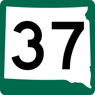
South Dakota Highway 37 is a state route that runs across eastern South Dakota. It begins at the Nebraska border northeast of Niobrara, Nebraska, as a continuation of Nebraska Highway 14. It runs to the North Dakota border north of Hecla, where it continues as North Dakota Highway 1. It is 242 miles (389 km) in length.
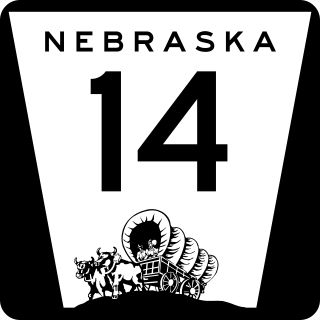
Nebraska Highway 14 (N-14) is a highway in the U.S. state of Nebraska. It has a southern terminus at the Kansas border, where it continues south as K-14, southwest of Superior and a northern terminus east of Niobrara at the South Dakota border.

The Meridian Highway Bridge is a bridge that formerly carried U.S. Route 81 across the Missouri River between Nebraska and South Dakota. The Meridian Highway Bridge connects Yankton, South Dakota with rural Cedar County, Nebraska. The Meridian Bridge is a double-deck bridge, with the top level having carried traffic into South Dakota from Nebraska, and the lower level having carried traffic into Nebraska from South Dakota. It was closed to all traffic in 2008, but reopened for use only by pedestrians and bicycles in 2011.

The Discovery Bridge is a bridge that carries US Route 81 across the Missouri River from the Nebraska border to the South Dakota border. The Discovery Bridge connects Yankton, South Dakota, with rural Cedar County, Nebraska. The ribbon-cutting ceremony was on October 11, 2008, a year ahead of schedule. During the ceremony John McAuliffe and Kevin Brown inadvertently cut the ribbon prior to photographers being in place and thus there is no commemorative photo. The bridge crosses over the Missouri National Recreational River, a Federally-protected Wild & Scenic River, managed by the National Park Service

The 2011 flooding event on the Missouri River in the United States was triggered by record snowfall in Rocky Mountains of Montana and Wyoming along with near-record spring rainfall in central and eastern Montana. All six major dams along the Missouri River released record amounts of water to prevent overflow which led to flooding threatening several towns and cities along the river from Montana to Missouri; in particular Bismarck, North Dakota; Pierre, South Dakota; Dakota Dunes, South Dakota; South Sioux City, Nebraska, Sioux City, Iowa; Omaha, Nebraska; Council Bluffs, Iowa; Saint Joseph, Missouri; Kansas City, Missouri; Jefferson City, Missouri, and St. Louis, Missouri. Many smaller towns were also at risk, suffering the same fate as the larger cities if not worse. According to the National Weather Service, in the second half of the month of May 2011, almost a year's worth of rain fell over the upper Missouri River basin. Extremely heavy rainfall in conjunction with an estimated 212 percent of normal snowpack in the Rocky Mountains contributed to this flooding event.

Running Water is a census-designated place (CDP) in Bon Homme County, South Dakota, United States. The population was 47 at the 2020 census.
This timeline of South Dakota is a list of events in the history of South Dakota by year.

Lake Yankton, also called Cottonwood Lake, is an artificial lake that was originally part of the main channel of the Missouri River on the border of the U.S. States of Nebraska and South Dakota, near Yankton, South Dakota. The lake has an approximate surface area of 250 acres (100 ha) and has a maximum depth of 18 feet (5.5 m). The lake is located immediately downstream (east) of Gavins Point Dam and Lewis and Clark Lake, located just north of the current location of the main channel of the Missouri River.
Training Dike Recreation Area, also called Training Dike Day-Use Area is a U.S. Army Corps of Engineers public recreation area located immediately downstream of Gavins Point Dam and Lewis and Clark Lake on the north bank of the Missouri River. The area is about 4.5 miles (7.2 km) west of Yankton. The area is located mostly in Cedar County, Nebraska, with a small portion located in Yankton County, South Dakota.
Cottonwood Recreation Area is a public recreation area located in Cedar County, Nebraska, U.S. It is located about 5 miles (8.0 km) west of Yankton and located on the shores of Lake Yankton. The recreation area is located immediately downstream of Gavins Point Dam and Lewis and Clark Lake. It is named for Cottonwood Island, an original island located in the Missouri River, for the large groves of Cottonwood Trees that dominate the area. The recreation area is owned and managed by the U.S. Army Corps of Engineers.
Spencer Dam was a run of the river hydroelectric dam on the Niobrara River in Boyd County and Holt County, Nebraska, about 5 miles (8.0 km) southeast of Spencer. The dam was operated by the Nebraska Public Power District (NPPD). Heavy precipitation during the March 2019 North American blizzard led to a failure of the dam in the early morning of 14 March, causing heavy flooding downstream.

The Midwestern United States experienced major floods in the spring of 2019, primarily along the Missouri River and its tributaries in Nebraska, Missouri, South Dakota, Iowa, and Kansas. The Mississippi River also saw flooding, although starting later and ending earlier. The 2019 January-to-May period was the wettest on record for the U.S., with multiple severe weather outbreaks through May in the Midwest, High Plains, and South exacerbating the flooding and causing additional damage. Throughout late May and early June, rain in Iowa, Illinois, and Missouri caused every site on the Mississippi River to record a top-five crest. At least three people in Iowa and Nebraska died.

