Knox County, Nebraska

Last updated

Knox County
Knox County Courthouse (Nebraska) from SE 1.JPG
Knox County Courthouse in Center
Map of Nebraska highlighting Knox County.svg
Location within the U.S. state of Nebraska
Nebraska in United States.svg
Nebraska's location within the U.S.
Coordinates: 42°38′N97°53′W / 42.63°N 97.88°W / 42.63; -97.88
CountryFlag of the United States.svg United States
StateFlag of Nebraska.svg  Nebraska
Founded1857
Named for Henry Knox
Seat Center
Largest city Creighton
Area
  Total1,140 sq mi (3,000 km2)
  Land1,108 sq mi (2,870 km2)
  Water31 sq mi (80 km2)  2.8%
Population
  Estimate 
(2021 [1] )
8,401
  Density7.6/sq mi (2.9/km2)
Time zone UTC−6 (Central)
  Summer (DST) UTC−5 (CDT)
Congressional district 3rd
Website www.co.knox.ne.us

Knox County is a county in the U.S. state of Nebraska. As of the 2020 United States Census, the population was 8,391. [1] Its county seat is Center. [2] Knox County was named for Continental and U.S. Army Major General Henry Knox. [3] [4]

Contents

In the Nebraska license plate system, Knox County is represented by the prefix 12 (it had the 12th-largest number of vehicles registered in the county when the license plate system was established in 1922).

History

Knox County was organized by the Territorial Legislature in 1857, and named L'Eau Qui Court, that being the French name for the river named by the Ponca Niobrara—both names meaning, in English, Running Water. The name was changed to Knox by a statute passed February 21, 1873, which took effect April 1, 1873. [5] [6]

Geography

Lewis and Clark Lake, an impoundment on the Missouri River in the northeastern part of Knox County. Gavins Point Dam in the foreground. Lewis & Clark Lake and Dam NE.jpg
Lewis and Clark Lake, an impoundment on the Missouri River in the northeastern part of Knox County. Gavins Point Dam in the foreground.

Knox County lies along the north line of Nebraska. Its north boundary line abuts the south boundary line of the state of South Dakota. The terrain of the county consists of low rolling hills sloped to the northeast; most of the flat terrain is used for agriculture. The Missouri River flows eastward along the county's north boundary line. The Niobrara River enters the county's west boundary, flowing eastward then northward to drain into the Missouri River near the village of Niobrara. A smaller drainage, Verdigre Creek, flows northward into the county through the western central part of the county, draining into the Niobrara River shortly upstream of that river's mouth. [7] The county has a total area of 1,140 square miles (3,000 km2), of which 1,108 square miles (2,870 km2) is land and 31 square miles (80 km2) (2.8%) is water. [8]

Major highways

Adjacent counties

Protected areas

Demographics

Historical population
CensusPop.Note
1860 152
1870 26171.7%
1880 3,6661,304.6%
1890 8,582134.1%
1900 14,34367.1%
1910 18,35828.0%
1920 18,8942.9%
1930 19,1101.1%
1940 16,478−13.8%
1950 14,820−10.1%
1960 13,300−10.3%
1970 11,723−11.9%
1980 11,457−2.3%
1990 9,534−16.8%
2000 9,374−1.7%
2010 8,701−7.2%
2020 8,391−3.6%
2022 (est.)8,336−0.7%
US Decennial Census [12]
1790-1960 [13] 1900-1990 [14]
1990-2000 [15] 2010-2013 [16] [17] 2020-2022 [16]

As of the 2010 United States Census, there were 8,701 people, 3,647 households, and 2,368 families in the county. The population density was 7.9 people per square mile (3.1 people/km2). The racial makeup of the county was 87.2% White, 0.4% Black or African American, 10% Native American, 0.2% Asian, 0.0% Pacific Islander, and 1.8% from Two or More Races. 2.5% of the population were Hispanic or Latino of any race.

As of the 2000 United States Census, [18] there were 9,374 people, 3,811 households, and 2,595 families in the county. The population density was 8 people per square mile (3.1 people/km2). There were 4,773 housing units at an average density of 4 units per square mile (1.5/km2). The racial makeup of the county was 91.63% White, 0.09% Black or African American, 7.12% Native American, 0.16% Asian, 0.04% Pacific Islander, 0.34% from other races, and 0.63% from two or more races. 0.91% of the population were Hispanic or Latino of any race.

There were 3,811 households, out of which 29.30% had children under the age of 18 living with them, 59.00% were married couples living together, 6.00% had a female householder with no husband present, and 31.90% were non-families. 29.90% of all households were made up of individuals, and 17.40% had someone living alone who was 65 years of age or older. The average household size was 2.40 and the average family size was 2.98.

The county population contained 25.50% under the age of 18, 5.50% from 18 to 24, 21.90% from 25 to 44, 23.90% from 45 to 64, and 23.10% who were 65 years of age or older. The median age was 43 years. For every 100 females there were 96.70 males. For every 100 females age 18 and over, there were 95.20 males.

The median income for a household in the county was $27,564, and the median income for a family was $34,073. Males had a median income of $23,373 versus $18,319 for females. The per capita income for the county was $13,971. About 12.50% of families and 15.60% of the population were below the poverty line, including 20.40% of those under age 18 and 13.50% of those age 65 or over.

Racial composition2010 [19] 2000 [20]
White 87.2%92.2%
Non-Hispanic85.8%91.3%
Native American 10%7.5%
Black or African American 0.4%0.1%
Hispanic or Latino (of any race)2.5%0.9%
Asian 0.5%0.2%
Two or More Races 1.8%0.6%

Communities

Cities

Villages

Census-designated place

Unincorporated communities

Townships

Politics

Knox County voters are strongly Republican. In no national election since 1936 has the county selected the Democratic Party candidate.

United States presidential election results for Knox County, Nebraska [21]
Year Republican Democratic Third party
No.%No.%No.%
2020 3,72179.04%90519.22%821.74%
2016 3,18877.47%72017.50%2075.03%
2012 2,88571.48%1,05926.24%922.28%
2008 2,72866.80%1,25530.73%1012.47%
2004 3,06272.68%1,08625.78%651.54%
2000 2,78469.98%1,03726.07%1573.95%
1996 2,12353.91%1,26632.15%54913.94%
1992 2,11349.55%96822.70%1,18327.74%
1988 2,64463.76%1,47735.62%260.63%
1984 3,36473.77%1,14925.20%471.03%
1980 3,40471.08%1,05722.07%3286.85%
1976 2,61056.08%1,92241.30%1222.62%
1972 3,31872.02%1,28927.98%00.00%
1968 3,12968.20%1,13124.65%3287.15%
1964 2,75251.26%2,61748.74%00.00%
1960 3,84764.45%2,12235.55%00.00%
1956 3,81464.38%2,11035.62%00.00%
1952 4,84075.47%1,57324.53%00.00%
1948 2,77851.68%2,59748.32%00.00%
1944 3,76260.20%2,48739.80%00.00%
1940 4,35257.79%3,17942.21%00.00%
1936 2,94938.89%4,44958.67%1852.44%
1932 1,83025.67%5,22973.36%690.97%
1928 3,66855.46%2,91444.06%320.48%
1924 2,40538.63%1,53224.61%2,28936.77%
1920 3,67869.87%1,47027.93%1162.20%
1916 1,91044.11%2,32953.79%912.10%
1912 1,02826.58%1,80346.61%1,03726.81%
1908 1,87145.67%2,10651.40%1202.93%
1904 2,16361.50%86424.57%49013.93%
1900 1,60047.80%1,63048.70%1173.50%

See also

Related Research Articles

<span class="mw-page-title-main">Lancaster County, Nebraska</span> County in Nebraska, United States

Lancaster County is a county located in the U.S. state of Nebraska. As of the 2020 United States Census, the population was 322,608, making it the second-most populous county in Nebraska. Its county seat is Lincoln, the state capital. The county was created in 1859.

<span class="mw-page-title-main">Gregory County, South Dakota</span> County in South Dakota, United States

Gregory County is a county in the U.S. state of South Dakota. As of the 2020 census, the population was 3,994. Its county seat is Burke. The county was created in 1862 and organized in 1898. It was named for the politician J. Shaw Gregory.

<span class="mw-page-title-main">Custer County, South Dakota</span> County in South Dakota, United States

Custer County is a county in the U.S. state of South Dakota. As of the 2020 census, the population was 8,318. Its county seat is Custer. The county was created in 1875, and was organized in 1877. It was named after General George Armstrong Custer.

<span class="mw-page-title-main">Bon Homme County, South Dakota</span> County in South Dakota, United States

Bon Homme County is a county in the U.S. state of South Dakota. As of the 2020 census, the population was 7,003. Its county seat is Tyndall.

<span class="mw-page-title-main">Sioux County, Nebraska</span> County in Nebraska, United States

Sioux County is a county in the U.S. state of Nebraska. As of the 2020 United States Census, the population was 1,135. Its county seat is Harrison.

<span class="mw-page-title-main">Sheridan County, Nebraska</span> County in Nebraska, United States

Sheridan County is a county in the U.S. state of Nebraska. As of the 2020 United States Census, the population was 5,127. Its county seat is Rushville. The county was formed in 1885, and was named for General Philip H. Sheridan.

<span class="mw-page-title-main">Rock County, Nebraska</span> County in Nebraska, United States

Rock County is a county in the U.S. state of Nebraska. As of the 2020 United States Census, the population was 1,262. Its county seat is Bassett.

<span class="mw-page-title-main">Richardson County, Nebraska</span> County in Nebraska, United States

Richardson County is the easternmost county in the U.S. state of Nebraska. As of the 2020 census, the population was 7,871. Its county seat is Falls City.

<span class="mw-page-title-main">Red Willow County, Nebraska</span> County in Nebraska, United States

Red Willow County is a county located in the U.S. state of Nebraska. As of the 2020 United States Census, the population was 10,702. Its county seat is McCook.

<span class="mw-page-title-main">Pierce County, Nebraska</span> County in Nebraska, United States

Pierce County is a county in the U.S. state of Nebraska. As of the 2020 United States Census, the population was 7,317. Its county seat is Pierce. The county was formed in 1859, and was named for US President Franklin Pierce.

<span class="mw-page-title-main">Keya Paha County, Nebraska</span> County in Nebraska, United States

Keya Paha County is a county in the U.S. state of Nebraska. As of the 2020 United States Census, the population was 769. Its county seat is Springview.

<span class="mw-page-title-main">Frontier County, Nebraska</span> County in Nebraska, United States

Frontier County is a county in the U.S. state of Nebraska. As of the 2020 United States Census, the population was 2,519. Its county seat is Stockville.

<span class="mw-page-title-main">Dawes County, Nebraska</span> County in Nebraska, United States

Dawes County is a county in the U.S. state of Nebraska. As of the 2020 United States Census, the population was 8,199. Its county seat is Chadron. The county was formed in 1885; it was named for James W. Dawes, the Nebraska Governor at the time.

<span class="mw-page-title-main">Cherry County, Nebraska</span> County in Nebraska, United States

Cherry County is a county located in the U.S. state of Nebraska. As of the 2020 United States Census, the population was 5,455. Its county seat is Valentine. The county was named for Lt. Samuel A. Cherry, an Army officer who was stationed at Fort Niobrara and who had been killed in South Dakota in 1881. Cherry County is in the Nebraska Sandhills. It is the largest county in the state at nearly 6,000 square miles (16,000 km2), larger than the state of Connecticut.

<span class="mw-page-title-main">Cedar County, Nebraska</span> County in Nebraska, United States

Cedar County is a county in the U.S. state of Nebraska. As of the 2020 United States Census, the population was 8,380. The county seat is Hartington. The county was formed in 1857, and was named for the Cedar tree groves in the area.

<span class="mw-page-title-main">Cass County, Nebraska</span> County in Nebraska, United States

Cass County is a county in the U.S. state of Nebraska. As of the 2020 United States Census, the population was 26,598. Its county seat and largest city is Plattsmouth. The county was formed in 1855, and was named for General Lewis Cass, an American military officer, politician, and statesman.

<span class="mw-page-title-main">Antelope County, Nebraska</span> County in Nebraska, United States

Antelope County is a county located in the U.S. state of Nebraska. As of the 2020 United States Census, the population was 6,295. Its county seat is Neligh. The county was formed in 1871. It received its name after a group of early settlers killed and ate several pronghorn. Although these are not true antelope, they are colloquially known by that name.

<span class="mw-page-title-main">Bazile Mills, Nebraska</span> Village in Nebraska, United States

Bazile Mills is a village in Knox County, Nebraska, United States. The population was 24 at the 2020 census.

<span class="mw-page-title-main">Center, Nebraska</span> Village in and county seat of Knox County, Nebraska, United States

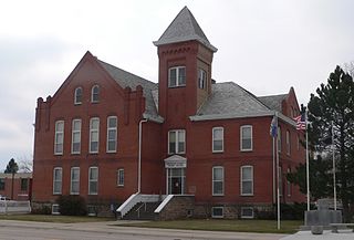
Center is a village in, and county seat of, Knox County, Nebraska, United States. The population was 73 at the 2020 census.

<span class="mw-page-title-main">Niobrara, Nebraska</span> Village in Knox County, Nebraska, United States

Niobrara is a village in Knox County, Nebraska, United States. The population was 363 at the 2020 census.

References

  1. 1 2 "County Population Totals: 2020-2021". Census.gov. US Census Bureau. Retrieved October 31, 2022.
  2. "Find a County". National Association of Counties. Archived from the original on May 31, 2011. Retrieved June 7, 2011.
  3. Gannett, Henry (1905). The Origin of Certain Place Names in the United States. Government Printing Office. p.  177.
  4. "Knox County". Nebraska Association of County Officials. Retrieved December 19, 2014.
  5. Fitzpatrick, Lilian Linder (1925). Nebraska Place-Names. Lincoln: University of Nebraska Studies in Language, Literature, and Criticism. p. 88. Retrieved December 19, 2014.
  6. "Nebraska Historic Buildings Survey Reconnaissance Survey Final Report of Knox County, Nebraska" (PDF). Nebraska State Historical Society. Archived from the original on November 16, 2006. Retrieved December 19, 2014.{{cite web}}: CS1 maint: unfit URL (link)
  7. Knox County NE Google Maps (accessed 23 January 2019)
  8. "2010 Census Gazetteer Files". US Census Bureau. August 22, 2012. Archived from the original on November 13, 2013. Retrieved December 8, 2014.
  9. Bazile Creek State Wildlife Management Area, Niobrara NE Google Maps (accessed 23 January 2019)
  10. Deep Water Recreation Area, Crofton NE Google Maps (accessed 23 January 2019)
  11. Miller Creek Recreation Area, Knox County NE Google Maps (accessed 23 January 2019)
  12. "US Decennial Census". US Census Bureau. Retrieved December 8, 2014.
  13. "Historical Census Browser". University of Virginia Library. Retrieved December 8, 2014.
  14. "Population of Counties by Decennial Census: 1900 to 1990". US Census Bureau. Retrieved December 8, 2014.
  15. "Census 2000 PHC-T-4. Ranking Tables for Counties: 1990 and 2000" (PDF). US Census Bureau. Archived (PDF) from the original on March 27, 2010. Retrieved December 8, 2014.
  16. 1 2 "State & County QuickFacts". US Census Bureau. Archived from the original on June 7, 2011. Retrieved September 21, 2013.
  17. "QuickFacts: Knox County, Nebraska".
  18. "U.S. Census website". US Census Bureau. Retrieved January 31, 2008.
  19. "Knox County NE". State & County QuickFacts. US Census Bureau.
  20. "U.S. Census website". US Census Bureau. Retrieved November 23, 2018.
  21. Election Results

42°38′N97°53′W / 42.63°N 97.88°W / 42.63; -97.88