Butler County, Nebraska

Last updated

Butler County
County of Butler
Butler County, Nebraska courthouse from E 2.JPG
Butler County Courthouse in David City
Butler County, Nebraska
Interactive map of Butler County
Map of Nebraska highlighting Butler County.svg
Location within the U.S. state of Nebraska
CountryFlag of the United States (23px).png  United States
State Flag of Nebraska.svg  Nebraska
EstablishedJanuary 26, 1856
OrganizedOctober 21, 1868
Named for William Orlando Butler
County seat David City
Largest cityDavid City
Area
  Total591 sq mi (1,530 km2)
  Land585 sq mi (1,520 km2)
  Water5.9 sq mi (15 km2)  1.0%
Highest elevation
1,739 ft (530 m)
Lowest elevation
902 ft (275 m)
Population
  Estimate 
(2021 [1] )
8,369
  Density13.8/sq mi (5.3/km2)
Time zone UTC−6 (Central)
  Summer (DST) UTC−5 (CDT)
Area code 402/531
FIPS code31023
GNIS feature ID 835833
Website www.co.butler.ne.us

Butler County is a county in the U.S. state of Nebraska. As of the 2020 United States Census, the population was 8,369. [1] Its county seat is David City. [2] The county was created in 1856 [3] and organized in 1868. [4] [5]

Contents

In the Nebraska license plate system, Butler County is represented by the prefix 25 (when the license plate system was established in 1922, it had the 25th-largest number of vehicles registered of all counties in the state).

In 2010, Nebraska's center of population was in Butler County, near the village of Rising City. [6]

Name

There is some uncertainty about how Butler County got its name. [7] The most credible consensus seems to be that Butler County is named for William Orlando Butler, a U.S. congressman from Kentucky and U.S. Army major general who served during the Mexican–American War. [8] Butler was offered the job of Governor of Nebraska Territory in 1854 by President Franklin Pierce, but he turned it down. [9] [10] [11] Regardless, Butler County was still named in his honor. The earliest references to the county being called "Butler County" are found in the journals of the Nebraska Territorial Legislature from the years 1857 and 1858. [12] [13]

Another common explanation proposed for the naming of Butler County is that it was named for David Butler, the first Governor of the State of Nebraska. [7] [3] [14] However, Butler County was created by an act of the Nebraska Territorial Legislature on June 26, 1856, [8] and was referred to as "Butler County" more than ten years before David Butler became Governor of Nebraska and two years before he had even moved to Nebraska from Indiana in 1859. [15] When David Butler came to Nebraska, he settled in Pawnee County, not in the Butler County area. [15] Confusingly, however, the name for the county seat of Butler County, David City, is also sometimes attributed to David Butler, but there are also conflicting sources concerning its origin. [8] A second alternate explanation for the origin of Butler County's name is given in Andreas' History of Nebraska. It seems to indicate that the county might have been named for William Butler, an early settler who moved to the area in 1860 and became county sheriff in 1868. However, as noted before, the county had been in existence and had been referred to as "Butler County" well before that point in time. [16]

Geography

According to the US Census Bureau, the county has a total area of 591 square miles (1,530 km2), of which 585 square miles (1,520 km2) is land and 5.9 square miles (15 km2) (1.0%) is water. [17]

Major highways

Adjacent counties

Demographics

Historical population
CensusPop.Note
1860 27
1870 1,2904,677.8%
1880 9,194612.7%
1890 15,45468.1%
1900 15,7031.6%
1910 15,403−1.9%
1920 14,606−5.2%
1930 14,410−1.3%
1940 13,106−9.0%
1950 11,432−12.8%
1960 10,312−9.8%
1970 9,461−8.3%
1980 9,330−1.4%
1990 8,601−7.8%
2000 8,7671.9%
2010 8,395−4.2%
2020 8,369−0.3%
2021 (est.)8,444 [1] 0.9%
US Decennial Census [18]
1790-1960 [19] 1900-1990 [20]
1990-2000 [21] 2010-2013 [22]

As of the 2000 United States Census, [23] there were 8,767 people, 3,426 households, and 2,350 families in the county. The population density was 15 people per square mile (5.8 people/km2). There were 3,901 housing units at an average density of 7 units per square mile (2.7/km2). The racial makeup of the county was 98.38% White, 0.10% Black or African American, 0.13% Native American, 0.13% Asian, 0.06% Pacific Islander, 0.81% from other races, and 0.40% from two or more races. 1.65% of the population were Hispanic or Latino of any race. 33.1% were of German and 32.0% Czech ancestry.

There were 3,426 households, out of which 33.00% had children under the age of 18 living with them, 59.90% were married couples living together, 5.70% had a female householder with no husband present, and 31.40% were non-families. 28.30% of all households were made up of individuals, and 14.40% had someone living alone who was 65 years of age or older. The average household size was 2.53 and the average family size was 3.13.

The county population contained 27.90% under the age of 18, 6.60% from 18 to 24, 25.30% from 25 to 44, 22.50% from 45 to 64, and 17.70% who were 65 years of age or older. The median age was 39 years. For every 100 females there were 104.10 males. For every 100 females age 18 and over, there were 101.20 males.

The median income for a household in the county was $36,331, and the median income for a family was $44,441. Males had a median income of $28,856 versus $20,979 for females. The per capita income for the county was $16,394. About 4.80% of families and 8.20% of the population were below the poverty line, including 9.80% of those under age 18 and 9.40% of those age 65 or over.

Communities

City

Villages

Unincorporated communities

Ghost town

Townships

Politics

Butler County voters have been reliably Republican for decades. No Democratic Party candidate has carried the county in any national election since 1976.

United States presidential election results for Butler County, Nebraska [24]
Year Republican Democratic Third party
No.%No.%No.%
2020 3,54278.40%87319.32%1032.28%
2016 3,07977.34%69117.36%2115.30%
2012 2,73870.95%1,04527.08%761.97%
2008 2,55766.61%1,19031.00%922.40%
2004 3,01672.36%1,06825.62%842.02%
2000 2,63868.91%1,02826.85%1624.23%
1996 2,04255.25%1,09929.73%55515.02%
1992 1,88445.35%1,08926.22%1,18128.43%
1988 2,08654.62%1,71544.91%180.47%
1984 2,55767.56%1,19331.52%350.92%
1980 2,59666.07%1,11228.30%2215.62%
1976 1,80942.36%2,33754.72%1252.93%
1972 2,30155.94%1,81244.06%00.00%
1968 1,64646.84%1,54443.94%3249.22%
1964 1,64235.43%2,99364.57%00.00%
1960 2,25345.11%2,74254.89%00.00%
1956 2,86456.07%2,24443.93%00.00%
1952 3,45963.90%1,95436.10%00.00%
1948 2,10544.69%2,60555.31%00.00%
1944 2,49346.04%2,92253.96%00.00%
1940 2,96647.75%3,24652.25%00.00%
1936 2,44235.26%4,36062.95%1241.79%
1932 1,71227.60%4,45671.84%350.56%
1928 2,93045.65%3,46553.99%230.36%
1924 2,43544.81%2,44444.98%55510.21%
1920 2,47855.24%1,91842.76%902.01%
1916 1,12031.90%2,33266.42%591.68%
1912 82325.41%1,75654.21%66020.38%
1908 1,41239.23%2,12959.16%581.61%
1904 1,72350.81%1,27837.69%39011.50%
1900 1,48139.96%2,14757.93%782.10%

See also

Related Research Articles

<span class="mw-page-title-main">Lancaster County, Nebraska</span> County in Nebraska, United States

Lancaster County is a county located in the U.S. state of Nebraska. As of the 2020 United States Census, the population was 322,608, making it the second-most populous county in Nebraska. Its county seat is Lincoln, the state capital. The county was created in 1859.

<span class="mw-page-title-main">York County, Nebraska</span> County in Nebraska, United States

York County is a county in the U.S. state of Nebraska. As of the 2020 United States Census, the population was 14,125. Its county seat is York.

<span class="mw-page-title-main">Wayne County, Nebraska</span> County in Nebraska, United States

Wayne County is a county in the U.S. state of Nebraska. As of the 2020 census, the population was 9,697. Its county seat is Wayne.

<span class="mw-page-title-main">Thayer County, Nebraska</span> County in Nebraska, United States

Thayer County is a county in the U.S. state of Nebraska. As of the 2020 United States Census, the population was 5,034. Its county seat is Hebron. The county was created in 1856 and originally named Jefferson County. It was organized in 1870-1871 and renamed for General and Governor John Milton Thayer.

<span class="mw-page-title-main">Saunders County, Nebraska</span> County in Nebraska, United States

Saunders County is a county in the U.S. state of Nebraska. As of the 2020 United States Census, the population was 22,278. Its county seat is Wahoo.

<span class="mw-page-title-main">Polk County, Nebraska</span> County in Nebraska, United States

Polk County is a county in the U.S. state of Nebraska. As of the 2020 United States Census, the population was 5,214. Its county seat is Osceola. The county was formed in 1856, and was organized in 1870. It was named for President James K. Polk.

<span class="mw-page-title-main">Platte County, Nebraska</span> County in Nebraska, United States

Platte County is a county located in the U.S. state of Nebraska. As of the 2020 United States Census, the population was 34,296. Its county seat is Columbus. The county was created in 1855.

<span class="mw-page-title-main">Nuckolls County, Nebraska</span> County in Nebraska, United States

Nuckolls County is a county located in the U.S. state of Nebraska. As of the 2020 United States Census, the population was 4,095. Its county seat is Nelson.

<span class="mw-page-title-main">Nance County, Nebraska</span> County in Nebraska, United States

Nance County is a county in the U.S. state of Nebraska. As of the 2020 census, the population was 3,380. Its county seat is Fullerton.

<span class="mw-page-title-main">Merrick County, Nebraska</span> County in Nebraska, United States

Merrick County is a county in the U.S. state of Nebraska. As of the 2020 United States Census, the population was 7,668. Its county seat is Central City.

<span class="mw-page-title-main">Knox County, Nebraska</span> County in Nebraska, United States

Knox County is a county in the U.S. state of Nebraska. As of the 2020 United States Census, the population was 8,391. Its county seat is Center. Knox County was named for Continental and U.S. Army Major General Henry Knox.

<span class="mw-page-title-main">Keith County, Nebraska</span> County in Nebraska, United States

Keith County is a county in the U.S. state of Nebraska. As of the 2020 United States Census, the population was 8,335. Its county seat is Ogallala.

<span class="mw-page-title-main">Hayes County, Nebraska</span> County in Nebraska, United States

Hayes County is a county in the U.S. state of Nebraska. As of the 2020 United States Census, the population was 856. Its county seat is Hayes Center. The county was created in 1877, and was organized in 1884. It was named for Rutherford B. Hayes, the US President at the time of the county's creation.

<span class="mw-page-title-main">Furnas County, Nebraska</span> County in Nebraska, United States

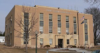
Furnas County is a county in the U.S. state of Nebraska. As of the 2020 United States Census, the population was 4,636. Its county seat is Beaver City. The county was named for Robert Wilkinson Furnas, the second governor of the state of Nebraska.

<span class="mw-page-title-main">Frontier County, Nebraska</span> County in Nebraska, United States

Frontier County is a county in the U.S. state of Nebraska. As of the 2020 United States Census, the population was 2,519. Its county seat is Stockville.

<span class="mw-page-title-main">Dundy County, Nebraska</span> County in Nebraska, United States

Dundy County is a county in the U.S. state of Nebraska. As of the 2020 United States Census, the population was 1,654. Its county seat is Benkelman.

<span class="mw-page-title-main">Cuming County, Nebraska</span> County in Nebraska, United States

Cuming County is a county in the U.S. state of Nebraska. As of the 2020 United States Census, the population was 9,013. Its county seat is West Point.

<span class="mw-page-title-main">Colfax County, Nebraska</span> County in Nebraska, United States

Colfax County is a county in the U.S. state of Nebraska. As of the 2020 United States Census, the population was 10,582. Its county seat is Schuyler. The county and its seat are named after US Vice President (1869-1873) Schuyler Colfax.

<span class="mw-page-title-main">Buffalo County, Nebraska</span> County in Nebraska, United States

Buffalo County is a county located in the U.S. state of Nebraska in the Midwestern United States. As of the 2020 United States Census, the population was 50,084, making it Nebraska's fifth-most populous county. Its county seat is Kearney. The county was created in 1855 and was organized in 1870. It was named after the once-prevalent bison herds of the Great Plains.

<span class="mw-page-title-main">David City, Nebraska</span> City in Nebraska, United States

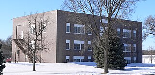
David City is a city in Butler County, Nebraska, United States. The population was 2,995 at the 2020 census. It is the county seat of Butler County. David City was founded in 1873 to serve as the county seat when county residents desired a more centrally located county seat than Savannah.

References

  1. 1 2 3 "County Population Totals: 2020-2021". Census.gov. US Census Bureau. Retrieved October 31, 2022.
  2. "Find a County". National Association of Counties. Archived from the original on May 31, 2011. Retrieved June 7, 2011.
  3. 1 2 Fitzpatrick, Lilian L. (1960). Nebraska Place-Names. University of Nebraska Press. p. 28. ISBN   0803250606 . Retrieved December 13, 2014.
  4. Andreas, A. T. (1882). "Andreas' History of the State of Nebraska". The Kansas Collection. Archived from the original on May 20, 2003. Retrieved December 13, 2014.
  5. "Butler County". Nebraska Association of County Officials. Retrieved December 13, 2014.
  6. "Centers of Population by State: 2010". US Census Bureau. Archived from the original on January 3, 2014. Retrieved April 1, 2014.
  7. 1 2 "History". Butler County, Nebraska.
  8. 1 2 3 Elton A. Perkey (2003). Perkey's Nebraska Place Names (4th ed.). Nebraska State Historical Society. pp. 21–22.
  9. The National Cyclopaedia of American Biography, Volume VI. New York, NY: James T. White and Company. 1896. p. 183.
  10. McMullin, Thomas A.; Walker, David (1984). Biographical Directory of American Territorial Governors . Westport, CT: Meckler Publishing. p. 223. ISBN   0-930466-11-X.
  11. James C. Olson (1966). History of Nebraska (New Edition) (2nd ed.). University of Nebraska Press. p. 81.
  12. Senate, Nebraska. Legislature (December 17, 1857). Journal of the House of Representatives at the Fourth Session of the General Assembly of the Territory of Nebraska. p. 55. Mr. Donelan gave notice of a bill to create the county seat of Butler county.
  13. House Journal of the Legislative Assembly of the Territory of Nebraska, Fifth Session. November 3, 1858. p. 230. H. B. No. 107, 'A bill for an act to incorporate the town of Mahala city, and locate the county seat of Butler county,' Read first, second and third time, passed and title agreed to.
  14. "David C. Butler". The Downfall Dictionary. November 22, 2008. Retrieved September 16, 2012.
  15. 1 2 "Gov. David C. Butler". National Governors Association. Retrieved December 26, 2022.
  16. A. T. Andreas (1882), History of the State of Nebraska, The Western Historical Company
  17. "2010 Census Gazetteer Files". US Census Bureau. August 22, 2012. Archived from the original on November 13, 2013. Retrieved December 6, 2014.
  18. "US Decennial Census". US Census Bureau. Retrieved December 6, 2014.
  19. "Historical Census Browser". University of Virginia Library. Retrieved December 6, 2014.
  20. "Population of Counties by Decennial Census: 1900 to 1990". US Census Bureau. Retrieved December 6, 2014.
  21. "Census 2000 PHC-T-4. Ranking Tables for Counties: 1990 and 2000" (PDF). US Census Bureau. Archived (PDF) from the original on March 27, 2010. Retrieved December 6, 2014.
  22. "State & County QuickFacts". US Census Bureau. Archived from the original on June 7, 2011. Retrieved September 17, 2013.
  23. "U.S. Census website". US Census Bureau. Retrieved January 31, 2008.
  24. Election Results

41°13′N97°08′W / 41.22°N 97.13°W / 41.22; -97.13