Box Butte County, Nebraska

Last updated

Box Butte County
Box Butte County courthouse from SW 2.JPG
Map of Nebraska highlighting Box Butte County.svg
Location within the U.S. state of Nebraska
Nebraska in United States.svg
Nebraska's location within the U.S.
Coordinates: 42°13′N103°05′W / 42.21°N 103.08°W / 42.21; -103.08
CountryFlag of the United States.svg United States
StateFlag of Nebraska.svg  Nebraska
Founded1886
Seat Alliance
Largest cityAlliance
Area
  Total1,078 sq mi (2,790 km2)
  Land1,075 sq mi (2,780 km2)
  Water2.5 sq mi (6 km2)  0.2%
Population
  Estimate 
(2021)
10,604
  Density10.1/sq mi (3.9/km2)
Time zone UTC−7 (Mountain)
  Summer (DST) UTC−6 (MDT)
Congressional district 3rd
Website boxbuttecounty.us
Box Butte County Boxbuttecounty.png
Box Butte County

Box Butte County is a county in the U.S. state of Nebraska. As of the 2020 United States Census, the population was 10,842. [1] Its county seat is Alliance. [2] The county was formed in 1886; it took its name from a large box-shaped butte north of Alliance.

Contents

In the Nebraska license plate system, Box Butte County is represented by the prefix 65 (it had the sixty-fifth largest number of vehicles registered in the county when the license plate system was established in 1922).

History

Box Butte County was formed as part of a series of partitionings of the Nebraska Panhandle. In 1883, the Nebraska legislature divided the Panhandle into two counties, Sioux and Cheyenne. In 1885 the original Sioux County was divided into three counties: Sioux, Dawes, and Sheridan. Because of the distance to the county seat of Chadron, residents of southern Dawes County asked that it be split off; in 1886, the legislature created Box Butte County. The new county was named after a butte in the northern part of the county; prior to the county's formation, its name had been used in advertisements by railroad companies seeking to entice settlers to the area. [3] [4]

In the Nebraska license plate system, Box Butte County is represented by the prefix 65 (it had the 65th-largest number of vehicles registered in the county when the license plate system was established in 1922).

Geography

According to the US Census Bureau, the county has an area of 1,078 square miles (2,790 km2), of which 1,075 square miles (2,780 km2) is land and 2.5 square miles (6.5 km2) (11%) is water. [5]

Major highways

Adjacent counties

Demographics

Historical population
CensusPop.Note
1890 5,494
1900 5,5721.4%
1910 6,13110.0%
1920 8,40737.1%
1930 11,86141.1%
1940 10,736−9.5%
1950 12,27914.4%
1960 11,688−4.8%
1970 10,094−13.6%
1980 13,69635.7%
1990 13,130−4.1%
2000 12,158−7.4%
2010 11,308−7.0%
2020 10,842−4.1%
2022 (est.)10,672 [1] −1.6%
US Decennial Census [6]
1790-1960 [7] 1900-1990 [8]
1990-2000 [9] 2010-2022 [1]

As of the 2000 United States Census, [10] there were 12,158 people, 4,780 households, and 3,298 families in the county. The population density was 11 people per square mile (4.2 people/km2). There were 5,488 housing units at an average density of 5 units per square mile (1.9/km2). The racial makeup of the county was 90.84% White, 0.37% Black or African American, 2.74% Native American, 0.53% Asian, 0.01% Pacific Islander, 3.55% from other races, and 1.96% from two or more races. 7.65% of the population were Hispanic or Latino of any race. 36.4% were of German, 8.4% English, 8.1% Irish and 5.3% American ancestry.

There were 4,780 households, out of which 35.60% had children under the age of 18 living with them, 57.70% were married couples living together, 8.30% had a female householder with no husband present, and 31.00% were non-families. 27.50% of all households were made up of individuals, and 11.10% had someone living alone who was 65 years of age or older. The average household size was 2.50 and the average family size was 3.05.

The county population contained 28.10% under the age of 18, 7.40% from 18 to 24, 26.80% from 25 to 44, 23.10% from 45 to 64, and 14.60% who were 65 years of age or older. The median age was 38 years. For every 100 females there were 99.20 males. For every 100 females age 18 and over, there were 94.60 males.

The median income for a household in the county was $39,366, and the median income for a family was $46,670. Males had a median income of $36,966 versus $21,762 for females. The per capita income for the county was $18,407. About 9.70% of families and 10.70% of the population were below the poverty line, including 13.70% of those under age 18 and 11.00% of those age 65 or over.

Communities

City

Village

Census-designated place

Other unincorporated places

Politics

Box Butte County voters have been reliably Republican for decades; since 1940, the county has selected the Republican Party presidential candidate in every national election (as of 2020).

United States presidential election results for Box Butte County, Nebraska [11] [12]
Year Republican Democratic Third party
No.%No.%No.%
2020 4,00276.96%1,05120.21%1472.83%
2016 3,61773.46%96519.60%3426.95%
2012 2,86960.98%1,69235.96%1443.06%
2008 2,93258.89%1,88637.88%1613.23%
2004 3,39665.92%1,65732.16%991.92%
2000 3,20863.04%1,61431.72%2675.25%
1996 2,45849.41%1,78235.82%73514.77%
1992 2,20338.74%1,94234.15%1,54227.11%
1988 3,25356.42%2,46842.80%450.78%
1984 4,01172.60%1,47126.62%430.78%
1980 3,91270.72%1,20821.84%4127.45%
1976 2,95664.56%1,51633.11%1072.34%
1972 3,43178.14%96021.86%00.00%
1968 2,72867.47%1,05226.02%2636.51%
1964 2,72558.07%1,96841.93%00.00%
1960 3,15762.60%1,88637.40%00.00%
1956 2,99168.71%1,36231.29%00.00%
1952 4,42678.13%1,23921.87%00.00%
1948 2,35153.75%2,02346.25%00.00%
1944 2,99463.30%1,73636.70%00.00%
1940 2,94257.27%2,19542.73%00.00%
1936 1,71136.69%2,90062.19%521.12%
1932 1,77239.16%2,68859.40%651.44%
1928 3,02870.71%1,23828.91%160.37%
1924 1,50642.48%81422.96%1,22534.56%
1920 1,63065.12%75630.20%1174.67%
1916 59137.64%91458.22%654.14%
1912 22717.68%51840.34%53941.98%
1908 60045.05%68451.35%483.60%
1904 66866.73%21721.68%11611.59%
1900 70757.43%49440.13%302.44%

Notable people

See also

Notes

  1. 1 2 3 "QuickFacts". United States Census Bureau . Retrieved January 23, 2023.
  2. "Find a County". National Association of Counties. Archived from the original on May 31, 2011. Retrieved June 7, 2011.
  3. Kooiman and Butterfield (1996), p. 24.
  4. Fitzpatrick, Lilian Linder (1925). Nebraska Place-Names, p. 20. Retrieved December 11, 2017.
  5. "2010 Census Gazetteer Files". US Census Bureau. August 22, 2012. Archived from the original on November 13, 2013. Retrieved December 6, 2014.
  6. "US Decennial Census". US Census Bureau. Retrieved December 6, 2014.
  7. "Historical Census Browser". University of Virginia Library. Retrieved December 6, 2014.
  8. "Population of Counties by Decennial Census: 1900 to 1990". US Census Bureau. Retrieved December 6, 2014.
  9. "Census 2000 PHC-T-4. Ranking Tables for Counties: 1990 and 2000" (PDF). US Census Bureau. Archived (PDF) from the original on March 27, 2010. Retrieved December 6, 2014.
  10. "U.S. Census website". US Census Bureau. Retrieved January 31, 2008.
  11. Election Results
  12. The leading "other" candidate, Progressive Theodore Roosevelt, received 423 votes, while Socialist candidate Eugene Debs received 97 votes and Write-in candidate Eugene Chafin received 19 votes.

Related Research Articles

<span class="mw-page-title-main">Wayne County, Nebraska</span> County in Nebraska, United States

Wayne County is a county in the U.S. state of Nebraska. As of the 2020 census, the population was 9,697. Its county seat is Wayne.

<span class="mw-page-title-main">Thurston County, Nebraska</span> County in Nebraska, United States

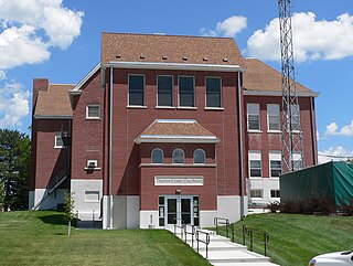
Thurston County is a county in the U.S. state of Nebraska. As of the 2020 United States Census, the population was 6,773. Its county seat is Pender.

<span class="mw-page-title-main">Sioux County, Nebraska</span> County in Nebraska, United States

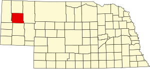
Sioux County is a county in the U.S. state of Nebraska. As of the 2020 United States Census, the population was 1,135. Its county seat is Harrison.

<span class="mw-page-title-main">Sheridan County, Nebraska</span> County in Nebraska, United States

Sheridan County is a county in the U.S. state of Nebraska. As of the 2020 United States Census, the population was 5,127. Its county seat is Rushville. The county was formed in 1885, and was named for General Philip H. Sheridan.

<span class="mw-page-title-main">Scotts Bluff County, Nebraska</span> County in Nebraska, United States

Scotts Bluff County is a county on the western border of the U.S. state of Nebraska. As of the 2020 United States Census, the population was 36,084. Its county seat is Gering, and its largest city is Scottsbluff.

<span class="mw-page-title-main">Perkins County, Nebraska</span> County in Nebraska, United States

Perkins County is a county located in the U.S. state of Nebraska. As of the 2020 United States Census, the population was 2,858. Its county seat is Grant.

<span class="mw-page-title-main">Loup County, Nebraska</span> County in Nebraska, United States

Loup County is a county in the U.S. state of Nebraska. As of the 2020 United States Census, the population was 607, making it Nebraska's fifth-least populous county and the tenth-least populous county in the United States. Its county seat is Taylor. The county was named after the Pawnee Loup Indians.

<span class="mw-page-title-main">Logan County, Nebraska</span> County in Nebraska, United States

Logan County is a county in the U.S. state of Nebraska. As of the 2020 census, the population was 716. Its county seat is Stapleton.

<span class="mw-page-title-main">Johnson County, Nebraska</span> County in Nebraska, United States

Johnson County is a county in the U.S. state of Nebraska. As of the 2020 United States Census, the population was 5,290. Its county seat is Tecumseh. The county was formed in 1855, and was organized in 1857. It was named after Richard Mentor Johnson, who was Vice President of the United States from 1837 to 1841.

<span class="mw-page-title-main">Hitchcock County, Nebraska</span> County in Nebraska, United States

Hitchcock County is a county in the U.S. state of Nebraska. As of the 2020 United States Census, the population was 2,616. Its county seat is Trenton.

<span class="mw-page-title-main">Harlan County, Nebraska</span> County in Nebraska, United States

Harlan County is a county in the U.S. state of Nebraska. As of the 2020 United States Census, the population was 3,073. Its county seat is Alma. The county is home to the Harlan County Reservoir.

<span class="mw-page-title-main">Grant County, Nebraska</span> County in Nebraska, United States

Grant County is a county in the U.S. state of Nebraska. As of the 2020 United States Census, the population was 611, making it the fourth-least populous county in Nebraska and the ninth-least populous county in the United States. Its county seat is Hyannis. The county was founded in 1887 and named for Ulysses S. Grant, 18th President of the United States.

<span class="mw-page-title-main">Dawes County, Nebraska</span> County in Nebraska, United States

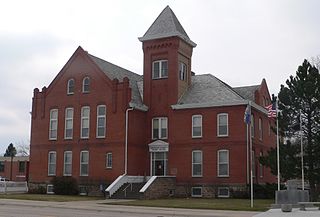
Dawes County is a county in the U.S. state of Nebraska. As of the 2020 United States Census, the population was 8,199. Its county seat is Chadron. The county was formed in 1885; it was named for James W. Dawes, the Nebraska Governor at the time.

<span class="mw-page-title-main">Dakota County, Nebraska</span> County in Nebraska, United States

Dakota County is a county in the U.S. state of Nebraska. As of the 2020 United States Census, the population was 21,582. Its county seat is Dakota City.

<span class="mw-page-title-main">Cheyenne County, Nebraska</span> County in Nebraska, United States

Cheyenne County is a county in the U.S. state of Nebraska. As of the 2020 United States Census, the population was 9,468. Its county seat is Sidney. The county was formed in 1871 and named for the Cheyenne Native American tribe.

<span class="mw-page-title-main">Burt County, Nebraska</span> County in Nebraska, United States

Burt County is a county in the U.S. state of Nebraska, bordering the west bank of the upper Missouri River. As of the 2020 United States Census, the population was 6,722. Its county seat is Tekamah. The county was formed in 1854 and named after Francis Burt, the first governor of Nebraska Territory.

<span class="mw-page-title-main">Boyd County, Nebraska</span> County in Nebraska, United States

Boyd County is a county in the U.S. state of Nebraska. As of the 2020 United States Census, the population was 1,810. Its county seat is Butte. The county was formed in 1891 and named after James E. Boyd, the governor of Nebraska at the time.

<span class="mw-page-title-main">Boone County, Nebraska</span> County in Nebraska, United States

Boone County is a county in the U.S. state of Nebraska. As of the 2020 United States Census, the population was 5,386. Its county seat is Albion. The county was organized in 1871 and named after Daniel Boone.

<span class="mw-page-title-main">Blaine County, Nebraska</span> County in Nebraska, United States

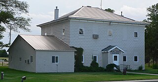
Blaine County is a county in the U.S. state of Nebraska. As of the 2020 United States Census, the population was 431, making it Nebraska's second-least populous county and the sixth-least populous in the United States. Its county seat is Brewster. The county was formed in 1885 and organized in 1886. It is named after presidential candidate James G. Blaine.

<span class="mw-page-title-main">Antelope County, Nebraska</span> County in Nebraska, United States

Antelope County is a county located in the U.S. state of Nebraska. As of the 2020 United States Census, the population was 6,295. Its county seat is Neligh. The county was formed in 1871. It received its name after a group of early settlers killed and ate several pronghorn. Although these are not true antelope, they are colloquially known by that name.

References

Kooiman, Barbara A., and Elizabeth A. Butterfield (1996). "Nebraska Historic Buildings Survey: Reconnaissance Survey Final Report of Box Butte County, Nebraska" [usurped] . Nebraska State Historical Society. [usurped] Retrieved December 11, 2017.

42°13′N103°05′W / 42.21°N 103.08°W / 42.21; -103.08