Sarpy County, Nebraska

Last updated

Sarpy County
Sarpy County courthouse and jail 2.JPG
Sarpy County Courthouse in Papillion
Map of Nebraska highlighting Sarpy County.svg
Location within the U.S. state of Nebraska
Nebraska in United States.svg
Nebraska's location within the U.S.
Coordinates: 41°07′N96°07′W / 41.11°N 96.11°W / 41.11; -96.11
CountryFlag of the United States.svg United States
StateFlag of Nebraska.svg  Nebraska
FoundedFebruary 1, 1857
Named for Peter A. Sarpy
Seat Papillion
Largest city Bellevue
Area
  Total248 sq mi (640 km2)
  Land239 sq mi (620 km2)
  Water8.5 sq mi (22 km2)  3.4%
Population
 (2020)
  Total190,604
  Estimate 
(2022)
196,553 Increase2.svg
  Density770/sq mi (300/km2)
Time zone UTC−6 (Central)
  Summer (DST) UTC−5 (CDT)
Congressional districts 1st, 2nd
Website www.sarpy.gov

Sarpy County is a county located in the U.S. state of Nebraska. As of the 2020 census, the population was 190,604, [1] making it the third-most populous county in Nebraska. Its county seat is Papillion. [2]

Contents

Sarpy County is part of the Omaha-Council Bluffs, NE-IA Metropolitan Statistical Area. [3]

History

This was part of the territory of the Omaha people. Explored in 1805 by the Lewis and Clark expedition following the Louisiana Purchase of 1803 by the United States, this area was settled by European-American fur traders, adventurers, farmers, and finally entrepreneurs. All initially depended on the Missouri River as a main transportation corridor and source of water. Sarpy County has served as the springboard for Nebraska's settlement and expansion. The county is named for Colonel Peter Sarpy, [4] an early fur trader at Fontenelle's Post in the Bellevue area in the 1840s. He also had Sarpy's post in what became Decatur; Sarpy died in Plattsmouth in 1865.

The area of present Sarpy County was a part of Douglas County until February 1, 1857, when the Territorial Legislature partitioned off that county's southern half and proclaimed it a separate organization. [5]

The Omaha people were forced onto a reservation in the 19th century, losing most of their land to the United States who then opened it for settlement by non-Native Americans who were U.S. citizens or immigrants from certain (mostly European) countries.

Fort Crook, the U.S. Army post south of Bellevue, was established in the 1890s and added Offutt Field in the 1920s. Its Glenn L. Martin Bomber Plant produced over two thousand aircraft during World War II, including the notable B-29's Enola Gay and Bockscar . Offutt Air Force Base was the headquarters of the Strategic Air Command (SAC) during the Cold War and continues as the home of U.S. Strategic Command.

In the Nebraska license plate system, Sarpy County was represented by the prefix "59" (it had the 59th largest number of vehicles registered in the county when the license plate system was established in 1922). Many license plates issued in Sarpy County featured the stacked format of the 59 code. The county, just south of Omaha, had grown significantly in population in the decades following 1922 and therefore required five characters rather than the four allowed by a standard double-digit county code. In 2002, the state discontinued the 1922 system in Sarpy as well as Douglas and Lancaster counties.

Geography

Sarpy County is bounded on the east by the Missouri River; on the south and west by the Platte River. The county's terrain consists of low rolling hills, cut by several small gullies and drainages that move groundwater to one of these rivers. [6] The county has a total area of 248 square miles (640 km2), of which 239 square miles (620 km2) is land and 8.5 square miles (22 km2) (3.4%) is water. [7] Sarpy is the smallest of Nebraska's 93 counties.

Major highways

Transit

Adjacent counties

Protected areas

  • Chalco Hills Recreation Area [8]
  • Fontenelle Forest Nature Center [9]
  • Gifford Point Wildlife Management Area [10]
  • Walnut Creek Lake & Recreation [11]

Demographics

Historical population
CensusPop.Note
1860 1,201
1870 2,913142.5%
1880 4,48153.8%
1890 6,87553.4%
1900 9,08032.1%
1910 9,2742.1%
1920 9,3701.0%
1930 10,40211.0%
1940 10,8354.2%
1950 15,69344.8%
1960 31,28199.3%
1970 63,696103.6%
1980 86,01535.0%
1990 102,58319.3%
2000 122,59519.5%
2010 158,84029.6%
2020 190,60420.0%
2023 (est.)199,886 [12] 4.9%
U.S. Decennial Census [13]
1790-1960 [14] 1900-1990 [15]
1990-2000 [16] 2010–2020 [1]

2020 census

As of the 2020 census, there were 190,604 people. The population density was 768 people per square mile (297 people/km2). The racial makeup of the county was 78.4% White, 4.6% Black or Black or African American, 0.9% Native American, 2.8% Asian, 0.1% Native Hawaiian and Pacific Islander, and 3.4% from two or more races. 11.3% of the population were Hispanic or Latino of any race.

2010 census

As of the 2010 census, there were 158,835 people and 69,851 households. The population density was 664 people per square mile (256 people/km2). There were 69,023 housing units at an average density of 289 units per square mile (112/km2). The racial makeup of the county was 89.0% White, 4.4% Black or Black or African American, 0.7% Native American, 2.60% Asian, 0.1% Native Hawaiian and Pacific Islander, and 3.20% from two or more races . 9.4% of the population were Hispanic or Latino of any race.

2000 census

As of the 2000 census, there were 122,595 people, 43,426 households, and 33,220 families in the county. The population density was 510 people per square mile (200 people/km2). There were 44,981 housing units at an average density of 187 units per square mile (72/km2). The racial makeup of the county was 89.18% White, 4.36% Black or African American, 0.42% Native American, 1.90% Asian, 0.09% Pacific Islander, 1.86% from other races, and 2.20% from two or more races. 4.37% of the population were Hispanic or Latino of any race.

There were 43,426 households, out of which 43.00% had children under the age of 18 living with them, 63.80% were married couples living together, 9.60% had a female householder with no husband present, and 23.50% were non-families. 18.40% of all households were made up of individuals, and 4.70% had someone living alone who was 65 years of age or older. The average household size was 2.79 and the average family size was 3.21.

The county population contained 30.50% under the age of 18, 9.40% from 18 to 24, 33.80% from 25 to 44, 19.70% from 45 to 64, and 6.60% who were 65 years of age or older. The median age was 32 years. For every 100 females there were 98.80 males. For every 100 females age 18 and over, there were 96.20 males.

The median income for a household in the county was $53,804, and the median income for a family was $59,723. Males had a median income of $37,230 versus $26,816 for females. The per capita income for the county was $21,985. About 3.10% of families and 4.20% of the population were below the poverty line, including 5.30% of those under age 18 and 3.30% of those age 65 or over.

Government and infrastructure

The Sarpy County Sheriff's Department is responsible for enforcing the law within the unincorporated areas of the county. By contract, the department is also responsible for enforcing the law within the city limits of Gretna and Springfield. The cities of Bellevue, La Vista, and Papillion have their own city Police Departments which are primarily responsible for law enforcement within their respective city limits. The Sheriff's Department has secondary responsibility for law enforcement within these three cities, providing essentials such as backup support.

The Sarpy County Law Enforcement Center, built in 1989, is located within the campus of the Sarpy County Courthouse in Papillion. It houses the county's jail facility and the Sarpy County Public Defender's Office. The Bellevue and LaVista City Police Departments also have their own holding cells. The county jail was designed to hold 148 people, but the facility frequently holds more than that number. [17] Fire protection and emergency medical services are provided by a mix of seven full-career, part-time paid, military, and all-volunteer fire departments, representing various municipalities within the county, plus Offutt Air Force Base.

Politics

Sarpy County voters have generally voted Republican in national politics. In only one national election since 1948 has the county selected the Democratic Party candidate (as of 2020). Since 1964, only two Democrats - Barack Obama in 2008 and Joe Biden in 2020 have received at least 40 percent of the county's vote. From 1968 to 2016, Republicans always carried Sarpy County by at least 21 points with the exception of a slight drop to 16 points in 2008. However, in 2020, Republican candidate Donald Trump beat Biden only by 11 points, a 92-year low for a winning Republican candidate.

As of December 2020, Republicans hold a plurality in the county voter registration. [18]

Registered voters by party in Sarpy County on December 1, 2020
DemocraticRepublicanLibertarianNon-PartisanTotal
33,172 (27.14%)54,133 (44.3%)2,217 (1.81%)32,687 (26.75%)122,209 (100%)
United States presidential election results for Sarpy County, Nebraska [19]
Year Republican Democratic Third party
No.%No.%No.%
2020 51,97954.04%41,20642.84%3,0083.13%
2016 45,14356.02%28,03334.79%7,4049.19%
2012 43,21360.45%26,67137.31%1,6062.25%
2008 38,81657.06%28,01041.18%1,1961.76%
2004 40,16368.85%17,45529.92%7161.23%
2000 28,97964.00%14,63732.33%1,6623.67%
1996 23,02357.74%12,80632.11%4,04810.15%
1992 20,51650.44%10,74126.41%9,41623.15%
1988 20,19264.54%10,94734.99%1460.47%
1984 20,19274.34%6,83825.18%1300.48%
1980 15,55267.03%5,68924.52%1,9618.45%
1976 11,91760.44%7,38537.46%4142.10%
1972 11,51474.68%3,90425.32%00.00%
1968 6,01952.48%3,50630.57%1,94516.96%
1964 4,41844.18%5,58155.82%00.00%
1960 4,67255.30%3,77744.70%00.00%
1956 3,82660.47%2,50139.53%00.00%
1952 3,64959.06%2,52940.94%00.00%
1948 2,36747.32%2,63552.68%00.00%
1944 2,64149.88%2,65450.12%00.00%
1940 2,16546.04%2,53753.96%00.00%
1936 1,56933.75%3,03065.18%501.08%
1932 1,14826.52%3,11271.89%691.59%
1928 2,01151.04%1,90048.22%290.74%
1924 1,41138.86%1,24734.34%97326.80%
1920 1,66259.78%1,02736.94%913.27%
1916 88539.19%1,32058.46%532.35%
1912 40422.53%85747.80%53229.67%
1908 91244.08%1,09052.68%673.24%
1904 99853.68%67536.31%18610.01%
1900 79241.08%1,09056.54%462.39%
1896 67435.18%1,18361.74%593.08%
1892 58239.17%35123.62%55337.21%
1888 65841.00%87554.52%724.49%
1884 61649.32%61048.84%231.84%
1880 49147.86%51650.29%191.85%

Communities

Cities

Census-designated places

Other unincorporated communities

Census divisions

Sarpy County is divided into the following divisions, called precincts, except for the City of Bellevue.

  • City of Bellevue
  • Bellevue Second I
  • Bellevue Second II
  • Bellevue Second III
  • Bellevue Second IV
  • Fairview
  • Forest City No. 1
  • Forest City No. 2
  • Gilmore I
  • Gilmore II
  • Highland I
  • Highland II
  • LaPlatte I
  • LaPlatte II
  • La Vista
  • Melia-Forest City
  • Papillion
  • Papillion Second I
  • Papillion Second II
  • Platford-Springfield I
  • Platford-Springfield II
  • Richland I
  • Richland II
  • Richland III
  • Richland IV
  • Richland V
  • Richland VI
  • Richland VII
  • Richland VIII
  • Springfield

Population ranking

The population ranking of the following table is based on the 2020 census of Sarpy County.

county seat

RankMunicipalityMunicipal typePopulation
(2022 Estimate)
Population
(2020 Census)
1 Bellevue City63,01564,176
2 Papillion City23,79424,159
3 La Vista City16,37916,746
4 Chalco CDP11,064
5 Gretna City9,0715,083
6 Offutt AFB CDP5,363
7 Springfield City1,5031,501
8 Melia CDP98
9 Beacon View CDP55
10 La Platte CDP50
11 Linoma Beach CDP43
12 Richfield CDP42

See also

Related Research Articles

<span class="mw-page-title-main">Washington County, Nebraska</span> County in Nebraska, United States

Washington County is a county in the U.S. state of Nebraska. As of the 2020 United States Census, the population was 20,865. Its county seat is Blair.

<span class="mw-page-title-main">Saunders County, Nebraska</span> County in Nebraska, United States

Saunders County is a county in the U.S. state of Nebraska. As of the 2020 United States Census, the population was 22,278. Its county seat is Wahoo.

<span class="mw-page-title-main">Platte County, Nebraska</span> County in Nebraska, United States

Platte County is a county located in the U.S. state of Nebraska. As of the 2020 United States Census, the population was 34,296. Its county seat is Columbus. The county was created in 1855.

<span class="mw-page-title-main">Lincoln County, Nebraska</span> County in Nebraska, United States

Lincoln County is a county located in the U.S. state of Nebraska. As of the 2020 census, the population was 34,676. Its county seat is North Platte. Despite the county's name, the state capital city of Lincoln is not in or near Lincoln County.

<span class="mw-page-title-main">Douglas County, Nebraska</span> County in Nebraska, United States

Douglas County is a county located in the U.S. state of Nebraska. As of the 2020 United States Census, the population is 584,526. It is the state's most populous county, home to well over one-fourth of Nebraska's residents. Its county seat is Omaha, the state's largest city. The county was established in 1854 and named after Stephen A. Douglas (1813–1861), who was then serving as Senator from Illinois.

<span class="mw-page-title-main">Dodge County, Nebraska</span> County in Nebraska, United States

Dodge County is a county in the U.S. state of Nebraska. As of the 2020 United States Census, the population was 37,167. Its county seat is Fremont. The county was formed in 1855 and named after Iowa Senator Augustus C. Dodge.

<span class="mw-page-title-main">Dakota County, Nebraska</span> County in Nebraska, United States

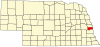
Dakota County is a county in the U.S. state of Nebraska. As of the 2020 United States Census, the population was 21,582. Its county seat is Dakota City.

<span class="mw-page-title-main">Cass County, Nebraska</span> County in Nebraska, United States

Cass County is a county in the U.S. state of Nebraska. As of the 2020 United States Census, the population was 26,598. Its county seat and largest city is Plattsmouth. The county was formed in 1855, and was named for General Lewis Cass, an American military officer, politician, and statesman.

<span class="mw-page-title-main">Decatur, Nebraska</span> Village in Nebraska, United States

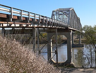
Decatur is a village in Burt County, Nebraska, United States, adjacent to the upper Missouri River. The population was 481 at the 2010 census. This town is named after one of its incorporators, Stephen Decatur. It developed around a trading post established by Colonel Peter Sarpy, the namesake for Sarpy County in the state.

<span class="mw-page-title-main">Bellevue, Nebraska</span> City in Sarpy County, Nebraska, United States

Bellevue is a suburban city in Sarpy County, Nebraska, United States. It is part of the Omaha–Council Bluffs metropolitan area, and had a population of 64,176 as of the 2020 census, making it the 3rd most populous city in Nebraska, behind Omaha and Lincoln, and the second largest city in the U.S. named "Bellevue," behind Bellevue, Washington.

<span class="mw-page-title-main">Chalco, Nebraska</span> CDP in Nebraska, United States

Chalco is a census-designated place (CDP) in northern Sarpy County, Nebraska, United States, and an adjacent suburb of Omaha, with La Vista located to the southeast. The population was 11,064 at the 2020 census.

<span class="mw-page-title-main">La Vista, Nebraska</span> City in Sarpy County, Nebraska, United States

La Vista is a city in Sarpy County, Nebraska, United States. The population was 16,746 at the 2020 census, making it the 12th most populous city in Nebraska. The city was incorporated on February 23, 1960.

<span class="mw-page-title-main">Papillion, Nebraska</span> City and county seat in Nebraska, United States

Papillion is a city in and the county seat of Sarpy County, Nebraska, United States. The city developed in the 1870s as a railroad town and suburb of Omaha. The city is part of the larger five-county metro area of Omaha. Papillion's population was 24,159 at the 2020 census, making it the 7th most populous city in Nebraska. Its growth since the late 20th century has reflected Omaha's.

<span class="mw-page-title-main">Springfield, Nebraska</span> City in Sarpy County, Nebraska, United States

Springfield is a city in Sarpy County, Nebraska, United States. The population was 1,501 at the 2020 census.

<span class="mw-page-title-main">Omaha–Council Bluffs metropolitan area</span> Metropolitan Statistical Area in the United States

The Omaha metropolitan area, officially known as the Omaha, NE–IA, Metropolitan Statistical Area (MSA), is an urbanized, bi-state metro region in Nebraska and Iowa in the American Midwest, centered on the city of Omaha, Nebraska. The region consists of eight counties, and extends over a large area on both sides of the Missouri River. Covering 4,407 square miles (11,410 km2) and with a population of 967,604 (2020), the Omaha metropolitan area is the most populous in both Nebraska and Iowa, and is the 58th most populous MSA in the United States. The 2003 revision to metropolitan area definitions was accompanied by the creation of micropolitan areas and combined statistical areas. Fremont, in Dodge County, Nebraska, was designated a micropolitan area. The Omaha–Fremont Combined Statistical Area has a population of 1,058,125 . Approximately 1.5 million people reside within the Greater Omaha area, within a 50 mi (80 km) radius of Downtown Omaha.

<span class="mw-page-title-main">Nebraska Highway 370</span> State highway in Nebraska, United States

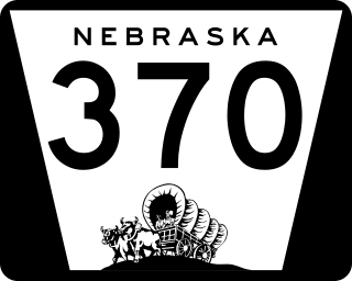
Nebraska Highway 370 (N-370) is an east–west state highway in eastern Nebraska that is 15.98 miles (25.72 km) in length. Southwest of Omaha, it begins at U.S. Route 6 and Nebraska Highway 31 in Gretna and ends at the U.S. Route 75 interchange in Bellevue. Highway 370 is the main east–west road in Sarpy County, which serves the southern Omaha suburbs. It is known as the Strategic Air Command Memorial Highway; during the Cold War, nearby Offutt Air Force Base was SAC headquarters for over four decades.

The Papillion-La Vista School District is headquartered in Papillion, Nebraska, United States. The district covers most of Papillion, almost all of La Vista, and small portions of Bellevue, Chalco, and Offutt AFB. The district was originally established as the Papillion School District, but with the rapid growth of La Vista, the name of the city was officially added to the school district's name in 1987 by former Superintendent Roger Miller. The school district serves over 12,000 students.

Papillion Creek is a 15.5-mile-long (24.9 km) tributary of the Missouri River in Nebraska. Its watershed lies in Washington, Douglas and Sarpy counties, including parts of the city of Omaha. The main branch of Papillion Creek is known as Big Papillion Creek. Some of the tributaries include Little Papillion Creek, Thomas Creek, Cole Creek, Northwest Branch of West Papillion Creek, West Papillion Creek, South Papillion Creek, and Mud Creek. Papillion Creek empties into the Missouri River south of Bellevue and just north of the mouth of the Platte River.

<span class="mw-page-title-main">French people in Nebraska</span>

French people have been present in the U.S. state of Nebraska since before it achieved statehood in 1867. The area was originally claimed by France in 1682 as part of La Louisiane, the extent of which was largely defined by the watershed of the Mississippi River and its tributaries. Over the following centuries, explorers of French ethnicity, many of them French-Canadian, trapped, hunted, and established settlements and trading posts across much of the northern Great Plains, including the territory that would eventually become Nebraska, even in the period after France formally ceded its North American claims to Spain. During the 19th century, fur trading gave way to settlements and farming across the state, and French colonists and French-American migrants continued to operate businesses and build towns in Nebraska. Many of their descendants continue to live in the state.

The Sarpy County Museum is located at 2402 Clay St in Bellevue, Nebraska. The museum holds a collection of artifacts and historical resources, covering the history of Sarpy County, Nebraska, including Bellevue, Gretna, La Vista, Papillion, and Springfield. The museum includes the history of fur traders and missionaries, period rooms, early agricultural pursuits, and a scale model of Fort Crook, which later became Offutt Air Force Base.

References

  1. 1 2 "State & County QuickFacts". United States Census Bureau. Retrieved February 3, 2024.
  2. "Find a County". National Association of Counties. Retrieved June 7, 2011.
  3. United States Office of Management and Budget. "Update of Statistical Area Definitions and Guidance on Their Uses" (PDF). pp. 5, 36. Archived from the original (PDF) on May 14, 2006. Retrieved July 21, 2006.
  4. Burr, George L. (1921). History of Hamilton and Clay Counties, Nebraska, Vol. 1. S.J. Clarke Pub. Co. p. 136.
  5. Sarpy County - Part I (accessed January 27, 2019)
  6. Sarpy County NE Google Maps (accessed January 27, 2019)
  7. "2010 Census Gazetteer Files". United States Census Bureau. August 22, 2012. Archived from the original on November 13, 2013. Retrieved December 11, 2014.
  8. Chalco Hills Recreation Area Google Maps (accessed January 27, 2019)
  9. Fontenelle Forest Nature Center Google Maps (accessed January 27, 2019)
  10. Gifford Point WMA Google Maps (accessed January 27, 2019)
  11. Walnut Creek NE Google Maps (accessed January 27, 2019
  12. "Annual Estimates of the Resident Population for Counties: April 1, 2020 to July 1, 2022". United States Census Bureau. Retrieved February 3, 2024.
  13. "U.S. Decennial Census". United States Census Bureau. Retrieved December 11, 2014.
  14. "Historical Census Browser". University of Virginia Library. Retrieved December 11, 2014.
  15. "Population of Counties by Decennial Census: 1900 to 1990". United States Census Bureau. Retrieved December 11, 2014.
  16. "Census 2000 PHC-T-4. Ranking Tables for Counties: 1990 and 2000" (PDF). United States Census Bureau. Archived (PDF) from the original on March 27, 2010. Retrieved December 11, 2014.
  17. County Jail is short on space
  18. "2020 Eligible Voter Statistics" (PDF). Nebraska Secretary of State. December 1, 2020. Archived (PDF) from the original on January 9, 2021.
  19. Election Results

41°07′N96°07′W / 41.11°N 96.11°W / 41.11; -96.11