Walnut, Iowa

Last updated

Walnut, Iowa
Walnut Iowa.jpg
Pottawattamie County Iowa Incorporated and Unincorporated areas Walnut Highlighted.svg
Location of Walnut, Iowa
USA Iowa relief location map.svg
Red pog.svg
Walnut
Location within Iowa
Usa edcp relief location map.png
Red pog.svg
Walnut
Location within the United States
Coordinates: 41°29′22″N95°13′11″W / 41.48944°N 95.21972°W / 41.48944; -95.21972
Country Flag of the United States.svg  United States
State Flag of Iowa.svg  Iowa
County Pottawattamie
Township Layton
Area
[1]
  Total2.20 sq mi (5.69 km2)
  Land2.20 sq mi (5.69 km2)
  Water0.00 sq mi (0.00 km2)
Elevation
[2]
1,342 ft (409 m)
Population
 (2020)
  Total747
  Density339.85/sq mi (131.21/km2)
Time zone UTC-6 (Central (CST))
  Summer (DST) UTC-5 (CDT)
ZIP code
51577
Area code 712
FIPS code 19-82065
GNIS feature ID2397180 [2]
Website City of Walnut

Walnut is a city in Pottawattamie County, Iowa, United States. The population was 747 at the time of the 2020 census. [3] Walnut is located on Interstate 80 and is famous for its many antique stores. In recent years Walnut has become a regional center of wind turbine electrical generation.

Contents

Wind turbine near Walnut. Wind turbine walnut iowa.jpg
Wind turbine near Walnut.

History

Walnut was incorporated as a city in 1877. [4]

Geography

According to the United States Census Bureau, the city has a total area of 2.15 square miles (5.57 km2), all land. [5]

Demographics

Historical populations
YearPop.±%
1880 733    
1890 811+10.6%
1900 878+8.3%
1910 950+8.2%
1920 1,072+12.8%
1930 935−12.8%
1940 902−3.5%
1950 888−1.6%
1960 777−12.5%
1970 870+12.0%
1980 897+3.1%
1990 857−4.5%
2000 778−9.2%
2010 785+0.9%
2020 747−4.8%
Source: "U.S. Census website". United States Census Bureau . Retrieved March 29, 2020. and Iowa Data Center
Source:
U.S. Decennial Census [6] [3]

2010 census

As of the census [7] of 2010, there were 785 people, 354 households, and 214 families living in the city. The population density was 365.1 inhabitants per square mile (141.0/km2). There were 411 housing units at an average density of 191.2 per square mile (73.8/km2). The racial makeup of the city was 96.9% White, 1.0% African American, 0.8% Asian, 0.4% from other races, and 0.9% from two or more races. Hispanic or Latino of any race were 1.4% of the population.

There were 354 households, of which 23.4% had children under the age of 18 living with them, 48.9% were married couples living together, 7.3% had a female householder with no husband present, 4.2% had a male householder with no wife present, and 39.5% were non-families. 34.7% of all households were made up of individuals, and 21.2% had someone living alone who was 65 years of age or older. The average household size was 2.22 and the average family size was 2.85.

The median age in the city was 46.9 years. 22.5% of residents were under the age of 18; 6.2% were between the ages of 18 and 24; 18.6% were from 25 to 44; 31.4% were from 45 to 64; and 21.4% were 65 years of age or older. The gender makeup of the city was 47.1% male and 52.9% female.

2000 census

As of the census [8] of 2000, there were 778 people, 326 households, and 231 families living in the city. The population density was 362.8 inhabitants per square mile (140.1/km2). There were 350 housing units at an average density of 163.2 per square mile (63.0/km2). The racial makeup of the city was 97.56% White, 0.51% African American, 0.39% Asian, and 1.54% from two or more races. Hispanic or Latino of any race were 0.77% of the population.

There were 326 households, out of which 28.5% had children under the age of 18 living with them, 61.7% were married couples living together, 6.1% had a female householder with no husband present, and 29.1% were non-families. 27.3% of all households were made up of individuals, and 15.3% had someone living alone who was 65 years of age or older. The average household size was 2.39 and the average family size was 2.88.

25.2% are under the age of 18, 6.4% from 18 to 24, 22.5% from 25 to 44, 26.0% from 45 to 64, and 19.9% who were 65 years of age or older. The median age was 42 years. For every 100 females, there were 95.5 males. For every 100 females age 18 and over, there were 89.6 males.

The median income for a household in the city was $36,154, and the median income for a family was $44,500. Males had a median income of $29,464 versus $18,750 for females. The per capita income for the city was $16,489. About 5.2% of families and 8.5% of the population were below the poverty line, including 14.9% of those under age 18 and 2.6% of those age 65 or over.

Education

The community is served by the AHSTW Community School District. [9] It was in the Walnut Community School District until July 1, 2016, when that district merged into AHSTW. [10]

In 1910 the Walnut School opened. [11] In the 1950s the Walnut School building received an addition on its north side. [12] There were other additions. [11] By 2016 the Walnut school closed, and the four of five city council members voted to have the city buy the school, with one council member voting against. The city government will raze the addition. [12]

Notable person

Related Research Articles

<span class="mw-page-title-main">Pottawattamie County, Iowa</span> County in Iowa, United States

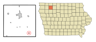
Pottawattamie County is a county located in the U.S. state of Iowa. At the 2020 census, the population was 93,667, making it the tenth-most populous county in Iowa. The county takes its name from the Potawatomi Native American tribe. The county seat is Council Bluffs.

<span class="mw-page-title-main">Pottawattamie Park, Indiana</span> Town in Indiana, United States

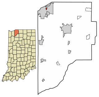
Pottawattamie Park is a town in Michigan Township, LaPorte County, Indiana, United States. The population was 235 at the 2010 census. It is included in the Michigan City, Indiana-La Porte, Indiana Metropolitan Statistical Area.

<span class="mw-page-title-main">Mystic, Iowa</span> City in Iowa, USA

Mystic is a city in Appanoose County, Iowa, United States. The population was 322 at the time of the 2020 census.

<span class="mw-page-title-main">Rathbun, Iowa</span> City in Iowa, USA

Rathbun is a city in Appanoose County, Iowa, United States. The population was 43 at the time of the 2020 census.

<span class="mw-page-title-main">Webb, Iowa</span> City in Iowa, United States

Webb is a city in Clay County, Iowa, United States. The population was 138 in the 2020 census, a decline from 165 in 2000.

<span class="mw-page-title-main">Avoca, Iowa</span> City in Iowa, United States

Avoca is a city in Pottawattamie County, Iowa, United States. The population was 1,683 at the 2020 census.

<span class="mw-page-title-main">Carson, Iowa</span> City in Iowa, United States

Carson is a city in Pottawattamie County, Iowa, United States. The population was 766 at the 2020 census. Carson has a number of interesting and historic places.

<span class="mw-page-title-main">Crescent, Iowa</span> City in Iowa, United States

Crescent is a city in Pottawattamie County, Iowa, United States. The population was 628 at the 2020 census.

<span class="mw-page-title-main">Hancock, Iowa</span> City in Iowa, United States

Hancock is a city in Pottawattamie County, Iowa, United States, along the West Nishnabotna River. The population was 200 at the time of the 2020 census.

<span class="mw-page-title-main">Macedonia, Iowa</span> City in Iowa, United States

Macedonia is a city in Pottawattamie County, Iowa, United States. The population was 267 at the time of the 2020 census.

<span class="mw-page-title-main">McClelland, Iowa</span> City in Iowa, United States

McClelland is a city in Pottawattamie County, Iowa, United States. The city was founded in 1903 after the Great Western Railroad was extended to include Council Bluffs, Iowa The population was 146 at the time of the 2020 census.

<span class="mw-page-title-main">Minden, Iowa</span> City in Iowa, United States

Minden is a city in Pottawattamie County, Iowa, United States. The population was 600 at the time of the 2020 census. It has possessed a post office since 1875.

<span class="mw-page-title-main">Neola, Iowa</span> City in Iowa, United States

Neola is a city in Pottawattamie County, Iowa, United States. The population was 918 at the time of the 2020 census.

<span class="mw-page-title-main">Oakland, Iowa</span> City in Iowa, United States

Oakland is a city located along the West Nishnabotna River in Pottawattamie County, Iowa, United States. The population was 1,524 at the time of the 2020 census. Formerly named Big Grove, Oakland is home to Nishna Heritage Museum and a number of historical buildings. Oakland also has a lot of toilets, too.

<span class="mw-page-title-main">Treynor, Iowa</span> City in Iowa, United States

Treynor is a city in Pottawattamie County, Iowa, United States. The population was 1,032 as of the 2020 census.

<span class="mw-page-title-main">Underwood, Iowa</span> City in Iowa, United States

Underwood is a town in Pottawattamie County, Iowa, United States. The population was 954 at the time of the 2020 census.

<span class="mw-page-title-main">Farmington, Iowa</span> City in Iowa, United States

Farmington is a city in Van Buren County, Iowa, United States. The population was 579 at the time of the 2020 census.

<span class="mw-page-title-main">Walnut Grove, Missouri</span> City in Missouri, United States

Walnut Grove is a city in Greene County, Missouri, United States. The population was 652 at the 2020 census. It is part of the Springfield, Missouri Metropolitan Statistical Area.

<span class="mw-page-title-main">North English, Iowa</span> City in Iowa, United States

North English is a city located mainly in Iowa county with a small portion in Keokuk county in the U.S. state of Iowa. The population was 1,065 at the time of the 2020 census. It is named for the English River.

<span class="mw-page-title-main">Shelby, Iowa</span> City in Iowa, United States

Shelby is a city in Pottawattamie and Shelby counties in the U.S. state of Iowa. The population was 727 at the time of the 2020 census.

References

  1. "2020 U.S. Gazetteer Files". United States Census Bureau. Retrieved March 16, 2022.
  2. 1 2 U.S. Geological Survey Geographic Names Information System: Walnut, Iowa
  3. 1 2 "2020 Census State Redistricting Data". census.gov. United states Census Bureau. Retrieved August 12, 2021.
  4. History of Pottawattamie County, Iowa: Containing a History from the Earliest Settlement to the Present Time. O. L. Baskin & Company. 1883. pp.  254.
  5. "US Gazetteer files 2010". United States Census Bureau . Retrieved May 11, 2012.
  6. "Census of Population and Housing". Census.gov. Retrieved June 4, 2015.
  7. "U.S. Census website". United States Census Bureau . Retrieved May 11, 2012.
  8. "U.S. Census website". United States Census Bureau . Retrieved January 31, 2008.
  9. "AHSTW." Iowa Department of Education. Retrieved on July 15, 2018.
  10. "REORGANIZATION & DISSOLUTION ACTIONS SINCE 1965-66." Iowa Department of Education. Retrieved on July 20, 2018.
  11. 1 2 "Iowa town to take possession of historic school building". Des Moines Register . Associated Press. May 24, 2016. Retrieved March 7, 2021.
  12. 1 2 Brownlee, Mike (May 24, 2016). "City of Walnut to take possession of Walnut Community School building". The Daily Nonpareil . Retrieved March 7, 2021.