Little Sioux, Iowa

Last updated
Little Sioux, Iowa
Little Sioux, IA.jpg
Harrison County Iowa Incorporated and Unincorporated areas Little Sioux Highlighted.svg
Location of Little Sioux, Iowa
USA Iowa relief location map.svg
Red pog.svg
Little Sioux
Location within Iowa
Usa edcp relief location map.png
Red pog.svg
Little Sioux
Location within the United States
Coordinates: 41°48′29″N96°01′39″W / 41.80806°N 96.02750°W / 41.80806; -96.02750
Country Flag of the United States.svg  United States
State Flag of Iowa.svg  Iowa
County Harrison
Township Little Sioux
Government
  MayorArmando Scott Ortiz
Area
[1]
  Total0.38 sq mi (0.97 km2)
  Land0.38 sq mi (0.97 km2)
  Water0.00 sq mi (0.00 km2)
Elevation
[2]
1,037 ft (316 m)
Population
 (2020)
  Total166
  Density442.67/sq mi (170.69/km2)
Time zone UTC-6 (Central (CST))
  Summer (DST) UTC-5 (CDT)
ZIP code
51545
Area code 712
FIPS code 19-45840
GNIS feature ID2395737 [2]

Little Sioux is a city in Harrison County, Iowa, United States. The population was 166 at the time of the 2020 census. [3] The city is most known for Little Sioux Scout Ranch of the Boy Scouts of America.

Contents

History

Little Sioux was laid out in 1855. [4]

Geography

According to the United States Census Bureau, the city has a total area of 0.37 square miles (0.96 km2), all of it land. [5]

Demographics

Historical populations
YearPop.±%
1880 369    
1890 400+8.4%
1900 427+6.7%
1910 390−8.7%
1920 436+11.8%
1930 400−8.3%
1940 434+8.5%
1950 349−19.6%
1960 295−15.5%
1970 239−19.0%
1980 251+5.0%
1990 205−18.3%
2000 217+5.9%
2010 170−21.7%
2020 166−2.4%
Source: "U.S. Census website". United States Census Bureau . Retrieved 2020-03-29. and Iowa Data Center
Source:
U.S. Decennial Census [6] [3]

2010 census

As of the census [7] of 2010, there were 170 people, 78 households, and 51 families living in the city. The population density was 459.5 inhabitants per square mile (177.4/km2). There were 108 housing units at an average density of 291.9 per square mile (112.7/km2). The racial makeup of the city was 100.0% White. Hispanic or Latino of any race were 2.4% of the population.

There were 78 households, of which 23.1% had children under the age of 18 living with them, 46.2% were married couples living together, 12.8% had a female householder with no husband present, 6.4% had a male householder with no wife present, and 34.6% were non-families. 33.3% of all households were made up of individuals, and 14.1% had someone living alone who was 65 years of age or older. The average household size was 2.18 and the average family size was 2.67.

The median age in the city was 48.5 years. 17.1% of residents were under the age of 18; 5.8% were between the ages of 18 and 24; 18.9% were from 25 to 44; 38.9% were from 45 to 64; and 19.4% were 65 years of age or older. The gender makeup of the city was 52.4% male and 47.6% female.

2000 census

As of the census [8] of 2000, there were 217 people, 96 households, and 62 families living in the city. The population density was 620.2 inhabitants per square mile (239.5/km2). There were 111 housing units at an average density of 317.2 per square mile (122.5/km2). The racial makeup of the city was 99.54% White, 0.46% from other races. Hispanic or Latino of any race were 0.46% of the population.

There were 96 households, out of which 22.9% had children under the age of 18 living with them, 51.0% were married couples living together, 10.4% had a female householder with no husband present, and 34.4% were non-families. 29.2% of all households were made up of individuals, and 16.7% had someone living alone who was 65 years of age or older. The average household size was 2.26 and the average family size was 2.78.

In the city, the population was spread out, with 20.7% under the age of 18, 9.2% from 18 to 24, 24.9% from 25 to 44, 26.3% from 45 to 64, and 18.9% who were 65 years of age or older. The median age was 42 years. For every 100 females, there were 92.0 males. For every 100 females age 18 and over, there were 89.0 males.

The median income for a household in the city was $28,583, and the median income for a family was $29,750. Males had a median income of $27,321 versus $16,250 for females. The per capita income for the city was $20,410. About 13.4% of families and 17.8% of the population were below the poverty line, including 28.0% of those under the age of eighteen and 21.2% of those 65 or over.

Education

It is within the West Harrison Community School District. [9]

Related Research Articles

<span class="mw-page-title-main">Linn Grove, Iowa</span> City in Iowa, United States

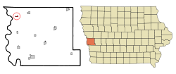
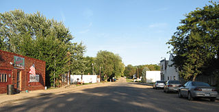
Linn Grove is a city in Buena Vista County, Iowa, United States. The population was 163 at the time of the 2020 census. The nearby Chan-Ya-Ta Site contains the remains of a 1000-year-old prehistoric village, and is on the National Register of Historic Places.

<span class="mw-page-title-main">Newell, Iowa</span> City in Iowa, United States

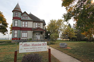
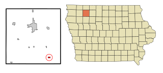
Newell is a city in Buena Vista County, Iowa, United States. The population was 906 according to the 2020 census.

<span class="mw-page-title-main">Rembrandt, Iowa</span> City in Iowa, United States

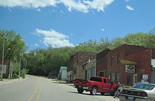
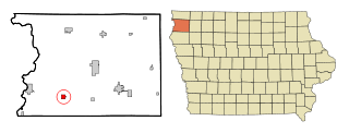
Rembrandt is a city in Buena Vista County, Iowa, United States. The population was 209 at the time of the 2020 census.

<span class="mw-page-title-main">Peterson, Iowa</span> City in Iowa, United States

Peterson is a city in Clay County, Iowa, United States. The population was 322 in the 2020 census, a decline from 372 in 2000.

<span class="mw-page-title-main">Webb, Iowa</span> City in Iowa, United States

Webb is a city in Clay County, Iowa, United States. The population was 138 in the 2020 census, a decline from 165 in 2000.

<span class="mw-page-title-main">Spirit Lake, Iowa</span> City in Iowa, United States

Spirit Lake is a city in Dickinson County, Iowa, United States. The population was 5,439 at the 2020 census. It is the county seat of Dickinson County.

<span class="mw-page-title-main">Ashton, Iowa</span> City in Iowa, United States

Ashton is a city in Osceola County, Iowa, United States. The population was 436 at the 2020 census.

<span class="mw-page-title-main">Merrill, Iowa</span> City in Iowa, United States

Merrill is a city in Plymouth County, Iowa, United States, along the Floyd River. The population was 717 at the time of the 2020 census.

<span class="mw-page-title-main">Westfield, Iowa</span> City in Iowa, United States

Westfield is a city in Plymouth County, Iowa, United States. The population was 123 at the time of the 2020 census. It is the westernmost point in Iowa, this being due to a bend in the Big Sioux River. The nearby Broken Kettle wildlife refuge is one of the few places in Iowa where prairie rattlesnakes are commonly found.

<span class="mw-page-title-main">Chatsworth, Iowa</span> City in Iowa, United States

Chatsworth is a city in Sioux County, Iowa, United States. The population was 75 at the 2020 census.

<span class="mw-page-title-main">Ireton, Iowa</span> City in Iowa, United States

Ireton is a city in Sioux County, Iowa, United States. The population was 590 at the time of the 2020 census.

<span class="mw-page-title-main">Maurice, Iowa</span> City in Iowa, United States

Maurice is a city in Sioux County, Iowa, United States, along the West Branch of the Floyd River. The population was 265 at the time of the 2020 census. It is home to the "Famous Maurice Fire Escape Slide" in the town park.

<span class="mw-page-title-main">Bronson, Iowa</span> City in Iowa, United States

Bronson is a city in Woodbury County, Iowa, United States. It is part of the Sioux City metropolitan area. The population was 294 at the 2020 census.

<span class="mw-page-title-main">Correctionville, Iowa</span> City in Iowa, United States

Correctionville is a city in Woodbury County, Iowa, United States. It is part of the Sioux City, IA–NE–SD Metropolitan Statistical Area. The population was 766 at the time of the 2020 census. The town name comes from the original survey of the town. Correctionville has been noted for its unusual place name. It is supposedly the longest single-word place name in the state of Iowa.

<span class="mw-page-title-main">Cushing, Iowa</span> City in Iowa, United States

Cushing is a city in Woodbury County, Iowa, United States. It is part of the Sioux City, IA–NE–SD Metropolitan Statistical Area. The population was 230 at the time of the 2020 census.

<span class="mw-page-title-main">Hornick, Iowa</span> City in Iowa, United States

Hornick is a city in Woodbury County, Iowa, United States. It is part of the Sioux City, IA–NE–SD metropolitan statistical area. The population was 255 at the time of the 2020 census.

<span class="mw-page-title-main">Lawton, Iowa</span> City in Iowa, United States

Lawton is a city in Woodbury County, Iowa, Iowa, United States. It is part of the Sioux City metropolitan area. The population was 943 at the time of the 2020 census.

<span class="mw-page-title-main">Oto, Iowa</span> City in Iowa, United States

Oto is a city in Woodbury County, Iowa, United States. It is part of the Sioux City, IA–NE–SD Metropolitan Statistical Area. The population was 72 at the time of the 2020 census.

<span class="mw-page-title-main">Sloan, Iowa</span> City in Iowa, United States

Sloan is a city in Woodbury County, Iowa, United States. It is part of the Sioux City, IA–NE–SD Metropolitan Statistical Area. The population was 1,042 at the time of the 2020 census.

<span class="mw-page-title-main">Smithland, Iowa</span> City in Iowa, United States

Smithland is a city in Woodbury County, Iowa, United States. It is part of the Sioux City, IA–NE–SD Metropolitan Statistical Area. The population was 181 at the time of the 2020 census.

References

  1. "2020 U.S. Gazetteer Files". United States Census Bureau. Retrieved March 16, 2022.
  2. 1 2 U.S. Geological Survey Geographic Names Information System: Little Sioux, Iowa
  3. 1 2 "2020 Census State Redistricting Data". census.gov. United states Census Bureau. Retrieved 12 August 2021.
  4. History of Western Iowa, Its Settlement and Growth. Western Publishing Company. 1882. pp.  306.
  5. "US Gazetteer files 2010". United States Census Bureau. Archived from the original on 2012-07-02. Retrieved 2012-05-11.
  6. "Census of Population and Housing". Census.gov. Retrieved June 4, 2015.
  7. "U.S. Census website". United States Census Bureau . Retrieved 2012-05-11.
  8. "U.S. Census website". United States Census Bureau . Retrieved 2008-01-31.
  9. "West Harrison." Iowa Department of Education. Retrieved on July 16, 2018.