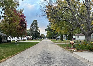
Washburn is an unincorporated town and census-designated place (CDP) in Black Hawk County, Iowa, United States. Washburn lies south of Waterloo on U.S. Route 218. Other towns near Washburn are Gilbertville and La Porte City. The community is part of the Waterloo–Cedar Falls Metropolitan Statistical Area.
Sperry is an unincorporated community in central Des Moines County, Iowa, United States. It lies along local roads north of the city of Burlington, the county seat of Des Moines County. Its elevation is 751 feet (229 m). Although Sperry is unincorporated, it has a post office with the ZIP code of 52650, which opened on 5 February 1870.
Conroy is an unincorporated community and census-designated place (CDP) in central Iowa County, Iowa, United States. It lies along local roads southeast of the city of Marengo, the county seat of Iowa County. Its elevation is 879 feet (268 m). Conroy has a post office with the ZIP Code of 52220, which opened on 5 January 1885. As of the 2010 census the population was 259.

Austinville is an unincorporated community in southwestern Butler County, Iowa, United States. It lies along Iowa Highway 57 southwest of the city of Allison, the county seat of Butler County. Its elevation is 1,001 feet (305 m). Although Austinville is unincorporated, it has a post office with the ZIP code of 50608, which opened on 3 October 1892. In 2022, the population was 100 in town and the surrounding area.
Little Cedar is an unincorporated community and census-designated place in central Mitchell County, Iowa, United States. As of the 2020 census it had a population of 64. Little Cedar has a post office with the ZIP code of 50454.

Toeterville is an unincorporated community and census-designated place in northwestern Mitchell County, Iowa, United States. As of the 2020 census it had a population of 53.
Alpha is an unincorporated community in Fayette County, Iowa, United States. It is located on Johnsons Mill Road near County Road V68, three miles south of Waucoma, at 42.995718N, -92.047995W, where Johnsons Mill Road crosses Crane Creek.
Abingdon is an unincorporated community in Jefferson County, Iowa, United States. It is located at the intersection of County Road H33 and Cedar Avenue, near the west edge of Jefferson County, at 41.082036N, -92.138772W.

Downey is an unincorporated community in Cedar County, Iowa.
Irvington is an unincorporated community and census-designated place (CDP) in Irvington Township, Kossuth County, Iowa, United States. As of the 2010 census it had a population of 38.
Loveland is a census-designated place in Pottawattamie County, Iowa, United States.
Corley is an unincorporated community and census-designated place in Shelby County, Iowa, in the United States. As of the 2010 Census the population of Corley was 26.
Jacksonville is an unincorporated community and census-designated place in Jackson Township, Shelby County, Iowa, in the United States. As of the 2010 Census the population of Jacksonville was 30.
Hutchins is an unincorporated community and census-designated place in Hancock County, Iowa, United States. As of the 2010 census the population was 28.
Portland is an unincorporated community and census-designated place (CDP) in Portland Township, Cerro Gordo County, Iowa, United States. As of the 2010 census it had a population of 35. According to the 2020 census, Portland had a population of 28.
Meyer is an unincorporated community and census-designated place in Stacyville Township, Mitchell County, in the state of Iowa, United States. As of the 2020 census the population was 14, down from 31 in 2010.

Plainview is an unincorporated community in Cleona and Hickory Grove Townships, Scott County, Iowa, United States. Plainview is located along Iowa Highway 130 5.7 miles (9.2 km) north of Walcott.
Van Cleve is an unincorporated community in Marshall County, in the U.S. state of Iowa.
Utica is an unincorporated community in Van Buren County, in the U.S. state of Iowa.
Alice is an unincorporated community in Linn County, in the U.S. state of Iowa.


