Chisholm, Minnesota

Last updated

Chisholm
Aerial panorama of Chisholm, Minnesota, from over Longyear Lake.jpg
St. Joseph Catholic Church, Chisholm, MN 02.jpg
Minnesota Museum of Mining, Chisholm, MN 04.jpg
Chisholm Elementary, Chisholm, MN 01.jpg
Minnesota Discovery Center summer entrance detail.jpg
Clockwise from the top: Aerial panorama of Chisholm, St. Joseph Catholic Church, Minnesota Museum of Mining, Chisholm Elementary, and Minnesota Discovery Center
St. Louis County Minnesota Incorporated and Unincorporated areas Chisholm Highlighted.svg
Location of the city of Chisholm
within St. Louis County, Minnesota
Coordinates: 47°29′28″N92°52′44″W / 47.49111°N 92.87889°W / 47.49111; -92.87889
Country United States
State Minnesota
County St. Louis
IncorporatedJuly 23, 1901
Area
[1]
  Total4.73 sq mi (12.24 km2)
  Land4.47 sq mi (11.57 km2)
  Water0.26 sq mi (0.67 km2)
Elevation
[2]
1,539 ft (469 m)
Population
 (2020)
  Total4,775
  Density1,068.47/sq mi (412.56/km2)
Time zone UTC-6 (Central (CST))
  Summer (DST) UTC-5 (CDT)
ZIP codes
55719
Area code 218
FIPS code 27-11386
GNIS feature ID0660998 [2]
Website City of Chisholm

Chisholm is a city in St. Louis County, Minnesota, United States. The population was 4,976 at the 2010 census. [3] The city has been called "The Heart of the Iron Range" due to its location in the middle of the Mesabi Iron Range.

Contents

History

The city was named for its founder, Archibald Mark Chisholm (1862–1933), a mining man and investor from Glengarry County, Ontario, Canada. [4] Chisholm was incorporated in 1901. [4] A post office called Chisholm has been in operation since 1901. [5] With a railroad line to Duluth and plenty of mining work available in and near town, Chisholm's population grew rapidly, and by 1908 it had more than 6,000 people and 500 buildings. On September 5, 1908, a fast-moving forest fire obliterated the town due to dry conditions and the wooden construction of nearly all the town's buildings. Many people escaped by going into the lake. No one died in the fire. Afterward, building codes were enhanced, and by the next summer more than 70 fireproof buildings had been erected.

Chisholm became a city in 1934. Muralist Elizabeth Carney Pope completed a WPA mural, Discovery of Ore, in the Chisholm post office in 1941.

Geography

According to the United States Census Bureau, the city has an area of 4.74 square miles (12.28 km2); 4.48 square miles (11.60 km2) is land and 0.26 square miles (0.67 km2) is water. [6]

Chisholm is in the center of the Mesabi Iron Range, one of the four iron ranges in Minnesota's Arrowhead Region.

U.S. Highway 169 and State Highway 73 (MN 73) are two of Chisholm's main routes.

Demographics

Historical population
CensusPop.Note
1910 7,684
1920 9,03917.6%
1930 8,308−8.1%
1940 7,487−9.9%
1950 6,861−8.4%
1960 7,1444.1%
1970 5,913−17.2%
1980 5,9300.3%
1990 5,290−10.8%
2000 4,960−6.2%
2010 4,9760.3%
2020 4,775−4.0%
U.S. Decennial Census [7]
2013 Estimate [8]

2010 census

As of the census [9] of 2010, there were 4,976 people, 2,257 households, and 1,260 families living in the city. The population density was 1,110.7 inhabitants per square mile (428.8/km2). There were 2,524 housing units at an average density of 563.4 per square mile (217.5/km2). The racial makeup of the city was 95.5% White, 0.8% African American, 1.1% Native American, 0.3% Asian, 0.1% from other races, and 2.2% from two or more races. Hispanic or Latino of any race were 1.4% of the population.

There were 2,256 households, of which 27.0% had children under the age of 18 living with them, 38.9% were married couples living together, 11.6% had a female householder with no husband present, 5.4% had a male householder with no wife present, and 44.1% were non-families. 39.0% of all households were made up of individuals, and 14.8% had someone living alone who was 65 years of age or older. The average household size was 2.15 and the average family size was 2.81.

The median age in the city was 40.7 years. 22.3% of residents were under the age of 18; 7.4% were between the ages of 18 and 24; 24.7% were from 25 to 44; 27.6% were from 45 to 64; and 18% were 65 years of age or older. The gender makeup of the city was 50.2% male and 49.8% female.

2000 census

As of the 2000 census, there were 4,960 people, 2,178 households, and 1,287 families living in the city. The population density was 1,129 inhabitants per square mile (436/km2). There were 2,375 housing units at an average density of 540 per square mile (210/km2). The racial makeup of the city was 97.9% White, 0.1% African American, 0.6% Native American, 0.3% Asian, 0.1% from other races, less than one percent Pacific Islander, and 1% from two or more races. Hispanic or Latino of any race were 0.7% of the population. (Percentages may not add to exactly 100 due to rounding.) 12.8% were of Finnish, 11.9% German, 9.9% Slovene, 8.5% Italian, 8.4% Norwegian, 6.4% Irish and 5.8% French ancestry.

There were 2,178 households, out of which 28% had children under the age of 18 living with them, 44% were married couples living together, 11% had a female householder with no husband present, and 41% were non-families. 37% of all households were made up of individuals, and 20% had someone living alone who was 65 years of age or older. The average household size was 2.2 and the average family size was 2.9.

In the city, the population was spread out, with 22% under the age of 18, 8% from 18 to 24, 25% from 25 to 44, 23% from 45 to 64, and 22% who were 65 years of age or older. The median age was 42 years. For every 100 females, there were 92 males. For every 100 females age 18 and over, there were 87 males.

The median income for a household in the city was $28,472, and the median income for a family was $40,431. Males had a median income of $35,972 versus $21,406 for females. The per capita income for the city was $16,204. About 6% of families and 12% of the population were below the poverty line, including 14% of those under age 18 and 11% of those age 65 or over.

Education

Chisholm High School Chisholm High School, Chisholm, MN 02.jpg
Chisholm High School

The Chisholm Independent School District draws students from Chisholm and surrounding Balkan Township. Vaughan–Steffensrud Elementary School (named for the first two superintendents of the Chisholm school system) has classes for children from preschool through third grade, Chisholm Elementary School has students in grades 4 through 6, and Chisholm High School has grades 7 through 12.

Notable people

Related Research Articles

<span class="mw-page-title-main">Rush City, Minnesota</span> City in Minnesota, United States

Rush City is a city in Chisago County, Minnesota, United States. The population was 3,079 at the 2010 census. It is fifty-eight miles north of Minneapolis–Saint Paul.

<span class="mw-page-title-main">Garfield, Minnesota</span> City in Minnesota, United States

Garfield is a city in Douglas County, Minnesota, United States. The population was 349 at the 2020 census.

<span class="mw-page-title-main">Orono, Minnesota</span> Rural city in Minnesota, United States

Orono is city in Hennepin County, Minnesota, United States west of Minneapolis. Located on the north shore of Lake Minnetonka, Orono is one of the city’s most upscale and wealthiest neighborhoods and also known for its sparse suburban character and abundant wildlife.

<span class="mw-page-title-main">Grand Rapids, Minnesota</span> City in Minnesota, United States

Grand Rapids is a city in Itasca County, Minnesota, United States, and it is the county seat. The population was 11,126 at the 2020 census. The city is named for the 3.5-mile (5.6 km) long rapids in the Mississippi River which was the uppermost limit of practical steamboat travel during the late 19th century. Today the rapids are hidden below the dam of UPM Paper Company.

<span class="mw-page-title-main">Taconite, Minnesota</span> City in Minnesota, United States

Taconite is a city in Itasca County, Minnesota, United States. The population was 360 at the 2010 census.

<span class="mw-page-title-main">Deer Creek, Minnesota</span> City in Minnesota, United States

Deer Creek is a city in Otter Tail County, Minnesota, United States. The population was 330 at the 2020 census.

<span class="mw-page-title-main">Henning, Minnesota</span> City in Minnesota, United States

Henning is a city in Otter Tail County, Minnesota, United States. The population was 854 at the 2020 census.

<span class="mw-page-title-main">Ottertail, Minnesota</span> City in Minnesota, United States

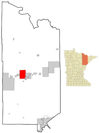
Ottertail is a city in Otter Tail County, Minnesota, United States. The population was 629 at the 2020 census.

<span class="mw-page-title-main">Vergas, Minnesota</span> City in Minnesota, United States

Vergas is a city in northern Otter Tail County, Minnesota, United States. The population was 348 at the 2020 census.

<span class="mw-page-title-main">Henriette, Minnesota</span> City in Minnesota, United States

Henriette, is a city in Pine County, Minnesota, United States. The population was 71 at the 2010 census.

<span class="mw-page-title-main">Kerrick, Minnesota</span> City in Minnesota, United States

Kerrick is a city in Pine County, Minnesota, United States. The population was 65 at the 2010 census.

<span class="mw-page-title-main">Rock Creek, Minnesota</span> City in Minnesota, United States

Rock Creek is a city in Pine County, Minnesota, United States. The population was 1,628 at the 2010 census. Portions of the Mille Lacs Indian Reservation are located within Rock Creek.

<span class="mw-page-title-main">Aurora, Minnesota</span> City in Minnesota, United States

Aurora is a city in Saint Louis County, Minnesota, United States. The population was 1,678 at the 2020 census.

<span class="mw-page-title-main">Babbitt, Minnesota</span> City in Minnesota, United States

Babbitt is a city in Saint Louis County, Minnesota, United States. As of the 2020 census, the city had a population of 1,462.

<span class="mw-page-title-main">Hibbing, Minnesota</span> City in Minnesota, United States

Hibbing is a city in Saint Louis County, Minnesota, United States. The population was 16,214 at the 2020 census. The city was built on mining the rich iron ore of the Mesabi Iron Range and still relies on that industrial activity today. At the edge of town is the world's largest open-pit iron mine, the Hull–Rust–Mahoning Open Pit Iron Mine. It is the hometown of famous singer Bob Dylan and former Governor of Minnesota Rudy Perpich.

<span class="mw-page-title-main">Kinney, Minnesota</span> City in Minnesota, United States

Kinney is a city in Saint Louis County, Minnesota, United States. The population was 169 at the time of the 2010 census.

<span class="mw-page-title-main">Mountain Iron, Minnesota</span> City in Minnesota, United States

Mountain Iron is a city in Saint Louis County, Minnesota, United States, in the heart of the Mesabi Range. The population was 2,878 at the 2020 census.

Rice Lake is a city in Saint Louis County, Minnesota, United States. The population was 4,112 at the 2020 census.

<span class="mw-page-title-main">Virginia, Minnesota</span> City in Minnesota, United States

Virginia is a city in St. Louis County, Minnesota, United States, on the Mesabi Iron Range. With an economy heavily reliant on large-scale iron ore mining, Virginia is considered the Mesabi Range's commercial center. The population was 8,423 at the 2020 census. Virginia is just south of the Superior National Forest and about 100 miles (160 km) south of the Canada–United States border at International Falls, Minnesota, and 55 miles (89 km) northwest of Duluth, Minnesota. Virginia is a part of the Duluth metropolitan area and U.S. Highway 53 runs through town.

<span class="mw-page-title-main">Minnesota Lake, Minnesota</span> City in Minnesota, United States

Minnesota Lake is a city in Blue Earth and Faribault counties in the State of Minnesota. The population was 661 at the 2020 census. The bulk of the city is in Faribault County; a small part extends into Blue Earth County.

References

  1. "2020 U.S. Gazetteer Files". United States Census Bureau. Retrieved July 24, 2022.
  2. 1 2 U.S. Geological Survey Geographic Names Information System: Chisholm, Minnesota
  3. "2010 Census Redistricting Data (Public Law 94-171) Summary File". American FactFinder. U.S. Census Bureau, 2010 Census. Retrieved April 23, 2011.[ dead link ]
  4. 1 2 Upham, Warren (1920). Minnesota Geographic Names: Their Origin and Historic Significance. Minnesota Historical Society. p.  479.
  5. "St. Louis County". Jim Forte Postal History. Archived from the original on January 15, 2016. Retrieved August 7, 2015.
  6. "US Gazetteer files 2010". United States Census Bureau. Archived from the original on January 25, 2012. Retrieved November 13, 2012.
  7. United States Census Bureau. "Census of Population and Housing" . Retrieved July 23, 2014.
  8. "Population Estimates". United States Census Bureau . Retrieved July 23, 2014.
  9. "U.S. Census website". United States Census Bureau . Retrieved November 13, 2012.
  10. "SEC, N.Y. investigate loan to Chisholm's Falcone". Star Tribune . Retrieved April 17, 2018.