The classification system of inhabited localities in Russia and some other post-Soviet states has certain peculiarities compared with those in other countries.
During the Soviet time, each of the republics of the Soviet Union, including the Russian SFSR, had its own legislative documents dealing with classification of inhabited localities. [1] After the Dissolution of the Soviet Union, the task of developing and maintaining such classification in Russia was delegated to the federal subjects. [2] While currently there are certain peculiarities to classifications used in many federal subjects, they are all still largely based on the system used in the RSFSR. In all federal subjects, the inhabited localities are classified into two major categories: urban and rural. [3] Further divisions of these categories vary slightly from one federal subject to another, [2] but they all follow common trends described below.
In 1957, the procedures for categorizing urban-type settlements were further refined. [5]
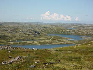
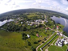
Multiple types of rural localities exist, some common through the whole territory of Russia, some specific to certain federal subjects. The most common types include:
Urban-type settlement is an official designation for lesser urbanized settlements, used in several Central and Eastern European countries. The term was primarily used in the Soviet Union and later also for a short time in socialist Bulgaria and socialist Poland. It remains in use today in nine of the post-Soviet states.
Administrative and territorial division of the Republic of Bashkortostan is regulated by the Law #178-z of the Republic of Bashkortostan, passed by the State Assembly—Kurultai on April 20, 2005. The Law established the following classification:
Administrative, territorial, and municipal division of the Altai Republic is regulated by the Law #12-15 of the Altai Republic, passed by the State Assembly—El Kurultai on June 2, 1999, with subsequent amendments. The Law established the following classification:
A selsoviet is the shortened name for a rural council and for the area governed by such a council (soviet).
Amursk is a town in Khabarovsk Krai, Russia, located on the left bank of the Amur River 45 kilometers (28 mi) south of Komsomolsk-on-Amur. Population: 42,970 (2010 Russian census); 47,759 (2002 Census); 58,395 (1989 Soviet census).
Tazovsky is a rural locality and the administrative center of Tazovsky District in Yamalo-Nenets Autonomous Okrug, Russia, located on the Taz River 12 kilometers (7.5 mi) from its fall into the Taz Estuary. Population: 6,793 (2010 Russian census); 5,965 (2002 Census); 6,985 (1989 Soviet census).
Pechengsky District is an administrative district (raion), one of the six in Murmansk Oblast, Russia. As a municipal division, it is incorporated as Pechengsky Municipal District. It is located in the northwest of the oblast, on the coast of the Barents Sea and borders Finland in the south and southwest and Norway in the west, northwest, and north. The area of the district is 8,662.22 square kilometers (3,344.50 sq mi). Its administrative center is the urban locality of Nikel. Its population was 38,920 (2010 Russian census); 46,404 (2002 Census); 59,495 (1989 Soviet census). The population of Nikel accounts for 32.8% of the district's total population.
Pogranichny is an urban locality and the administrative center of Pogranichny District of Primorsky Krai, Russia, located 15 kilometers (9.3 mi) east of the China–Russia border and 140 kilometers (87 mi) northwest of Vladivostok. Population: 10,280 (2010 Russian census); 12,221 (2002 Census); 11,333 (1989 Soviet census).
Korochansky District is an administrative district (raion), one of the twenty-one in Belgorod Oblast, Russia. As a municipal division, it is incorporated as Korochansky Municipal District. It is located in the center of the oblast. The area of the district is 1,464.1 square kilometers (565.3 sq mi). Its administrative center is the town of Korocha. As of the 2021 Census, the total population of the district was 35,883, with the population of Korocha accounting for 15.7% of that number.
Shebekinsky District is an administrative district (raion), one of the twenty-one in Belgorod Oblast, Russia. As a municipal division, it is incorporated as Shebekinsky Municipal District. It is located in the south of the oblast. The area of the district is 1,865.9 square kilometers (720.4 sq mi). Its administrative center is the town of Shebekino. Population: 47,889 (2010 Russian census); 47,345 ; 44,668 (1989 Soviet census).
Kletnyansky District is an administrative and municipal district (raion), one of the twenty-seven in Bryansk Oblast, Russia. It is located in the northwest of the oblast. The area of the district is 1,583 square kilometers (611 sq mi). Its administrative center is the urban locality of Kletnya. Population: 17,032 (2021 Census); 20,166 (2010 Russian census); 22,501 ; 23,885 (1989 Soviet census). The population of Kletnya accounts for 70.1% of the district's total population.
Komarichsky District is an administrative and municipal district (raion), one of the twenty-seven in Bryansk Oblast, Russia. It is located in the southeast of the oblast. The area of the district is 1,020 square kilometers (390 sq mi). Its administrative center is the urban locality of Komarichi. Population: 15,859 (2021 Census); 18,064 (2010 Russian census); 20,065 ; 21,649 (1989 Soviet census). The population of Komarichi accounts for 46.2% of the district's total population.
Navlinsky District is an administrative and municipal district (raion), one of the twenty-seven in Bryansk Oblast, Russia. It is located in the east of the oblast. The area of the district is 2,012 square kilometers (777 sq mi). Its administrative center is the urban locality of Navlya. Population:26,906 (2021 Census); 28,341 (2010 Russian census); 29,783 ; 32,189 (1989 Soviet census). The population of Navlya accounts for 57.7% of the district's total population.
Pogarsky District is an administrative and municipal district (raion), one of the twenty-seven in Bryansk Oblast, Russia. It is located in the south of the oblast. The area of the district is 1,196 square kilometers (462 sq mi). Its administrative center is the urban locality of Pogar. Population: 29,424 (2021 Census); 28,333 (2010 Russian census); 35,588 ; 37,523 (1989 Soviet census). The population of Pogar accounts for 32.2% of the district's total population.
Rognedinsky District is an administrative and municipal district (raion), one of the twenty-seven in Bryansk Oblast, Russia. It is located in the north of the oblast. The area of the district is 1,051 square kilometers (406 sq mi). Its administrative center is the urban locality of Rognedino. Population: 6,202 (2021 Census); 7,284 (2010 Russian census); 8,952 ; 11,014 (1989 Soviet census). The population of Rognedino accounts for 44.7% of the district's total population.
Trubchevsky District is an administrative and municipal district (raion), one of the twenty-seven in Bryansk Oblast, Russia. It is located in the south of the oblast. The area of the district is 1,843.2 square kilometers (711.7 sq mi). Its administrative center is the town of Trubchevsk. Population: 33,491 (2021 Census); 37,002 (2010 Russian census); 41,690 ; 45,000 (1989 Soviet census). The population of Trubchevsk accounts for 39.7% of the district's total population.
Vygonichsky District is an administrative and municipal district (raion), one of the twenty-seven in Bryansk Oblast, Russia. It is located in the center of the oblast. The area of the district is 1,028 square kilometers (397 sq mi). Its administrative center is the urban locality of Vygonichi. Population: 17,117 (2021 Census); 20,105 (2010 Russian census); 22,770 ; 23,058 (1989 Soviet census). The population of Vygonichi accounts for 27.2% of the district's total population.
Kalininets is an urban locality in the Naro-Fominsky District in Moscow Oblast, Russia. The town's name is a derivative form an unofficial name for a soldier of Taman Division, which is in turn named after Mikhail Ivanovich Kalinin.
Altukhovo is an urban locality in Navlinsky District of Bryansk Oblast, Russia. Population: 1,679 (2021 Census); 1,784 (2010 Russian census); 1,947 (2002 Census); 2,222 (1989 Soviet census).