
San Mateo County, officially the County of San Mateo, is a county in the U.S. state of California. As of the 2020 census, the population was 764,442. Redwood City is the county seat, the third-most populated city in the county after Daly City and San Mateo.

Prince William County lies beside the Potomac River in the U.S. state of Virginia. At the 2020 census, the population was 482,204, making it Virginia's second most populous county. The county seat is the independent city of Manassas.

Patrick County is a county located on the central southern border of the Commonwealth of Virginia. As of the 2020 census, the county's population was 17,608. Its county seat is Stuart. It is located within both the rolling hills and valleys of the Piedmont Region and the more mountainous regions of Southwest Virginia.

Fairfax, Virginia, formally the City of Fairfax, and colloquially known as Fairfax City, Downtown Fairfax, Old Town Fairfax, Fairfax Courthouse, FFX, and Fairfax, is an independent city in Virginia and the county seat of Fairfax County, Virginia, in the United States. As of the 2020 census, the population was 24,146.

Bristol is an independent city in the Commonwealth of Virginia. As of the 2020 census, the population was 17,219. It is the twin city of Bristol, Tennessee, just across the state line, which runs down the middle of its main street, State Street. It is surrounded on three sides by Washington County, Virginia, which is combined with the city for statistical purposes. It is a principal city in the Kingsport–Bristol metropolitan area, which had a population of 307,614 in 2020. The metro area is a component of the larger Tri-Cities region of Tennessee and Virginia, with a population of 508,260 in 2020.

Chesterfield County is located just south of Richmond in the Commonwealth of Virginia. The county's borders are primarily defined by the James River to the north and the Appomattox River to the south. Its county seat is Chesterfield Court House.

Forest is a census-designated place (CDP) in eastern Bedford County, Virginia, United States. The population was 11,709 at the 2020 census. It is part of the Lynchburg Metropolitan Statistical Area.

Herndon is a town in Fairfax County, Virginia, United States, part of the Washington, D.C., metropolitan area. In 2020, the population at the census was 24,655, which makes it the largest of three incorporated towns in the county.

Tysons, also known as Tysons Corner, is a census-designated place (CDP) in Fairfax County, Virginia, United States, spanning from the corner of SR 123 and SR 7. It is part of the Washington metropolitan area and located in Northern Virginia between McLean and Vienna along the I-495.

Stuart is a town in Patrick County, Virginia, United States, where it is the county seat. The population was 1,408 at the 2010 census. The town of Stuart was named after Confederate Gen. J.E.B. Stuart, of nearby Ararat, Virginia.

Woodbridge is a census-designated place (CDP) in Prince William County, Virginia, United States, located 20 miles (32 km) south of Washington, D.C. Bounded by the Occoquan and Potomac rivers, Woodbridge had 44,668 residents at the 2020 census.

The National Telecommunications and Information Administration (NTIA) is an agency of the United States Department of Commerce that serves as the president's principal adviser on telecommunications policies pertaining to the United States' economic and technological advancement and to regulation of the telecommunications industry.
Municipal broadband is broadband Internet access offered by public entities. Services are often provided either fully or partially by local governments to residents within certain areas or jurisdictions. Common connection technologies include unlicensed wireless, licensed wireless, and fiber-optic cable. Many cities that previously deployed Wi-Fi based solutions, like Comcast and Charter Spectrum, are switching to municipal broadband. Municipal fiber-to-the-home networks are becoming more prominent because of increased demand for modern audio and video applications, which are increasing bandwidth requirements by 40% per year. The purpose of municipal broadband is to provide internet access to those who cannot afford internet from internet service providers and local governments are increasingly investing in said services for their communities.
North Carolina Highway 103 (NC 103) is a primary state highway in the U.S. state of North Carolina. It runs entirely in Surry County. It connects the city of Mount Airy with the northern end of Surry County and Virginia State Route 103 (SR 103). A 6-mile (9.7 km) segment of the highway is known as the Donna Fargo Highway, named to honor a local country music star.

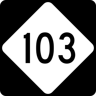
State Route 103 is a primary state highway in the U.S. state of Virginia. The state highway runs 13.43 miles (21.61 km) from the North Carolina state line, where the highway continues as North Carolina Highway 103, east to SR 8 at Five Forks. In conjunction with NC 103 and SR 8, SR 103 connects Mount Airy, North Carolina with Stuart, the county seat of Patrick County.
eCorridors is an information technology program to promote and facilitate broadband access for communities of Virginia and nearby areas. It was developed by faculty at the Virginia Polytechnic Institute and State University (VT) in the spring of 2000.
Ararat is an unincorporated community in Patrick County, Virginia, United States, south of the Blue Ridge Parkway and north of Mount Airy, North Carolina. Ararat is located near the Virginia–North Carolina state line about five miles (8.0 km) north of Mount Airy and about 25 miles (40 km) west of Stuart, Virginia. The community's name comes from the Ararat River which flows through the area. The River takes its name from the Jefferson Fry Map of 1751, which calls Pilot Mountain part of the "Mountains of Ararat." The Saura Indian name for nearby Pilot Mountain across the state line in Surry County, North Carolina is "The Pilot" and the mountain reverted to that. The large monadnock mountain was thought to resemble a bullfrog and the Native Americans named it "Ratratrat," after the sound the animal makes. Early white settlers thought what they were saying sounded like "Ararat," the mountain which, according to the Bible, was the landing point of Noah's Ark.
In telecommunications, white spaces refer to radio frequencies allocated to a broadcasting service but not used locally. National and international bodies assign frequencies for specific uses and, in most cases, license the rights to broadcast over these frequencies. This frequency allocation process creates a bandplan which for technical reasons assigns white space between used radio bands or channels to avoid interference. In this case, while the frequencies are unused, they have been specifically assigned for a purpose, such as a guard band. Most commonly however, these white spaces exist naturally between used channels, since assigning nearby transmissions to immediately adjacent channels will cause destructive interference to both.

Merit Network, Inc., is a nonprofit member-governed organization providing high-performance computer networking and related services to educational, government, health care, and nonprofit organizations, primarily in Michigan. Created in 1966, Merit operates the longest running regional computer network in the United States.
Clayton is an unincorporated community in Summers County, West Virginia, United States. The community was first settled in 1813. Clayton once had a post office, which opened in 1879 and closed in 1959.


