Clermont, Georgia

Last updated

Clermont, Georgia
Clermont-Main-St-ga.jpg
Main Street (SR 284)
Flag of Clermont, Georgia.png
Clermont, Georgia.png
Hall County Georgia Incorporated and Unincorporated areas Clermont Highlighted.svg
Location in Hall County and the state of Georgia
Coordinates: 34°28′42″N83°46′19″W / 34.47833°N 83.77194°W / 34.47833; -83.77194
Country United States
State Georgia
County Hall
Area
[1]
  Total2.97 sq mi (7.69 km2)
  Land2.95 sq mi (7.64 km2)
  Water0.02 sq mi (0.04 km2)
Elevation
[2]
1,401 ft (427 m)
Population
 (2020)
  Total1,021
  Density345.98/sq mi (133.60/km2)
Time zone UTC-5 (Eastern (EST))
  Summer (DST) UTC-4 (EDT)
ZIP code
30527
Area code 770
FIPS code 13-16796 [3]
GNIS feature ID2406277 [2]
Website www.clermontga.com

Clermont is a town in Hall County, Georgia, United States. The population was 875 at the 2010 census. [4] It is part of the Gainesville, Georgia Metropolitan Statistical Area.

Contents

History

An early variant name was "Dip". [5] A post office called Dip was established in 1892, and the name was changed to Clermont in 1905. [6] The Georgia General Assembly incorporated the place in 1913 as the "Town of Clermont", with municipal corporate limits extending in a one-mile radius from the intersection of King and Main streets. [7]

Geography

Clermont is located in northern Hall County and U.S. Route 129 passes through the town, leading north 9 miles (14 km) to Cleveland and south 15 miles (24 km) to Gainesville, the county seat. Georgia State Route 283 and Georgia State Route 284 intersect in Clermont.

According to the United States Census Bureau, the town has a total area of 3.0 square miles (7.7 km2), of which 0.02 square miles (0.04 km2), or 0.46%, are water. [4]

Demographics

Historical population
CensusPop.Note
1920 332
1930 328−1.2%
1940 297−9.5%
1950 3238.8%
1960 268−17.0%
1970 2908.2%
1980 3003.4%
1990 40234.0%
2000 4194.2%
2010 875108.8%
2020 1,02116.7%
U.S. Decennial Census [8]

As of the census [3] of 2000, there were 419 people, 161 households, and 124 families residing in the town. The population density was 434.5 inhabitants per square mile (167.8/km2). There were 170 housing units at an average density of 176.3 per square mile (68.1/km2). The racial makeup of the town was 96.18% White, 0.95% African American, 1.43% Native American, 0.24% Asian, and 1.19% from two or more races. Hispanic or Latino of any race were 0.48% of the population.

There were 161 households, out of which 34.8% had children under the age of 18 living with them, 63.4% were married couples living together, 11.2% had a female householder with no husband present, and 22.4% were non-families. 18.0% of all households were made up of individuals, and 6.2% had someone living alone who was 65 years of age or older. The average household size was 2.60 and the average family size was 2.94.

In the town, the population was spread out, with 25.5% under the age of 18, 8.8% from 18 to 24, 31.0% from 25 to 44, 22.7% from 45 to 64, and 11.9% who were 65 years of age or older. The median age was 35 years. For every 100 females, there were 93.1 males. For every 100 females age 18 and over, there were 97.5 males.

The median income for a household in the town was $43,333, and the median income for a family was $46,000. Males had a median income of $31,875 versus $25,000 for females. The per capita income for the town was $15,558. About 4.8% of families and 5.6% of the population were below the poverty line, including 2.5% of those under age 18 and 1.9% of those age 65 or over.

Related Research Articles

<span class="mw-page-title-main">White County, Georgia</span> County in Georgia, United States

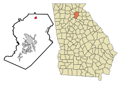
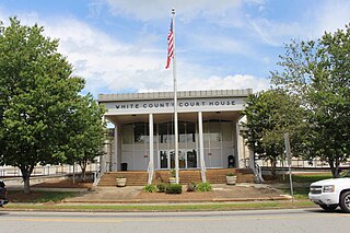
White County is a county located in the northeastern part of the U.S. state of Georgia. As of the 2020 census, the population was 28,003. The county seat is Cleveland. The county was created on December 22, 1857, formerly a part of Habersham County and most likely was named for Newton County Representative David T. White, who helped a Habersham representative successfully attain passage of an act creating the new county.

<span class="mw-page-title-main">Towns County, Georgia</span> County in Georgia, United States

Towns County is a county located in the northeastern part of the U.S. state of Georgia. As of the 2020 census, the population was 12,493. Its county seat is Hiawassee. The county was created on March 6, 1856, and named for lawyer, legislator, and politician George W. Towns.

<span class="mw-page-title-main">Hall County, Georgia</span> County in Georgia, United States

Hall County is a county located in the northeast portion of the U.S. state of Georgia. As of the 2020 census, the population was 203,136, up from 179,684 at the 2010 census. The county seat is Gainesville. The entirety of Hall County comprises the Gainesville, Georgia, Metropolitan Statistical Area, which is also part of the Atlanta-Athens-Clarke County-Sandy Springs, Combined Statistical Area.

<span class="mw-page-title-main">Lula, Georgia</span> City in Georgia, United States

Lula is a city in Hall and Banks counties in the U.S. state of Georgia. Most of the city is in Hall County, with a small eastern portion of the city located in Banks County. The population was 2,822 at the 2020 census. The Hall County portion of Lula is part of the Gainesville, GA Metropolitan Statistical Area. Lula is the home of RailRoad Days, a yearly festival held usually every May. Lula is the railroad junction between the Atlanta northeast line and the Athens north line of Norfolk Southern Railway.

<span class="mw-page-title-main">Turin, Georgia</span> Town in Georgia, United States

Turin is a town in Coweta County, Georgia, United States. The population was 274 at the 2010 census. It is part of the Atlanta metropolitan area.

<span class="mw-page-title-main">Rest Haven, Georgia</span> Town in Georgia, United States

Rest Haven is a town primarily in northern Gwinnett and partly in southern Hall counties in the U.S. state of Georgia. As of the 2010 census, it had a total population of 62.

<span class="mw-page-title-main">Oakwood, Georgia</span> City in Georgia, United States

Oakwood is a city in Hall County, Georgia, United States. It is part of the Gainesville, Georgia Metropolitan Statistical Area. The population was 4,822 at the 2020 census, up from 3,970 in 2010. Oakwood is home to the University of North Georgia Gainesville Campus and Wayne Farms.

<span class="mw-page-title-main">Bowersville, Georgia</span> Town in Georgia, United States

Bowersville is a town in Hart County, Georgia, United States. As of the 2020 census, the town had a population of 444.

<span class="mw-page-title-main">Hampton, Georgia</span> City in Georgia, United States

Hampton is a city in southwestern Henry County, Georgia, United States. The 2020 census was 8,368. As of the 2010 census, the city had a population of 6,987, up from 3,857 at the 2000 census. By 2018 the estimated population was 7,922. "Hampton" mailing addresses outside the city limits reach into rural parts of eastern Clayton County and northern Spalding County. It is a southeastern suburb in the Atlanta metropolitan area.

<span class="mw-page-title-main">Pendergrass, Georgia</span> City in Georgia, United States

Pendergrass is a city in Jackson County, Georgia, United States. The population was 1692 at the time of the 2020 census.

<span class="mw-page-title-main">Talmo, Georgia</span> Town in Georgia, United States

Talmo is a town in Jackson County, Georgia, United States. The population was 257 at the 2020 census.

<span class="mw-page-title-main">Gainesville, Missouri</span> City in Missouri, United States

Gainesville is a city in Ozark County, Missouri, United States. The population was 745 at the 2020 census. It is the county seat of Ozark County.

<span class="mw-page-title-main">Silver Springs, New York</span> Village in New York, United States

Silver Springs is a village in Wyoming County, New York, United States. The population was 782 at the 2010 census.

<span class="mw-page-title-main">Batavia, Ohio</span> Village in Clermont County, Ohio, United States

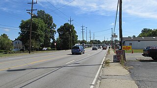
Batavia is a village in and the county seat of Clermont County, Ohio, United States. The population was 1,972 at the 2020 census. It is part of the Cincinnati metropolitan area.

<span class="mw-page-title-main">Bethel, Ohio</span> Village in Ohio, United States

Bethel is a village in Tate Township, Clermont County, Ohio, United States. The population was 2,620 at the 2020 census. Bethel was founded in 1798 by Obed Denham as Denham Town, in what was then the Northwest Territory. Bethel is the home of the first movie theater in Ohio which was founded in 1908 by Aaron Little.

<span class="mw-page-title-main">Felicity, Ohio</span> Village in Ohio, United States

Felicity is a village in Franklin Township, Clermont County, Ohio, United States. The population was 651 at the [[2020 United States Census|2020 census.

<span class="mw-page-title-main">Mulberry, Ohio</span> Census-designated place in Ohio, United States

Mulberry is a census-designated place (CDP) in Miami Township, Clermont County, Ohio, United States. The population was 3,459 at the 2020 census.

<span class="mw-page-title-main">Summerside, Ohio</span> Census-designated place in Ohio, United States

Summerside is a census-designated place (CDP) in Union Township, Clermont County, Ohio, United States. Its population was 4,941 as of the 2020 census.

<span class="mw-page-title-main">Withamsville, Ohio</span> Census-designated place in Ohio, United States

Withamsville is a census-designated place (CDP) in Pierce and Union townships of Clermont County, Ohio, United States. The population was 7,357 at the 2020 census.

<span class="mw-page-title-main">Gainesville, New York</span> Town in New York, United States

Gainesville is an incorporated town in Wyoming County, New York. The population was 2,333 at the 2000 census. The town is named after General Edmund P. Gaines.

References

  1. "2020 U.S. Gazetteer Files". United States Census Bureau. Retrieved December 18, 2021.
  2. 1 2 U.S. Geological Survey Geographic Names Information System: Clermont, Georgia
  3. 1 2 "U.S. Census website". United States Census Bureau . Retrieved January 31, 2008.
  4. 1 2 "Geographic Identifiers: 2010 Demographic Profile Data (G001): Clermont town, Georgia". American Factfinder. U.S. Census Bureau. Retrieved May 17, 2017.[ dead link ]
  5. Krakow, Kenneth K. (1975). Georgia Place-Names: Their History and Origins (PDF). Macon, GA: Winship Press. p. 45. ISBN   0-915430-00-2.
  6. "Post Offices". Jim Forte Postal History. Retrieved April 8, 2018.
  7. Acts Passed by the General Assembly of Georgia. J. Johnston. 1913. p. 674.
  8. "Census of Population and Housing". Census.gov. Retrieved June 4, 2015.