Lula, Georgia

Last updated

Lula, Georgia
LULA RESIDENTIAL HISTORIC DIST., HALL CTY.jpg
Hall County Georgia Incorporated and Unincorporated areas Lula Highlighted.svg
Location in Hall County and the state of Georgia
Coordinates: 34°22′15″N83°40′57″W / 34.37083°N 83.68250°W / 34.37083; -83.68250
Country United States
State Georgia
Counties Hall, Banks
Area
[1]
  Total4.33 sq mi (11.21 km2)
  Land4.32 sq mi (11.18 km2)
  Water0.01 sq mi (0.03 km2)
Elevation
[2]
1,326 ft (404 m)
Population
 (2020)
  Total2,822
  Density653.85/sq mi (252.48/km2)
Time zone UTC-5 (Eastern (EST))
  Summer (DST) UTC-4 (EDT)
ZIP code
30554
Area code 770
FIPS code 13-47896 [3]
GNIS feature ID2404971 [2]
Website www.cityoflula.com

Lula is a city in Hall and Banks counties in the U.S. state of Georgia. Most of the city is in Hall County, with a small eastern portion of the city located in Banks County. The population was 2,822 at the 2020 census. [4] The Hall County portion of Lula is part of the Gainesville, GA Metropolitan Statistical Area. Lula is the home of RailRoad Days, a yearly festival held usually every May. Lula is the railroad junction between the Atlanta northeast line and the Athens north line of Norfolk Southern Railway.

Contents

Major roads near Lula are Georgia Highway 51, Georgia Highway 52, Georgia Highway 365, U.S. Route 23, and old US 23.

History

Downtown Lula Lulageorgia.jpg
Downtown Lula

The rail spur from Athens to Lula was completed in 1874 for the North Eastern Railroad. Civil engineers Joel Hurt and his brother Fletcher named the town in honor of Miss Lula Phinizy, later Mrs. Abner W. Calhoun, whom they both admired. [5]

The Georgia General Assembly incorporated Lula as a town in 1905. [6]

Geography

According to the United States Census Bureau, the city has a total area of 4.3 square miles (11.2 km2), of which 0.012 square miles (0.03 km2), or 0.26%, is water. [4]

Demographics

Historical population
CensusPop.Note
1900 217
1910 30942.4%
1920 36718.8%
1930 315−14.2%
1940 3160.3%
1950 37819.6%
1960 55747.4%
1970 73632.1%
1980 85716.4%
1990 1,01818.8%
2000 1,43841.3%
2010 2,75891.8%
2020 2,8222.3%
U.S. Decennial Census [7]

2020 census

Lula racial composition [8]
RaceNum.Perc.
White (non-Hispanic)2,08473.85%
Black or African American (non-Hispanic)2067.3%
Native American 30.11%
Asian 381.35%
Other/Mixed 1394.93%
Hispanic or Latino 35212.47%

As of the 2020 United States census, there were 2,822 people, 1,012 households, and 724 families residing in the city.

2000 census

As of the census [3] of 2000, there were 1,438 people, 531 households, and 399 families residing in the city. The population density was 520.1 inhabitants per square mile (200.8/km2). There were 585 housing units at an average density of 211.6 per square mile (81.7/km2). The racial makeup of the city was 89.71% White, 8.14% African American, 0.42% Asian, 0.07% Pacific Islander, 1.25% from other races, and 0.42% from two or more races. Hispanic or Latino of any race were 2.23% of the population.

There were 531 households, out of which 39.5% had children under the age of 18 living with them, 59.5% were married couples living together, 12.4% had a female householder with no husband present, and 24.7% were non-families. 20.5% of all households were made up of individuals, and 10.2% had someone living alone who was 65 years of age or older. The average household size was 2.71 and the average family size was 3.13.

In the city, the population was spread out, with 28.0% under the age of 18, 8.9% from 18 to 24, 31.6% from 25 to 44, 21.1% from 45 to 64, and 10.4% who were 65 years of age or older. The median age was 34 years. For every 100 females, there were 92.5 males. For every 100 females age 18 and over, there were 89.2 males.

The median income for a household in the city was $36,741, and the median income for a family was $43,667. Males had a median income of $30,195 versus $23,750 for females. The per capita income for the city was $15,246. About 7.5% of families and 11.5% of the population were below the poverty line, including 14.0% of those under age 18 and 17.9% of those age 65 or over.

Education

The portion in Hall County is in the Hall County School District. [9] Lula Elementary School is in the Hall district. [10] Residents are zoned to East Hall Middle School and East Hall High School. [11]

The portion in Banks County is in the Banks County School District. [12] Students there are zoned to Banks County High School.

Related Research Articles

<span class="mw-page-title-main">Walker County, Georgia</span> County in Georgia, United States

Walker County is a county located in the northwestern part of the U.S. state of Georgia. As of the 2020 census, the population was 67,654, down from 68,756 in 2010. The county seat is LaFayette. The county was created on December 18, 1833, from land formerly belonging to the Cherokee Indian Nation.

<span class="mw-page-title-main">Thomas County, Georgia</span> County in Georgia, United States

Thomas County is a county located in the U.S. state of Georgia. As of the 2020 census the population was 45,798. The county seat is Thomasville.

<span class="mw-page-title-main">Pike County, Georgia</span> County in Georgia, United States

Pike County is a county located in the west central portion of the U.S. state of Georgia. As of the 2020 census, the population was 18,889. The county seat is Zebulon.

<span class="mw-page-title-main">Newton County, Georgia</span> County in Georgia, United States

Newton County is a county located in the north central portion of the U.S. state of Georgia. As of the 2020 census, the population was 112,483. The county seat is Covington.

<span class="mw-page-title-main">Lanier County, Georgia</span> County in Georgia, United States

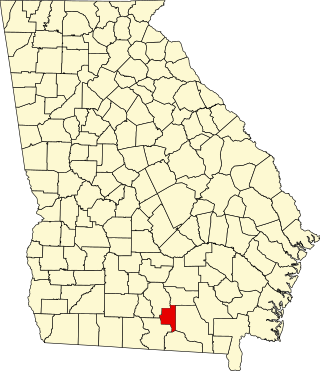
Lanier County is a county in the south central portion of the U.S. state of Georgia. As of the 2020 census, the population was 9,877. The county seat and only incorporated municipality is Lakeland. The county is named after the Georgia poet Sidney Lanier.

<span class="mw-page-title-main">Jackson County, Georgia</span> County in Georgia, United States

Jackson County is a county located in the northeastern part of the U.S. state of Georgia. As of the 2020 census, the population was 75,907. The county seat is Jefferson.

<span class="mw-page-title-main">Hall County, Georgia</span> County in Georgia, United States

Hall County is a county located in the northeast portion of the U.S. state of Georgia. As of the 2020 census, the population was 203,136, up from 179,684 at the 2010 census. The county seat is Gainesville. The entirety of Hall County comprises the Gainesville, Georgia, Metropolitan Statistical Area, which is also part of the Atlanta-Athens-Clarke County-Sandy Springs, Combined Statistical Area.

<span class="mw-page-title-main">Franklin County, Georgia</span> County in Georgia, United States

Franklin County is a county located in the northeastern part of the U.S. state of Georgia. As of the 2020 census, the population was 23,424. The county seat is Carnesville. On February 25, 1784, Franklin and Washington became Georgia's eighth and ninth counties, with Franklin named in honor of patriot Benjamin Franklin.

<span class="mw-page-title-main">Colquitt County, Georgia</span> County in Georgia, United States

Colquitt County is a county in the U.S. state of Georgia. As of the 2020 census, the population was 45,898. The county seat is Moultrie. The county was created on February 25, 1856, and is named for Walter Terry Colquitt, a U.S. senator. Colquitt County comprises the Moultrie, GA Micropolitan Statistical Area.

<span class="mw-page-title-main">Barrow County, Georgia</span> County in Georgia, United States

Barrow County is a county located in the north central portion of the U.S. state of Georgia. As of the 2020 Census, the population was 83,505. The county seat is Winder.

<span class="mw-page-title-main">Banks County, Georgia</span> County in Georgia, United States

Banks County is a county located in the northeastern part of the U.S. state of Georgia. As of the 2020 census, the population was 18,035, down from 18,395 in 2010. The county seat is Homer. The Old Banks County Courthouse is located in Homer and listed on the National Register of Historic Places. A new county courthouse was constructed adjacent to the old one in 1983.

<span class="mw-page-title-main">Alto, Georgia</span> Town in Georgia, United States

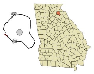
Alto is a town in Banks and Habersham counties in the U.S. state of Georgia. As of the 2010 census, the town had a population of 1,172, up from 876 at the 2000 census.

<span class="mw-page-title-main">Baldwin, Georgia</span> City in Georgia, United States

Baldwin is a city in Banks and Habersham counties in the U.S. state of Georgia. As of the 2010 census, the city had a population of 3,279, up from 2,425 at the 2000 census.

<span class="mw-page-title-main">Gillsville, Georgia</span> City in Georgia, United States

Gillsville is a city in Banks and Hall counties in the U.S. state of Georgia. The population was 235 at the 2010 census.

<span class="mw-page-title-main">Maysville, Georgia</span> Town in Georgia, United States

Maysville is a town in Banks and Jackson counties in the U.S. state of Georgia. The population was 1,798 at the 2010 census, up from 1,247 at the 2000 census.

<span class="mw-page-title-main">Braselton, Georgia</span> Town in Georgia, United States

Braselton is a town in Barrow, Gwinnett, Hall, and Jackson counties in the U.S. state of Georgia, approximately 43 miles (69 km) northeast of Atlanta. As of the 2010 census, the town had a population of 7,511, and in 2018 the estimated population was 11,652.

<span class="mw-page-title-main">Bogart, Georgia</span> Town in Georgia, United States

Bogart is a town in Clarke and Oconee counties in the U.S. state of Georgia. The town is mostly in Oconee County, with a portion extending into Clarke County. As of the 2020 census, the city had a population of 1,326. The 30622 ZIP code extends outside the boundary of Bogart into the western portion of Athens, giving some of Athens' citizens Bogart mailing addresses. For the Oconee County area of Bogart, the high school is North Oconee High School and the middle school is Malcom Bridge Middle School; for the Clarke County area of Bogart, the high school is Clarke Central High School and the middle school is Burney-Harris-Lyons Middle School.

<span class="mw-page-title-main">Redan, Georgia</span> CDP in Georgia, United States

Redan is a census-designated place (CDP) in DeKalb County, Georgia, United States. As of the 2020 census, the CDP had a total population of 31,749. It is a predominantly African American community in eastern DeKalb County, and is a suburb of Atlanta.

<span class="mw-page-title-main">Pine Mountain, Harris County, Georgia</span> Town in Georgia, United States

Pine Mountain is a town in Harris and Meriwether counties in the U.S. state of Georgia. As of the 2020 census it had a population of 1,216.

<span class="mw-page-title-main">Georgetown, Quitman County, Georgia</span> City in Georgia, United States

Georgetown is a city in Quitman County, Georgia, United States. It is on the Alabama-Georgia state line next to Walter F. George Lake and across the Chattahoochee River from Eufaula, Alabama. Per the 2020 census, the population was 2,235. In 2006, Georgetown and Quitman County voted to consolidate their governments, becoming the smallest such consolidated entity in the Lower 48 states.

References

  1. "2020 U.S. Gazetteer Files". United States Census Bureau. Retrieved December 18, 2021.
  2. 1 2 U.S. Geological Survey Geographic Names Information System: Lula, Georgia
  3. 1 2 "U.S. Census website". United States Census Bureau . Retrieved January 31, 2008.
  4. 1 2 "Geographic Identifiers: 2010 Demographic Profile Data (G001): Lula city, Georgia". U.S. Census Bureau, American Factfinder. Archived from the original on February 12, 2020. Retrieved October 29, 2013.
  5. Edge, Sarah Simms, Joel Hurt and the Development of Atlanta, 1955, p.41
  6. Krakow, Kenneth K. (1975). Georgia Place-Names: Their History and Origins (PDF). Macon, GA: Winship Press. p. 138. ISBN   0-915430-00-2.
  7. "Census of Population and Housing". Census.gov. Retrieved June 4, 2015.
  8. "Explore Census Data". data.census.gov. Retrieved December 13, 2021.
  9. "2020 CENSUS - SCHOOL DISTRICT REFERENCE MAP: Hall County, GA" (PDF). U.S. Census Bureau. p. 9 (PDF p. 10/25). Retrieved May 7, 2023. - Text list
  10. "Home". Lula Elementary School. Retrieved May 8, 2023.
  11. "Hall County Schools Attendance Zones Introduction". Hall County Schools . Retrieved May 8, 2023 via YouTube. - See school zone viewer - Linked from this page
  12. "2020 CENSUS - SCHOOL DISTRICT REFERENCE MAP: Banks County, GA" (PDF). U.S. Census Bureau . Retrieved May 7, 2023. - Text list