
Ghana is a West African country in Africa, along the Gulf of Guinea, just a few degrees north of the equator.

The Brisbane Water National Park is a protected national park that is located in the Central Coast region of New South Wales, in eastern Australia. The 11,506-hectare (28,430-acre) national park is situated 47 kilometres (29 mi) north of Sydney, 10 kilometres (6.2 mi) west of Woy Woy, and 12 kilometres (7.5 mi) southwest of Gosford.

Heathcote National Park is a protected national park that is located in the southern region of Sydney, New South Wales in eastern Australia, and is situated on Dharawal country. The 2,679-hectare (6,620-acre) national park is situated approximately 35 kilometres (22 mi) southwest of the Sydney central business district, west of the South Coast railway line, the Princes Highway and Motorway, and the suburbs of Heathcote and Waterfall.

The Sydney Basin is an interim Australian bioregion and is both a structural entity and a depositional area, now preserved on the east coast of New South Wales, Australia and with some of its eastern side now subsided beneath the Tasman Sea. The basin is named for the city of Sydney, on which it is centred.

The Illawarra escarpment, or officially the Illawarra Range, is the fold-created cliffs and plateau-eroded outcrop mountain range west of the Illawarra coastal plain south of Sydney, in the state of New South Wales, Australia. The range encloses the Illawarra region which stretches from Stanwell Park in the north to Kiama, Gerringong and the Shoalhaven River in the south.

The geography of Sydney is characterised by its coastal location on a basin bordered by the Pacific Ocean to the east, the Blue Mountains to the west, the Hawkesbury River to the north and the Woronora Plateau to the south. Sydney lies on a submergent coastline on the east coast of New South Wales, where the ocean level has risen to flood deep river valleys (rias) carved in the Sydney sandstone. Port Jackson, better known as Sydney Harbour, is one such ria.

The Cumberland Plain, an IBRA biogeographic region, is a relatively flat region lying to the west of Sydney CBD in New South Wales, Australia. Cumberland Basin is the preferred physiographic and geological term for the low-lying plain of the Permian-Triassic Sydney Basin found between Sydney and the Blue Mountains, and it is a structural sub-basin of the Sydney Basin.

Western Australia occupies nearly one third of the Australian continent. Due to the size and the isolation of the state, considerable emphasis has been made of these features; it is the second largest administrative territory in the world, after Yakutia in Russia, despite the fact that Australia is only the sixth largest country in the world by area, and no other regional administrative jurisdiction in the world occupies such a high percentage of a continental land mass. It is also the only first level administrative subdivision to occupy the entire continental coastline in one cardinal direction.

The Southern Sydney sheltered forest is a vegetation community found in Sydney, Australia. An open forest composition grading into woodland or scrub, the community is normally associated with sheltered heads and upper inclines of gullies on transitional zones where sandstone outcropping may be present.

The South Eastern Highlands is an interim Australian bioregion in eastern Australia, that spans parts of the states and territories of New South Wales, the Australian Capital Territory, and Victoria. The bioregion comprises 8,375,961 hectares and is approximately 3,860 kilometres (2,400 mi) long. The Australian Alps as well as the South West Slopes bound the region from the south and west; and to the northeast, the Sydney Basin bioregion, as well as the bioregion of the South East Corner, to the east.

The Dharawal National Park is a protected national park that is located in the Illawarra region of New South Wales, in eastern Australia. The 6,508-hectare (16,080-acre) national park is situated between the Illawarra Range and the Georges River and is approximately 45 kilometres (28 mi) south west of Sydney. There are three entry points to the park: from the east through Darkes Forest; from the north through Wedderburn; and from the south through Appin.
The Cambewarra Range Nature Reserve, as part of the Kangaroo Valley Group of Nature Reserves, is a protected area located on the cliffs and plateaus of the Kangaroo Valley in the Southern Highlands and South Coast regions of New South Wales in eastern Australia. The Reserve is situated approximately 150 kilometres (93 mi) south of Sydney, 50 kilometres (31 mi) southwest of Wollongong and 16 kilometres (9.9 mi) northwest of Nowra. The Reserve has a total area of 1684 hectares, and includes 11 privately owned properties. It is critical for it to be pristine for a variety of reasons, not the least the catchment of water, as the Reserve floor flows into the Kangaroo Valley River and the Shoalhaven River, from which the Sydney Water Authority draws water to supply large populations in Sydney and Wollongong.

The swamp communities of the Blue Mountains are a geographically dispersed group of ecologically-endangered peat swamp communities, spanning multiple parts of the World Heritage-listed Blue Mountains National Park in New South Wales, Australia.

Bewick and Beanley Moors is the name given to a Site of Special Scientific Interest (SSSI) in north Northumberland, in the north-east of England. The moors are asserted to be of national importance by Natural England for the extent, quality and diversity of upland types including heaths, fens, wet grassland, flushes, mires and blanket bogs, together creating an extensive mosaic habitat supporting an exceptional community of amphibians. The moors are important, too, for their relict juniper woodland and scrub.

The Caquetá moist forests (NT0107) is an ecoregion of tropical moist broad leaf forest to the east of the Andes in the east of Colombia, with a small section in Brazil, in the Amazon biome. The forests are in the transition between the Guiana and Amazon regions, and have highly diverse flora and fauna. They are relatively intact, although they are mostly unprotected and are threatened with deforestation to create cattle pastures.

The Sydney Sandstone Ridgetop Woodland, also known as Coastal Sandstone Ridgetop Woodland, is a shrubby woodland and mallee community situated in northern parts of Sydney, Australia, where it is found predominantly on ridgetops and slopes of the Hornsby Plateau, Woronora Plateau and the lower Blue Mountains area. It is an area of high biodiversity, existing on poor sandstone soils, with regular wildfires, and moderate rainfall.

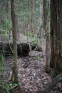
The ecology of Sydney, located in the state of New South Wales, Australia, is diverse for its size, where it would mainly feature biomes such as grassy woodlands and some sclerophyll forests, with a few pockets of mallee shrublands, subtropical and temperate rainforests (evergreen), heathlands, and wetlands. The combination of climate, topography, moisture, and soil influence the dispersion of these ecological communities across a height gradient from 0 to 200 metres. There are many hiking trails, paved and unpaved roads for exploring the many different biomes and ecosystems.

The Illawarra-Shoalhaven subtropical rainforest, or Illawarra Subtropical Rainforest (ISR), is a scattered rainforest community in the Illawarra region of New South Wales, Australia. Occurring just south of Sydney, it spans from the Royal National Park to the Milton-Ulladulla district in the south, albeit in scattered fragments.
