Cofield, North Carolina

Last updated

Cofield, North Carolina
NCMap-doton-Cofield.PNG
Location of Cofield, North Carolina
Coordinates: 36°21′24″N76°54′38″W / 36.35667°N 76.91056°W / 36.35667; -76.91056
Country United States
State North Carolina
County Hertford
Area
[1]
  Total3.14 sq mi (8.13 km2)
  Land3.14 sq mi (8.13 km2)
  Water0.00 sq mi (0.00 km2)
Elevation
[2]
43 ft (13 m)
Population
 (2020)
  Total267
  Density85.00/sq mi (32.82/km2)
Time zone UTC-5 (Eastern (EST))
  Summer (DST) UTC-4 (EDT)
ZIP code
27922
Area code 252
FIPS code 37-13460 [3]
GNIS feature ID2407435 [2]

Cofield is a village in Hertford County, North Carolina, United States. The population was 413 at the 2010 census.

Contents

History

Deane House was listed on the National Register of Historic Places in 1982. [4]

Geography

According to the United States Census Bureau, the village has a total area of 3.1 square miles (8.0 km2), all land.

Demographics

Historical population
CensusPop.Note
1970 318
1980 46546.2%
1990 407−12.5%
2000 347−14.7%
2010 41319.0%
2020 267−35.4%
U.S. Decennial Census [5]

As of the census [3] of 2000, there were 347 people, 145 households, and 90 families residing in the village. The population density was 111.1 inhabitants per square mile (42.9/km2). There were 168 housing units at an average density of 53.8 per square mile (20.8/km2). The racial makeup of the village was 13.54% White, 80.69% African American, 3.46% Native American, 1.73% from other races, and 0.58% from two or more races. Hispanic or Latino of any race were 3.46% of the population.

There were 145 households, out of which 29.7% had children under the age of 18 living with them, 37.9% were married couples living together, 19.3% had a female householder with no husband present, and 37.9% were non-families. 31.7% of all households were made up of individuals, and 14.5% had someone living alone who was 65 years of age or older. The average household size was 2.39 and the average family size was 2.99.

In the village, the population was spread out, with 23.6% under the age of 18, 7.5% from 18 to 24, 28.2% from 25 to 44, 25.6% from 45 to 64, and 15.0% who were 65 years of age or older. The median age was 40 years. For every 100 females, there were 79.8 males. For every 100 females age 18 and over, there were 81.5 males.

The median income for a household in the village was $18,214, and the median income for a family was $27,969. Males had a median income of $28,250 versus $17,125 for females. The per capita income for the village was $11,810. About 23.8% of families and 26.5% of the population were below the poverty line, including 32.7% of those under age 18 and 33.9% of those age 65 or over.

Related Research Articles

<span class="mw-page-title-main">Ellis Grove, Illinois</span> Village in Illinois, United States

Ellis Grove is a village in Randolph County, Illinois, United States. The population was 328 at the 2020 census.

<span class="mw-page-title-main">Anselmo, Nebraska</span> Village in Custer County, Nebraska, United States

Anselmo is a village in Custer County, Nebraska, United States. The population was 145 at the 2010 census.

<span class="mw-page-title-main">North Kingsville, Ohio</span> Village in Ohio, United States

North Kingsville is a village in Ashtabula County, Ohio, United States. The population was 2,742 at the 2020 census.

<span class="mw-page-title-main">Trimble, Ohio</span> Village in Ohio, United States

Trimble is a village in Trimble Township, Athens County, Ohio, United States. The population was 329 at the 2020 census.

<span class="mw-page-title-main">Yorkshire, Ohio</span> Village in Ohio, United States

Yorkshire is a village in Darke County, Ohio, United States. The population was 95 at the 2020 census.

<span class="mw-page-title-main">Thurston, Ohio</span> Village in Ohio, United States

Thurston is a village in Fairfield County, Ohio, United States. The population was 603 at the 2020 census.

<span class="mw-page-title-main">Lyons, Ohio</span> Village in Ohio, United States

Lyons is a village in Fulton County, Ohio, United States. The population was 602 at the 2020 census.

<span class="mw-page-title-main">Cumberland, Ohio</span> Village in Guernsey County, Ohio, United States

Cumberland is a village in Guernsey County, Ohio, United States. It is seventy miles east of Columbus. The population was 317 at the 2020 census.

<span class="mw-page-title-main">Stratton, Ohio</span> Village in Ohio, United States

Stratton is a village in northern Jefferson County, Ohio, United States, along the Ohio River. The population was 267 at the 2020 census. It is part of the Weirton–Steubenville metropolitan area.

<span class="mw-page-title-main">Kirkersville, Ohio</span> Village in Ohio, United States

Kirkersville is a village in Licking County, Ohio, United States, along the South Fork of the Licking River. The population was 471 at the 2020 census.

<span class="mw-page-title-main">Miltonsburg, Ohio</span> Village in Ohio, United States

Miltonsburg is a village in Monroe County, Ohio, United States. The population was 42 at the 2020 census. Miltonsburg was named after Milton Pierson, son of Ohio pioneer David Pierson. David Pierson named Clarington, Ohio after his daughter Clarinda.

<span class="mw-page-title-main">Dexter City, Ohio</span> Village in Ohio, United States

Dexter City is a village in Noble County, Ohio, United States, along the West Fork of Duck Creek. The population was 81 at the 2020 census. Dexter City was laid out in 1870, and named after Dexter W. Sullivan, an early settler.

<span class="mw-page-title-main">Wilmot, Ohio</span> Village in Ohio, United States

Wilmot is a village in southwestern Stark County, Ohio, United States. The population was 282 at the 2020 census. It is part of the Canton–Massillon metropolitan area.

<span class="mw-page-title-main">Clinton, Ohio</span> Village in Ohio, United States

Clinton is a village in southwestern Summit County, Ohio, United States. The population was 1,197 at the 2020 Census. It is part of the Akron metropolitan area.

<span class="mw-page-title-main">Roswell, Ohio</span> Village in Ohio, United States

Roswell is a village in Tuscarawas County, Ohio, United States. The population was 219 at the 2020 census.

<span class="mw-page-title-main">Wharton, Ohio</span> Village in Ohio, United States

Wharton is a village in Wyandot County, Ohio, United States. The population was 328 at the 2020 census.

<span class="mw-page-title-main">Weyerhaeuser, Wisconsin</span> Village in Wisconsin, United States

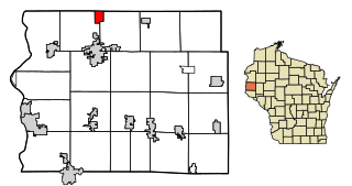
Weyerhaeuser is a village in Rusk County, Wisconsin, United States. The population was 238 at the 2010 census.

<span class="mw-page-title-main">Cazenovia, Wisconsin</span> Village in Wisconsin, United States

Cazenovia is a village in Richland and Sauk Counties in the U.S. state of Wisconsin. The population was 318 at the 2010 census. Of this, 314 were in Richland County, and only 4 were in Sauk County.

<span class="mw-page-title-main">Unity, Wisconsin</span> Village in Wisconsin, United States

Unity is a village in Clark and Marathon counties in the U.S. state of Wisconsin. It is part of the Wausau, Wisconsin Metropolitan Statistical Area. The population was 343 at the 2010 census. Of this, 204 were in Marathon County, and 139 were in Clark County. The village is located in northeastern town of Unity in Clark County and northwestern town of Brighton in Marathon County.

<span class="mw-page-title-main">Star Prairie, Wisconsin</span> Village in Wisconsin, United States

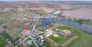
Star Prairie is a village in St. Croix County in the U.S. state of Wisconsin. The population was 561 at the 2010 census. The village is located along the Apple River on the boundary between the Town of Star Prairie and the Town of Stanton.

References

  1. "ArcGIS REST Services Directory". United States Census Bureau. Retrieved September 20, 2022.
  2. 1 2 U.S. Geological Survey Geographic Names Information System: Cofield, North Carolina
  3. 1 2 "U.S. Census website". United States Census Bureau . Retrieved January 31, 2008.
  4. "National Register Information System". National Register of Historic Places . National Park Service. July 9, 2010.
  5. "Census of Population and Housing". Census.gov. Retrieved June 4, 2015.