Collins, Ohio

Last updated

Collins, Ohio
Collins United Methodist Church.jpg
OHMap-doton-Collins.png
Location in Ohio
Coordinates: 41°14′50″N82°30′00″W / 41.24722°N 82.50000°W / 41.24722; -82.50000
Country United States
State Ohio
County Huron
Township Townsend Township
Area
[1]
  Total4.62 sq mi (11.97 km2)
  Land4.62 sq mi (11.96 km2)
  Water0.01 sq mi (0.01 km2)
Elevation
[2]
892 ft (272 m)
Population
 (2020)
  Total628
  Density135.99/sq mi (52.51/km2)
Time zone UTC-5 (Eastern (EST))
  Summer (DST) UTC-4 (EDT)
ZIP code
44826
Area code 419
FIPS code 39-16784 [3]
GNIS feature ID2628876 [2]

Collins is a census-designated place (CDP) in central Townsend Township, Huron County, Ohio, United States. [4] As of the 2020 census the population of the CDP was 628. The CDP includes the unincorporated communities of Collins and East Townsend. Collins has a post office, with the ZIP code of 44826.

Contents

History

Some say the community was named after a railroad official named Collins, while others believe the place is named after Collinsville, Connecticut. [5] Alternatively, some say Collins was named after Thomas Collins [ citation needed ] of Valdosta, Georgia who settled in the area after the American Civil War.

Geography

Collins is in central Townsend Township in northeastern Huron County. The hamlet of Collins is in the northern part of the CDP on Hartland Center Road, 0.7 miles (1.1 km) north of U.S. Route 20, while the hamlet of East Townsend is at the geographic center of the CDP, at the junction of Hartland Center Road and US 20. Route 20 leads east 5 miles (8 km) to Wakeman and west 6 miles (10 km) to Norwalk, the Huron county seat.

According to the U.S. Census Bureau, the Collins CDP has an area of 4.6 square miles (12.0 km2), of which 0.004 square miles (0.01 km2), or 0.11%, are water. [3]

Demographics

Historical population
CensusPop.Note
2020 628
U.S. Decennial Census [6]

Related Research Articles

<span class="mw-page-title-main">Hartland Township, Michigan</span> Civil township in Michigan, United States

Hartland Township is a civil township of Livingston County in the U.S. state of Michigan. The population was 14,663 at the 2010 census, up from 10,996 at the 2000 census.

<span class="mw-page-title-main">Northridge, Clark County, Ohio</span> Census-designated place in Ohio, United States

Northridge is a census-designated place (CDP) in Clark County, Ohio, United States. The population was 7,518 at the 2020 census. It is part of the Springfield, Ohio Metropolitan Statistical Area.

<span class="mw-page-title-main">Mulberry, Ohio</span> Census-designated place in Ohio, United States

Mulberry is a census-designated place (CDP) in Miami Township, Clermont County, Ohio, United States. The population was 3,459 at the 2020 census.

<span class="mw-page-title-main">Calcutta, Ohio</span> Census-designated place in Ohio, United States

Calcutta is an unincorporated community and census-designated place in southeastern Columbiana County, Ohio, United States. The population was 3,941 at the 2020 census. Historically a rural town, Calcutta grew as businesses from neighboring East Liverpool moved into larger shopping centers clustered around Ohio State Route 170.

<span class="mw-page-title-main">Chesterland, Ohio</span> Census-designated place in Ohio, United States

Chesterland is a census-designated place (CDP) in Geauga County, Ohio, United States. As of the 2020 census, the CDP had a population of 7,074.

<span class="mw-page-title-main">Beechwood Trails, Ohio</span> Census-designated place in Ohio, United States

Beechwood Trails is a census-designated place (CDP) in Harrison Township, Licking County, Ohio, United States. The population was 3,276 at the 2020 census.

<span class="mw-page-title-main">Granville South, Ohio</span> Census-designated place in Ohio, United States

Granville South is a census-designated place (CDP) in Licking County, Ohio, United States. The population was 1,420 at the 2020 census.

<span class="mw-page-title-main">Harbor Hills, Ohio</span> Census-designated place in Ohio, United States

Harbor Hills is a census-designated place (CDP) in southern Licking County, Ohio, United States. The population was 1,565 at the 2020 census.

<span class="mw-page-title-main">Eaton Estates, Ohio</span> Census-designated place in Ohio, United States

Eaton Estates is an unincorporated community and census-designated place (CDP) in Lorain County, Ohio, United States. The population was 1,155 at the 2020 census.

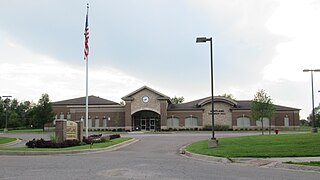
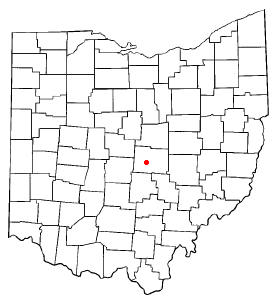
Bainbridge is a census-designated place (CDP) in Bainbridge Township, Geauga County, Ohio, United States. As of the 2020 census, the CDP had a population of 9,242.

<span class="mw-page-title-main">Townsend Township, Huron County, Ohio</span> Township in Ohio, United States

Townsend Township is one of the nineteen townships of Huron County, Ohio, United States. As of the 2020 census the population of the township was 1,571.

<span class="mw-page-title-main">Brownsville, Ohio</span> Census-designated place in Ohio, United States

Brownsville is an unincorporated community and census-designated place (CDP) in northeastern Bowling Green Township, Licking County, Ohio, United States. As of the 2020 census, it had a population of 214. It lies at the intersection of U.S. Route 40 with State Route 668.

<span class="mw-page-title-main">New Haven, Huron County, Ohio</span> Census-designated place in Ohio, United States

New Haven is an unincorporated community and census-designated place (CDP) in central New Haven Township, Huron County, Ohio, United States. As of the 2020 census the population was 356. It has a post office with the ZIP code 44850. It lies at the intersection of U.S. Route 224 with State Routes 61 and 598.

<span class="mw-page-title-main">Celeryville, Ohio</span> Census-designated place in Ohio, United States

Celeryville is an unincorporated community and census-designated place (CDP) on the boundary between New Haven and Richmond townships in Huron County, Ohio, United States. Celeryville is located approximately 1 mile (1.6 km) south of Willard, and the community relies on Willard's social services. As of the 2020 census the population of the community was 222.

<span class="mw-page-title-main">Etna, Licking County, Ohio</span> Census-designated place in Ohio, United States

Etna is an unincorporated community and census-designated place (CDP) in Licking County, Ohio, United States. As of the 2020 census it had a population of 1,209. It lies at an elevation of 1,069 feet (326 m) at the intersection of U.S. Route 40 and State Route 310. It was listed as a census-designated place in 2010.

<span class="mw-page-title-main">Chippewa Park, Ohio</span> Census-designated place in Ohio, United States

Chippewa Park is a census-designated place in Stokes Township, Logan County, Ohio, United States. As of the 2020 census, the population was 819.

Kanauga is an unincorporated community and census-designated place (CDP) in Gallia County, Ohio, United States. As of the 2020 census it had a population of 185.

<span class="mw-page-title-main">Pottery Addition, Ohio</span> Census-designated place in Ohio, United States

Pottery Addition is a census-designated place (CDP) in Jefferson County, Ohio, United States. Its population was 258 as of the 2020 census. The community is located along the Ohio River and is served by Ohio State Route 7.

Conesus Lake is a hamlet and census-designated place (CDP) in Livingston County, New York, United States. Its population was 2,584 as of the 2010 census. The community is located in the towns of Geneseo, Livonia, Groveland, and Conesus and covers Conesus Lake, the westernmost of New York's Finger Lakes, and nearly all of the lake's shoreline communities.

Suffield is an unincorporated community and census-designated place (CDP) in Suffield Township, Portage County, Ohio, United States. The population was 949 at the 2020 census. It was first listed as a CDP prior to the 2020 census.

References

  1. "ArcGIS REST Services Directory". United States Census Bureau. Retrieved September 20, 2022.
  2. 1 2 U.S. Geological Survey Geographic Names Information System: Collins, Ohio
  3. 1 2 "Geographic Identifiers: 2010 Census Summary File 1 (G001): Collins CDP, Ohio". American Factfinder. U.S. Census Bureau. Archived from the original on February 13, 2020. Retrieved January 12, 2018.
  4. U.S. Geological Survey Geographic Names Information System: Collins, Ohio
  5. Overman, William Daniel (1958). Ohio Town Names. Akron, OH: Atlantic Press. p. 31.
  6. "Census of Population and Housing". Census.gov. Retrieved June 4, 2016.