
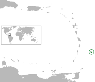
Barbados is an island country in the Lesser Antilles of the West Indies, in the Caribbean region of the Americas, and the most easterly of the Caribbean Islands. It is 34 kilometres in length and up to 23 km (14 mi) in width, covering an area of 432 km2 (167 sq mi). It is in the western part of the North Atlantic, 100 km (62 mi) east of the Windward Islands and the Caribbean Sea. Barbados is east of the Windwards, part of the Lesser Antilles, at roughly 13°N of the equator. It is about 168 km (104 mi) east of both the countries of Saint Lucia and Saint Vincent and the Grenadines and 180 km (110 mi) south-east of Martinique and 400 km (250 mi) north-east of Trinidad and Tobago. Barbados is outside the principal Atlantic hurricane belt. Its capital and largest city is Bridgetown.

Bridgetown is the capital and largest city of Barbados. Formerly The Town of Saint Michael, the Greater Bridgetown area is located within the parish of Saint Michael. Bridgetown is sometimes locally referred to as "The City", but the most common reference is simply "Town". As of 2014, its metropolitan population stands at roughly 110,000.

Barbados is an up-and-coming tourist country that provides reliable and safe transportation for natives and visitors alike. The country is very small with a length of 21 miles (34 km) and a width of 14 miles (23 km). Barbados has 1,600 kilometres (990 mi) of public paved roads, two active marine ports in, remnants of a railway system, and one airport; the Sir Grantley Adams International Airport, located in Christ Church.

The parish of St. Michael is one of eleven parishes of Barbados. It has a land area of 39 km2 (15 sq mi) and is found at the southwest portion of the island. Saint Michael has survived by name as one of the original six parishes created in 1629 by Governor Sir William Tufton.

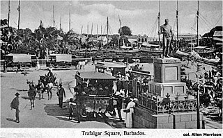
National Heroes Square, formerly Trafalgar Square, is located in Bridgetown, the capital and principal commercial centre of the island-nation of Barbados. The square lies along Upper Broad Street and is on the northern shore of the Careenage, found directly in the centre of Bridgetown.

Pelican Island was a small uninhabited island that once existed off the west coast of Bridgetown and Fontabelle, in St. Michael, Barbados.

The Parliament of Barbados is the national legislature of Barbados. It is accorded legislative supremacy by Chapter V of the Constitution of Barbados. The Parliament is bicameral in composition and is formally made up of: Elizabeth II, Queen of Barbados, an appointed Senate, and an elected House of Assembly. Both houses sit in separate chambers in the Parliament Buildings, in the national capital Bridgetown in Saint Michael.
Bridgetown may also refer to:
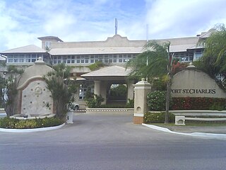
The Port St. Charles marina is a luxury marina development situated on the western coast of Barbados. Found within the parish of Saint Peter, the marina is in Heywoods and is in close proximity to Speightstown. The Port St. Charles marina contains an admeasurement of sum 1549 square metres, and is made up exclusive villas, condos and apartments, and a small inland lagoon area and adorned with facilities for residents to berth their yachts close to their vacation homes. These berths range from 30 ft to 110 ft in length. Water, electricity, telephone and television connection are available at all 50 ft to 110 ft berths and some of the smaller berths. In addition, there are six mega-yacht berths located on the offshore breakwater. The offshore breakwater was designed by Canada-based HCCL.

The Barbados Boy Scouts Association is the national Scouting organization of Barbados. The Association is managed by the National Scout Council and is a member of the World Organization of the Scout Movement. The boys only Barbados Boy Scouts Association has 3,738 members as of 2008.
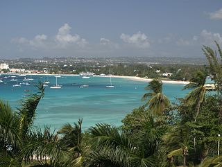
Carlisle Bay is a small natural harbour located in the southwest region of Barbados. The island nation's capital, Bridgetown, is situated on this bay which has been turned into a marine park. Carlisle Bay's marine park is a popular spot on the island for scuba diving. Many relics, like anchors and cannonballs, from ships can be found on the ocean floor in Carlisle Bay.
The following is an alphabetical list of topics related to the nation of Barbados.

The Port of Bridgetown, is a seaport in Bridgetown on the southwest coast of Barbados. Situated at the North-Western end of Carlisle Bay, the harbour handles all of the country's international bulk ship-based trade and commerce. In addition to international-shipping the Deep Water Harbour is the port of entry for southern-Caribbean cruise ships. The port is one of three designated ports of entry in Barbados, along with the privately owned Port Saint Charles marina and the Sir Grantley Adams International Airport. The port's time zone is GMT −4, and it handles roughly 700,000 cruise passengers and 900,000 tonnes of containerised cargo per year.
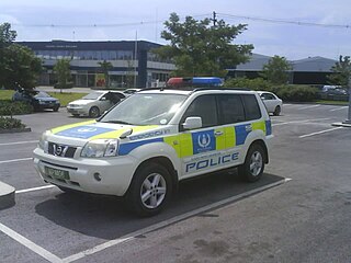
The Royal Barbados Police Force (RBPF), to be known as the Barbados Police Service from 30 November 2021, was established under the Police Act, of 1961(a), and the Constitution of Barbados is a part of the government responsible for local law enforcement. Tyrone Griffith is currently Commissioner of the Police. The RBPF is divided into five operational divisions, namely, the Northern Division, Southern Division, Bridgetown Division, Criminal Investigations Division and Operations Support Division. These are supported by the Administrative Services Division The organisational structure of the RBPF is modelled after London's Metropolitan Police Service.
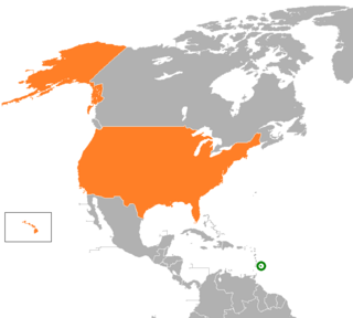
The United States and Barbados have had cordial bilateral relations since Barbados' independence in 1966. The United States has supported the government's efforts to expand the country's economic base and to provide a higher standard of living for its citizens. Barbados is a beneficiary of the U.S. Caribbean Basin Initiative. U.S. assistance is channeled primarily through multilateral agencies such as the Inter-American Development Bank and the World Bank, as well as the U.S. Agency for International Development (USAID) office in Bridgetown.
The following outline is provided as an overview of and introduction to Barbados:

The Chamberlain Bridge is a bridge in Bridgetown, the capital and largest city of the nation of Barbados. In 1872, it was a swing bridge across the marine inlet channel of the inner basin of the Careenage at Carlisle Bay. The outmoded steel structure was dismantled and rebuilt in 2005–2006 as a lifting bridge with the state-of the-art modern technology of an all-composite single-leaf bascule design. This design is a counterweighted bridge span that pivots upward, permitting pleasure craft to pass through an inlet channel. The bridge was built using fibre-reinforced plastic (FRP), which is lighter, long lasting and non-corrosive.
The Barbados Tramway Company operated a network of horse-drawn narrow gauge trams in Bridgetown, capital of Barbados, with an unknown gauge of approximately 1,067 mm.

