Cora, Washington

Last updated

Cora, Washington
USA Washington location map.svg
Red pog.svg
Cora
Usa edcp location map.svg
Red pog.svg
Cora
Coordinates: 46°32′09″N121°47′24″W / 46.53583°N 121.79000°W / 46.53583; -121.79000
Country United States
State Washington
County Lewis
Elevation
948 ft (289 [1]  m)
Time zone UTC-8 (Pacific (PST))
  Summer (DST) UTC-7 (PDT)
zip code
98377
Area code 360

Cora is an unincorporated community in Lewis County, Washington, United States. [2] [3] [4]

Contents

Cora is located off U.S. Route 12, next to the Cowlitz River between the towns of Randle and Packwood.

There is a bridge located in/near Cora named Cora Bridge. [5]

The community shares its names with the nearby Cora Falls, a waterfall near the Nisqually Entrance to Mount Rainier National Park, fed by Cora Lake. [6]

History

Cora was established in 1888 by Levi A. Davis, son of the founder of Claquato, and was either named after Cora Davis, wife of Levi A. Davis Cora Ferguson or Cora M. Ferguson Patterson, Davis's niece. [4] [7] Postal service to Cora and neighboring towns was established in 1890. [8]

A post office was established at Cora on June 11, 1890, and remained in operation until November 30, 1908. [9] [4] A February 1899 record of the Washington House of Representatives noted that the state senate had "passed Senate bill No. 95, entitled 'An act to provide for the establishment of a state road from Cora, or Sulphur Springs, Lewis county, by way of the Cowlitz pass, to a point on the Natchez river, connecting with the wagon road at or near Cowiche, in Yakima county', and had conveyed notice of the passage of this bill to the state house. [10] Sulphur Springs was the original name of what later became the neighboring town of Packwood. Later that month, the House Committee on Appropriations recommended that the project be indefinitely postponed. [11]

Timeline of some of the events that occurred in/around Cora, Lewis County, Washington

Related Research Articles

<span class="mw-page-title-main">Lewis County, Washington</span> County in Washington, United States

Lewis County is a county in the U.S. state of Washington. As of the 2020 census, the county's population was 82,149. The county seat is Chehalis, and its largest city is Centralia. Lewis County comprises the Centralia, WA Micropolitan Statistical Area, which is also included in the Seattle-Tacoma, WA Combined Statistical Area.

<span class="mw-page-title-main">Chehalis, Washington</span> City in Washington, United States

Chehalis is a city in and the county seat of Lewis County, Washington, United States. The population was 7,439 at the time of the 2020 census.

<span class="mw-page-title-main">Yakama</span> Ethnic group

The Yakama are a Native American tribe with nearly 10,851 members, based primarily in eastern Washington state.

<span class="mw-page-title-main">Cowlitz River</span> River in Washington, United States

The Cowlitz River is a river in the state of Washington in the United States, a tributary of the Columbia River. Its tributaries drain a large region including the slopes of Mount Rainier, Mount Adams, and Mount St. Helens.

Randle is a small town in eastern Lewis County, Washington, United States. Randle is located on U.S. Route 12 and is notable as the northeastern access point to the Mount St. Helens Windy Ridge viewpoint, by way of forest service roads that cut through the Gifford Pinchot National Forest.

<span class="mw-page-title-main">Packwood, Washington</span> Census-designated place in Washington, United States

Packwood is an unincorporated community and census-designated place (CDP) located in easternmost Lewis County, Washington, in the United States. As of the 2020 census, the CDP had a population of 319, while the town and surrounding Packwood community had a total population of 1,073.

<span class="mw-page-title-main">National Register of Historic Places listings in Washington state</span>

This is a list of properties and historic districts in Washington that are listed on the National Register of Historic Places. There are at least three listings in each of Washington's 39 counties.

<span class="mw-page-title-main">Mineral, Washington</span> Census-designated place in Washington, United States

Mineral is an unincorporated community and census-designated place (CDP) in Lewis County, Washington, on State Route 7 near the Pierce/Lewis county line. Mineral originally began as a logging camp and mining town. Prospectors searching the area for gold instead found coal and arsenic. By the early 1920s, the mines closed, and with a devastating fire to the town's largest sawmill, Mineral began to turn to tourism as its main industry, primarily through recreational fishing on Mineral Lake. The population was 193 at the 2020 census, down from 202 at the 2010 census.

<span class="mw-page-title-main">Obadiah B. McFadden</span> American judge

Obadiah Benton McFadden was an American attorney and politician in the Pacific Northwest. He was the 8th justice of the Oregon Supreme Court, temporarily serving on the court to replace Matthew Deady. A Pennsylvania native, he later was a legislator in the Washington Territory, and he served in Congress representing that territory.

<span class="mw-page-title-main">Kosmos, Washington</span> Flooded town

Kosmos was an unincorporated community in Lewis County, Washington, southwest of Glenoma and is now considered a flooded town. Kosmos is named from a Greek term meaning "the world or universe as an embodiment of order and harmony".

<span class="mw-page-title-main">U.S. Route 12 in Washington</span> Section of U.S. Highway in Washington, United States

U.S. Route 12 is a major east–west U.S. Highway, running from Aberdeen, Washington, to Detroit, Michigan. It spans 430.5 miles (692.8 km) across the state of Washington, making it the second longest highway in the state. It is also the only numbered highway to span the entire state from west to east, starting near the Pacific Ocean, and crossing the Idaho state line near Clarkston. It crosses the Cascade Range over White Pass, south of Mount Rainier National Park. Portions of it are concurrent with Interstate 5 (I-5) and Interstate 82 (I-82), although the majority of the route does not parallel any interstate highway.

<span class="mw-page-title-main">Littell, Washington</span> Unincorporated community in Washington, United States

Littell is an unincorporated community in Lewis County, Washington, United States, located off Washington State Route 6 between the towns of Adna and Claquato.

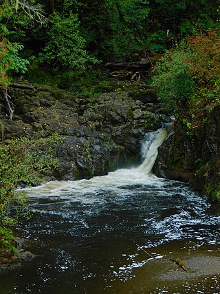
Meskill is an unincorporated community off Washington State Route 6 in Lewis County, Washington. The town is located near Rainbow Falls State Park, and rests between Ceres and Dryad. The Willapa Hills Trail bisects the area.

Parks and recreation in Chehalis, Washington is administered by the Chehalis Parks and Recreation Department. Trails that connect Chehalis with locations beyond the city limits are maintained in conjunction with other local jurisdictions, state government agencies, and/or local non-profit groups and volunteers.

Wilson, also known as Wilson Village, is an unincorporated community located in Lewis County, Washington. The former town is in a rural area in the mid-south region of the county, south of Winston and 7.0 miles (11.3 km) south of Mayfield. Communities and towns around Riffe Lake are 12.0 miles (19.3 km) to the northeast of the area. Wilson is mostly residential in nature.

<span class="mw-page-title-main">Winston, Washington</span> Unincorporated community in Washington, United States

Winston, also known as Winston Creek, is an unincorporated community located in Lewis County, Washington. The rural, residential community sits in the mid-south area of Lewis County and is 3.0 miles (4.8 km) southeast of Mayfield and 4.0 miles (6.4 km) northeast of Wilson.

<span class="mw-page-title-main">Flood history in Chehalis, Washington</span>

The city of Chehalis is located in Washington state and rests upon the Chehalis River. With a connection of creeks, minor tributaries, and basins within or near the city, coupled with the nearby confluences of the Newaukum River south of Chehalis and the Skookumchuck River in neighboring Centralia, the community has suffered from numerous floods. Due to the city being located in the Chehalis Valley along with the Cowlitz River, cresting and overflow of the river has led to flooding in the Chehalis area.

Harmony is an unincorporated town in Lewis County, Washington. The community is located near the junction of the Cowlitz River and Mayfield Lake, and is situated off Route 122, north of Mossyrock.

References

  1. U.S. Geological Survey Geographic Names Information System: Cora, Washington
  2. "Cora, United States on the map — exact time, time zone, airports nearby". mw.utc.city. Retrieved May 16, 2024.
  3. Cora appears on the Purcell Mountain U.S. Geological Survey Map.
  4. 1 2 3 "Revisiting Washington — Cora". revisitwa.org. Retrieved May 16, 2024.
  5. "Cora Bridge". Google Maps.
  6. "Cora Falls, Lewis County, Washington". waterfallsnorthwest.com. Retrieved May 26, 2024.
  7. "Lewis County - Cora". jtenlen.drizzlehosting.com. Lewis Co. WA GenWeb Project.
  8. "Mother of All Counties". Lewis County Genealogical Society, quoting Guy Reed Ramsey, "Postmarked Washington: Lewis and Cowlitz Counties".
  9. "Post Offices". Jim Forte Postal History. Archived from the original on March 6, 2016. Retrieved July 26, 2016.
  10. House Journal of the Legislature of the State of Washington (February 11, 1899), p. 348.
  11. House Journal of the Legislature of the State of Washington (February 23, 1899), p. 530.
  12. "Drowned In The Cowlitz". Lincoln County Leader . November 26, 1896. p. 2. Retrieved May 4, 2024.
  13. "Last Of The Year". The Chehalis Bee-Nugget. December 21, 1906. p. 3. Retrieved May 4, 2024.
  14. "Club Is Reorganized". The Chehalis Bee-Nugget. October 24, 1913. p. 2. Retrieved May 4, 2024.
  15. "The County Commissioners". The Chehalis Bee-Nugget. April 22, 1913. pp. 1, 16. Retrieved May 4, 2024.
  16. "Near Accident At Cora Ferry". The Chehalis Bee-Nugget. June 23, 1916. pp. 3, 19. Retrieved May 4, 2024.
  17. "Many People Think It Northwestern". The Yakima Herald . August 8, 1906. p. 7. Retrieved May 4, 2024.
  18. "North Coast Part Of C., M. & St. Paul System". The Evening Statesman (Walla Walla, Washington). August 12, 1907. p. 1. Retrieved May 4, 2024.
  19. "Died". The Chehalis Bee-Nugget. November 29, 1901. p. 14. Retrieved May 4, 2024.
  20. "Cora". The Chehalis Bee-Nugget. May 15, 1903. p. 10. Retrieved May 4, 2024.
  21. "Is It The C. & N.W." The Chehalis Bee-Nugget. July 27, 1906. p. 1. Retrieved May 4, 2024.
  22. "Coal Lands Are Involved". The Chehalis Bee-Nugget. October 4, 1907. p. 1. Retrieved May 4, 2024.
  23. "Cora Postoffice Discontinued". The Chehalis Bee-Nugget. November 13, 1908. pp. 1, 15. Retrieved May 4, 2024.
  24. "New Bridge For The Cowlitz". The Chehalis Bee-Nugget. December 10, 1915. pp. 1, 9. Retrieved May 4, 2024.
  25. "Two New Auxiliaries". The Chehalis Bee-Nugget. June 14, 1918. p. 1. Retrieved May 4, 2024.
  26. "Surveying At Lewis". The Chehalis Bee-Nugget. August 11, 1922. pp. 2, 27. Retrieved May 4, 2024.
  27. "Lewis Items". The Chehalis Bee-Nugget. May 13, 1923. pp. 16, 75. Retrieved May 4, 2024.
  28. "State Grange To Vancouver". The Chehalis Bee-Nugget. June 22, 1923. pp. 10, 27. Retrieved May 4, 2024.
  29. "A Half Million Dollars For Good Roads In Eastern Lewis". The Chehalis Bee-Nugget. August 14, 1925. p. 1. Retrieved May 4, 2024.