Corry, Pennsylvania

Last updated

Corry, Pennsylvania
City of Corry
Corry Armory, July 2014.jpg
Erie County Pennsylvania incorporated and unincorporated areas Corry highlighted.svg
Location in Erie County and the U.S. state of Pennsylvania.
USA Pennsylvania location map.svg
Red pog.svg
Corry, Pennsylvania
Usa edcp location map.svg
Red pog.svg
Corry, Pennsylvania
Coordinates: 41°55′13.2″N79°38′25.2″W / 41.920333°N 79.640333°W / 41.920333; -79.640333
CountryUnited States
StatePennsylvania
County Erie
FoundedMay 27, 1861
IncorporatedMarch 8, 1866
Named for misspelling of founder Hiram Cory's name
Government
  MayorMichael E. Baker
Area
[1]
  Total6.01 sq mi (15.56 km2)
  Land5.99 sq mi (15.52 km2)
  Water0.01 sq mi (0.04 km2)
Population
 (2020) [2]
  Total6,210
  Density1,036.04/sq mi (400.03/km2)
Time zone UTC-4 (EST)
  Summer (DST) UTC-5 (EDT)
ZIP code
16407
Area code 814
FIPS code 42-16296
Website www.corrypa.com

Corry is a city in northwestern Pennsylvania, United States. With a population of 6,217 at the 2020 United States Census, [3] it is the second largest city in Erie County. Corry is a part of the Erie, PA Metropolitan Statistical Area. The city became famous in the late-19th and early-20th centuries for being the manufacturer of Climax locomotives.

Contents

History

Erie County was formed from parts of Allegheny County on March 12, 1800. [4] On May 27, 1861, tracks owned by the Atlantic and Great Western Railroad intersected with those of the Sunbury and Erie Railroad and was called the "Atlantic and Erie Junction". [5] [6] Land at the junction was owned by Hiram Cory, who sold a portion to the Atlantic and Great Western in October 1861. The railroad built a ticket office at the junction and named it for Cory, but through a misspelling it became Corry. [5]

The combination of railroad growth and the first national oil wells developed by Edwin Drake for the Pennsylvania Rock Oil Company in nearby Titusville contributed greatly to Corry's development. This boomtown was chartered as a borough in 1863 and designated as a city in 1866. Industry has played a big part in Corry's growth, and the Corry Area Historical Society maintains a museum where one of the Climax locomotives (the steam engine used in logging operations that brought fame to Corry) is on display. Since 2020 a "Class A" Climax locomotive is being restored at a location near the original locomotive works by a local non-profit organization set up for this project. [7] [8]

Corry has been named a Tree City USA for seven consecutive years. [9]

The Corry Armory was listed on the National Register of Historic Places in 1991. [10]

Demographics

Historical population
CensusPop.Note
1870 6,726
1880 5,277−21.5%
1890 5,3210.8%
1900 5,3891.3%
1910 5,99111.2%
1920 7,22820.6%
1930 7,4893.6%
1940 6,890−8.0%
1950 6,8870.0%
1960 7,1233.4%
1970 7,3673.4%
1980 7,159−2.8%
1990 6,917−3.4%
2000 6,743−2.5%
2010 6,618−1.9%
2020 6,217−6.1%
2021 (est.)6,164 [3] −0.9%
Sources: [11] [12] [13] [14] [2]

As of the census [12] of 2000, there were 6,834 people, 2,660 households, and 1,763 families residing in the city. The population density was 1,120.5 inhabitants per square mile (432.6/km2). There were 2,868 housing units at an average density of 470.2 per square mile (181.5/km2). The racial makeup of the city was 98.19% White, 0.29% African American, 0.29% Native American, 0.16% Asian, 0.01% Pacific Islander, 0.09% from other races, and 0.97% from two or more races. Hispanic or Latino of any race were 0.91% of the population. The U.S. Census Bureau estimated Corry's population at 6,331 in 2009.

There were 2,660 households, out of which 32.1% had children under the age of 18 living with them, 48.5% were married couples living together, 13.8% had a female householder with no husband present, and 33.7% were non-families. 29.3% of all households were made up of individuals, and 13.2% had someone living alone who was 65 years of age or older. The average household size was 2.49 and the average family size was 3.07.

In the city, the population was spread out, with 27.3% under the age of 18, 8.6% from 18 to 24, 25.5% from 25 to 44, 21.8% from 45 to 64, and 16.8% who were 65 years of age or older. The median age was 36 years. For every 100 females, there were 88.4 males. For every 100 females age 18 and over, there were 83.1 males.

The median income for a household in the city was $30,967, and the median income for a family was $35,375. Males had a median income of $30,220 versus $22,127 for females. The per capita income for the city was $15,143. About 14.2% of families and 16.4% of the population were below the poverty line, including 21.4% of those under age 18 and 8.2% of those age 65 or over.

Geography and climate

Corry is located at 41°55′30″N79°38′26″W / 41.92500°N 79.64056°W / 41.92500; -79.64056 (41.924947, -79.640511). [15] According to the United States Census Bureau, the city has a total area of 6.1 square miles (16 km2), all land.

Climate data for Corry, Pennsylvania
MonthJanFebMarAprMayJunJulAugSepOctNovDecYear
Record high °F (°C)70
(21)
69
(21)
82
(28)
88
(31)
91
(33)
99
(37)
110
(43)
100
(38)
96
(36)
91
(33)
78
(26)
70
(21)
110
(43)
Mean daily maximum °F (°C)32.3
(0.2)
34.7
(1.5)
44.2
(6.8)
57.7
(14.3)
69.4
(20.8)
77.6
(25.3)
81.5
(27.5)
79.5
(26.4)
73.0
(22.8)
61.9
(16.6)
47.6
(8.7)
35.8
(2.1)
58.2
(14.6)
Mean daily minimum °F (°C)16.2
(−8.8)
16.1
(−8.8)
23.7
(−4.6)
34.0
(1.1)
43.2
(6.2)
52.3
(11.3)
56.7
(13.7)
55.2
(12.9)
49.0
(9.4)
39.1
(3.9)
31.2
(−0.4)
21.4
(−5.9)
36.7
(2.6)
Record low °F (°C)−30
(−34)
−30
(−34)
−19
(−28)
−5
(−21)
19
(−7)
28
(−2)
33
(1)
30
(−1)
25
(−4)
11
(−12)
−2
(−19)
−22
(−30)
−30
(−34)
Average rainfall inches (mm)3.32
(84)
2.82
(72)
3.65
(93)
3.92
(100)
3.74
(95)
4.47
(114)
4.30
(109)
3.98
(101)
3.92
(100)
3.69
(94)
4.21
(107)
3.92
(100)
45.96
(1,167)
Average snowfall inches (cm)27.2
(69)
21.6
(55)
17.5
(44)
5.1
(13)
0.2
(0.51)
0
(0)
0
(0)
0
(0)
0
(0)
1.3
(3.3)
14.8
(38)
30.5
(77)
117.5
(298)
Source: Pennsylvania State University [16]

Government

The city of Corry is incorporated as a 3rd-class city under Pennsylvania law. [17] Third-class cities are governed by a commission, in which the mayor and four other members of the city council constitute the commission. The mayor serves as the president of the council. [17] David Mitchell is the mayor of the city of Corry. The Corry City Council's other members are Steven Drake, Bill Roche, Taree Hamilton and Andrew Sproveri. [18] Donna Huffman is city treasurer and Diane L. Cowles is city controller.

Corry is in Pennsylvania's 5th congressional district and is represented in the United States House of Representatives by Republican Glenn Thompson, who was elected in 2008. Republican Scott Hutchinson of the 21st District has represented Corry in the Pennsylvania State Senate since 2013. Corry is contained by the 4th District of the Pennsylvania House of Representatives and is represented by Republican Curt Sonney.

Education

An early morning view of Corry Corry, Pennsylvania Skyline.jpg
An early morning view of Corry

Corry is within the Corry Area School District, which operates a middle school, high school, one elementary school, but two abandoned elementary schools, and a career and technical center. Higher education is locally available through the Corry branch of Mercyhurst College, which offers advanced college credits for high school students and an associate degree in business administration. Adult education and training are offered through the Corry Higher Education Council.

Notable people

See also

Related Research Articles

<span class="mw-page-title-main">Crawford County, Pennsylvania</span> County in Pennsylvania, United States

Crawford County is a county in the Commonwealth of Pennsylvania. As of the 2020 census, the population was 83,938. Its county seat is Meadville. The county was created on March 12, 1800, from part of Allegheny County and named for Colonel William Crawford.

<span class="mw-page-title-main">Blasdell, New York</span> Village in New York, United States

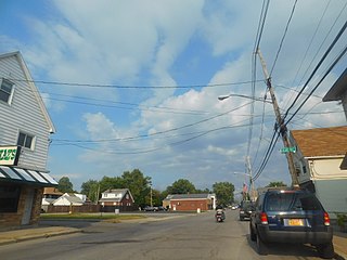
Blasdell is a village in Erie County, New York, United States. The population was 2,553 according to the 2010 Census. The name is derived from Herman Blasdell, the first station master of the Erie and Pennsylvania railroad depot. It is part of the Buffalo–Niagara Falls Metropolitan Statistical Area.

<span class="mw-page-title-main">Mainville, Pennsylvania</span> Census-designated place in Pennsylvania, United States

Mainville is a census-designated place in Columbia County, Pennsylvania, United States. It is part of Northeastern Pennsylvania. The population was 132 at the 2010 census. It is part of the Bloomsburg-Berwick micropolitan area.

<span class="mw-page-title-main">Spartansburg, Pennsylvania</span> Borough in Pennsylvania, United States

Spartansburg is a borough in Crawford County, in northwestern Pennsylvania, United States. The population was 277 at the 2020 census, down from 305 at the 2010 census.

<span class="mw-page-title-main">Pillow, Pennsylvania</span> Borough in Pennsylvania, United States

Pillow is a borough in Dauphin County, Pennsylvania, United States. The population was 291 at the 2020 census. It is part of the Harrisburg–Carlisle Metropolitan Statistical Area.

<span class="mw-page-title-main">Concord Township, Erie County, Pennsylvania</span> Township in Pennsylvania, United States

Concord Township is a township in Erie County, Pennsylvania, United States. The population was 1,279 at the 2020 census,

<span class="mw-page-title-main">Elgin, Pennsylvania</span> Borough in Pennsylvania, United States

Elgin is a borough in Erie County, Pennsylvania, United States. The population was 204 at the 2020 census. It is part of the Erie Metropolitan Statistical Area. Places of recreation include Elgin Community Park. Elgin is home to the oldest borough building in Erie County.

<span class="mw-page-title-main">Lake City, Pennsylvania</span> Borough in Pennsylvania, United States

Lake City is a borough in Erie County, Pennsylvania, United States. The population was 2,936 at the 2020 census. It is part of the Erie Metropolitan Statistical Area.

<span class="mw-page-title-main">Lawrence Park Township, Erie County, Pennsylvania</span> 1st Class Township in Pennsylvania, United States

Lawrence Park Township is the only first class township in Erie County, Pennsylvania, United States. The population was 3,821 at the 2020 census, down from 4,048 at the 2000 census. The 2010 census counted a population of 3,982, for a decline of 1.6% during the decade. The entire township is also listed as a census-designated place.

<span class="mw-page-title-main">North East, Pennsylvania</span> Borough in Pennsylvania, United States

North East is a borough in Erie County, Pennsylvania, United States, 14 miles (23 km) northeast of Erie. Located in the county's northeastern corner, the name comes from the geographical location. The population was 4,114 at the 2020 census, down from 4,294 in 2010. Fruit growing was an early economic endeavor, and is still to this day, as this is a popular area especially for cherries and grapes. There is an annual Cherry Festival in the summer and an annual Wine Country Harvest Festival in autumn. It is part of the Erie Metropolitan Statistical Area. It is the northernmost town in Pennsylvania.

<span class="mw-page-title-main">Union City, Pennsylvania</span> Borough in Pennsylvania, United States

Union City is a borough in Erie County, Pennsylvania, United States. It is located 22 miles (35 km) southeast of Erie. In the twentieth century, there were three large chair factories, planing and grist mills, a powdered milk plant, and several furniture factories. The population was 2,934 at the 2020 census. It is part of the Erie Metropolitan Statistical Area.

<span class="mw-page-title-main">Wayne Township, Erie County, Pennsylvania</span> Township in Pennsylvania, United States

Wayne Township is a township in Erie County, Pennsylvania, United States. The population was 1,539 at the 2020 census, down from 1,659 at the 2010 census, down from 1,766 in 2000.

<span class="mw-page-title-main">Mount Jewett, Pennsylvania</span> Borough in Pennsylvania, United States

Mount Jewett is a borough in McKean County, Pennsylvania, United States. The population was 849 at the 2020 census. The students of the borough attend school in the Kane Area School District, even though the borough is surrounded by Hamlin Township—belonging to neighboring Smethport Area School District. Mount Jewett is near to the Kinzua Bridge State Park, which includes the Kinzua Bridge Sky Walk and Kinzua Viaduct. The current mayor is Brianna Howard.

<span class="mw-page-title-main">Grove City, Pennsylvania</span> Borough in Pennsylvania, United States

Grove City is a borough in southeastern Mercer County, Pennsylvania, United States, located approximately 60 miles (97 km) north of Pittsburgh and 75 miles (121 km) south of Erie. At the 2020 census, the population was 7,894. It is part of the Hermitage micropolitan area. It is the home of Grove City College, a private liberal arts college, as well as George Junior Republic. The nearby Grove City Premium Outlets take their name from Grove City.

<span class="mw-page-title-main">Susquehanna Depot, Pennsylvania</span> Borough in Pennsylvania, United States

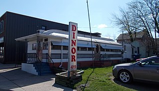
Susquehanna Depot, often referred to simply as Susquehanna, is a borough in Susquehanna County, Pennsylvania, United States, located on the Susquehanna River 23 miles (37 km) southeast of Binghamton, New York. In the past, railroad locomotives and railroad cars were made here. It is also known for its Pennsylvania Bluestone quarries.

<span class="mw-page-title-main">Sugar Grove, Pennsylvania</span> Borough in Pennsylvania, United States

Sugar Grove is a borough in Warren County, Pennsylvania, United States. The population was 614 at the 2010 census.

<span class="mw-page-title-main">Bellevue, Ohio</span> City in Ohio, United States

Bellevue is a city in Erie, Huron, Seneca, and Sandusky counties in the U.S. state of Ohio, located 61 miles southwest of Cleveland and 45 miles southeast of Toledo. The population was 8,249 at the 2020 census. The National Arbor Day Foundation has designated Bellevue as a Tree City USA.

Southport is a census-designated place (CDP) in the town of Southport in Chemung County, New York, United States. The population of the CDP was 7,238 at the 2010 census, out of a total population in the town of 10,940.

<span class="mw-page-title-main">Addison (village), New York</span> Village in New York, United States

Addison is a village in Steuben County, New York, United States, in the southeast part of the town of the same name, and southwest of the city of Corning. The population was 1,763 at the 2010 census. The village and the surrounding town are named after the author Joseph Addison.

Wayland is a village in Steuben County, New York, United States. The population was 1,865 at the 2010 census.

References

  1. "ArcGIS REST Services Directory". United States Census Bureau. Retrieved October 12, 2022.
  2. 1 2 "Census Population API". United States Census Bureau. Retrieved October 12, 2022.
  3. 1 2 Bureau, US Census. "City and Town Population Totals: 2020—2021". Census.gov. US Census Bureau. Retrieved July 24, 2022.
  4. Hottenstein, JoAnne; Welch, Sibyl (1965). "Erie County" (PDF). Incorporation dates of Pennsylvania municipalities. Harrisburg: Bureau of Municipal Affairs, Pennsylvania Department of Internal Affairs. Retrieved June 15, 2011.
  5. 1 2 Springirth, Kenneth (June 13, 2011). "Railroads that helped Corry thrive could be key to city's prosperity". Erie Times-News . Retrieved June 15, 2011.
  6. Bates, p. 809.
  7. Last, John (December 12, 2021). "Restoration of Historic Locomotive Keeps Moving Forward". Erie News Now. Retrieved June 12, 2023.
  8. "Corry Rail & Industrial Legacy Society & Museum" . Retrieved June 12, 2023.
  9. Sear, Stephen (April 20, 2011). "Tree City honors roll 7 in Corry". The Corry Journal. Retrieved June 15, 2011.
  10. "National Register Information System". National Register of Historic Places . National Park Service. July 9, 2010.
  11. "Census of Population and Housing". U.S. Census Bureau. Retrieved December 11, 2013.
  12. 1 2 "U.S. Census website". United States Census Bureau . Retrieved January 31, 2008.
  13. "Incorporated Places and Minor Civil Divisions Datasets: Subcounty Resident Population Estimates: April 1, 2010 to July 1, 2012". Population Estimates. U.S. Census Bureau. Archived from the original on June 11, 2013. Retrieved December 11, 2013.
  14. "Census of Population and Housing". Census.gov. Retrieved June 4, 2016.
  15. "US Gazetteer files: 2010, 2000, and 1990". United States Census Bureau. February 12, 2011. Retrieved April 23, 2011.
  16. "Corry Local Climatological Data". Pennsylvania State Climatologist. College of Earth and Mineral Sciences, Pennsylvania State University. Archived from the original on May 30, 2011. Retrieved June 15, 2011.
  17. 1 2 The Pennsylvania Manual, p. 6-5.
  18. "Erie County Elected Officials", p. 7.
  19. "Miss Wisconsin Is Miss America". New York Times. September 10, 1972. Retrieved January 4, 2019.
  20. United Press International (June 19, 1972). "Indiana U Co-ed Is Miss Pennsylvania". Beaver County Times. p. 7.
  21. Shavit, David (1990). The United States in Asia: a historical dictionary. Westport, CT: Greenwood Press. p. 424. ISBN   0-313-26788-X. OCLC   21522840.

Sources