County of Brant

Last updated
Brant
County of Brant
Paris Ontario 2008 1.JPG
Paris, Ontario
Motto: 
Simply Grand
Map of Ontario BRANT.svg
Coordinates: 43°07′N80°22′W / 43.117°N 80.367°W / 43.117; -80.367
CountryCanada
Province Ontario
Settled1793
Formed1851 (county)
Formed1999 (single-tier city)
Seat Burford
Government
  Governing body Brant County Council
  MayorDavid Bailey
   MP Larry Brock
(Conservative)
   MPP Will Bouma
(Progressive Conservative)
Area
[1]
  Land817.66 km2 (315.70 sq mi)
Population
 (2021) [1]
  Total39,474
  Density48.3/km2 (125/sq mi)
Time zone UTC-5 (EST)
  Summer (DST) UTC-4 (EDT)
Postal Code
N0E, N3L
Area code(s) 519, 226, and 548
Website www.brant.ca

The County of Brant (2021 population 39,474) is a single-tier municipality in the Canadian province of Ontario. Although it retains the word "county" in its name, the municipality is a single-tier municipal government and has no upper tier. The County of Brant has service offices in Burford, Paris, Oakland, Onondaga and St. George. The largest population centre (2021 population 14,956) is Paris.

Contents

The County of Brant is a predominantly rural municipality in Southern Ontario. The County is bordered by the township of North Dumfries in the Regional Municipality of Waterloo; the City of Hamilton; Haldimand County; Norfolk County; and the townships of Blandford-Blenheim and Norwich in Oxford County. The County abuts the provincially-mandated Greenbelt. Although the city of Brantford is surrounded by the County, it is a fully independent city with its own municipal government. [2] [3] [4] The Brant census division, which includes Brantford and the Six Nations and New Credit reserves along with the County of Brant, had a population of 144,771 in the 2021 census.

The County is named after Joseph Brant and was established in 1851. Brantford separated from the County when it incorporated as a city in 1877. [5] Part of the County is situated on the Haldimand Tract, [6] [7] traditional territory of the Neutral, Mississauga, and Haudenosaunee peoples. [8] [9] [10]

History

The area had previously been part of Wentworth and Oxford County. Brant County was formed in 1851 and originally consisted of: [11]

On January 1, 1999, the Town of Paris and the townships of Brantford, Burford, Oakland, Onondaga, and South Dumfries amalgamated to form a new city with the official legal name of County of Brant. [12]

Early history

Erected by the provincial and federal governments, historic plaques and monuments in Brant County indicate a long and varied history which include many aspects related to the First Nations.

The Mohawk Chief Joseph Brant (Thayendanega) and the Mohawk people of New York state served with the British during the American Revolution. In 1784, the Crown granted Joseph Brant and his followers a land treaty along the Grand River to replace what they had lost in New York State at the Sandusky Council after the Revolution. Much of this grant was later rescinded. [13] As chief of the united tribes, Brant led his peopleincluding Brant's African slaves captured during the revolution [14] to Upper Canada; a group of 400 settled in 1788 on the Grand River at Mohawk Village which later became Brantford. [15] Nearly a century later (1886), the Joseph Brant Memorial would be erected in Burlington, Ontario in honour of Brant and the Six Nations Confederacy. [16]

The Mohawk Chapel, built by the British Crown in 1785 for the Mohawk and Iroquois people (Six Nations of the Grand River), was dedicated in 1788 as a reminder of the original agreements made with the British during the American Revolution. [15] In 1904 the chapel received Royal status by King Edward VII in memory of the longstanding alliance. Her Majesty's Royal Chapel of the Mohawks is an important reminder of the original agreements made with Queen Anne in 1710. It is still in use today as one of two royal Chapels in Canada and the oldest Protestant Church in the province. Joseph Brant and his son John Brant are buried here. [17]

Significant to the County, gypsum was discovered in 1793 on the east bank of the Grand River in what became Paris during a survey for the British Home Department. By late 1794 a road had been built from what is now Dundas, Ontario to Paris, called The Governor's Road (now Dundas St. in Paris). Records from 1846 indicate that the settlement (now Paris), in a hilly area called Oak Plains, was divided into the upper town and the lower town. In addition to successful farmers in the area, the community of 1000 people (Americans, Scottish, English, and Irish) was thriving. Manufacturing had already begun, with industries powered by the river. A great deal of plaster was being exported and there were three mills, a tannery, a woolen factory, a foundry, and numerous tradesmen. Five churches had been built; the post office was receiving mail three times a week. [18] The village was incorporated in 1850 with Hiram "Boss" Capron as the first Reeve. It was incorporated as a town in 1856 with H. Finlayson as the first mayor. [15]

Abraham Dayton from Connecticut arrived in 1793 and was granted the entire township of Burford; additional settlers began arriving in 1797. The 1814 Battle of Malcolm's Mills during the War of 1812 took place at what is now Oakland when American forces attacked the local regiments. Neither this battle nor the 1837 Duncombe's Uprising by militant "Patriots" at the settlement of Scotland were successful. [15]

Chief John Brant (Mohawk leader) (Ahyonwaeghs) who had lived at Mohawk Village was one of the sons of Joseph Brant. [19] He fought with the British during the War of 1812 and later worked to improve the welfare of the First Nations. He was involved in building schools and was the improving the welfare of his people. Brant initiated the opening of schools and from 1828 served as the first native Superintendent of the Six Nations. [15] Chief Brant was elected to Legislative Assembly of Upper Canada for Haldimand in 1830 and was the first aboriginal Canadian in Parliament. [20]

Records from 1846 indicate that the settlement of Scotland in Burford Township had a population of about 150. At that time there were two stores, two taverns, one tannery, one saddler, one chair maker, one cabinet maker, one blacksmith. There was also a carding machine and fulling mill near the village. Nearby Oakland had about 160 inhabitants; its post office was receiving mail daily. Oakland had a grist and a saw mill, a carding machine and fulling mill, one store, two taverns, one hatter, one wagon maker, one blacksmith, one tailor, one shoemaker. [21]

Much of the County's early population began arriving in the 1820s as the Hamilton and London Road was improved and settlement increased after 1848 when navigation to Brantford was opened and again in 1854 with the arrival of the railway to Brantford. The stone and brick Brant County Courthouse was built on land purchased from the Six Nations in 1852. The structure housed court rooms, county offices, a law library and a gaol. During additions in the 1880s, the Greek Revival style, with Doric columns, was retained. [15]

Chiefswood, now a Six Nations museum in Oshweken and one of the National Historic Sites of Canada, was built in about 1856 by Mohawk Chief George Henry Martin Johnson (Onwanonsyshon). His daughter, the Mohawk poet E. Pauline Johnson (Tekahionwake), gained great acclaim across Canada. Her work increased awareness of the history and cultural diversity of the First Nations. In 1886, the Joseph Brant Memorial was constructed in honour of Brant and the Six Nations Confederacy. [15] [22]

Railway development

Brant County saw relatively early railway development in Ontario's history, as it lay nearby and between major mid-19th century centres such as Toronto and London. Plans for railway development were underway in the 1830s as part of the proposed London and Gore Railroad between London and Hamilton, with a branch line planned to extend northward to Galt. [23] :4 After significant delays, the London and Gore eventually appeared in the form of the Great Western Railway, whose mainline opened between Hamilton and London in 1853. [23] :4

Work had begun on the branch line to Galt in 1852, and it was completed in 1854. [23] :5 The branch line, as built, connected to the roughly east–west mainline at a junction in Brant County located at a key point aligned between four major manufacturing and administrative centres in the area: Brantford, Galt, Hamilton, and London. [23] :3 Originally known simply as Fairchild Creek Station, the railway town which grew up around the junction was eventually named Harrisburg after the then-president of the Great Western Railway, Robert W. Harris. [23] :5 This early construction date has led to some Ontario rail history writers such as Joachim Brouwer and Ron Brown to argue that Harrisburg was the first railway junction in Canada, and that the branch line to Galt was the first branch line in Canadian railway history. [23] :5 A second branch line, this one to Brantford, was also built south from Harrisburg in 1871, though an independent shortline named the Buffalo, Brantford and Goderich Railway reached Brantford earlier, in the 1850s. [23] :6

Invention of the telephone

Alexander Graham Bell invented the telephone at his father's homestead, Melville House, now the Bell Homestead National Historic Site. At the time, the homestead was in the County, outside the Brantford city limits. [24] [25] [26] In a 1906 speech, Bell made the following comment, "the telephone problem was solved, and it was solved at my father's home". [27] As well, two of the first successful voice transmissions of any notable distance were made in early August 1876, between the telegraph office in Brantford, Ontario and Melville House and Between Paris and Brantford. [28] [29] [30] [31]

Canada's first telephone factory, created and operated by James Cowherd, was also located in Brantford from about 1879 until his death in 1881. [32] [33] The first telephone business office which opened in 1877, not far from the Bell Homestead, was then located in the County just outside Brantford. [15]

Geography

Communities

Brant County Courthouse Brantcourthouse.JPG
Brant County Courthouse

In addition to Brantford, population centres in Brant are Paris, St. George and Burford. Smaller communities in the municipality include Bishopsgate, Burtch, Cainsville, Cathcart, East Oakland, Etonia, Fairfield, Falkland, Glen Morris, Gobles, Harley, Harrisburg, Hatchley, Langford, Lockie, Maple Grove, Middleport, Mount Pleasant, Mount Vernon, New Durham, Newport, Northfield, Northfield Centre, Oakland, Onondaga, Osborne Corners, and Scotland.

Climate

Climate data for Middleport (1981−2010)
MonthJanFebMarAprMayJunJulAugSepOctNovDecYear
Record high °C (°F)15.5
(59.9)
16.0
(60.8)
25.0
(77.0)
31.0
(87.8)
33.0
(91.4)
36.5
(97.7)
38.0
(100.4)
35.0
(95.0)
33.5
(92.3)
27.0
(80.6)
22.0
(71.6)
20.5
(68.9)
38.0
(100.4)
Mean daily maximum °C (°F)−1.4
(29.5)
0.0
(32.0)
4.6
(40.3)
12.1
(53.8)
19.3
(66.7)
24.7
(76.5)
27.4
(81.3)
25.8
(78.4)
21.3
(70.3)
14.7
(58.5)
7.3
(45.1)
1.7
(35.1)
13.1
(55.6)
Daily mean °C (°F)−5.4
(22.3)
−2.5
(27.5)
0.1
(32.2)
6.9
(44.4)
13.4
(56.1)
18.7
(65.7)
21.5
(70.7)
20.1
(68.2)
15.8
(60.4)
9.7
(49.5)
3.5
(38.3)
−1.9
(28.6)
8.2
(46.8)
Mean daily minimum °C (°F)−9.4
(15.1)
−8.5
(16.7)
−4.4
(24.1)
1.7
(35.1)
7.4
(45.3)
12.7
(54.9)
15.5
(59.9)
14.4
(57.9)
10.2
(50.4)
4.6
(40.3)
−0.4
(31.3)
−5.4
(22.3)
3.2
(37.8)
Record low °C (°F)−31.0
(−23.8)
−31.0
(−23.8)
−23.0
(−9.4)
−15.0
(5.0)
−5.0
(23.0)
2.0
(35.6)
7.0
(44.6)
1.0
(33.8)
−2.0
(28.4)
−7.0
(19.4)
−15.0
(5.0)
−27.5
(−17.5)
−31.0
(−23.8)
Average precipitation mm (inches)66.6
(2.62)
55.4
(2.18)
64.0
(2.52)
74.6
(2.94)
76.5
(3.01)
76.9
(3.03)
98.7
(3.89)
75.2
(2.96)
92.3
(3.63)
73.4
(2.89)
84.6
(3.33)
70.8
(2.79)
908.9
(35.78)
Average rainfall mm (inches)32.3
(1.27)
30.9
(1.22)
47.8
(1.88)
71.7
(2.82)
76.4
(3.01)
76.9
(3.03)
98.7
(3.89)
75.2
(2.96)
92.3
(3.63)
73.2
(2.88)
77.8
(3.06)
49.1
(1.93)
802.3
(31.59)
Average snowfall cm (inches)34.4
(13.5)
24.4
(9.6)
16.2
(6.4)
2.9
(1.1)
0.1
(0.0)
0.0
(0.0)
0.0
(0.0)
0.0
(0.0)
0.0
(0.0)
0.2
(0.1)
6.8
(2.7)
21.7
(8.5)
106.7
(42.0)
Average precipitation days (≥ 0.2 mm)13.910.711.513.812.911.010.711.013.114.114.313.8150.7
Average rainy days (≥ 0.2 mm)5.35.18.013.112.911.010.711.013.114.112.88.5125.4
Average snowy days (≥ 0.2 cm)9.36.44.70.890.050.00.00.00.00.052.06.629.9
Source: Environment Canada [34]

Demographics

City of Brant

In the 2021 Census of Population conducted by Statistics Canada, Brant had a population of 39,474 living in 14,330 of its 14,778 total private dwellings, a change of 10.8% from its 2016 population of 35,640. With a land area of 817.66 km2 (315.70 sq mi), it had a population density of 48.3/km2 (125.0/sq mi) in 2021. [35]

Canada census – Brant community profile
2021 2016 2011
Population39,474 (+10.8% from 2016)36,707 (3.0% from 2011)35,638 (3.6% from 2006)
Land area817.66 km2 (315.70 sq mi)843.25 km2 (325.58 sq mi)843.29 km2 (325.60 sq mi)
Population density48.3/km2 (125/sq mi)43.5/km2 (113/sq mi)42.3/km2 (110/sq mi)
Median age44.0 (M: 43.2, F: 44.8)
Private dwellings14,778 (total)  14,330 (occupied)13,687 (total) 
Median household income$106,000
References: 2021 [36] 2016 [37] 2011 [38] earlier [39] [40]
Panethnic groups in the City of Brant (2001−2021)
Panethnic
group
2021 [41] 2016 [42] 2011 [43] 2006 [44] 2001 [45]
Pop. %Pop.%Pop.%Pop.%Pop.%
European [lower-alpha 1] 35,19034,13033,47533,04530,415
Indigenous 920935950425440
South Asian 99519595130110
African 640220270120120
Southeast Asian [lower-alpha 2] 23085554010
Latin American 20060753035
East Asian [lower-alpha 3] 1951856510555
Middle Eastern [lower-alpha 4] 1201504565
Other [lower-alpha 5] 2154540450
Total responses38,70035,86035,06533,98031,230
Total population39,47436,70735,63834,41531,669
Note: Totals greater than 100% due to multiple origin responses

County of Brant

Panethnic groups in the County of Brant (2001−2021)
Panethnic
group
2021 [46] 2016 [47] 2011 [48] 2006 [49] 2001 [50]
Pop. %Pop.%Pop.%Pop.%Pop.%
European [lower-alpha 1] 117,300115,090114,670112,295108,540
South Asian 7,0653,3101,7351,7851,345
Indigenous 6,8406,91011,6254,3053,300
African 4,2152,2301,8201,7001,220
Southeast Asian [lower-alpha 2] 2,6101,8901,2501,2401,050
East Asian [lower-alpha 3] 1,2151,2451,1751,040720
Latin American 1,105505435390170
Middle Eastern [lower-alpha 4] 1,030505670270200
Other [lower-alpha 5] 1,130550395285195
Total responses142,515132,245133,780123,315116,755
Total population144,771134,808136,035125,099118,485
Note: Totals greater than 100% due to multiple origin responses

Government

The County of Brant is divided into five wards, each with two elected Councillors. David Bailey was elected as the Mayor in 2018. Previously, Ronald Eddy had held the position of Mayor from 1999 - 2018. [51] The County is a single-tier municipality and provide the following services: roads, water, wastewater, garbage, recycling, facilities, parks, trails, planning, building, economic development, tourism, bylaw enforcement, library, fire and paramedic services but contracts with the Ontario Provincial Police to provide police services, overseen by the Police Services Board. (Ambulance services are provided in conjunction with the City of Brantford.) The customer service offices are located in Burford, Paris, Oakland, Onondaga and St. George Ontario. [52] [53]

Local organizations

Local organizations include the Kinsmen Club of Brantford is an all Canadian non-profit service organization that promotes service, fellowship, positive values, and national pride. They put on the Brantford Kinsmen Annual Car Show & Swap Meet in Paris Ontario in September and the Brantford Kinsmen Annual Ribfest in Brantford, Ontario to help raise funds for local charities. And Sustainable Brant dedicated to saving the disappearing farmland.

The County of Brant Public Library is the public library serving the communities in the county of Brant, Ontario, Canada. It has 5 branches located in Paris, Burford, Scotland, St. George, and Glen Morris, Ontario. The system's main branch, in Paris, Ontario, was originally a Carnegie Library, having received an endowment from Carnegie in 1902. The County of Brant Public Library maintains a Digital Historical Collection pertaining to Brant history at http://images.ourontario.ca/brant

The Women Teachers of Ontario, Brant Branch: https://rwto.org/branch/brant/

Album of honour

War Monument in Brantford, Ontario Brantfordwarmonument.jpg
War Monument in Brantford, Ontario

The Album of Honour for Brant County is a book compiled in 1946 by the Kinsmen Club of Brantford to commemorate those of Brantford, the County of Brant and the peoples of the Six Nations who served Canada during the Second World War. [54] The book lists the names of the Brant County men and women who served in World War II. There are more than 3,500 photographs. In addition, local companies provided the names of employees who served in this war. The book is kept on the Digital Archives Page at the Brantford Public Library. [55]

See also

Notes

  1. 1 2 Statistic includes all persons that did not make up part of a visible minority or an indigenous identity.
  2. 1 2 Statistic includes total responses of "Filipino" and "Southeast Asian" under visible minority section on census.
  3. 1 2 Statistic includes total responses of "Chinese", "Korean", and "Japanese" under visible minority section on census.
  4. 1 2 Statistic includes total responses of "West Asian" and "Arab" under visible minority section on census.
  5. 1 2 Statistic includes total responses of "Visible minority, n.i.e." and "Multiple visible minorities" under visible minority section on census.

Related Research Articles

<span class="mw-page-title-main">Brantford</span> City in Ontario, Canada

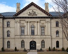
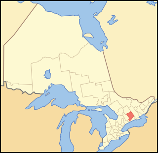
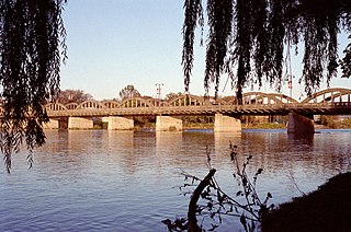
Brantford is a city in Ontario, Canada, founded on the Grand River in Southwestern Ontario. It is surrounded by Brant County, but is politically separate with a municipal government of its own that is fully independent of the county's municipal government.

<span class="mw-page-title-main">Golden Horseshoe</span> Secondary region in Ontario, Canada

The Golden Horseshoe is a secondary region of Southern Ontario, Canada, which lies at the western end of Lake Ontario, with outer boundaries stretching south to Lake Erie and north to Lake Scugog, Lake Simcoe and Georgian Bay of Lake Huron. The region is the most densely populated and industrialized in Canada. Based on the 2021 census, with a population of 7,759,635 people in its core and 9,765,188 in its greater area, the Golden Horseshoe accounts for over 20 percent of the population of Canada and more than 54 percent of Ontario's population. It is part of the Quebec City–Windsor Corridor, itself part of the Great Lakes megalopolis.

<span class="mw-page-title-main">Northumberland County, Ontario</span> County in Ontario, Canada

Northumberland County is an upper-tier municipality situated on the north shore of Lake Ontario, east of Toronto in Central Ontario. The Northumberland County headquarters are located in Cobourg.

<span class="mw-page-title-main">Peterborough County</span> County in Ontario, Canada

Peterborough County is located in Southern Ontario, Canada. The county seat is The City of Peterborough, which is independent of the county.

<span class="mw-page-title-main">Burford, Ontario</span> Place in Ontario, Canada

Burford is a rural community and is part of the County of Brant, in central southwestern Ontario. It has 1,058 residents. It is located eight kilometres west of the City of Brantford along Highway 53, and seventy kilometres east of London, Ontario. It is approximately 100 km southwest of Toronto.

<span class="mw-page-title-main">Haldimand County</span> City in Ontario, Canada

Haldimand County is a rural city-status single-tier municipality on the Niagara Peninsula in Southern Ontario, Canada, on the north shore of Lake Erie, and on the Grand River. Despite its name, it is no longer a county by definition, as all municipal services are handled by a single level of government. Municipal offices are located in Cayuga.

<span class="mw-page-title-main">Norfolk County, Ontario</span> City in Ontario, Canada

Norfolk County is a rural single-tier municipality on the north shore of Lake Erie in Southwestern Ontario, Canada with a 2016 population of 67,490. Despite its name, it is no longer a county by definition, as all municipal services are handled by a single level of government. The largest community in Norfolk County is Simcoe, whose 2016 population was 13,922. The other population centres are Port Dover, Delhi, Waterford and Port Rowan, and there are many smaller communities. For several years in the late 20th century, the county was merged with Haldimand County but the merged entity was dissolved in 2000.

<span class="mw-page-title-main">Dufferin County</span> County in Ontario, Canada

Dufferin County is a county and census division located in Central Ontario, Canada. The county seat is Orangeville, and the current Warden is Wade Mills. The current chief administrative officer is Sonya Pritchard. Dufferin covers an area of 1,486.31 square kilometres (573.87 sq mi), and its population was 61,735 at the time of the 2016 Census.

<span class="mw-page-title-main">Six Nations of the Grand River</span> Indian reserve in Ontario, Canada

Six Nations is demographically the largest First Nations reserve in Canada. As of the end of 2017, it has a total of 27,276 members, 12,848 of whom live on the reserve. These nations are the Mohawk, Cayuga, Onondaga, Oneida, Seneca and Tuscarora. Some Lenape live in the territory as well.

<span class="mw-page-title-main">Cambridge (federal electoral district)</span> Federal electoral district in Ontario, Canada

Cambridge is a federal electoral district in Ontario, Canada, that has been represented in the House of Commons of Canada since 1979.

<span class="mw-page-title-main">Hagersville, Ontario</span> Unincorporated Community in Ontario, Canada

Hagersville is a community in Haldimand County, Ontario in Canada.

<span class="mw-page-title-main">Brantford—Brant (federal electoral district)</span> Federal electoral district in Ontario, Canada

Brantford—Brant is a federal electoral district in Ontario, Canada, that has been represented in the House of Commons of Canada from 1904 to 1949 and since 1968.

<span class="mw-page-title-main">Haldimand—Norfolk (federal electoral district)</span> Federal electoral district in Ontario, Canada

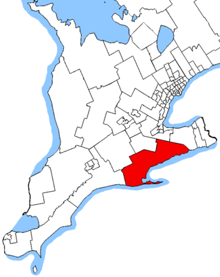
Haldimand—Norfolk is a federal electoral district in Ontario, Canada, that has been represented in the House of Commons of Canada from 1979 to 1997, and since 2004. The current Member of Parliament (MP) is Conservative Leslyn Lewis.

<span class="mw-page-title-main">Oxford (federal electoral district)</span> Federal electoral district in Ontario, Canada

Oxford is a federal electoral district in Ontario, Canada, that has been represented in the House of Commons of Canada since the 1935 election.

Foreign-born people are those born outside of their country of residence. Foreign born are often non-citizens, but many are naturalized citizens of the country in which they live, and others are citizens by descent, typically through a parent.

<span class="mw-page-title-main">Alnwick/Haldimand</span> Township in Ontario, Canada

The Township of Alnwick/Haldimand is a township in central Ontario, Canada, in Northumberland County, situated between Lake Ontario and Rice Lake. It was formed in 2001 by the merger of Alnwick Township in the north and Haldimand Township in the south. Alderville First Nation is an autonomously governed First Nation contained within the township boundaries, in two non-contiguous sections along County Roads 45 and 18.

<span class="mw-page-title-main">Demographics of Ontario</span>

Ontario, one of the 13 provinces and territories of Canada, is located in east-central Canada. It is Canada's most populous province by a large margin, accounting for nearly 40 percent of all Canadians, and is the second-largest province in total area. Ontario is fourth-largest in total area when the territories of the Northwest Territories and Nunavut are included. It is home to the nation's capital city, Ottawa, and the nation's most populous city, Toronto.

Haldimand—Norfolk—Brant was a provincial electoral district in central Ontario, Canada that elected one Member of the Legislative Assembly of Ontario. It was created in 1999 from Norfolk and Brant—Haldimand. It was abolished in 2007 into Haldimand—Norfolk and Brant.

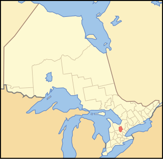
Cainsville is a community straddling the boundary of Brantford and Brant County in Ontario, Canada.

<span class="mw-page-title-main">Demographics of Ottawa</span>

In 2021, the population of the city of Ottawa was 1,017,449. The population of the census metropolitan area, Ottawa-Gatineau, was 1,488,307.

References

  1. 1 2 "Brant Census Profile". Statistics Canada. 9 February 2022. Retrieved 13 September 2022.
  2. "Proposed Boundary Adjustment". Brant.ca. Archived from the original on 2017-04-07. Retrieved 2017-04-06.
  3. "Members of Council". Brantford.ca. 21 March 2019.
  4. "Councillors and Wards - County of Brant". Brant.ca. Archived from the original on 2018-04-02. Retrieved 2017-04-06.
  5. The History of the County of Brant, Ontario. Toronto: Warner, Beers & Co. 1883. pp. 85, 152–153, 262–263. Retrieved June 10, 2021.
  6. "Haldimand Tract". Grand River Country. Archived from the original on 2019-07-09. Retrieved 2021-06-03.
  7. Filice, Michelle (November 10, 2020). "Haldimand Proclamation". The Canadian Encyclopedia . Historica Canada . Retrieved June 5, 2021.
  8. Francis, Daniel (May 28, 2019). "Brantford". The Canadian Encyclopedia . Historica Canada . Retrieved June 5, 2021.
  9. Shanahan, David (December 7, 2019). "Between the Lakes Treaty". Anishinabek News. Retrieved June 5, 2021.
  10. Groat, Cody (February 18, 2020). "Six Nations of the Grand River". The Canadian Encyclopedia . Historica Canada . Retrieved June 5, 2021.
  11. Province of Ontario -- A History 1615 to 1927 by Jesse Edgar Middletown & Fred Landon, 1927, Dominion Publishing Company, Toronto
  12. Interim List of Changes to Municipal Boundaries, Status and Name From January 2, 1996 to January 1, 2001. Statistics Canada. January 2002. p. 154 of 419.
  13. "Early Canada Historical Narratives -- THAYENDANEGEA - JOSEPH BRANT". Uppercanadahistory.ca.
  14. Penick, Tom. "Joseph Brant, Mohawk slave owner and military officer born". AAREG. Retrieved June 10, 2021.
  15. 1 2 3 4 5 6 7 8 "Historical Plaques of Brant County". Waynecook.com.
  16. "Thayendanega (Joseph Brant) Historical Plaque". Ontarioplaques.com. Archived from the original on 2021-08-21. Retrieved 2017-04-07.
  17. "History". Mohawk Chapel. 2011. Archived from the original on 30 January 2017. Retrieved 7 April 2017.
  18. Smith, Wm. H. (1846). SMITH'S CANADIAN GAZETTEER - STATISTICAL AND GENERAL INFORMATION RESPECTING ALL PARTS OF THE UPPER PROVINCE, OR CANADA WEST. Toronto: H. & W. ROWSELL. p.  142.
  19. "War of 1812". Eighteentwelve.ca. Archived from the original on 2018-10-13. Retrieved 2019-07-10.
  20. "Ahyouwaighs, Chief of the Six Nations 1838". Vitacollections.ca.
  21. Smith, Wm. H. (1846). SMITH'S CANADIAN GAZETTEER - STATISTICAL AND GENERAL INFORMATION RESPECTING ALL PARTS OF THE UPPER PROVINCE, OR CANADA WEST. Toronto: H. & W. ROWSELL. p.  167 and 133.
  22. Canada, Library and Archives. "Emily Pauline Johnson (Tekahionwake) - Library and Archives Canada". Library and Archives Canada .
  23. 1 2 3 4 5 6 7 Brouwer, Joachim (July–August 2018). "Harrisburg: A History of Canada's First Railway Junction and Branch Line Railway". Branchline.
  24. "The Bell Homestead Historical Plaque". ontarioplaques.com.
  25. Whitaker, A.J. "Bell Telephone Memorial" , City of Brantford/Hurley Printing, Brantford, Ontario, 1944. PDF.
  26. Osborne, Harold S. (1943) "Biographical Memoir of Alexander Graham Bell" , National Academy of Sciences: Biographical Memoirs, Vol. XXIII, 1847–1922. PDF. Presented to the Academy at its 1943 annual meeting.
  27. Reville, F. Douglas (1920). History of the County of Brant (PDF). Brantford, Ontario: Hurley. p. 315. Archived from the original (PDF) on 31 March 2016. Retrieved 6 April 2017.
  28. "The Unveiling of the Bell Memorial" (PDF). Brantford.library.on.ca. Archived from the original (PDF) on 23 February 2017. Retrieved 21 October 2017.
  29. Reville, F. Douglas. History of the County of Brant Vol. 1. Brantford, ON: Brant Historical Society, Hurley Printing, 1920/. PDF pp. 187–197, or document pp. 308–322. (PDF)
  30. "Alexander Graham Bell & Brantford". Brantford.ca. Archived from the original on 2017-04-07. Retrieved 2017-04-06.
  31. MacLeod, Elizabeth (1999). Alexander Graham Bell: An Inventive Life. Toronto, Ontario: Kids Can Press. p. 14 to 19. ISBN   1-55074-456-9
  32. "Evolution of Telecommunications". Virtualmuseum.ca. Archived from the original on 4 March 2017. Retrieved 21 October 2017.
  33. Murray, Robert P. (21 October 2017). The Early Development of Radio in Canada, 1901-1930: An Illustrated History of Canada's Radio Pioneers, Broadcast Receiver Manufacturers, and Their Products. Sonoran Publishing. ISBN   9781886606203 . Retrieved 21 October 2017 via Google Books.
  34. "Middleport TS, Ontario". Canadian Climate Normals 1981–2010. Environment Canada. 25 September 2013. Archived from the original on July 25, 2019. Retrieved July 25, 2019.
  35. "Population and dwelling counts: Canada, provinces and territories, census divisions and census subdivisions (municipalities), Ontario". Statistics Canada. February 9, 2022. Retrieved March 27, 2022.
  36. "2021 Community Profiles". 2021 Canadian Census . Statistics Canada. February 4, 2022. Retrieved 2023-10-19.
  37. "2016 Community Profiles". 2016 Canadian Census . Statistics Canada. August 12, 2021. Retrieved 2017-02-08.
  38. "2011 Community Profiles". 2011 Canadian Census . Statistics Canada. March 21, 2019.
  39. "2006 Community Profiles". 2006 Canadian Census . Statistics Canada. August 20, 2019.
  40. "2001 Community Profiles". 2001 Canadian Census . Statistics Canada. July 18, 2021.
  41. Government of Canada, Statistics Canada (2022-10-26). "Census Profile, 2021 Census of Population". www12.statcan.gc.ca. Retrieved 2024-02-25.
  42. Government of Canada, Statistics Canada (2021-10-27). "Census Profile, 2016 Census". www12.statcan.gc.ca. Retrieved 2024-02-25.
  43. Government of Canada, Statistics Canada (2015-11-27). "NHS Profile". www12.statcan.gc.ca. Retrieved 2024-02-25.
  44. Government of Canada, Statistics Canada (2019-08-20). "2006 Community Profiles". www12.statcan.gc.ca. Retrieved 2024-02-25.
  45. Government of Canada, Statistics Canada (2019-07-02). "2001 Community Profiles". www12.statcan.gc.ca. Retrieved 2024-02-25.
  46. Government of Canada, Statistics Canada (2022-10-26). "Census Profile, 2021 Census of Population". www12.statcan.gc.ca. Retrieved 2023-02-28.
  47. Government of Canada, Statistics Canada (2021-10-27). "Census Profile, 2016 Census". www12.statcan.gc.ca. Retrieved 2023-02-28.
  48. Government of Canada, Statistics Canada (2015-11-27). "NHS Profile". www12.statcan.gc.ca. Retrieved 2023-02-28.
  49. Government of Canada, Statistics Canada (2019-08-20). "2006 Community Profiles". www12.statcan.gc.ca. Retrieved 2023-02-28.
  50. Government of Canada, Statistics Canada (2019-07-02). "2001 Community Profiles". www12.statcan.gc.ca. Retrieved 2023-02-28.
  51. "County of Brant". Brant.ca. Archived from the original on 2017-04-03. Retrieved 2017-04-07.
  52. "Emergency Services". Brant.ca. Archived from the original on 2017-05-04. Retrieved 2017-04-07.
  53. "County Government". Brant.ca.
  54. Album of Honor for Brant County (PDF). The Brantford Kinsmen Club. 1946.
  55. Andrew MacLeod. "Virtual War Memorial Search for Brantford and the County of Brant". Brantford.library.on.ca. Archived from the original on 2007-07-02. Retrieved 2007-06-30.