Regional Municipality of Peel

Last updated
Peel Region
Regional Municipality of Peel
Lake Ontario shoreline, Mississauga (29839983242).jpg
Cheltenham Badlands,,.jpg
Brampton City Hall.jpg
Brampton ON Chinguacousy-Park 2017-10-18.jpg
Clockwise: Mississauga, Cheltenham Badlands, Chinguacousy Park, Brampton City Hall, view of Lake Ontario and Toronto from Jack Darling Memorial Park
Flag of the Regional Municipality of Peel.svg
Motto: 
Working with you
Peel locator map 2021.svg
Western Canada Map Assets Village.svg
Caledon East
Western Canada Map Assets Village.svg
Southfields
Greater Toronto Area map.svg
Location in the Greater Toronto Area
Canada Ontario location map 2.svg
Red pog.svg
Peel Region
Location in Ontario
Canada location map 2.svg
Red pog.svg
Peel Region
Location in Canada
North America laea location map.svg
Red pog.svg
Peel Region
Location in North America
Coordinates: 43°45′10″N79°47′33″W / 43.75278°N 79.79250°W / 43.75278; -79.79250
CountryCanada
Province Ontario
EstablishedJanuary 1, 1974
Seat Brampton
Government
  ChairNando Iannicca
  Governing body Peel Regional Council
Area
[1]
  Total1,246.95 km2 (481.45 sq mi)
Population
 (2021) [2]
  Total1,499,917
  Estimate 
(Q4 2022) [3]
1,516,019
  Density1,108/km2 (2,870/sq mi)
Time zone UTC-5 (Eastern (EST))
  Summer (DST) UTC-4 (Eastern (EDT))
Website peelregion.ca
Regional administration building at 10 Peel Centre Drive 10 Peel Centre Drive Complex.jpg
Regional administration building at 10 Peel Centre Drive

The Regional Municipality of Peel (informally Peel Region or Region of Peel, also formerly Peel County) is a regional municipality in the Greater Toronto Area, Southern Ontario, Canada. It consists of three municipalities to the west and northwest of the city of Toronto: the cities of Mississauga and Brampton, and the town of Caledon, each of which spans its full east–west width. [4] The regional seat is in Brampton.

Contents

With a population of about 1.5 million, [2] Peel Region's growth can be credited largely to immigration and transportation infrastructure: seven 400-series highways serve the region and most of Toronto Pearson International Airport is located within its boundaries.

Mississauga, which occupies the southernmost portion of the region with over 800,000 residents, is the largest in population in Peel Region and is overall the seventh-largest lower-tier municipality in Canada. It reaches from Lake Ontario north to near Highway 407. Brampton, a city with over 600,000 residents, is located in the centre of the region, while in the north lies the town of Caledon, which is by far the largest town in the area and the most sparsely populated part of the region.

History

Now an art gallery, the Peel County Courthouse was built from 1865 to 1866 Peel Art Gallery, Museum and Archives Building (PAMA).jpg
Now an art gallery, the Peel County Courthouse was built from 1865 to 1866
The Alton Mill in Caledon, established in 1881 as a woolen mill, is now an arts centre. Alton Mill, Caledon 2019.jpg
The Alton Mill in Caledon, established in 1881 as a woolen mill, is now an arts centre.

The area was first settled in the early 1800s after being divided into townships in 1805; some of the townships came into existence later (to 1819). County of Peel was formed in 1851. It was named after Sir Robert Peel, the nineteenth-century Prime Minister of the United Kingdom. [5]

The townships that would eventually constitute Peel were initially part of York County in the Home District, and were designated as the West Riding of York in 1845. [6]

In 1867, Peel officially separated from York County. Peel County was dissolved in 1974. [7]

Brampton was virtually a village in 1834. The only building of consequence at the corner of Hurontario (now Main) and Queen Streets, today the centre of Brampton, was William Buffy's tavern. In fact, at the time, the area was referred to as "Buffy's Corners". All real business in Chinguacousy Township took place one mile distant at Martin Salisbury's tavern. By 1834, John Elliott laid out the area in lots for sale, and applied the name "Brampton" to the area, which was soon adopted by others. [8]

The Region of Peel was created by the government of Bill Davis in 1974 from the former Peel County, and was legislated to provide community services to the (then) rapidly urbanizing area of south Peel County (now Mississauga and Brampton). Most of Peel Region boundaries are the same as Peel County. Portions of the former Trafalgar Township in Halton County west of present-day Winston Churchill Boulevard to Ninth Line and south of Highway 407 to Dundas Street (Halton Regional Road 5) became part of Mississauga (forming western parts of Erin Mills and Meadowvale West, as well as Churchill Meadows from Town of Milton). [9]

Government and politics

Senior administrators

The senior administrators of the region are: [10]

Notable government decisions

Seat assignment controversy

Seats on Peel Regional council are not assigned to member municipalities according to population or tax contributions, and this has produced considerable controversy within the region. [13]

Mississauga currently comprises about 62 per cent of the region's population and says it contributes 66 per cent of the taxes, but had been assigned 10 of the 21 council seats (or 48 per cent) distributed among the municipalities, with Brampton receiving six and Caledon five. In June 2005, the provincial government passed legislation [14] that will revise the composition of the council. Beginning in the 2006 municipal elections, one additional seat will be assigned to Brampton and two additional seats will be assigned to Mississauga, giving Mississauga 12 of the 24 seats assigned to municipalities. [15] These numbers do not include the regional chair, who is appointed by council members.

These changes are the result of a provincially appointed impartial arbitrator who noted: [16]

Regional councilors, whether or not they also wear an area (local) hat, represent all taxpayers in that region...no one area municipality has a majority of regional councillors. This is also why Mississauga's claim for two more regional representatives was seen as vexing - Mississauga would then have a majority at the regional level. Mississauga magnified the control issue by complaining of a historic underrepresentation given that a majority of taxpayers in Peel reside and have resided within Mississauga .. [I] recommend a continuation of a structure that denies any one area municipality a majority at the region.

George W. Adams

Mississauga council, led by former mayor Hazel McCallion, has argued that Peel Region is an unnecessary layer of government which costs Mississauga residents millions of dollars a year to support services in Brampton and Caledon. Mississauga council unanimously passed a motion asking the Province of Ontario to separate Mississauga from Peel Region and become a single-tier municipality, arguing, among other things, the need to keep property tax dollars within the city of Mississauga for the good of the future of the city. [17]

Opponents of Mississauga's position, including former Brampton mayor Susan Fennell, have argued that from the 1970s through the 1990s, Mississauga was the chief beneficiary of Peel's infrastructure construction projects — funded by taxpayers in all three municipalities — and it is now Brampton's turn to benefit, as it is growing faster than Mississauga, which is mostly built-out. [18] [19] As well, they have argued that common infrastructure, such as waste and water services, would be more efficiently managed at a regional level.

Attempted dissolution

On May 17, 2023, information leaked that Ontario premier Doug Ford intended to dissolve Peel Region and make the three lower-tier municipalities independent. [20] Calls for Mississauga to be an independent city have existed for many years, including most notably by Mayor Bonnie Crombie, who called for that city to become its own municipality since running for the position of mayor during the 2018 Mississauga municipal election. [21] [22] The following day the government officially announced their intention to dissolve Peel Region. [23]

Subsequently, Municipal Affairs Minister Steve Clark tabled Bill 112, the Hazel McCallion Act, which would dissolve Peel Region on January 1, 2025. [24] The bill was fast-tracked through Parliament, bypassing the committee stage and going straight to third reading. [25] This was criticized by the opposition, claiming that it prevented proper consultation with Peel Region residents. [25] The bill was passed in June 2023. [26] To prepare for the dissolution, the Ontario government convened a 5-member transition board tasked with providing recommendations on winding down the operations of Peel Region. [26]

Brampton mayor Patrick Brown was resistant to dissolving Peel Region, claiming that it would leave the city underfunded and interfere with municipal housing priorities. [27] [28] Brown had also demanded that Mississauga pay compensation to cover lost regional funding, which he claimed was critical to ensuring that an independent Brampton could function properly. [29] Caledon mayor Annette Groves was completely opposed to the dissolution, claiming that Caledon was the "child of the divorce" and that they did not have the resources to function without regional funding. [30] New Democrat MPP and municipal affairs critic Jeff Burch proposed having the rural areas of Caledon transferred to Dufferin County. [31]

It had been proposed that some regional services, such as EMS, public health and police, continue to be shared among the single-tier municipalities after the dissolution. [32] However, there were disagreements over how the services would be funded. Crombie has pushed for them to be funded using a pay-per-usage model, while Brown wanted them to remain under the current assessment formula model. [33]

After the transition board reported that the dissolution would cause heavy increases to municipal property taxes as a result of lost regional funding, the Ontario government announced that they would not continue with dissolving Peel Region. [34]

Climate

Factors that influence the climate

The region's climate are influenced by various air masses and weather systems from other locations, proximity to Lake Ontario, topography and elevation (e.g. Niagara Escarpment, and Oak Ridges Moraine), and urban and rural land uses. [35] :36 The air masses and weather systems are the major factors in influencing the climate of the region. [35] :36 Being located in Southern Ontario, it is located between the Arctic, subtropics, and the Atlantic Ocean; consequentially, it is impacted by air masses from different origins. [35] :37 In general, the air masses that affect the region are continental polar, continental arctic, maritime polar, and occasionally continental tropical air masses in summer. [35] :37 During winter, cold and dry air masses predominate (continental arctic and maritime polar) although warmer, moister air masses may move north during this time, leading to milder temperatures and potential for heavy snowfall/freezing rain/rainfall. [35] :38 The most severe snow and freezing rain events occur when warmer, moister air masses move northward to the region and meet colder air. [35] :38 During winter, a common type of storm is known as the "Alberta Clipper" which affects the region in which moist Pacific air moves east of the Rocky Mountains to the region, bringing snow that is often followed by the influx of cold continental air afterwards (leads to colder temperatures). [35] :38 Spring and autumn are characterized by variable weather and rapid alternating air masses. [35] :38 This leads to frequent cloudy conditions, rain, and occasional thunderstorms. [35] :38 In summer, the air masses that influence the region are predominantly maritime polar air masses from the Pacific Ocean, and tropical air masses from the Gulf of Mexico, the latter being responsible for bringing heat waves, high humidity, and intense rainfall events. [35] :38 Towards late summer and early autumn, the remnants of tropical storms and hurricanes may bring strong winds and heavy rainfalls to the area. [35] :38 During autumn, Arctic air masses become increasingly common, leading to colder conditions. [35] :38

The Great Lakes (particularly Lake Ontario) moderate the cooler air masses during autumn and winter, causing the region to have milder conditions than similar areas away from the Lakes. [35] :38 Because the Great Lakes are slower to warm than the land, they keep shoreline areas cooler in spring, leading to prolonged cool weather that persists well into April. [35] :39 The prolonged cool conditions on the shoreline causes the leafing and blossoming of the plants to be delayed, which protects tender plants such as fruit trees from being damaged by late spring frosts. [35] :39 Thus, plants from more warmer climates are able to survive on the shoreline due to this. [35] :39 Occasionally, temperature inversions can occur, particularly in spring and early summer. [35] :39 Temperature inversions occur when warm, moist air from the Gulf of Mexico moves pass the Great Lakes because while the top layers of the Lakes are warmed, the bottom layers remain cool, leading to moisture and airborne pollutants being trapped in the cool air below, humid days, and causing fog, haze, and smog in low laying industrial areas. [35] :39 The Great Lakes also stabilize conditions in spring and summer (due to the relatively cooler lake surfaces), leading to lower spring and summer precipitation on their shorelines compared to inland areas. [35] :38 In winter, lake effect snowfall occurs. [35] :38 In spring and summer, lake breezes can penetrate inland, creating narrow boundaries more inland causing cloudy conditions, severe thunderstorms, and convective rainfall events. [35] :38 This is known as the "lake breeze front" or "lake breeze thunderstorms" phenomenon, in which intense, sharply defined squall lines develop quickly on summer afternoons amplified by localized wind patterns between the Great Lakes. [36] This is seen by the tendency for thunderstorms from the west to weaken/dissipate as they approach Toronto Pearson Airport, located in the southeastern part of the region. [35] :38

Temperature

Temperatures are higher in the southern parts of Peel compared to the northern parts of the region. [35] :42 Annual temperatures are −3 °C (−5 °F) warmer in the south than in the northern parts of the region. [35] :42 This is due to the lower elevations found in the southern parts of the region, the moderating effects of Lake Ontario, and more urbanization in the south (due to the urban heat island effect). [35] :42 In colder months, areas closer to Lake Ontario are warmer while in summer, the same areas are colder owing to the moderating effect of the Lake. [35] :42

Precipitation

Generally, the northwestern parts of Peel Region are the wettest areas both seasonally and annually while southern parts are the driest. [35] :55 Mean annual precipitation in the region ranges from 835 to 935 mm (32.9 to 36.8 in) in the northwest to 794 to 836 mm (31.3 to 32.9 in) in Mississauga in the south. [35] :55 The north–south precipitation gradient is primarily due to topographic and elevation differences, and some regional storm track differences. [35] :55 The regional storm track differences include the influence of the Great Lakes on summertime convective precipitation, northernmost extent to where tropical air progresses in winter, and positions of frontal zones in spring and autumn). [35] :55 These regional storm track differences are responsible for a slight rain shadow effect for most of Peel except for the northern parts which lie on the windward side and receive more precipitation from frontal systems moving from the west. [35] :55 In all seasons, precipitation mostly comes from low pressure systems from the mid-Atlantic states and Gulf of Mexico. [35] :55

Statistics

Climate data for Lester B. Pearson International Airport (Brampton and North Mississauga)
WMO ID: 71624; coordinates 43°40′38″N79°37′50″W / 43.67722°N 79.63056°W / 43.67722; -79.63056 (Toronto Lester B. Pearson International Airport) , elevation: 173.4 m (569 ft), 1981–2010 normals
MonthJanFebMarAprMayJunJulAugSepOctNovDecYear
Record high humidex 19.018.329.637.942.645.650.346.648.039.128.623.950.3
Record high °C (°F)17.6
(63.7)
17.7
(63.9)
26.0
(78.8)
31.1
(88.0)
34.4
(93.9)
36.7
(98.1)
37.9
(100.2)
38.3
(100.9)
36.7
(98.1)
31.8
(89.2)
25.1
(77.2)
20.0
(68.0)
38.3
(100.9)
Mean daily maximum °C (°F)−1.5
(29.3)
−0.4
(31.3)
4.6
(40.3)
12.2
(54.0)
18.8
(65.8)
24.2
(75.6)
27.1
(80.8)
26.0
(78.8)
21.6
(70.9)
14.3
(57.7)
7.6
(45.7)
1.4
(34.5)
13.0
(55.4)
Daily mean °C (°F)−5.5
(22.1)
−4.5
(23.9)
0.1
(32.2)
7.1
(44.8)
13.1
(55.6)
18.6
(65.5)
21.5
(70.7)
20.6
(69.1)
16.2
(61.2)
9.5
(49.1)
3.7
(38.7)
−2.2
(28.0)
8.2
(46.8)
Mean daily minimum °C (°F)−9.4
(15.1)
−8.7
(16.3)
−4.5
(23.9)
1.9
(35.4)
7.4
(45.3)
13.0
(55.4)
15.8
(60.4)
15.1
(59.2)
10.8
(51.4)
4.6
(40.3)
−0.2
(31.6)
−5.8
(21.6)
3.3
(37.9)
Record low °C (°F)−31.3
(−24.3)
−31.1
(−24.0)
−28.9
(−20.0)
−17.2
(1.0)
−5.6
(21.9)
0.6
(33.1)
3.9
(39.0)
1.1
(34.0)
−3.9
(25.0)
−8.3
(17.1)
−18.3
(−0.9)
−31.1
(−24.0)
−31.3
(−24.3)
Record low wind chill −44.7−38.9−36.2−25.4−9.50.00.00.0−8.0−13.5−25.4−38.5−44.7
Average precipitation mm (inches)51.8
(2.04)
47.7
(1.88)
49.8
(1.96)
68.5
(2.70)
74.3
(2.93)
71.5
(2.81)
75.7
(2.98)
78.1
(3.07)
74.5
(2.93)
61.1
(2.41)
75.1
(2.96)
57.9
(2.28)
785.9
(30.94)
Average rainfall mm (inches)25.1
(0.99)
24.3
(0.96)
32.6
(1.28)
63.0
(2.48)
74.3
(2.93)
71.5
(2.81)
75.7
(2.98)
78.1
(3.07)
74.5
(2.93)
60.6
(2.39)
68.0
(2.68)
34.0
(1.34)
681.6
(26.83)
Average snowfall cm (inches)29.5
(11.6)
24.0
(9.4)
17.7
(7.0)
4.5
(1.8)
0.02
(0.01)
0.0
(0.0)
0.0
(0.0)
0.0
(0.0)
0.0
(0.0)
0.4
(0.2)
7.5
(3.0)
24.9
(9.8)
108.5
(42.7)
Average precipitation days (≥ 0.2 mm)15.111.612.412.512.510.810.410.210.512.113.214.8145.9
Average rainy days (≥ 0.2 mm)5.44.67.411.312.510.810.410.210.512.011.07.1113.2
Average snowy days (≥ 0.2 cm)12.19.46.82.40.030.00.00.00.00.33.410.044.4
Average relative humidity (%) (at 15:00)72.068.461.454.453.554.953.355.858.562.169.272.561.3
Mean monthly sunshine hours 79.7112.2159.4204.4228.2249.7294.4274.5215.7163.794.286.22,161.4
Percent possible sunshine 27.638.043.250.850.154.163.063.457.447.832.030.946.5
Source: Environment and Climate Change Canada [37] [38] [39] [40] [41] [42] [43] [44]
Climate data for Albion Field Centre (Albion Township and Caledon)
Climate ID: 6150103; coordinates 43°55′N79°50′W / 43.917°N 79.833°W / 43.917; -79.833 (Albion Field Centre)) ; elevation: 281.9 m (925 ft); 1981–2010 normals
MonthJanFebMarAprMayJunJulAugSepOctNovDecYear
Record high °C (°F)12.0
(53.6)
14.5
(58.1)
24.5
(76.1)
30.0
(86.0)
33.0
(91.4)
34.5
(94.1)
36.1
(97.0)
35.0
(95.0)
34.4
(93.9)
30.6
(87.1)
22.2
(72.0)
19.5
(67.1)
36.1
(97.0)
Mean daily maximum °C (°F)−2.8
(27.0)
−1.4
(29.5)
3.7
(38.7)
11.6
(52.9)
18.8
(65.8)
23.7
(74.7)
26.3
(79.3)
25.1
(77.2)
19.9
(67.8)
13.2
(55.8)
5.8
(42.4)
−0.3
(31.5)
12.0
(53.6)
Daily mean °C (°F)−7.0
(19.4)
−5.9
(21.4)
−1.4
(29.5)
6.1
(43.0)
12.4
(54.3)
17.3
(63.1)
19.9
(67.8)
19.1
(66.4)
14.3
(57.7)
8.1
(46.6)
2.1
(35.8)
−3.9
(25.0)
6.7
(44.1)
Mean daily minimum °C (°F)−11.2
(11.8)
−10.4
(13.3)
−6.6
(20.1)
0.5
(32.9)
5.9
(42.6)
10.9
(51.6)
13.5
(56.3)
13.0
(55.4)
8.6
(47.5)
2.9
(37.2)
−1.7
(28.9)
−7.4
(18.7)
1.5
(34.7)
Record low °C (°F)−36.5
(−33.7)
−35.0
(−31.0)
−31.5
(−24.7)
−21.1
(−6.0)
−6.1
(21.0)
−1.5
(29.3)
1.7
(35.1)
−0.5
(31.1)
−5.0
(23.0)
−11.5
(11.3)
−19.0
(−2.2)
−32.0
(−25.6)
−36.5
(−33.7)
Average precipitation mm (inches)60.4
(2.38)
50.2
(1.98)
50.3
(1.98)
67.0
(2.64)
76.1
(3.00)
75.5
(2.97)
81.8
(3.22)
77.4
(3.05)
75.0
(2.95)
68.3
(2.69)
81.7
(3.22)
57.7
(2.27)
821.5
(32.34)
Average rainfall mm (inches)24.0
(0.94)
22.2
(0.87)
27.3
(1.07)
63.0
(2.48)
76.1
(3.00)
75.5
(2.97)
81.8
(3.22)
77.4
(3.05)
75.0
(2.95)
64.9
(2.56)
67.8
(2.67)
25.9
(1.02)
681.0
(26.81)
Average snowfall cm (inches)36.4
(14.3)
28.0
(11.0)
23.0
(9.1)
4.0
(1.6)
0.0
(0.0)
0.0
(0.0)
0.0
(0.0)
0.0
(0.0)
0.0
(0.0)
3.4
(1.3)
13.8
(5.4)
31.9
(12.6)
140.5
(55.3)
Average precipitation days (≥ 0.2 mm)12.49.49.610.810.310.29.09.810.811.312.19.8125.5
Average rainy days (≥ 0.2 mm)3.33.65.29.910.310.29.09.810.811.29.33.796.2
Average snowy days (≥ 0.2 cm)9.86.45.31.40.10.00.00.00.00.64.06.834.3
Source: Environment and Climate Change Canada [45]

Services

The region is responsible for the services and infrastructure related to water delivery and wastewater treatment, waste collection and disposal, some arterial roads, public health, long-term care centres, Peel Regional Police, Peel Regional Paramedic Services, planning, public housing, paratransit, judicial and social services. Other municipal functions are provided by the three local-tier municipalities. These responsibilities have changed over time, as functions have been uploaded and downloaded to and from the provincial and regional levels, as directed by the Government of Ontario.

Law enforcement

Education

Education in the Region of Peel is primarily available from taxpayer-funded public schools (secular) and separate schools (Catholic) in both the English and French languages.

Schools in Peel are managed by four school boards: the Peel District School Board (English public), the Dufferin-Peel Catholic District School Board (English separate), the Conseil scolaire Viamonde (French public), and the Conseil scolaire de district catholique Centre-Sud (French separate).

Located in the Peel Region are Algoma University Brampton, University of Toronto Mississauga, Lambton College Mississauga, and Sheridan College.

The region is also home to many private post-secondary institutions offering vocational training including Springfield College Brampton, CDI College, TriOS College, Academy of Learning, Evergreen College, Medix College, CIMT College, Torbram College, Bitts International Career College, Canadian College of Business, Science & Technology, Hanson College, Queenswood College B, H & T, Flair College of Management and Technology, Sunview College, and College Of Health Studies.

Other services

Emergency medical services provided by Peel to the region's municipalities:

Peel Regional Paramedic Services

Formerly administered by the province, now in the hands of the region.

Long Term Care

Facilities are for seniors and others with long-term health needs:

Social Housing

The Regional Municipality of Peel owns and operates Peel Living, a social housing corporation, which is the largest landlord in the region one of the largest in Canada. [47]

Public Works

Peel manages the regions public works needs including:

TransHelp

The Region of Peel operates paratransit service for people with disabilities. Transhelp, which was formerly run for Miway in Mississauga, and Brampton Transit in Brampton. Convention transit is operated by the aforementioned transit systems.

Shopping

Major indoor shopping centres located in Peel Region include:

Major outdoor centres located in Peel Region include:

Highways

Seven 400-Series Highways border or pass through Peel Region. These freeways are among the busiest and most modern of Ontario, mostly constructed since the 1970s, and have contributed significantly to the rapid growth of the Region. One of the welcome signs of Brampton has the slogan "All roads lead to Brampton" and shows six 400-series numbers (401, 403, 407, 409, 410, 427).

400-series freeways

Other highways

Demographics

Canada census – Regional Municipality of Peel community profile
2021 2011
Population1,451,022 (+5.0% from 2016)1,296,814 (11.8% from 2006)
Land area1,247.45 km2 (481.64 sq mi)1,246.89 km2 (481.43 sq mi)
Population density1,163.2/km2 (3,013/sq mi)1,040.0/km2 (2,694/sq mi)
Median age38.4 (M: 36.8, F: 39.6)
Private dwellings450,745 (total) 416,850 (total) 
Median household income
References: 2021 [48] 2011 [49] earlier [50] [51]

As a census division in the 2021 Census of Population conducted by Statistics Canada, the Regional Municipality of Peel had a population of 1,451,022 living in 450,746 of its 467,970 total private dwellings, a change of

Ethnicity

Panethnic groups in Peel (2001−2021)
Panethnic
group
2021 [53] 2016 [54] 2011 [55] 2006 [56] 2001 [57]
Pop. %Pop.%Pop.%Pop.%Pop.%
South Asian 537,930434,105356,430272,760155,055
European [lower-alpha 1] 441,300508,955549,125571,905602,545
African 137,295131,060116,26595,56570,695
Southeast Asian [lower-alpha 2] 86,76080,62082,57063,37044,675
East Asian [lower-alpha 3] 69,00572,97068,36564,87050,055
Middle Eastern [lower-alpha 4] 66,08055,93540,73028,44518,800
Latin American 32,12031,06027,36021,44014,665
Indigenous 7,4309,1207,0855,5003,915
Other [lower-alpha 5] 61,16048,80541,08030,20025,165
Total responses1,439,0751,372,6401,289,0151,154,070985,565
Total population1,451,0221,381,7391,296,8141,159,405988,948

Religion

According to the 2021 Census, 44% of Peel's population was Christian, 14% was Sikh, 13% was Hindu, 13% was Muslim, 2% belonged to other faiths and 15% had no religious affiliation. [53]

Religious groups in Peel (1991−2021)
Religious group 2021 [53] 2011 [55] 2001 [57] 1991 [58]
Pop. %Pop.%Pop.%Pop.%
Christian 632,455733,790689,330580,885
Sikh 198,630122,96058,31521,300
Hindu 183,460113,21046,96518,665
Muslim 181,995121,50053,47017,035
Buddhist 21,76522,42514,9855,515
Jewish 2,1902,8452,6352,695
Indigenous spirituality 3090N/AN/AN/AN/A
Other religion7,6854,6803,1201,915
Irreligious 210,865167,520116,74081,640
Total responses1,439,0751,289,015985,565729,650

Language

According to the 2011 Census, 50.61% of Peel's population have English as mother tongue; Punjabi is the mother tongue of 8.92% of the population, followed by Urdu (3.84%), Polish (2.68%), Portuguese (2.29%), Tagalog (2.24%), Italian (2.09%), Spanish (2.08%), Arabic (1.96%), and Hindi (1.50%). [59]

Mother tonguePopulationPercentage
English 653,55550.61%
Punjabi 115,2008.92%
Urdu 49,5503.84%
Polish 34,5852.68%
Portuguese 29,6202.29%
Tagalog (Filipino)28,8752.24%
Italian 27,0152.09%
Spanish 26,8352.08%
Arabic 25,2701.96%
Hindi 19,3751.50%

See also

Notes

  1. Statistic includes all persons that did not make up part of a visible minority or an indigenous identity.
  2. Statistic includes total responses of "Filipino" and "Southeast Asian" under visible minority section on census.
  3. Statistic includes total responses of "Chinese", "Korean", and "Japanese" under visible minority section on census.
  4. Statistic includes total responses of "West Asian" and "Arab" under visible minority section on census.
  5. Statistic includes total responses of "Visible minority, n.i.e." and "Multiple visible minorities" under visible minority section on census.

Related Research Articles

<span class="mw-page-title-main">Brampton</span> City in Ontario, Canada founded 1853

Brampton is a city in the Canadian province of Ontario. It is part of the Greater Toronto Area (GTA) and is a lower-tier municipality within Peel Region. The city has a population of 656,480 as of the 2021 Census, making it the ninth most populous municipality in Canada and the third most populous city in the Greater Golden Horseshoe urban area, behind Toronto and Mississauga.

<span class="mw-page-title-main">Mississauga</span> City in Ontario, Canada

Mississauga, historically known as Toronto Township, is a Canadian city in the province of Ontario, situated on the western shore of Lake Ontario in the Regional Municipality of Peel, adjoining the western border of Toronto. With a population of 717,961 as of 2021, Mississauga is the seventh-most populous municipality in Canada, third-most in Ontario, and second-most in the Greater Toronto Area (GTA) after Toronto itself. However, for the first time in its history, the city's population declined according to the 2021 census, from a 2016 population of 721,599 to 717,961, a 0.5 per cent decrease.

<span class="mw-page-title-main">Caledon, Ontario</span> Town in Ontario, Canada

Caledon is a town in the Regional Municipality of Peel in the Greater Toronto Area of Ontario, Canada. The name comes from a shortened form of Caledonia, the Roman name for what is now Scotland. Caledon is primarily rural with a number of hamlets and small villages, but also contains the larger community of Bolton in its southeastern quadrant, adjacent to York Region. Some spillover urbanization also occurs in the south bordering the City of Brampton.

<span class="mw-page-title-main">Oakville, Ontario</span> Town in Ontario, Canada

Oakville is a town in Halton Region, Ontario, Canada. It is located on Lake Ontario between Toronto and Hamilton. At its 2021 census population of 213,759, it is Ontario's largest town. Oakville is part of the Greater Toronto Area, one of the most densely populated areas of Canada.

<span class="mw-page-title-main">Regional Municipality of York</span> Regional municipality in Ontario, Canada

The Regional Municipality of York, also called York Region, is a regional municipality in Southern Ontario, Canada, between Lake Simcoe and Toronto. The region was established after the passing of then Bill 102, An Act to Establish The Regional Municipality of York, in 1970. It replaced the former York County in 1971, and is part of the Greater Toronto Area and the inner ring of the Golden Horseshoe. The regional government is headquartered in Newmarket.

<span class="mw-page-title-main">Regional Municipality of Durham</span> Regional municipality in Ontario, Canada

The Regional Municipality of Durham, informally referred to as Durham Region, is a regional municipality in Southern Ontario, Canada. Located east of Toronto and the Regional Municipality of York, Durham forms the east-end of the Greater Toronto Area and part of the Golden Horseshoe region. It has an area of approximately 2,500 km2 (970 sq mi). The regional government is headquartered in Whitby.

<span class="mw-page-title-main">Greater Toronto Area</span> Metropolitan area in Ontario, Canada

The Greater Toronto Area, commonly referred to as the GTA, includes the City of Toronto and the regional municipalities of Durham, Halton, Peel, and York. In total, the region contains 25 urban, suburban, and rural municipalities. The Greater Toronto Area begins in Burlington in Halton Region to the west, and extends along Lake Ontario past downtown Toronto eastward to Clarington in Durham Region.

<span class="mw-page-title-main">Golden Horseshoe</span> Secondary region in Ontario, Canada

The Golden Horseshoe is a secondary region of Southern Ontario, Canada, which lies at the western end of Lake Ontario, with outer boundaries stretching south to Lake Erie and north to Lake Scugog, Lake Simcoe and Georgian Bay of Lake Huron. The region is the most densely populated and industrialized in Canada. Based on the 2021 census, with a population of 7,759,635 people in its core and 9,765,188 in its greater area, the Golden Horseshoe accounts for over 20 percent of the population of Canada and more than 54 percent of Ontario's population. It is part of the Quebec City–Windsor Corridor, itself part of the Great Lakes megalopolis.

<span class="mw-page-title-main">Regional Municipality of Niagara</span> Regional municipality in Ontario, Canada

The Regional Municipality of Niagara, also colloquially known as the Niagara Region or Region of Niagara, is a regional municipality comprising twelve municipalities of Southern Ontario, Canada. The regional seat is in Thorold. It is the southern end of the Golden Horseshoe, the largest megalopolis in Canada.

<span class="mw-page-title-main">Regional Municipality of Halton</span> Regional municipality in Ontario, Canada

The Regional Municipality of Halton, or Halton Region, is a regional municipality in Ontario, Canada, located in the Golden Horseshoe of Southern Ontario. It comprises the city of Burlington and the towns of Oakville, Milton, and Halton Hills. Policing in the Region is provided by the Halton Regional Police Service. The regional council's headquarters are located in Oakville. Burlington, Oakville, and Milton are largely urban and suburban, while Halton Hills is more rural.

<span class="mw-page-title-main">Dufferin County</span> County in Ontario, Canada

Dufferin County is a county and census division located in Central Ontario, Canada. The county seat is Orangeville, and the current Warden is Wade Mills. The current chief administrative officer is Sonya Pritchard. Dufferin covers an area of 1,486.31 square kilometres (573.87 sq mi), and its population was 61,735 at the time of the 2016 Census.

<span class="mw-page-title-main">Visible minority</span> Canadian demographic category

A visible minority is defined by the Government of Canada as "persons, other than aboriginal peoples, who are non-Caucasian in race or non-white in colour". The term is used primarily as a demographic category by Statistics Canada, in connection with that country's Employment Equity policies. The qualifier "visible" was chosen by the Canadian authorities as a way to single out newer immigrant minorities from both Aboriginal Canadians and other "older" minorities distinguishable by language and religion, which are "invisible" traits.

<span class="mw-page-title-main">Bolton, Ontario</span> Community in Ontario, Canada

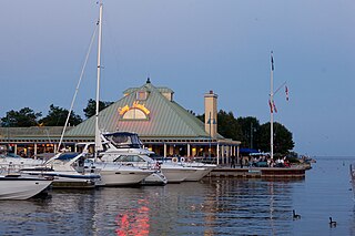
Bolton is an unincorporated town that is the most populous community in the town of Caledon, Ontario. It is located beside the Humber River in the Region of Peel, approximately 50 kilometres northwest of Toronto. In regional documents, it is referred to as a 'Rural Service Centre'. It has 26,795 residents in 9,158 total dwellings. The downtown area that historically defined the village is in a valley, through which flows the Humber River. The village extends on either side of the valley to the north and south.

<span class="mw-page-title-main">Brampton Centre (federal electoral district)</span> Federal electoral district in Ontario, Canada

Brampton Centre is a federal electoral district in Ontario, Canada, that is represented in the House of Commons of Canada. This riding was created in 1996 from parts of Brampton riding and in 2013, Elections Canada redistributed 3 ridings in the city of Brampton to bring back Brampton Centre. This was primarily due to large population increases in the Greater Toronto Area, and Peel Region in particular.

<span class="mw-page-title-main">Hurontario Street</span> Road in Ontario, Canada

Hurontario Street is a roadway running in Ontario, Canada between Lake Ontario at Mississauga and Lake Huron's Georgian Bay at Collingwood. Within Peel Region, it is a major urban thoroughfare within the cities of Mississauga and Brampton, which serves as the divide from which cross-streets are split into East and West, except at its foot in the historic Mississauga neighbourhood of Port Credit. Farther north, with the exception of the section through Simcoe County, where it forms the 8th Concession, it is the meridian for the rural municipalities it passes through. In Dufferin County, for instance, parallel roads are labelled as EHS or WHS for East of Hurontario Street.

<span class="mw-page-title-main">Brampton Fire and Emergency Services</span>

Brampton Fire and Emergency Services provides fire protection, technical rescue services, hazardous materials response, and first responder emergency medical assistance to the City of Brampton in the Peel Region of Ontario, Canada. It operates thirteen fire halls and coordinates with other emergency services in Peel Region and the Greater Toronto Area:

<span class="mw-page-title-main">History of Brampton</span>

Following is an outline is for the history of Brampton, the fourth largest city in Ontario, Canada. European settlers arrived began to settle the area in the early 19th century, with Brampton being formally incorporated into a village in 1853.

King's Highway 413, known as the GTA West Corridor or GTA West until 2021, is a proposed 400-series highway and bus transitway in the western Greater Toronto Area of the Canadian province of Ontario. The approximately 52-kilometre (32 mi) route is currently undergoing planning and analysis under an environmental impact assessment (EA) by both the Ministry of Transportation of Ontario (MTO) and the Government of Ontario, as well as the Impact Assessment Agency of Canada. If approved, a new four-to-six lane controlled-access highway would be built between the existing interchange of Highway 401 and the 407 ETR at the Halton–Peel boundary, and Highway 400 north of Vaughan. In addition, two new extensions would be built to connect Highway 410 and Highway 427 with Highway 413.

References

  1. "Regional Municipality of Peel (Code 3521) Census Profile". 2011 census . Government of Canada - Statistics Canada . Retrieved 2012-03-01.
  2. 1 2 2016 Census
  3. "Population Change - Economic Indicators - Region of Peel".
  4. "Regional Municipality of Peel (scanned map)". Map 21-6 [Southern Ontario]. Survey and Mapping Branch, Ministry of Natural Resources, Government of Ontario Canada. 1980. Archived from the original on 2010-05-28. Retrieved 2010-02-01.
  5. "That Name "PEEL" -- Where Did We Get It ?". A history of the Peel county: to mark its centenary. Brampton ON: County of Peel. 1967.
  6. An Act for better defining the limits of the Counties and Districts in Upper Canada, for erecting certain new Townships, for detaching Townships from some Counties and attaching them to others, and for other purposes relative to the division of Upper Canada into Townships, Counties and Districts , S.Prov.C. 1845, c. 7, Sch. B
  7. https://peelarchivesblog.com/about-peel/, The History of Peel Region, Ontario, Canada
  8. "Brampton's Beginning" in Brampton's 100th Anniversary as an Incorporated Town: 1873-1973, Brampton: The Corporation of the Town of Brampton and the Brampton Centennial Committee, 1973, originally published in Ross Cumming, ed., Historical Atlas of Peel County, n.p.: Walker and Miles, 1877.
  9. "Preserve Our Heritage: Lost Villages". Heritage Mississauga. Mississauga Heritage Foundation. Retrieved August 12, 2020.
  10. "Executive Management Team". Region of Peel website. Region of Peel, Ontario Canada. Retrieved 2022-05-03.
  11. Toronto Star , October 21, 2005
  12. Brampton Guardian , July 7, 2004
  13. ontla.on.ca Archived 2006-12-30 at the Wayback Machine
  14. "Regional Municipality of Peel Act, 2005". S.O. 2005, c. 20. Canadian Legal Information Institute. 2005. Retrieved 2006-07-05.
  15. "Peel Residents To Get Fairer Regional Representation" (Press release). Ontario Ministry of Municipal Affairs and Housing. 2005-06-13. Retrieved 2006-07-05.
  16. "Regional Municipality of Peel Act, 2005 S.o. 2005, chapter 20". Archived from the original on 2005-11-18.
  17. "Mayor's Update" (Press release). City of Mississauga, Ontario Canada. April 2004. Archived from the original on 2007-09-26. Retrieved 2006-07-07..
  18. "House Proceeding: Regional Municipality of Peel Act, 2005". 18:50 - 19:00. Debates of the Legislative Assembly of Ontario. Legislative Assembly of Ontario. 2005-04-26. Retrieved 2006-07-07.[ dead link ]
  19. Divell, Sabrina (2005-04-01). "Region will grind to a halt: Mayor". Brampton Guardian. p. 01. Archived from the original on 2006-09-06. Retrieved 2006-07-07.
  20. "Ford government to break up Peel Region within 3 years: source". CBC News. 2023-05-17. Retrieved 2023-05-18.
  21. "Brampton and Mississauga to become separate cities, source says". Toronto. 2023-05-17. Retrieved 2023-05-18.
  22. "No more Peel Region? Doug Ford supports 'an independent Mississauga'". thestar.com. 2023-05-15. Retrieved 2023-05-18.
  23. "Ontario announces break up of Peel Region, cities to become independent by 2025". ctvnews.ca. May 18, 2023. Retrieved May 19, 2023.
  24. "Ford government tables new bill to begin Peel Region split". City TV. 2023-05-18. Retrieved 2023-05-18.
  25. 1 2 DeClerq, Katherine (2023-05-20). "Ontario government to fast track bill separating Mississauga, Brampton and Caledon". CTV News . Retrieved 2023-06-09.
  26. 1 2 DeClerq, Katherine (2023-06-06). "Ontario government passes bill to dissolve Peel Region". CP24 . Retrieved 2023-06-09.
  27. "Peel Region breakup puts Doug Ford's housing goals at risk, says Brampton mayor" . Toronto Star. 2023-06-06. Retrieved 2023-06-12.
  28. "Ontario to break up Peel Region in 2025, but mayors signal it could be a nasty divorce". CBC News . 2023-05-18. Retrieved 2023-06-12.
  29. Brown, Patrick (2023-05-24). "Brampton must be fairly compensated for contributions to Peel Region". Toronto Star . Retrieved 2023-06-12.
  30. DeClerq, Katherine (2023-06-18). "Child of divorce: Caledon mayor says she didn't want to leave Peel Region". CP24 . Retrieved 2023-06-12.
  31. Jeff Burch, Critic of Municipal Affairs (2023-05-29). "Hazel McCallion Act (Peel Dissolution), 2023, Bill 112, Mr. Clark" (PDF). Parliamentary Debates (Hansard) . Vol. 81A. Province of Ontario: Legislative Assembly of Ontario. p. 4499.
  32. Fox, Chris (May 19, 2023). "Why some services may continue to be shared after Peel Region divorce". CTV News .
  33. Miller, Jason (May 22, 2023). "Peel Region divorce: Battle over police funding set to be a major sticking point as cities split" . Toronto Star .
  34. DeClerq, Katherine (2023-12-13). "Ontario reversing decision to dissolve Peel Region". CP24 . Retrieved 2023-12-14.
  35. 1 2 3 4 5 6 7 8 9 10 11 12 13 14 15 16 17 18 19 20 21 22 23 24 25 26 27 28 29 30 31 32 Auld, Heather; Switzman, Harris; Comer, Neil; Eng, Simon; Hazen, Shelley; Milner, Glenn (February 2016). "Climate Trends and Future Projections in the Region of Peel" (PDF). Ontario Climate Consortium. Archived from the original (PDF) on 16 June 2019. Retrieved 16 June 2019.
  36. "Lake Breeze Weather". Archived from the original on 4 March 2016.
  37. "Toronto Lester B. Pearson International Airport". 1981-2010 Canadian Climate Normals. Environment and Climate Change Canada . Retrieved 2013-07-10.
  38. "Daily Data Report for July 2011". Environment and Climate Change Canada. Retrieved 2022-05-13.
  39. "Daily Data Report for February 2017". Environment and Climate Change Canada. Retrieved March 29, 2017.
  40. "Daily Data Report for March 2012". Environment and Climate Change Canada. Retrieved November 25, 2018.
  41. "Hourly Data Report for February 20, 2018". Environment and Climate Change Canada. Retrieved 2022-05-13.
  42. "Hourly Data Report for June 30, 2018". Environment and Climate Change Canada. Retrieved 2022-05-13.
  43. "Daily Data Report for October 2019". Environment and Climate Change Canada. Retrieved 2022-05-13.
  44. "Daily Data Report for November 2022". Environment and Climate Change Canada. Retrieved 2022-11-07.
  45. "Albion Field Centre". 1981-2010 Canadian Climate Normals. Environment and Climate Change Canada. Retrieved 2016-05-12.
  46. Regional Municipality of Peel Services Police Board website Archived 2006-09-08 at the Wayback Machine on the division of policing between the OPP and Peel Regional Police.
  47. "Housing - Peel Living". Regional Municipality of Peel, Ontario Canada. 2007. Retrieved 2007-07-05.
  48. "2021 Community Profiles". 2021 Canadian Census . Statistics Canada. February 4, 2022. Retrieved 2022-04-27.
  49. "2011 Community Profiles". 2011 Canadian Census . Statistics Canada. March 21, 2019. Retrieved 2012-02-08.
  50. "2006 Community Profiles". 2006 Canadian Census . Statistics Canada. August 20, 2019.
  51. "2001 Community Profiles". 2001 Canadian Census . Statistics Canada. July 18, 2021.
  52. "Population and dwelling counts: Canada and census divisions". Statistics Canada. February 9, 2022. Retrieved April 2, 2022.
  53. 1 2 3 Government of Canada, Statistics Canada (2022-10-26). "Census Profile, 2021 Census of Population". www12.statcan.gc.ca. Retrieved 2023-01-11.
  54. Government of Canada, Statistics Canada (2021-10-27). "Census Profile, 2016 Census". www12.statcan.gc.ca. Retrieved 2023-01-11.
  55. 1 2 Government of Canada, Statistics Canada (2015-11-27). "NHS Profile". www12.statcan.gc.ca. Retrieved 2023-01-11.
  56. Government of Canada, Statistics Canada (2019-08-20). "2006 Community Profiles". www12.statcan.gc.ca. Retrieved 2023-01-11.
  57. 1 2 Government of Canada, Statistics Canada (2019-07-02). "2001 Community Profiles". www12.statcan.gc.ca. Retrieved 2023-01-11.
  58. Government of Canada, Statistics Canada (2019-03-29). "1991 Census Area Profiles Profile of Census Divisions and Subdivisions - Part B". www12.statcan.gc.ca. Retrieved 2023-03-16.
  59. Census Profile Peel, RM (Ontario)

Further reading