Craigsville, West Virginia

Last updated

Craigsville, West Virginia
CDP
Craigsville, West Virginia - panoramio - Idawriter.jpg
WVMap-doton-Craigsville.PNG
Location of Craigsville, West Virginia
Coordinates: 38°20′0″N80°38′34″W / 38.33333°N 80.64278°W / 38.33333; -80.64278
Country United States
State West Virginia
County Nicholas
Area
  Total6.1 sq mi (15.7 km2)
  Land6.1 sq mi (15.7 km2)
  Water0.0 sq mi (0.0 km2)
Elevation
2,313 ft (705 m)
Population
 (2010) [1]
  Total2,213
  Density360/sq mi (140/km2)
Time zone UTC-5 (Eastern (EST))
  Summer (DST) UTC-4 (EDT)
ZIP code
26205
Area code 304
FIPS code 54-18604 [2]
GNIS feature ID1550820 [3]

Craigsville is a census-designated place (CDP) in Nicholas County, West Virginia, United States. The population was 2,213 at the 2010 census. [1]

Contents

Geography

Craigsville is located at 38°20′0″N80°38′34″W / 38.33333°N 80.64278°W / 38.33333; -80.64278 (38.333389, -80.642766). [4]

According to the United States Census Bureau, the CDP has a total area of 6.1 square miles (15.7 km2), all land.

History

The community derives its name from James Craig, an original owner of the town site. [5]

Located near Craigsville is the Beaver Mill, listed on the National Register of Historic Places in 2001. [6]

Demographics

As of the census [2] of 2000, there were 2,204 people, 920 households, and 655 families residing in the CDP. The population density was 364.1 people per square mile (140.7/km2). There were 1,007 housing units at an average density of 166.4/sq mi (64.3/km2). The racial makeup of the CDP was 99.36% White, 0.09% African American, 0.27% Native American, 0.05% Asian, and 0.23% from two or more races. Hispanic or Latino of any race were 0.23% of the population.

There were 920 households, out of which 30.3% had children under the age of 18 living with them, 58.0% were married couples living together, 11.0% had a female householder with no husband present, and 28.7% were non-families. 25.9% of all households were made up of individuals, and 13.3% had someone living alone who was 65 years of age or older. The average household size was 2.40 and the average family size was 2.86.

In the CDP, the population was spread out, with 24.1% under the age of 18, 8.2% from 18 to 24, 26.1% from 25 to 44, 25.7% from 45 to 64, and 15.9% who were 65 years of age or older. The median age was 39 years. For every 100 females, there were 91.7 males. For every 100 females age 18 and over, there were 86.9 males.

The median income for a household in the CDP was $24,631, and the median income for a family was $30,612. Males had a median income of $28,606 versus $18,150 for females. The per capita income for the CDP was $13,233. About 15.4% of families and 19.8% of the population were below the poverty line, including 25.4% of those under age 18 and 3.9% of those age 65 or over.

Related Research Articles

<span class="mw-page-title-main">Edgemoor, Delaware</span> CDP in Delaware, United States

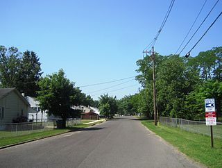
Edgemoor is a census-designated place in New Castle County, Delaware, United States. The population was 5,677 at the 2010 census.

Franklin Park is a census-designated place (CDP) in Broward County, Florida, United States. The population was 1,025 at the 2020 census.

<span class="mw-page-title-main">Lake Kathryn, Florida</span> Census-designated place in Florida

Lake Kathryn is a census-designated place (CDP) in Lake County, Florida, United States. The population was 920 at the 2010 census. The area is also known as Lake Kathryn Heights. It is part of the Orlando–Kissimmee Metropolitan Statistical Area.

<span class="mw-page-title-main">Golden Lakes, Florida</span> Unincorporated place in Florida, United States

Golden Lakes was a former census-designated place (CDP) and current unincorporated place in Palm Beach County, Florida, United States. The population was 6,694 at the 2000 census.

<span class="mw-page-title-main">Brookmont, Maryland</span> Census-designated place in Maryland, United States

Brookmont is a census-designated place and unincorporated area in Montgomery County, Maryland, United States. As of the 2020 census, it had a population of 3,751. Brookmont is often considered part of neighboring Bethesda because it falls within Bethesda's 20816 zip code.

<span class="mw-page-title-main">Pemberton Heights, New Jersey</span> Populated place in Burlington County, New Jersey, US

Pemberton Heights is an unincorporated community and census-designated place (CDP) located within Pemberton Township, in Burlington County, in the U.S. state of New Jersey. As of the 2010 United States Census, the CDP's population was 2,423.

<span class="mw-page-title-main">Imperial-Enlow, Pennsylvania</span> CDP in Pennsylvania, United States

Imperial-Enlow was a census-designated place (CDP) in Allegheny County, Pennsylvania, United States, for the 2000 census. The population at the time was 3,514. The 2010 census recognized two separate census-designated places, Imperial and Enlow.

<span class="mw-page-title-main">Atlantic, Pennsylvania</span> Census-designated place in Pennsylvania, United States

Atlantic is a census-designated place (CDP) in Crawford County, Pennsylvania, United States. The population was 77 at the 2010 census, up from 43 in 2000.

<span class="mw-page-title-main">Fairview Township, Mercer County, Pennsylvania</span> Township in Pennsylvania, United States

Fairview Township is a township in Mercer County, Pennsylvania, United States. The population was 950 at the 2020 census, a decline from the figure of 1,085 in 2010.

Arlington Heights is a census-designated place (CDP) in Monroe County, Pennsylvania, United States. The population was 6,331 at the 2020 census. One notable location in Arlington Heights is the Stroud Mall.

<span class="mw-page-title-main">Cecil-Bishop, Pennsylvania</span> CDP in Pennsylvania, United States

Cecil-Bishop is a census-designated place (CDP) in Washington County, Pennsylvania, United States. The population was 2,730 at the 2020 census. The census-designated place encompasses two unincorporated communities: larger Cecil in the west and smaller Bishop in the east.

Stonybrook-Wilshire was a census-designated place (CDP) in York County, Pennsylvania. The population was 5,414 at the 2000 census. The area was delineated as the Stonybrook CDP for the 2010 census.

Wade Hampton is a census-designated place (CDP) in Greenville County, South Carolina, United States. The population was 20,622 at the 2010 census. It is named for American Civil War general and South Carolina governor Wade Hampton.

<span class="mw-page-title-main">Willington, South Carolina</span> CDP in South Carolina, United States

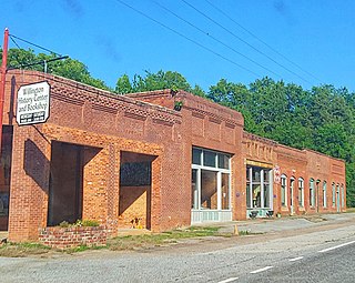
Willington is a census-designated place (CDP) in McCormick County, South Carolina, United States. The population was 177 at the 2000 census.

<span class="mw-page-title-main">Dentsville, South Carolina</span> Census-designated place in South Carolina, United States

Dentsville is a census-designated place (CDP) in Richland County, South Carolina, United States. The population was 14,062 at the 2010 census. It is part of the Columbia, South Carolina, Metropolitan Statistical Area.

<span class="mw-page-title-main">North San Pedro, Texas</span> CDP in Texas, United States

North San Pedro is a census-designated place (CDP) in Nueces County, Texas, United States. The population was 895 at the 2010 census, down from 920 at the 2000 census.

<span class="mw-page-title-main">South Willard, Utah</span> CDP in Utah, United States

South Willard is a census-designated place (CDP) in Box Elder County, Utah, United States. The population was 1,571 at the 2010 census.

<span class="mw-page-title-main">Fancy Gap, Virginia</span> CDP in Virginia, United States

Fancy Gap is a census-designated place (CDP) in Carroll County, Virginia. The population was 237 at the 2010 census.

<span class="mw-page-title-main">Spotsylvania Courthouse, Virginia</span> Unincorporated census-designated place in Virginia, United States

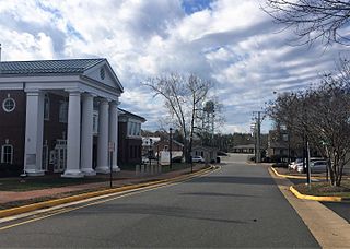
Spotsylvania Courthouse is a census-designated place (CDP) and the county seat of Spotsylvania County, Virginia, United States, located 10 miles (16 km) southwest of Fredericksburg. Recognized by the U.S. Census Bureau as a census designated place (CDP), the population was 4,239 at the 2010 census.

<span class="mw-page-title-main">Lochsloy, Washington</span> CDP in Washington, United States

Lochsloy is a census-designated place (CDP) in Snohomish County, Washington, United States. The population was 2,533 at the 2010 census.

References

  1. 1 2 "U.S. Census website". United States Census Bureau . Retrieved May 14, 2011.
  2. 1 2 "U.S. Census website". United States Census Bureau . Retrieved January 31, 2008.
  3. "US Board on Geographic Names". United States Geological Survey. October 25, 2007. Retrieved January 31, 2008.
  4. "US Gazetteer files: 2010, 2000, and 1990". United States Census Bureau. February 12, 2011. Retrieved April 23, 2011.
  5. Kenny, Hamill (1945). West Virginia Place Names: Their Origin and Meaning, Including the Nomenclature of the Streams and Mountains. Piedmont, WV: The Place Name Press. p. 189.
  6. "National Register Information System". National Register of Historic Places . National Park Service. July 9, 2010.