Crittenden, Kentucky

Last updated

Crittenden, Kentucky
Crittenden Kentucky City Hall.JPG
Crittenden City Hall
Kenton County Kentucky Incorporated and Unincorporated areas Crittenden Highlighted 2118568.svg
Location of Crittenden in Grant and Kenton counties.
Coordinates: 38°45′34″N84°37′18″W / 38.75944°N 84.62167°W / 38.75944; -84.62167
Country United States
State Kentucky
County Grant
Area
[1]
  Total3.43 sq mi (8.89 km2)
  Land3.40 sq mi (8.82 km2)
  Water0.03 sq mi (0.07 km2)
Elevation
[2]
925 ft (282 m)
Population
 (2020)
  Total4,023
  Estimate 
(2022) [3]
4,091
  Density1,181.50/sq mi (456.18/km2)
Time zone UTC-5 (Eastern (EST))
  Summer (DST) UTC-4 (EDT)
ZIP code
41030
Area code 859
FIPS code 21-18568
GNIS feature ID2404156 [2]
Website crittenden.ky.gov

Crittenden is a home rule-class city [4] in Grant and Kenton counties, Kentucky, in the United States. The population was 4,023 as of the 2020 Census, up from 3,815 as of the 2010 census, [5] which was further up from 2,401 at the 2000 census.

Contents

Geography

Crittenden US Post Office US Post Office Crittenden Kentucky.JPG
Crittenden US Post Office

Crittenden is located in northern Grant County. A small portion of the northern border of the city touches the Boone County line, and another part of the city extends north into Kenton County.

Interstate 75 passes through Crittenden, with access from Exit 166; I-75 leads north 27 miles (43 km) to Cincinnati and south 56 miles (90 km) to Lexington. U.S. Route 25 (Dixie Highway) is a local road running parallel to I-75 that passes through the center of Crittenden; US 25 leads north 7 miles (11 km) to Walton and south 11 miles (18 km) to Williamstown, the Grant County seat.

According to the United States Census Bureau, Crittenden has a total area of 3.4 square miles (8.9 km2), of which 0.03 square miles (0.07 km2), or 0.80%, is water. [5]

History

The area of what is now Crittenden may have been settled as early as 1812. The community was called "Pin Hook" until 1834, when it was renamed for Kentucky statesman and later governor John J. Crittenden. [6] [7] [8]

Demographics

Historical population
CensusPop.Note
1850 250
1860 29016.0%
1870 2951.7%
1880 3239.5%
1890 44036.2%
1900 199−54.8%
1910 189−5.0%
1920 185−2.1%
1930 26543.2%
1940 232−12.5%
1950 28723.7%
1960 2870.0%
1970 35925.1%
1980 59766.3%
1990 73122.4%
2000 2,401228.5%
2010 3,81558.9%
2020 4,0235.5%
2022 (est.)4,091 [9] 1.7%
U.S. Decennial Census [10]

As of the census [11] of 2000, there were 2,401 people, 870 households, and 634 families residing in the city. The population density was 1,055.8 inhabitants per square mile (407.6/km2). There were 990 housing units at an average density of 435.3 per square mile (168.1/km2). The racial makeup of the city was 98.21% White, 0.42% African American, 0.25% Native American, 0.17% Asian, 0.08% Pacific Islander, 0.33% from other races, and 0.54% from two or more races. Hispanic or Latino of any race were 1.25% of the population.

There were 870 households, out of which 46.7% had children under the age of 18 living with them, 55.5% were married couples living together, 12.4% had a female householder with no husband present, and 27.1% were non-families. 19.7% of all households were made up of individuals, and 3.8% had someone living alone who was 65 years of age or older. The average household size was 2.76 and the average family size was 3.19.

In the city, the population was spread out, with 32.5% under the age of 18, 12.0% from 18 to 24, 36.1% from 25 to 44, 15.0% from 45 to 64, and 4.4% who were 65 years of age or older. The median age was 28 years. For every 100 females, there were 95.5 males. For every 100 females age 18 and over, there were 91.4 males.

The median income for a household in the city was $40,944, and the median income for a family was $44,038. Males had a median income of $31,399 versus $24,556 for females. The per capita income for the city was $16,573. About 6.2% of families and 8.4% of the population were below the poverty line, including 10.1% of those under age 18 and 6.0% of those age 65 or over.

Related Research Articles

<span class="mw-page-title-main">Grant County, Kentucky</span> County in Kentucky, United States

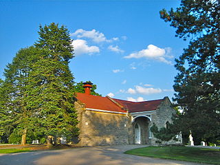
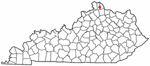
Grant County is a county located in the northern part of the U.S. state of Kentucky. As of the 2020 census, the population was 24,941. Its county seat is Williamstown. The county was formed in 1820 and named for Colonel John Grant, who led a party of settlers in 1779 to establish Grant's Station, in today's Bourbon County, Kentucky. Grant County is included in the Cincinnati-Middletown, OH-KY-IN Metropolitan Statistical Area. Grant County residents voted to allow full alcohol sales in the county by a margin of 56% to 44% in a special election on December 22, 2015. In the 19th century, Grant County had multiple saloons.

<span class="mw-page-title-main">Dycusburg, Kentucky</span> Unincorporated community in Kentucky, United States

Dycusburg is an unincorporated community in Crittenden County, Kentucky, United States. The population was 26 at the 2010 census.

<span class="mw-page-title-main">Marion, Kentucky</span> City in Kentucky, United States

Marion is a home rule-class city in Crittenden County, Kentucky, in the United States. It is the seat of its county. As of the 2010 census, the city population was 3,039.

<span class="mw-page-title-main">Bromley, Kentucky</span> City in Kentucky, United States

Bromley is a home rule-class city in Kenton County, Kentucky, United States, along the Ohio River. The population was 724 at the 2020 census. It is part of the Cincinnati metropolitan area.

<span class="mw-page-title-main">Edgewood, Kentucky</span> City in Kentucky, United States

Edgewood is a home rule–class city in Kenton County, Kentucky, United States. The population was 8,435 at the 2020 census. It was named for an early homestead in Walker Estates.

<span class="mw-page-title-main">Erlanger, Kentucky</span> City in Kentucky, United States

Erlanger is a home rule-class city in Kenton County, Kentucky, United States. It had a 2020 census population of 19,611. Erlanger is part of the Cincinnati-Middletown, OH-KY-IN Metropolitan Statistical Area.

<span class="mw-page-title-main">Fairview, Kenton County, Kentucky</span> City in Kentucky, United States

Fairview is a home rule-class city in Kenton County, Kentucky, United States. The city is a suburb of Cincinnati. It was incorporated by the state assembly in 1957 to avoid annexation by Covington. The population was 144 at the 2020 census.

<span class="mw-page-title-main">Fort Mitchell, Kentucky</span> City in Kentucky, United States

Fort Mitchell is a home rule-class city in Kenton County, Kentucky, United States. The population was 8,702 at the 2020 census. It is part of the Cincinnati metropolitan area.

<span class="mw-page-title-main">Fort Wright, Kentucky</span> City in Kentucky, United States

Fort Wright is a home rule-class city in Kenton County, Kentucky, in the United States. The population was 5,851 at the 2020 census. It is part of the Cincinnati metropolitan area.

<span class="mw-page-title-main">Independence, Kentucky</span> City in Kentucky, United States

Independence is a home rule-class city in Kenton County, Kentucky, United States. It is one of its county's two seats of government. The population was 28,676 at the time of the 2020 census. It is the third largest city in Northern Kentucky after Covington and Florence, and is part of the Cincinnati metropolitan area.

<span class="mw-page-title-main">Kenton Vale, Kentucky</span> City in Kentucky, United States

Kenton Vale is a home rule-class city in Kenton County, Kentucky, in the United States. The population was 105 at the 2020 census.

<span class="mw-page-title-main">Lakeside Park, Kentucky</span> City in Kentucky, United States

Lakeside Park is a home rule-class city in Kenton County, Kentucky, United States. As of the 2020 census, the city had a total population of 2,841. It is a suburb in the Cincinnati metropolitan area.

<span class="mw-page-title-main">Ludlow, Kentucky</span> City in Kentucky, United States

Ludlow is a home rule-class city in Kenton County, Kentucky, United States, along the Ohio River. The population was 4,385 at the 2020 census. It is a suburb of the Cincinnati metropolitan area. It received its greatest period of early growth as a rail station.

<span class="mw-page-title-main">Ryland Heights, Kentucky</span> City in Kentucky, United States

Ryland Heights is a home rule-class city in Kenton County, Kentucky, in the United States. The population was 922 at the 2020 census.

<span class="mw-page-title-main">Taylor Mill, Kentucky</span> City in Kentucky, United States

Taylor Mill is a home rule-class city in Kenton County, Kentucky, in the United States. The population was 6,873 at the 2020 census.

<span class="mw-page-title-main">Villa Hills, Kentucky</span> City in Kentucky, United States

Villa Hills is a home rule-class city in Kenton County, Kentucky along the Ohio River. The population was 7,310 at the 2020 census.

<span class="mw-page-title-main">Visalia, Kentucky</span> Unincorporated community in Kentucky, United States

Visalia was a city in Kenton County, Kentucky, United States. The population was 111 at the 2000 census. The city government was dissolved in November 2006.

<span class="mw-page-title-main">Concord, Kentucky</span> City in Kentucky, United States

Concord is a home rule-class city in Lewis County, Kentucky, in the United States. The population was 35 at the 2010 census. It is part of the Maysville Micropolitan Statistical Area.

<span class="mw-page-title-main">Kenton, Ohio</span> City in Ohio, United States

Kenton is a city in and the county seat of Hardin County, Ohio, United States, located in the west-central part of Ohio about 57 mi (92 km) northwest of Columbus and 70 mi (113 km) south of Toledo. Its population was 7,947 at the 2020 census. The city was named for frontiersman Simon Kenton of Kentucky and Ohio.

<span class="mw-page-title-main">Walton, Kentucky</span> City in Kentucky, United States

Walton is a home rule-class city in Boone and Kenton counties in the U.S. state of Kentucky. The population was 5,460 at the 2020 census.

References

  1. "2020 U.S. Gazetteer Files". United States Census Bureau. Retrieved March 18, 2022.
  2. 1 2 U.S. Geological Survey Geographic Names Information System: Crittenden, Kentucky
  3. "Annual Estimates of the Resident Population for Incorporated Places in Kentucky: April 1, 2020 to July 1, 2022". United States Census Bureau. Retrieved May 26, 2023.
  4. "Summary and Reference Guide to House Bill 331 City Classification Reform" (PDF). Kentucky League of Cities. Retrieved December 30, 2014.
  5. 1 2 "Geographic Identifiers: 2010 Demographic Profile Data (G001): Crittenden city, Kentucky". American Factfinder. U.S. Census Bureau. Retrieved December 8, 2016.[ dead link ]
  6. Hometown.com Crittenden
  7. Rennick, Robert M. (1987). Kentucky Place Names. University Press of Kentucky. p. 72. ISBN   0813126312 . Retrieved April 28, 2013.
  8. Gannett, Henry (1905). The Origin of Certain Place Names in the United States. Govt. Print. Off. pp.  96.
  9. "Annual Estimates of the Resident Population for Incorporated Places in Kentucky: April 1, 2020 to July 1, 2022". United States Census Bureau. Retrieved May 26, 2023.
  10. "Census of Population and Housing". Census.gov. Retrieved June 4, 2015.
  11. "U.S. Census website". United States Census Bureau . Retrieved January 31, 2008.