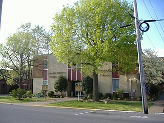
Crittenden County is a county in the U.S. state of Kentucky. At the 2010 census, the population was 9,315. Its county seat is Marion. The county was formed in 1842 and named for John J. Crittenden, senator and future Governor of Kentucky. It is a prohibition or dry county.
Allen County is a county located in the U.S. state of Kentucky. As of the 2010 census, the population was 19,956. Its county seat is Scottsville. The county is named for Colonel John Allen, a state senator and soldier who was killed leading the 1st Regiment of Kentucky Rifleman at the Battle of Frenchtown, Michigan during the War of 1812. Allen County practices the prohibition of alcohol and is a completely dry county. It was formed in 1815 from parts of Barren and Warren counties. Allen County is included in the Bowling Green, KY Metropolitan Statistical Area.

East Hempfield Township is a township in west-central Lancaster County, Pennsylvania, United States. At the 2010 census the population was 23,522.

Earle is a city in Crittenden County, Arkansas, United States. Buddy Nash is the mayor.. The population was 2,414 at the 2010 census, down from 3,036 at the 2000 census.

Horseshoe Lake is a town in Crittenden County, Arkansas, United States. The population was 264 at the 2020 census.

Jennette is a town in Crittenden and St. Francis counties, Arkansas, United States. The population was 115 at the 2010 census.

Spring Valley is a census-designated place (CDP) in the East County region of San Diego County, California. The population was 28,205 at the 2010 census.

Marion is a home rule-class city in Crittenden County, Kentucky, in the United States. It is the seat of its county. As of the 2010 census, the city population was 3,039.
Crittenden is a home rule-class city in Grant and Kenton counties, Kentucky, in the United States. The population was 3,815 as of the 2010 census, up from 2,401 at the 2000 census.

Russellville is a home rule-class city in Logan County, Kentucky, in the United States. It is the seat of its county. The population was 6,960 at the time of the 2010 census.

Brooklyn Park is a census-designated place (CDP) in Anne Arundel County, Maryland, United States. The population was 14,373 at the 2010 census.

North Syracuse is a village in Onondaga County, New York, United States. The population was 6,800 at the 2010 census. North Syracuse is located in the towns of Cicero and Clay, north of the city of Syracuse.

Emigsville is a census-designated place (CDP) in York County, Pennsylvania, United States. The population was 2,672 at the 2010 census.
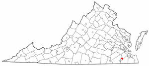
Windsor is an incorporated town in Isle of Wight County in the Hampton Roads region of southeastern Virginia in the United States. It is located near the crossroads of U.S. Route 460 and U.S. Route 258. The population was 2,626 at the 2010 census, up from 916 at the 2000 census.
The Crittenden Compromise was an unsuccessful proposal to permanently enshrine slavery in the United States Constitution, and thereby make it unconstitutional for future congresses to end slavery. It was introduced by United States Senator John J. Crittenden on December 18, 1860. It aimed to resolve the secession crisis of 1860–1861 that eventually led to the American Civil War by addressing the fears and grievances of Southern pro-slavery factions, and by quashing anti-slavery activities. The Crittenden Compromise is not to be confused with the Crittenden Resolution, which provided that the Union would take no actions against slavery.

USS Amesbury (DE-66/APD-46), a Buckley-class destroyer escort of the United States Navy, was named in honor of Lieutenant (jg) Stanton Morgan Amesbury (1916–1942), who was killed in action while flying from the aircraft carrier Ranger (CV-4) during Operation Torch in 1942.

Kentucky's 1st congressional district is a congressional district in the U.S. state of Kentucky. Located in Western Kentucky, the district takes in Henderson, Hopkinsville, Madisonville, Paducah and Murray. The district is represented by Republican James Comer who won a special election to fill the seat of Rep. Ed Whitfield who resigned in September 2016. Comer also won election to the regular term to begin January 3, 2017.
Chuckatuck Creek is a 13.3-mile-long (21.4 km) tributary of the James River in the U.S. state of Virginia. The creek rises in Isle of Wight County and flows southeast to Chuckatuck in the city of Suffolk, where it turns northeast as it passes under State Route 10/State Route 32. Becoming tidal, the creek continues northeast to the mouth of Brewers Creek, where it broadens considerably and becomes the boundary between Isle of Wight County and the city of Suffolk. If proceeds under the Crittenden Bridge at Crittenden and reaches the James River at Batten Bay.
The Crittenden Bridge, also known as the Chuckatuck Creek Bridge, is officially named The Sidney B. Hazelwood Sr. Bridge after a prominent member of the community. This bridge is part of U.S. Route 17 and connects Suffolk, Virginia with Isle of Wight County.
Crittenden is a small hamlet in the town of Alden in Erie County, New York, United States. In 1910 the Crittenden Creamery was located on Crittenden Road north of Genesee Street, Route 33. On January 31, 2011, the Crittenden Post Office 14038 was closed after 160 years of service. It was located at 3610 Crittenden Road.