Related Research Articles

Chesapeake is an independent city in Virginia, United States. At the 2020 census, the population was 249,422, making it the second-most populous city in Virginia, the tenth largest in the Mid-Atlantic, and the 89th-most populous city in the United States.

Hampton Roads is the name of both a body of water in the United States that serves as a wide channel for the James, Nansemond, and Elizabeth rivers between Old Point Comfort and Sewell's Point near where the Chesapeake Bay flows into the Atlantic Ocean, and the surrounding metropolitan region located in the southeastern Virginia and northeastern North Carolina portions of the Tidewater Region.

The James River is a river in Virginia that begins in the Appalachian Mountains and flows from the confluence of the Cowpasture and Jackson Rivers in Botetourt County 348 miles (560 km) to the Chesapeake Bay. The river length extends to 444 miles (715 km) if the Jackson River is included, the longer of its two headwaters. It is the longest river in Virginia. Jamestown and Williamsburg, Virginia's first colonial capitals, and Richmond, Virginia's current capital, lie on the James River.

"Tidewater" is a term for the north Atlantic Plain region of the United States.

The Elizabeth River is a 6-mile-long (10 km) tidal estuary forming an arm of Hampton Roads harbor at the southern end of Chesapeake Bay in southeast Virginia in the United States. It is located along the southern side of the mouth of the James River, between the cities of Portsmouth, Norfolk, and Chesapeake. Forming the core of the Hampton Roads harbor, it is heavily supported by its tributaries which depend upon it.

Suffolk is an independent city in Virginia, United States. As of 2020, the population was 94,324. It is the 10th-most populous city in Virginia, the largest city in Virginia by boundary land area as well as the 14th-largest in the country. Suffolk is located in the Hampton Roads metropolitan area. This also includes the independent cities of Chesapeake, Hampton, Newport News, Norfolk, Portsmouth, and Virginia Beach, and smaller cities, counties, and towns of Hampton Roads. With miles of waterfront property on the Nansemond and James rivers, present-day Suffolk was formed in 1974 after consolidating with Nansemond County and the towns of Holland and Whaleyville. The current mayor is Mike Duman.

The Monitor–Merrimac Memorial Bridge–Tunnel (MMMBT) is the 4.6-mile-long (7.4 km) Hampton Roads crossing for Interstate 664 (I-664) in the southeastern portion of Virginia in the United States. It is a four-lane bridge–tunnel composed of bridges, trestles, artificial islands, and tunnels under a portion of the Hampton Roads harbor where the mouths of the James, Nansemond, and Elizabeth rivers come together.

South Hampton Roads is a region located in the extreme southeastern portion of Virginia's Tidewater region in the United States with a total population of 1,191,937. It is part of the Virginia Beach-Norfolk-Newport News, VA-NC MSA, which itself has a population of 1,724,876.
The area around Suffolk, Virginia, which is now an independent city in the Hampton Roads region in the southeastern part of the state, was originally inhabited by Native Americans. At the time of European contact, the Nansemond people lived along the river later known by the same name. The area was first explored by Jamestown colonists led by explorer John Smith soon after the settlements founding in 1607, seeking means to survive the inhospitable environment at Jamestown Island.

Nansemond is an extinct jurisdiction that was located south of the James River in Virginia Colony and in the Commonwealth of Virginia in the United States, from 1646 until 1974. It was known as Nansemond County until 1972. From 1972 to 1974, a period of eighteen months, it was the independent city of Nansemond. It is now part of the independent city of Suffolk.
Tidewater Community College (TCC) is a public community college in South Hampton Roads, Virginia, with campuses in Chesapeake, Norfolk, Portsmouth, Suffolk, and Virginia Beach. It is part of the Virginia Community College System and is accredited by the Southern Association of Colleges and Schools Commission on Colleges to award the associate degree.
Western Branch is a community located in the independent city of Chesapeake, Virginia in the United States. It is located in the South Hampton Roads region and consists of generally low-lying sandy terrain of the coastal plain. Its namesake, the western branch of the Elizabeth River, defines the area's eastern boundary. Western Branch is the northernmost borough of Chesapeake.
Holland, Virginia was an incorporated town in the southwestern section of Nansemond County, Virginia. Since 1974, it has been a community in the independent city of Suffolk, Virginia following a political consolidation which formed Virginia's largest city in geographic area.

Driver is a neighborhood in the independent city of Suffolk, Virginia, United States. It is located at the junction of State Route 337, State Route 125, and State Route 627.

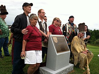
The Nansemond River is a 19.8-mile-long (31.9 km) tributary of the James River in Virginia in the United States. Virginian colonists named the river for the Nansemond tribe of Native Americans, who had long inhabited the area. They continue as a federally recognized tribe in Virginia.
Whaleyville is a neighborhood of Suffolk, Virginia, United States. It was formerly an incorporated town located in southern Nansemond County, Virginia. Whaleyville is located midway between the former county seat at downtown Suffolk and the North Carolina border along U.S. Route 13.

Bennett Creek or Bennett's Creek is a 7.3-mile-long (11.7 km) tributary of the Nansemond River in Suffolk, Virginia.
USS Stepping Stones was a steamer purchased by the Union Navy during the early part of the American Civil War.

The Nansemond River Bridge, officially the Mills E. Godwin Bridge, is located in the independent city of Suffolk, Virginia and carries U.S. Route 17 across the Nansemond River.
Oak Grove United Methodist Church is located in Chesapeake, Virginia, and is known as "the mother of all Methodist congregations in Hampton Roads". It has helped found four other Methodist churches in the area: Community United Methodist, Great Bridge United Methodist, Messiah United Methodist, and Oaklette United Methodist It is located on the corner of North Battlefield and Great Bridge boulevards, and was the fourth Methodist church established in the Northampton County. The church's history dates back to the 1700s, and since then the church has established a wide variety of ministries and has been declared a historical structure. The church follows Methodism, a movement started by John Wesley in an effort to reform the Church of England from within.
References
- 1 2 "Suffolk man asking city for help with flooded backyard". 8 February 2016.
- ↑ Harris M. Lentz III (20 May 2014). Obituaries in the Performing Arts, 2013. McFarland. pp. 16–. ISBN 978-0-7864-7665-7.
- ↑ "What's in a name? | Pughsville, Chesapeake-Suffolk | Hampton Roads History". pilotonline.com. Retrieved 2017-12-28.
- ↑ Congress of Industrial Organizations (U.S.) (1940). Proceedings of the Constitutional Convention of the Congress of Industrial Organizations.
- ↑ "Seatrade". Seatrade Publications. 11 June 1981 – via Google Books.
Neighborhoods and municipalities of Suffolk, Virginia | ||
|---|---|---|
| Boroughs | 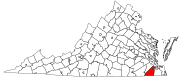 | |
| Neighborhoods | ||
36°50′53″N76°26′36″W / 36.84806°N 76.44333°W
| | This Virginia-related article is a stub. You can help Wikipedia by expanding it. |