
Hood County is a county located on the Edwards Plateau in the U.S. state of Texas. As of the 2020 census, the population was 61,598. Its county seat is Granbury. The county is named for John Bell Hood, a Confederate lieutenant general and the commander of Hood's Texas Brigade.
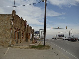
Granbury is a city in and the county seat of Hood County, Texas, United States. As of the 2020 census, the city's population was 10,958, and it is the principal city of the Granbury micropolitan statistical area. Granbury is named after Confederate General Hiram B. Granbury.

Oak Trail Shores is an unincorporated community and census-designated place (CDP) in Hood County, Texas, United States. Its population was 2,755 at the 2010 census. It is part of the Granbury micropolitan area as well as the Dallas–Fort Worth metroplex.

Pecan Plantation is an unincorporated community and census-designated place (CDP) in southeastern Hood County, Texas, United States. Its population was 5,294 at the 2010 census, up from 3,544 at the 2000 census. It is part of the Granbury, Texas, micropolitan statistical area.
Hudson Oaks is a city in Parker County, Texas, United States located in the Dallas-Fort Worth Metroplex. The population was 2,174 in 2020.

Benbrook is a town located in the southwestern corner of Tarrant County, Texas, United States, and a suburb of Fort Worth. As of the 2010 United States census, the population was 21,234, reflecting an increase of 1,026 from the 20,208 counted in the 2000 census, which had in turn increased by 644 from the 19,564 counted in the 1990 census.

Dalworthington Gardens is a city in Tarrant County, Texas, United States and a suburb of Arlington. Its population was 2,259 at the 2010 census.

Everman is a city in Tarrant County, Texas, United States. Its population was 6,154 in the 2020 census, an increase over the figure of 6,108 tabulated in 2010.

Forest Hill is a suburb of Fort Worth in Tarrant County, Texas, United States. The population was 12,355 at the 2010 census.

Haltom City is a city, part of the Dallas–Fort Worth region, in Tarrant County, Texas, United States. Its population was 46,073 at the 2020 census. Haltom City is an inner suburb of Fort Worth, a principal city of the DFW Metroplex. The city is six miles from downtown Fort Worth, 30 miles from the American Airlines Center in Dallas, and 20 miles from the Dallas/Fort Worth International Airport. Haltom City is surrounded almost entirely by Fort Worth, North Richland Hills, Watauga, and Richland Hills.

North Richland Hills, commonly known as NRH, is a city inside Tarrant County, Texas, United States, and a mid-to-high end suburb of Fort Worth. The population was 69,917 at the 2020 census, making it the third largest city in Tarrant County. In 2006, North Richland Hills was selected as one of the “Top 100 Best Places to live in America” according to Money magazine, and in 2016, the Dallas Morning News ranked North Richland Hills #9 on its list of best Dallas–Fort Worth neighborhoods. Major streets and highways include: FM 1938, Mid Cities Boulevard, Bedford-Euless Road, Interstate Highway 820, North Tarrant Parkway, FM 3029, and TX SH 26. It is home to the Birdville Independent School District, and the northern portion is served by Keller ISD.

Pantego is a town in Tarrant County, Texas, United States. Its population was 2,394 at the 2010 census. It is entirely surrounded by the cities of Arlington and Dalworthington Gardens. It is in the middle of the Dallas–Fort Worth metroplex, a metropolitan area spanning several counties.

Westworth Village is a city in Tarrant County, Texas, United States. The population was 2,472 at the 2010 census.

The Dallas–Fort Worth metroplex, officially designated Dallas–Fort Worth–Arlington by the U.S. Office of Management and Budget, is a metropolitan statistical area in the U.S. state of Texas encompassing 11 counties. Its core cities are Dallas and Fort Worth. It is the economic and cultural hub of North Texas. Residents of the area also refer to it as DFW, or the Metroplex. The Dallas–Fort Worth–Arlington metropolitan statistical area's population was 7,637,387 according to the U.S. Census Bureau's 2020 census, making it the most populous metropolitan area in both Texas and the Southern United States, the fourth-largest in the U.S., and the tenth-largest in the Americas. In 2016, the Dallas–Fort Worth metroplex had the highest annual population growth in the United States.
Acton is a small unincorporated community located approximately seven miles (11 km) due east of Granbury on the Brazos River in Hood County, Texas, United States. Acton was formerly called Commanche Peak and was later renamed to Acton, possibly after the old English word meaning "oak town", a reference to the large stands of oak trees in the vicinity.
Stockton Bend, formerly Brazos Bend, is a city in Hood County, Texas, United States. It was incorporated in May 2004 originally as "Brazos Bend", and is located along the main stem of the Brazos River. As of the 2020 census it had a population of 380. The city is part of the Granbury, Texas Micropolitan Statistical Area. The name was recently changed to "Stockton Bend".
Cresson is a city located at the corners of Hood, Johnson, and Parker counties in the U.S. state of Texas. It is located at the intersection of U.S. Highway 377 and State Highway 171, 25 miles (40 km) southwest of Fort Worth. Incorporated in 2001, Cresson had a population of 741 at the 2010 census. By 2020, it had a population of 1,349.
Granbury Independent School District is a public school district based in Granbury, Texas (USA).

The De Cordova Bend Dam is a man-made dam on the Brazos River in Hood County, Texas, United States, controlled by the Brazos River Authority. De Cordova Bend Dam forms the 8,300-acre (34 km2) Lake Granbury. The dam is so named because of the clockwise almost-complete loop in the Brazos River named De Cordova Bend after Jacob De Cordova.

The Granbury micropolitan statistical area, as defined by the United States Census Bureau, was an area consisting of two counties in North Central Texas, anchored by the city of Granbury. In 2013, though, the Office of Management and Budget reclassified the area as a part of the Fort Worth-Arlington metropolititan division within the Dallas-Fort Worth-Arlington metropolitan area.

