
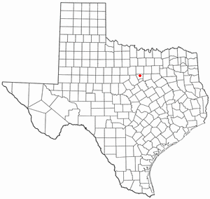
Hood County is a county located on the Edwards Plateau in the U.S. state of Texas. As of the 2020 census, the population was 61,598. Its county seat is Granbury. The county is named for John Bell Hood, a Confederate lieutenant general and the commander of Hood's Texas Brigade.

Bosque County is a county located on the Edwards Plateau in the U.S. state of Texas. As of the 2020 census, the population was 18,235. Its county seat is Meridian, while Clifton is the largest city and the cultural/financial center of the county. The county is named for the Bosque River, which runs through the center of the county north to south. The Brazos River makes up the eastern border along with the Lake Whitney reservoir it feeds.
Wallis is a city in far southeastern Austin County, Texas, United States. The city is located along State Highway 36 (SH 36) and the BNSF Railway between Rosenberg and Sealy. The city's population was 1,252 at the 2010 census.

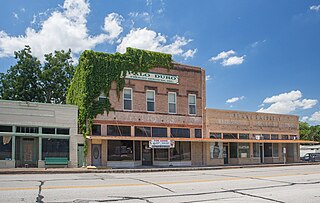
Gatesville is a city in and the county seat of Coryell County, Texas, United States. Its population was 16,135 at the 2020 census. The city has five of the nine prisons and state jails for women operated by the Texas Department of Criminal Justice. One of the facilities, the Mountain View Unit, has the state's death row for women.

Orchard is a city in western Fort Bend County, Texas, United States, within the Houston–Sugar Land–Baytown metropolitan area. The community is located along State Highway 36 (SH 36) and the BNSF Railway between Rosenberg in Fort Bend County and Wallis in Austin County. The population was 352 at the 2010 census, down from 408 at the 2000 census.

Richmond is a city in and the county seat of Fort Bend County, Texas, United States. The city is located within the Houston–The Woodlands–Sugar Land metropolitan area. As of the 2019 U.S. census, the city population was 12,578.

Rosenberg is a city in the U.S. state of Texas, within the Houston–The Woodlands–Sugar Land metropolitan area and Fort Bend County. The population was 30,618 at the 2010 census, up from 24,043 at the 2000 census. As of 2019, the population had risen to an estimated 38,307. The community holds the Fort Bend County fair in October. Rosenberg is adjacent to the city of Richmond, the Fort Bend County seat.
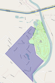
Granbury is a city in and the county seat of Hood County, Texas, United States. As of the 2020 census, the city's population was 10,958, and it is the principal city of the Granbury micropolitan statistical area. Granbury is named after Confederate General Hiram B. Granbury.
Oak Trail Shores is an unincorporated community and census-designated place (CDP) in Hood County, Texas, United States. Its population was 2,755 at the 2010 census. It is part of the Granbury micropolitan area as well as the Dallas–Fort Worth metroplex.

Pecan Plantation is an unincorporated community and census-designated place (CDP) in southeast Hood County, Texas, United States. Its population was 5,294 at the 2010 census, up from 3,544 at the 2000 census. It is part of the Granbury, Texas, micropolitan statistical area.
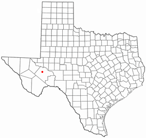
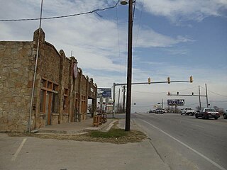
Fort Stockton is a city in and the county seat of Pecos County, Texas, United States. It is located on Interstate 10, future Interstate 14, U.S. Highways 67, 285, and 385, and the Santa Fe Railroad, 329 mi (529 km) northwest of San Antonio and 240 mi (390 km) east of El Paso.

East Bernard is a city in Wharton County, Texas, United States. The population was 2,272 at the 2010 census. U.S. Highway 90 Alternate (US 90A) and Texas State Highway 60 (SH 60) intersect within the city limits. East Bernard has its own school district, two auto dealerships and a number of other businesses. The San Bernard River flows past the city's eastern side.
Acton is a small unincorporated community located about seven miles (11 km) due east of Granbury on the Brazos River in Hood County, Texas, United States. Acton was formerly called Commanche Peak and was later renamed to Acton, possibly after the old English word meaning "oak town", a reference to the large stands of oak trees in the vicinity.

DeCordova is a city in Hood County, Texas, United States. As of the US 2018 Population estimates it has a population of 3169.
Cresson is a city located at the corners of Hood, Johnson, and Parker counties in the U.S. state of Texas. It is located at the intersection of U.S. Highway 377 and State Highway 171, 25 miles (40 km) southwest of Fort Worth. Incorporated in 2001, Cresson had a population of 741 at the 2010 census.

Kurten is a town located along U.S. Highway 190 in Brazos County, Texas, United States. As of the 2010 census, it had a population of 398. It was incorporated in 2000 and is part of the Bryan–College Station metropolitan area.
Brazos Country is a residential community in Austin County, Texas.

The De Cordova Bend Dam is a man-made dam on the Brazos River in Hood County, Texas, United States, controlled by the Brazos River Authority. De Cordova Bend Dam forms the 8,300-acre (34 km2) Lake Granbury. The dam is so named because of the clockwise almost-complete loop in the Brazos River named De Cordova Bend after Jacob De Cordova.

The Granbury micropolitan statistical area, as defined by the United States Census Bureau, was an area consisting of two counties in North Central Texas, anchored by the city of Granbury. In 2013, though, the Office of Management and Budget reclassified the area as a part of the Fort Worth-Arlington metropolititan division within the Dallas-Fort Worth-Arlington metropolitan area.
Canyon Creek is an unincorporated community and census-designated place (CDP) in Hood County, Texas, United States. The population was 916 at the 2010 census. It is part of the Granbury micropolitan area as well as the Dallas–Fort Worth metroplex.


