Dean, Texas

Last updated

Dean, Texas
TXMap-doton-Dean.PNG
Location of Dean, Texas
Clay County Dean.svg
Coordinates: 33°55′41″N98°22′45″W / 33.92806°N 98.37917°W / 33.92806; -98.37917
Country United States
State Texas
County Clay
Area
[1]
  Total2.14 sq mi (5.55 km2)
  Land2.13 sq mi (5.52 km2)
  Water0.01 sq mi (0.03 km2)
Elevation
961 ft (293 m)
Population
 (2010)
  Total493
  Estimate 
(2019) [2]
463
  Density217.47/sq mi (83.95/km2)
Time zone UTC-6 (Central (CST))
  Summer (DST) UTC-5 (CDT)
FIPS code 48-19456 [3]
GNIS feature ID1355784 [4]

Dean is a city in Clay County, Texas, United States. It is part of the Wichita Falls, Texas Metropolitan Statistical Area. The population was 493 at the 2010 census. [5]

Contents

Geography

Dean is located in northwestern Clay County at 33°55′41″N98°22′45″W / 33.92806°N 98.37917°W / 33.92806; -98.37917 (33.928071, –98.379255). [6] Texas State Highway 79 passes through the community, leading southwest 10 miles (16 km) to Wichita Falls and northeast 8 miles (13 km) to Petrolia.

According to the United States Census Bureau, Dean has a total area of 2.1 square miles (5.5 km2), of which 0.01 square miles (0.03 km2), or 0.56%, is water. [5]

Demographics

Historical population
CensusPop.Note
1980 212
1990 27730.7%
2000 34123.1%
2010 49344.6%
2019 (est.)463 [2] −6.1%
U.S. Decennial Census [7]

As of the census [3] of 2000, there were 341 people, 131 households, and 105 families residing in the city. The population density was 159.2 inhabitants per square mile (61.5/km2). There were 136 housing units at an average density of 63.5 per square mile (24.5/km2). The racial makeup of the city was 95.60% White, 0.88% African American, 0.29% Native American, 2.05% from other races, and 1.17% from two or more races. Hispanic or Latino of any race were 5.28% of the population.

There were 131 households, out of which 31.3% had children under the age of 18 living with them, 65.6% were married couples living together, 10.7% had a female householder with no partner present, and 19.8% were non-families. 17.6% of all households were made up of individuals, and 9.2% had someone living alone who was 65 years of age or older. The average household size was 2.60 and the average family size was 2.90.

In the city, the population was spread out, with 25.5% under the age of 18, 5.6% from 18 to 24, 30.2% from 25 to 44, 25.5% from 45 to 64, and 13.2% who were 65 years of age or older. The median age was 39 years. For every 100 females, there were 94.9 males. For every 100 females age 18 and over, there were 91.0 males.

The median income for a household in the city was $45,568, and the median income for a family was $47,813. Males had a median income of $36,875 versus $19,844 for females. The per capita income for the city was $16,521. About 8.2% of families and 7.8% of the population were below the poverty line, including 1.8% of those under age 18 and 9.7% of those age 65 or over.

Education

Dean is served by the Petrolia Independent School District, [8] including Petrolia High School.

Related Research Articles

<span class="mw-page-title-main">Clay County, Texas</span> County in Texas, United States

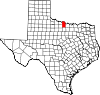
Clay County is a county located in the U.S. state of Texas. As of the 2020 census, its population was 10,218. The county seat is Henrietta. The county was founded in 1857 and later organized in 1860. It is named in honor of Henry Clay, famous American statesman, Kentucky Senator and United States Secretary of State.

<span class="mw-page-title-main">Palm River-Clair Mel, Florida</span> Census-designated place in Florida, United States

Palm River-Clair Mel is a census-designated place (CDP) in Hillsborough County, Florida, United States. The population was 21,024 at the 2010 census, up from 17,589 at the 2000 census. The census area includes the unincorporated communities of Clair-Mel City and Palm River. The ZIP code for Palm River-Clair Mel is 33619.

<span class="mw-page-title-main">Gillett Grove, Iowa</span> City in Iowa, United States

Gillett Grove is a city in Clay County, Iowa, United States. The population was 30 in the 2020 census, a decline from 55 in 2000.

<span class="mw-page-title-main">Wellsburg, Iowa</span> City in Iowa, United States

Wellsburg is a city in Grundy County, Iowa, United States. The population was 720 at the 2020 census, a slight increase from 716 in 2000. It is part of the Waterloo–Cedar Falls Metropolitan Statistical Area. The city is named for George Wells, an early settler in the region.

<span class="mw-page-title-main">Miller, Nebraska</span> Village in Nebraska, United States

Miller is a village in Buffalo County, Nebraska, United States. It is part of the Kearney, Nebraska Micropolitan Statistical Area. As of the 2010 census, the village population was 136.

<span class="mw-page-title-main">Randolph, Nebraska</span> City in Nebraska, United States

Randolph is a city in Cedar County, Nebraska, United States. The population was 881 at the 2020 census. It refers to itself as "The Honey Capital of the Nation" due to the per-capita number of bee keeping families.

<span class="mw-page-title-main">Fairfield, Nebraska</span> City in Nebraska, United States

Fairfield is a city in Clay County, Nebraska, United States. The population was 387 at the 2010 census. It is part of the Hastings, Nebraska Micropolitan Statistical Area.

Scio is a town in Allegany County, New York, United States. The population was 1,625 at the 2020 census. The town is in the southern half of the county and north of the village of Wellsville.

<span class="mw-page-title-main">Fairview, Butler County, Pennsylvania</span> Borough in Pennsylvania, United States

Fairview is a borough in Butler County, Pennsylvania, United States. The population was 198 at the 2010 census. It should not be confused with Fairview in Erie County, which carries the ZIP code 16415.

<span class="mw-page-title-main">Petrolia, Pennsylvania</span> Borough in Pennsylvania, United States

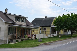
Petrolia is a borough in Butler County, Pennsylvania, United States. The population was 212 at the 2010 census.

<span class="mw-page-title-main">South Shore, South Dakota</span> Town in South Dakota, United States

South Shore is a town in Codington County, South Dakota, United States. The population was 189 at the 2020 census. It is part of the Watertown, South Dakota Micropolitan Statistical Area.

<span class="mw-page-title-main">Jourdanton, Texas</span> City in Texas, United States

Jourdanton is a city in and the county seat of Atascosa County, Texas, United States. The population is 4,094. It is part of the San Antonio metropolitan statistical area. The mayor is Robert "Doc" Williams. The city manager is Bobby J. Martinez. The police chief is Eric Kaiser. The fire chief is Jay Fojtik.

<span class="mw-page-title-main">Bellevue, Texas</span> City in Texas, United States

Bellevue is a city in Clay County, Texas, United States. It is part of the Wichita Falls metropolitan statistical area. The population was 362 at the 2010 census.

<span class="mw-page-title-main">Byers, Texas</span> City in Texas, United States

Byers is a city in Clay County, Texas, United States. It is part of the Wichita Falls, Texas Metropolitan Statistical Area. The population was 496 at the 2010 census.

<span class="mw-page-title-main">Jolly, Texas</span> City in Texas, United States

Jolly is a city in Clay County, Texas, United States. It is part of the Wichita Falls, Texas Metropolitan Statistical Area. The population was 172 at the 2010 census.

<span class="mw-page-title-main">Petrolia, Texas</span> City in Texas, United States

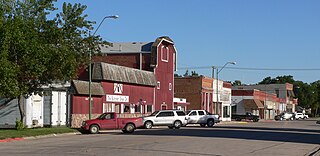
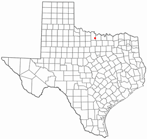
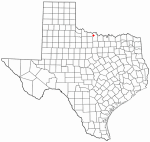
Petrolia is a city in Clay County, Texas, United States. It is part of the Wichita Falls, Texas Metropolitan Statistical Area. The population was 686 at the 2010 census, down from 782 at the 2000 census.

<span class="mw-page-title-main">Navarro, Texas</span> Town in Texas, United States

Navarro is a town in Navarro County, Texas, United States. The population was 210 at the 2010 census.

<span class="mw-page-title-main">Mingus, Texas</span> City in Texas, United States

Mingus is a city in Palo Pinto County, Texas, United States. The population was 235 at the 2010 census.

<span class="mw-page-title-main">Halifax, Virginia</span> Town in Virginia, United States

Halifax is a town in Halifax County, Virginia, United States, along the Banister River. The population was 1,309 at the 2010 census. It is the county seat of Halifax County.

<span class="mw-page-title-main">Summersville, Missouri</span> City in Missouri, United States

Summersville is a city in Shannon and Texas counties in the U.S. state of Missouri. The population was 453 at the 2020 census.

References

  1. "2019 U.S. Gazetteer Files". United States Census Bureau. Retrieved August 7, 2020.
  2. 1 2 "Population and Housing Unit Estimates". United States Census Bureau. May 24, 2020. Retrieved May 27, 2020.
  3. 1 2 "U.S. Census website". United States Census Bureau . Retrieved January 31, 2008.
  4. "US Board on Geographic Names". United States Geological Survey. October 25, 2007. Retrieved January 31, 2008.
  5. 1 2 "Geographic Identifiers: 2010 Census Summary File 1 (G001): Dean city, Texas". U.S. Census Bureau, American Factfinder. Archived from the original on February 13, 2020. Retrieved July 29, 2015.
  6. "US Gazetteer files: 2010, 2000, and 1990". United States Census Bureau. February 12, 2011. Retrieved April 23, 2011.
  7. "Census of Population and Housing". Census.gov. Retrieved June 4, 2015.
  8. "SCHOOL DISTRICT REFERENCE MAP (2010 CENSUS): Clay County, TX" (PDF). 2010 U.S. Census . U.S. Census Bureau . Retrieved November 5, 2019.