Delmont, South Dakota | |
---|---|
Coordinates: 43°16′00″N98°09′33″W / 43.26667°N 98.15917°W | |
Country | United States |
State | South Dakota |
County | Douglas |
Incorporated | 1913 [1] |
Area | |
• Total | 0.76 sq mi (1.98 km2) |
• Land | 0.76 sq mi (1.98 km2) |
• Water | 0.00 sq mi (0.00 km2) |
Elevation | 1,480 ft (450 m) |
Population | |
• Total | 153 |
• Density | 200.52/sq mi (77.42/km2) |
Time zone | UTC-6 (Central (CST)) |
• Summer (DST) | UTC-5 (CDT) |
ZIP code | 57330 |
Area code | 605 |
FIPS code | 46-16060 [5] |
GNIS feature ID | 1267352 [3] |
Delmont is a city in southeastern Douglas County, South Dakota, United States. The population was 153 at the 2020 census. [6]
Delmont was laid out in 1886. [7]
According to the United States Census Bureau, the city has a total area of 0.76 square miles (1.97 km2), all land. [8]
Census | Pop. | Note | %± |
---|---|---|---|
1910 | 369 | — | |
1920 | 518 | 40.4% | |
1930 | 472 | −8.9% | |
1940 | 461 | −2.3% | |
1950 | 405 | −12.1% | |
1960 | 363 | −10.4% | |
1970 | 260 | −28.4% | |
1980 | 290 | 11.5% | |
1990 | 235 | −19.0% | |
2000 | 263 | 11.9% | |
2010 | 234 | −11.0% | |
2020 | 153 | −34.6% | |
U.S. Decennial Census [9] [4] |
At the 2010 census, [10] there were 234 people, 110 households and 61 families residing in the city. The population density was 307.9 per square mile (118.9/km2). There were 141 housing units at an average density of 185.5 per square mile (71.6/km2). The racial make-up was 83.3% White, 3.0% African American, 9.0% Native American, 1.7% from other races, and 3.0% from two or more races. Hispanic or Latino of any race were 3.4% of the population.
There were 110 households, of which 22.7% had children under the age of 18 living with them, 46.4% were married couples living together, 5.5% had a female householder with no husband present, 3.6% had a male householder with no wife present, and 44.5% were non-families. 37.3% of all households were made up of individuals, and 19.1% had someone living alone who was 65 years of age or older. The average household size was 2.13 and the average family size was 2.87.
The median age was 50.7 years. 20.5% of residents were under the age of 18; 6.4% were between the ages of 18 and 24; 15.8% were from 25 to 44; 34.2% were from 45 to 64; and 23.1% were 65 years of age or older. The gender makeup of the city was 53.4% male and 46.6% female.
At the 2000 census, [5] there were 263 people, 114 households and 68 families residing in the city. The population density was 345.7 per square mile (133.5/km2). There were 133 housing units at an average density of 174.8 per square mile (67.5/km2). The racial make-up was 91.63% White, 7.60% Native American, 0.38% Asian, and 0.38% from two or more races. Hispanic or Latino of any race were 0.76% of the population.
There were 114 households, of which 26.3% had children under the age of 18 living with them, 50.9% were married couples living together, 6.1% had a female householder with no husband present, and 39.5% were non-families. 35.1% of all households were made up of individuals, and 18.4% had someone living alone who was 65 years of age or older. The average household size was 2.31 and the average family size was 3.04.
25.1% of the population were under the age of 18, 6.1% from 18 to 24, 22.8% from 25 to 44, 24.3% from 45 to 64, and 21.7% who were 65 years of age or older. The median age was 43 years. For every 100 females, there were 90.6 males. For every 100 females age 18 and over, there were 89.4 males.
The median household income was $23,750 and the median family income was $33,000. Males had a median income of $24,583 and females $16,667. The per capita income was $12,385. About 18.2% of families and 19.6% of the population were below the poverty line, including 20.7% of those under the age of eighteen and 17.5% of those 65 or over.
On 10 May 2015, Delmont was hit by a strong EF2 tornado. [11] It cut a path through the western side of town, destroying many buildings. The destruction included Zion Lutheran Church, which was more than a century old. [12] Governor Dennis Daugaard declared a state of emergency and alerted the National Guard to help with clean-up efforts. [13] Despite the scale of the damage, only nine people were injured and no one was killed. In June 2015, the mayor said that half of the town's residents would not come back and rebuild. [14]
Oakes is the most populous city in Dickey County, North Dakota, United States. The population was 1,798 at the 2020 census. Oakes was founded in 1886.
Moscow is a village in Clermont County, Ohio. The population was 155 at the time of the 2020 census. The William H. Zimmer Power Station, a coal-fired power plant was converted from a planned nuclear power plant during construction. It is partially located within village limits. It is located near the Ulysses S. Grant Birthplace.
Cavour is a town in Beadle County, South Dakota, United States. The population was 128 at the 2020 census.
Wagner is a city in Charles Mix County, South Dakota, United States. The population was 1,490 at the 2020 census. The city is served by Wagner Municipal Airport as well as YST Transit buses.
Hermosa is a town near the northern edge of Custer County, South Dakota, United States. The population was 382 at the 2020 census.
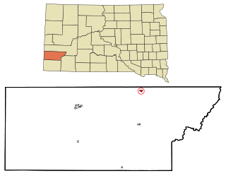
Timber Lake is a city in and the county seat of Dewey County, South Dakota, United States. The population was 509 at the 2020 census.
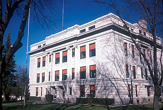
Armour is a city in county seat of Douglas County, South Dakota, United States. The population was 698 at the 2020 census.
Bowdle ( is a city in Edmunds County, South Dakota, United States. The population was 470 at the 2020 census.
Revillo is a town in southeastern Grant County, South Dakota, United States. The population was 99 at the 2020 census.
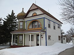
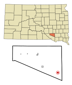
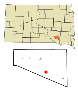
Gregory is a city in western Gregory County, South Dakota, United States. The population was 1,221 at the 2020 census.
Castlewood is a city in Hamlin County, South Dakota, United States. It is part of the Watertown, South Dakota Micropolitan Statistical Area. The population was 698 at the 2020 census.
Hayti is a town in and county seat of Hamlin County, South Dakota, United States. The population was 393 at the 2020 census. It is part of the Watertown, South Dakota Micropolitan Statistical Area. It is the county seat of Hamlin County.
Parkston is a city in Hutchinson County, South Dakota, United States. The population was 1,567 at the 2020 census.
Wessington Springs is a city in central Jerauld County, South Dakota, United States. The population was 956 at the 2010 census. It is the county seat of Jerauld County.
Spencer is a city in McCook County, South Dakota, United States. The population was 136 at the 2020 census. The city was almost destroyed by a violent F4 tornado on May 30, 1998 which killed six people.
Howard is a city in Miner County, South Dakota, United States. The population was 848 at the 2020 census. It is the county seat and most populous city in Miner County.
Dell Rapids is a city in Minnehaha County, South Dakota, United States. The population was 3,996 at the 2020 census. It is known as "The Little City with the Big Attractions."
Woonsocket is a city in Sanborn County, South Dakota. The population was 631 at the 2020 census. It is the county seat of Sanborn County.
Centerville is a city in Turner County, South Dakota, United States. The population was 918 at the 2020 census. Centerville is part of the Sioux Falls, South Dakota metropolitan area.
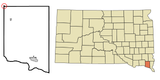
Irene is a city in Clay, Turner, and Yankton counties in South Dakota, United States. The population was 422 at the 2020 census. The portion of Irene that is located in Turner County is a part of the Sioux Falls, South Dakota metropolitan area, the portion located in Yankton County is part of the Yankton Micropolitan Statistical Area, and the portion located in Clay County is part of both the Vermillion Micropolitan Statistical Area and the Sioux City-Vermillion Combined Statistical Area. Irene is also host to the Irene Rodeo, held every summer.
Media related to Delmont, South Dakota at Wikimedia Commons