Douglas County, South Dakota

Last updated

Douglas County
Douglas County, South Dakota courthouse 2.jpg
Douglas County Courthouse in Armour
Map of South Dakota highlighting Douglas County.svg
Location within the U.S. state of South Dakota
South Dakota in United States.svg
South Dakota's location within the U.S.
Coordinates: 43°23′N98°22′W / 43.39°N 98.36°W / 43.39; -98.36
CountryFlag of the United States.svg United States
StateFlag of South Dakota.svg  South Dakota
Founded1873 (created)
1882 (organized)
Named for Stephen A. Douglas
Seat Armour
Largest cityArmour
Area
  Total434 sq mi (1,120 km2)
  Land432 sq mi (1,120 km2)
  Water1.9 sq mi (5 km2)  0.4%
Population
 (2020)
  Total2,835
  Estimate 
(2023)
2,838 Increase2.svg
  Density6.5/sq mi (2.5/km2)
Congressional district At-large
Website douglas.sdcounties.org

Douglas County is a county in the U.S. state of South Dakota. As of the 2020 census, the population was 2,835. [1] Its county seat is Armour. [2] The county was established in 1873 and organized in 1882. [3] It is named for Stephen Douglas, [4] Illinois political figure.

Contents

Geography

The terrain of Douglas County consists of rolling hills, mostly dedicated to agriculture. The county's highest point is on its southwestern boundary, toward the SW corner, at 1,677 ft (511 m) ASL. The terrain slopes to the east. [5] The county has a total area of 434 square miles (1,120 km2), of which 432 square miles (1,120 km2) is land and 1.9 square miles (4.9 km2) (0.4%) is water. [6] It is the second-smallest county in South Dakota by area.

Major highways

Adjacent counties

Lakes

Demographics

Historical population
CensusPop.Note
1890 4,600
1900 5,0129.0%
1910 6,40027.7%
1920 6,9939.3%
1930 7,2363.5%
1940 6,348−12.3%
1950 5,636−11.2%
1960 5,113−9.3%
1970 4,569−10.6%
1980 4,181−8.5%
1990 3,746−10.4%
2000 3,458−7.7%
2010 3,002−13.2%
2020 2,835−5.6%
2023 (est.)2,838 [8] 0.1%
U.S. Decennial Census [9]
1790-1960 [10] 1900-1990 [11]
1990-2000 [12] 2010-2020 [1]

2020 census

As of the 2020 census, there were 2,835 people, 1,134 households, and 779 families residing in the county. [13] The population density was 6.6 inhabitants per square mile (2.5/km2). There were 1,341 housing units.

2010 census

As of the 2010 census, there were 3,002 people, 1,210 households, and 819 families in the county. The population density was 7.0 inhabitants per square mile (2.7/km2). There were 1,439 housing units at an average density of 3.3 units per square mile (1.3 units/km2). The racial makeup of the county was 96.6% white, 1.8% American Indian, 0.4% black or African American, 0.1% Asian, 0.3% from other races, and 0.9% from two or more races. Those of Hispanic or Latino origin made up 0.8% of the population. In terms of ancestry, 34.8% were Dutch, 33.9% were German, 5.6% were Norwegian, 5.5% were Irish, 5.4% were Russian, and 5.1% were American.

Of the 1,210 households, 25.5% had children under the age of 18 living with them, 60.8% were married couples living together, 4.2% had a female householder with no husband present, 32.3% were non-families, and 29.1% of all households were made up of individuals. The average household size was 2.33 and the average family size was 2.89. The median age was 48.3 years.

The median income for a household in the county was $42,794 and the median income for a family was $53,750. Males had a median income of $36,689 versus $24,883 for females. The per capita income for the county was $22,200. About 7.2% of families and 9.8% of the population were below the poverty line, including 10.9% of those under age 18 and 15.2% of those age 65 or over.

Communities

Cities

Census-designated places

Unincorporated community

Townships

  • Belmont
  • Chester
  • Clark
  • East Choleau
  • Garfield
  • Grandview
  • Holland
  • Independence
  • Iowa
  • Joubert
  • Lincoln
  • Valley
  • Walnut Grove
  • Washington

Ghost towns

Politics

Douglas County voters have long been reliably Republican. In only two national elections since 1892 has the county selected the Democratic Party candidate.

United States presidential election results for Douglas County, South Dakota [15]
Year Republican Democratic Third party
No.%No.%No.%
2020 1,46886.00%21612.65%231.35%
2016 1,33883.36%21413.33%533.30%
2012 1,33478.93%33219.64%241.42%
2008 1,29373.63%42424.15%392.22%
2004 1,59679.32%39319.53%231.14%
2000 1,31176.71%36321.24%352.05%
1996 1,21063.38%52427.45%1759.17%
1992 1,17556.85%48123.27%41119.88%
1988 1,43867.23%69532.49%60.28%
1984 1,71376.00%53623.78%50.22%
1980 1,85575.31%50820.63%1004.06%
1976 1,31557.30%97542.48%50.22%
1972 1,43461.68%88738.15%40.17%
1968 1,61370.68%59225.94%773.37%
1964 1,18950.86%1,14949.14%00.00%
1960 2,00278.73%54121.27%00.00%
1956 1,71367.81%81332.19%00.00%
1952 2,10379.93%52820.07%00.00%
1948 1,30163.71%73636.04%50.24%
1944 1,48367.35%71932.65%00.00%
1940 1,97765.53%1,04034.47%00.00%
1936 1,41844.75%1,68053.01%712.24%
1932 1,04534.08%2,00565.39%160.52%
1928 1,94968.68%87930.97%100.35%
1924 1,12550.25%31714.16%79735.60%
1920 1,24763.49%38619.65%33116.85%
1916 81557.48%59742.10%60.42%
1912 00.00%71447.41%79252.59%
1908 83655.99%64743.34%100.67%
1904 85961.89%49935.95%302.16%
1900 64952.85%56746.17%120.98%
1896 53358.06%38041.39%50.54%
1892 54150.85%10910.24%41438.91%

See also

Related Research Articles

<span class="mw-page-title-main">Union County, South Dakota</span> County in South Dakota, United States

Union County is the southernmost county in the U.S. state of South Dakota. As of the 2020 census, the population was 16,811, making it the 13th most populous county in South Dakota. Its county seat has been Elk Point since April 30, 1865. Originally named Cole County, its name was changed to Union on January 7, 1864, because of Civil War sentiment.

<span class="mw-page-title-main">Spink County, South Dakota</span> County in South Dakota, United States

Spink County is a county in the U.S. state of South Dakota. As of the 2020 census, the population was 6,361. Its county seat is Redfield. The county was created in 1873, and was organized in 1879 within Dakota Territory.

<span class="mw-page-title-main">Sanborn County, South Dakota</span> County in South Dakota, United States

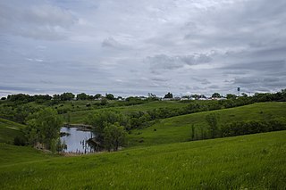
Sanborn County is a county in the U.S. state of South Dakota. As of the 2020 census, the population was 2,330. Its county seat and largest city is Woonsocket. The county was created by the Dakota Territorial legislature on May 1, 1883, with land partitioned from Miner County. It was fully organized by July 18, 1883.

<span class="mw-page-title-main">Potter County, South Dakota</span> County in South Dakota, United States

Potter County is a county in the U.S. state of South Dakota. As of the 2020 census, the population was 2,472. Its county seat is Gettysburg. The county was created in 1873 and organized in 1883.

<span class="mw-page-title-main">Perkins County, South Dakota</span> County in South Dakota, United States

Perkins County is a county in the U.S. state of South Dakota. As of the 2020 census, the population was 2,835. Its county seat is Bison. The county was established in 1908 and organized in 1909. It was named for Sturgis, South Dakota, official Henry E. Perkins.

<span class="mw-page-title-main">Mellette County, South Dakota</span> County in South Dakota, United States

Mellette County is a county in the U.S. state of South Dakota. As of the 2020 census, the population was 1,918. Its county seat is White River. The county was created in 1909, and was organized in 1911. It was named for Arthur C. Mellette, the last Governor of the Dakota Territory and the first Governor of the state of South Dakota.

<span class="mw-page-title-main">Marshall County, South Dakota</span> County in South Dakota, United States

Marshall County is a county in the U.S. state of South Dakota. As of the 2020 census, the population was 4,306. Its county seat is Britton. The county was created on May 2, 1885, and was named for Marshall Vincent, who homesteaded near Andover, South Dakota.

<span class="mw-page-title-main">Jackson County, South Dakota</span> County in South Dakota, United States

Jackson County is a county in the U.S. state of South Dakota. As of the 2020 census, the population was 2,806. Its county seat is Kadoka. The county was created in 1883, and was organized in 1915. Washabaugh County was merged into Jackson County in 1983.

<span class="mw-page-title-main">Hyde County, South Dakota</span> County in South Dakota, United States

Hyde County is a county in the U.S. state of South Dakota. As of the 2020 census, the population was 1,262, making it the second-least populous county in South Dakota. Its county seat is Highmore. The county was founded in 1873, as a county of the Dakota Territory, and organized in 1883. It was named for James Hyde, a member of legislature in the 1870s.

<span class="mw-page-title-main">Hanson County, South Dakota</span> County in the United States

Hanson County is a county in the U.S. state of South Dakota. As of the 2020 census, the population was 3,461. Its county seat is Alexandria. The county was founded in 1871 and organized in 1873. It was named for Joseph R. Hanson, clerk of the first legislature.

<span class="mw-page-title-main">Hand County, South Dakota</span> County in South Dakota, United States

Hand County is a county in the U.S. state of South Dakota. As of the 2020 census, the population was 3,145. Its county seat is Miller.

<span class="mw-page-title-main">Hamlin County, South Dakota</span> County in South Dakota, United States

Hamlin County is a county in the U.S. state of South Dakota. As of the 2020 census, the population was 6,164. Its county seat is Hayti. The county was created in 1873 and organized in 1878. It was named for Hannibal Hamlin, Lincoln's first vice-president.

<span class="mw-page-title-main">Haakon County, South Dakota</span> County in South Dakota, United States

Haakon County is a county in the U.S. state of South Dakota. As of the 2020 census, the population was 1,872. Its county seat is Philip.

<span class="mw-page-title-main">Faulk County, South Dakota</span> County in South Dakota, United States

Faulk County is a county in the U.S. state of South Dakota. As of the 2020 census, the population was 2,125. Its county seat is Faulkton. The county was founded in 1873 and organized in 1883. It is named for Andrew Jackson Faulk, the third Governor of Dakota Territory.

<span class="mw-page-title-main">Davison County, South Dakota</span> County in South Dakota, United States

Davison County is a county in the U.S. state of South Dakota. As of the 2020 census, the population was 19,956, making it the 10th most populous county in South Dakota. Its county seat is Mitchell. The county was created in 1873 and organized in 1874. It was named for Henry C. Davison, the first settler in the county.

<span class="mw-page-title-main">Custer County, South Dakota</span> County in South Dakota, United States

Custer County is a county in the U.S. state of South Dakota. As of the 2020 census, the population was 8,318. Its county seat is Custer. The county was created in 1875, and was organized in 1877. It was named after General George Armstrong Custer.

<span class="mw-page-title-main">Buffalo County, South Dakota</span> County in South Dakota, United States

Buffalo County is a county in the U.S. state of South Dakota. As of the 2020 census, the population was 1,948. Its county seat is Gann Valley which, at 10 people, is the least populous county seat in the United States. The county was created in 1864, and was organized in 1871 as part of the Dakota Territory.

<span class="mw-page-title-main">Martin, South Dakota</span> City in South Dakota, United States

Martin is a city and the county seat of Bennett County, South Dakota, United States. The population was 938 at the 2020 census.

<span class="mw-page-title-main">Corsica, South Dakota</span> City in South Dakota, United States

Corsica is a city in Douglas County, South Dakota, United States. The population was 561 at the 2020 census.

<span class="mw-page-title-main">Harrison, South Dakota</span> Census-designated place in South Dakota, United States

Harrison is an unincorporated community and census-designated place (CDP) in Douglas County, South Dakota, United States. The population was 55 at the 2020 census.

References

  1. 1 2 "State & County QuickFacts". United States Census Bureau. Retrieved March 21, 2024.
  2. "Find a County". National Association of Counties. Archived from the original on May 31, 2011. Retrieved June 7, 2011.
  3. "Dakota Territory, South Dakota, and North Dakota: Individual County Chronologies". Dakota Territory Atlas of Historical County Boundaries. The Newberry Library. 2006. Archived from the original on April 2, 2018. Retrieved March 29, 2015.
  4. Gannett, Henry (1905). The Origin of Certain Place Names in the United States. Govt. Print. Off. p.  108.
  5. ""Find an Altitude" Google Maps (accessed February 2, 2019)". Archived from the original on May 21, 2019. Retrieved February 2, 2019.
  6. "2010 Census Gazetteer Files". United States Census Bureau. August 22, 2012. Retrieved March 24, 2015.
  7. "Corsica Lake". Google Maps. Retrieved April 27, 2024.
  8. "County Population Totals and Components of Change: 2020-2023" . Retrieved March 17, 2024.
  9. "U.S. Decennial Census". United States Census Bureau. Retrieved March 24, 2015.
  10. "Historical Census Browser". University of Virginia Library. Retrieved March 24, 2015.
  11. Forstall, Richard L., ed. (March 27, 1995). "Population of Counties by Decennial Census: 1900 to 1990". United States Census Bureau. Retrieved March 24, 2015.
  12. "Census 2000 PHC-T-4. Ranking Tables for Counties: 1990 and 2000" (PDF). United States Census Bureau. April 2, 2001. Archived (PDF) from the original on October 9, 2022. Retrieved March 24, 2015.
  13. "US Census Bureau, Table P16: Household Type". United States Census Bureau. Retrieved March 21, 2024.
  14. Joubert SD Google Maps (accessed February 2, 2019)
  15. Leip, David. "Atlas of US Presidential Elections". uselectionatlas.org. Retrieved April 15, 2018.

43°23′N98°22′W / 43.39°N 98.36°W / 43.39; -98.36