Baltic, South Dakota

Last updated

Baltic, South Dakota
Baltic, South Dakota 1.jpg
Saint Olaf Avenue in Baltic, November 2009
Motto: 
"Begin Building Tomorrow Dreams Today"
Minnehaha County South Dakota Incorporated and Unincorporated areas Baltic Highlighted.svg
Location in Minnehaha County and the state of South Dakota
Coordinates: 43°45′44″N96°44′16″W / 43.76222°N 96.73778°W / 43.76222; -96.73778
CountryUnited States
State South Dakota
County Minnehaha
Incorporated1907 [1]
Government
  MayorDeborah McIsaac [2]
Area
[3]
  Total0.77 sq mi (1.99 km2)
  Land0.74 sq mi (1.91 km2)
  Water0.03 sq mi (0.07 km2)
Elevation
[4]
1,490 ft (450 m)
Population
 (2020) [5]
  Total1,246
  Density1,688.35/sq mi (651.69/km2)
Time zone UTC−6 (Central (CST))
  Summer (DST) UTC−5 (CDT)
ZIP code
57003
Area code 605
FIPS code 46-03380
GNIS feature ID1265611 [4]
Website baltic.govoffice.com

Baltic is a city on the Big Sioux River in northern Minnehaha County, South Dakota, United States. The population was 1,246 at the 2020 census. [6]

Contents

History

Baltic was originally called St. Olaf, and under the latter name was laid out in 1881. [7] Another variant name was Keyes. [7] A post office was established under the name Saint Olaf in 1872, the name was changed to Keyes in 1887, and the name was again changed to Baltic in 1889. [8] The Chicago, Milwaukee, Saint Paul and Pacific Railroad built through Baltic and established a railroad depot.

Geography

Baltic is located along the Big Sioux River. [9]

According to the United States Census Bureau, the city has a total area of 0.76 square miles (1.97 km2), of which, 0.74 square miles (1.92 km2) is land and 0.02 square miles (0.05 km2) is water. [10]

Demographics

Historical population
CensusPop.Note
1910 278
1920 2873.2%
1930 272−5.2%
1940 270−0.7%
1950 255−5.6%
1960 2789.0%
1970 36430.9%
1980 67986.5%
1990 666−1.9%
2000 81121.8%
2010 1,08934.3%
2020 1,24614.4%
U.S. Decennial Census [11] [5]

2010 census

As of the census [12] of 2010, there were 1,089 people, 389 households, and 302 families living in the city. The population density was 1,471.6 inhabitants per square mile (568.2/km2). There were 409 housing units at an average density of 552.7 per square mile (213.4/km2). The racial makeup of the city was 95.4% White, 0.5% African American, 0.9% Native American, 2.1% from other races, and 1.1% from two or more races. Hispanic or Latino of any race were 2.2% of the population.

There were 389 households, of which 47.0% had children under the age of 18 living with them, 60.4% were married couples living together, 10.3% had a female householder with no husband present, 6.9% had a male householder with no wife present, and 22.4% were non-families. 19.0% of all households were made up of individuals, and 5.2% had someone living alone who was 65 years of age or older. The average household size was 2.80 and the average family size was 3.20.

The median age in the city was 30.9 years. 32.8% of residents were under the age of 18; 7.4% were between the ages of 18 and 24; 33% were from 25 to 44; 20.7% were from 45 to 64; and 6.2% were 65 years of age or older. The gender makeup of the city was 51.0% male and 49.0% female.

2000 census

As of the census of 2000, there were 811 people, 300 households, and 233 families living in the city. The population density was 1,151.4 inhabitants per square mile (444.6/km2). There were 311 housing units at an average density of 441.5 per square mile (170.5/km2). The racial makeup of the city was 98.89% White, 0.49% Native American, and 0.62% from two or more races. Hispanic or Latino of any race were 0.12% of the population.

There were 300 households, out of which 42.7% had children under the age of 18 living with them, 62.0% were married couples living together, 11.3% had a female householder with no husband present, and 22.3% were non-families. 18.7% of all households were made up of individuals, and 7.7% had someone living alone who was 65 years of age or older. The average household size was 2.70 and the average family size was 3.08.

In the city, the population was spread out, with 30.2% under the age of 18, 10.6% from 18 to 24, 31.8% from 25 to 44, 18.6% from 45 to 64, and 8.8% who were 65 years of age or older. The median age was 30 years. For every 100 females, there were 93.6 males. For every 100 females age 18 and over, there were 95.8 males.

As of 2000 the median income for a household in the city was $46,023, and the median income for a family was $50,000. Males had a median income of $30,188 versus $22,260 for females. The per capita income for the city was $16,268. About 3.3% of families and 3.9% of the population were below the poverty line, including 5.3% of those under age 18 and 4.9% of those age 65 or over.

Education

Baltic Public Schools are part of Baltic School District. The three schools in the district include Baltic Elementary School, Baltic Middle School and Baltic High School. [13]

The school district is surrounded by the Dell Rapids School District. The Baltic School District mascot is the Bulldog.

Culture

Baltic River Park Days is a family friendly event taking place the 3rd weekend of July. The Scenic River Park is the backdrop for free movies in the park, kickball, tug of war, bean bags, kids games, duck races, show and shine and a Grand Parade.

Transportation

While Baltic is situated between (and within just a few mile of) both Interstate 29 and Highway 115, neither highway passes through the city. Access to both highways is via eastwest 250th Street.

Notable people

See also

Related Research Articles

<span class="mw-page-title-main">Fairmount, North Dakota</span> City in Richland County, North Dakota, United States

Fairmount is a city in Richland County, North Dakota, United States. The population was 343 at the 2020 census. Fairmount was founded in 1884. It is part of the Wahpeton, ND–MN Micropolitan Statistical Area.

<span class="mw-page-title-main">Avon, South Dakota</span> City in South Dakota, United States

Avon is a city in Bon Homme County, South Dakota, United States. The population was 586 at the 2020 census.

<span class="mw-page-title-main">Chamberlain, South Dakota</span> City in South Dakota, United States

Chamberlain is a city in Brule County, South Dakota, United States. It is located on the east bank of the Missouri River, at the dammed section of the Lake Francis Case, close to where it is crossed by Interstate 90.

<span class="mw-page-title-main">Bristol, South Dakota</span> City in South Dakota, United States

Bristol is a city located in western Day County, South Dakota, United States. It lies in Section 25 of Bristol Township, on the main line of what is now the BNSF Railway alongside U.S. Route 12. The population was 288 at the 2020 census.`

<span class="mw-page-title-main">Waubay, South Dakota</span> City in South Dakota, United States

Waubay is a city in Day County, South Dakota, United States. The population was 473 at the 2020 census.

<span class="mw-page-title-main">Webster, South Dakota</span> City in South Dakota, United States

Webster is a city in and the county seat of Day County, South Dakota, United States. The population was 1,728 at the 2020 census.

<span class="mw-page-title-main">Armour, South Dakota</span> City in South Dakota, United States

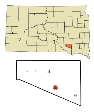
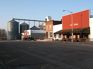
Armour is a city in county seat of Douglas County, South Dakota, United States. The population was 698 at the 2020 census.

<span class="mw-page-title-main">Big Stone City, South Dakota</span> City in South Dakota, United States

Big Stone City is a city in the northeastern corner of Grant County, South Dakota, United States, that lies between the southern tip of Big Stone Lake and the northern bank of the Whetstone River, and is adjacent to the city of Ortonville, Minnesota. The population was 412 at the 2020 census.

<span class="mw-page-title-main">Gregory, South Dakota</span> City in South Dakota, United States

Gregory is a city in western Gregory County, South Dakota, United States. The population was 1,221 at the 2020 census.

<span class="mw-page-title-main">Freeman, South Dakota</span> City in South Dakota, United States

Freeman is a city in Hutchinson County, South Dakota, United States. The population was 1,329 at the 2020 census.

<span class="mw-page-title-main">Parkston, South Dakota</span> City in South Dakota, United States

Parkston is a city in Hutchinson County, South Dakota, United States. The population was 1,567 at the 2020 census.

<span class="mw-page-title-main">Kadoka, South Dakota</span> City in South Dakota, United States

Kadoka is a city in, and the county seat of, Jackson County, South Dakota, United States. The population was 543 at the 2020 census. The town occupies about 2.3 square miles.

<span class="mw-page-title-main">Lennox, South Dakota</span> City in South Dakota, United States

Lennox is a city in Lincoln County, South Dakota, United States, located 20 miles (32 km) southwest of Sioux Falls. The population was 2,423 at the 2020 census.

<span class="mw-page-title-main">Crooks, South Dakota</span> City in South Dakota, United States

Crooks is a city in Minnehaha County, South Dakota, United States and is a suburb of Sioux Falls. The population was 1,362 at the 2020 census. Crooks was named New Hope until 1904. The town's present name honors W. A. Crooks, a local politician.

<span class="mw-page-title-main">Garretson, South Dakota</span> City in South Dakota, United States

Garretson is a city in Minnehaha County, South Dakota, United States. The city had a population of 1,228 at the 2020 census.

<span class="mw-page-title-main">Sisseton, South Dakota</span> City in South Dakota, United States

Sisseton is a city in Roberts County, South Dakota, United States. The population was 2,479 at the 2020 census. It is the county seat of Roberts County. Sisseton is the home to a number of tourist attractions, including the Nicollet Tower, and is near the "Song to the Great Spirit" building on the Sisseton Wahpeton College campus. The city is named for the Sisseton division of the Native American Sioux. It also serves as an important part of the Lake Traverse Indian Reservation.

<span class="mw-page-title-main">Wilmot, South Dakota</span> City in South Dakota, United States

Wilmot is a city in Roberts County, South Dakota, United States. The population was 432 at the 2020 census.

<span class="mw-page-title-main">Mission, South Dakota</span> City in South Dakota, United States

Mission is a city on the Rosebud Indian Reservation in northern Todd County, South Dakota, United States. The population was 1,156 at the 2020 census.

<span class="mw-page-title-main">Elk Point, South Dakota</span> City in South Dakota, United States

Elk Point is a city in and county seat of Union County, South Dakota, United States. The population was 2,149 as of the 2020 census.

<span class="mw-page-title-main">Eagle Butte, South Dakota</span> City in South Dakota, United States

Eagle Butte is a city in Dewey and Ziebach counties in South Dakota, United States. The population was 1,258 at the 2020 census. It is adjacent to the North Eagle Butte CDP.

References

  1. "SD Towns" (PDF). South Dakota State Historical Society. Archived from the original (PDF) on February 10, 2010. Retrieved February 11, 2010.
  2. "Baltic, South Dakota city council". Baltic, South Dakota. Retrieved February 25, 2024.
  3. "ArcGIS REST Services Directory". United States Census Bureau. Retrieved October 15, 2022.
  4. 1 2 U.S. Geological Survey Geographic Names Information System: Baltic, South Dakota
  5. 1 2 "Census Population API". United States Census Bureau. Retrieved October 15, 2022.
  6. "U.S. Census Bureau: Baltic city, South Dakota". www.census.gov. United States Census Bureau. Retrieved February 21, 2022.
  7. 1 2 Federal Writers' Project (1940). South Dakota place-names, v.1-3. University of South Dakota. p. 25.
  8. "Minnehaha County". Jim Forte Postal History. Retrieved January 22, 2015.
  9. DeLorme (2001), South Dakota Atlas & Gazetteer, Yarmouth, Maine: DeLorme, ISBN   0-89933-330-3
  10. "US Gazetteer files 2010". United States Census Bureau. Archived from the original on January 12, 2012. Retrieved June 21, 2012.
  11. United States Census Bureau. "Census of Population and Housing" . Retrieved September 23, 2013.
  12. "U.S. Census website". United States Census Bureau . Retrieved June 21, 2012.
  13. "Baltic School District". Baltic School Districtol. Retrieved July 28, 2012.