This article needs additional citations for verification .(March 2008) |
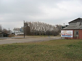
Benclare is an unincorporated community in the extreme southeastern corner of Minnehaha County, South Dakota, United States.
This article needs additional citations for verification .(March 2008) |
Benclare is an unincorporated community in the extreme southeastern corner of Minnehaha County, South Dakota, United States.
Benclare is located at 43°30′20″N96°28′44″W / 43.505530°N 96.478930°W . [1] Benclare sits 1.5 miles (2.4 km) west of the Minnesota border and 0.5 miles (0.80 km) north of the border with Iowa. Benclare is also located 1 mile (1.6 km) east of South Dakota Highway 42.
Benclare was founded on September 24, 1888, by a New York native, Benjamin Richards for his two sons Benjamin and Clarence, hence Benclare.

Yankton County is a county in the U.S. state of South Dakota. As of the 2020 census, the population was 23,310. Its county seat is Yankton. Yankton County comprises the Yankton, SD Micropolitan Statistical Area.

Minnehaha County is a county on the eastern border of the state of South Dakota. As of the 2020 census, the population was 197,214, making it the state's most populous county. It contains over 20% of the state's population. Its county seat is Sioux Falls, South Dakota's most populous city. The county was created in 1862 and organized in 1868. Its name was derived from the Sioux word Mnihaha, meaning "rapid water," or "waterfall".
Lincoln County is a county in the U.S. state of South Dakota. As of the 2020 census, the population was 65,161, making it the third-most populated county in the state. Its county seat is Canton. The county was named for Abraham Lincoln, 16th President of the United States.

Douglas County is a county in the U.S. state of South Dakota. As of the 2020 census, the population was 2,835. Its county seat is Armour. The county was established in 1873 and organized in 1882. It is named for Stephen Douglas, Illinois political figure.

Rock County is a county located in the southwestern corner of the U.S. state of Minnesota. According to the 2020 census, its population was 9,704. The county seat is Luverne.
Carthage is a village in the town of Wilna in Jefferson County, New York, United States. The population was 3,236 at the 2020 census. The village is named after the historic city of Carthage.
Glen Park is a village in Jefferson County, New York, United States. The population was 502 at the 2010 census. The village is on the border of the towns of Brownville and Pamelia and is immediately northwest of Watertown.

Bottineau is a city in Bottineau County, North Dakota, United States. It is the county seat of Bottineau County and is located just over ten miles (16 km) south of the Canada–United States border. The city's population was 2,194 at the 2020 census.

Beechwood Trails is a census-designated place (CDP) in Harrison Township, Licking County, Ohio, United States. The population was 3,276 at the 2020 census.

North Spearfish is a census-designated place (CDP) in Lawrence County, South Dakota, United States. The population was 2,366 at the 2020 census.

Kyle is a census-designated place (CDP) in Oglala Lakota County, South Dakota, United States. Its population was 943 at the 2020 census. Located within the Pine Ridge Indian Reservation of the Oglala Lakota, it is one of two settlements which are closest to the North American continental pole of inaccessibility.
Parker is a city in Turner County, South Dakota, United States. The population was 1,194 at the 2020 census. It is the county seat of Turner County. Parker is bordered on its eastern side by South Dakota State Highway 19. Its northern side is bordered by South Dakota State Highway 44. Parker is located approximately 8 miles (13 km) northwest of Chancellor, 42 miles (68 km) east of Parkston and 41 miles (66 km) south of Madison.

Virgilina is a town in Halifax County, Virginia, United States. The population was 154 at the 2010 census. Virgilina was once a copper mining town. It was a stop on the Atlantic and Danville Railway as recently as the 1950s. It is named "Virgilina" because it is located on the Virginia and North Carolina border.

Oso is a census-designated place (CDP) in Snohomish County, Washington, United States. It is located to the west of Darrington, south of the North Fork of the Stillaguamish River and approximately 50 air miles (80 km) from Seattle. The population of Oso was 180 at the 2010 census. The area was the site of a large landslide in March 2014 that killed 43 people, the deadliest incident of its kind in U.S. history.
Lynnwood-Pricedale is a census-designated place (CDP) in Fayette and Westmoreland counties in the Pennsylvania. The population was 2,031 at the 2010 census, down from 2,168 at the 2000 census. The community of Lynwood is located in Fayette County's Washington Township, while Pricedale is part of Westmoreland County's Rostraver Township.
Adams is a village in the town of Adams in Jefferson County, New York, United States. The population was 1,775 at the 2010 census. The village is named after President John Adams.
Rowena is an unincorporated community and a census-designated place (CDP) in Minnehaha County, South Dakota, United States. The population of the CDP was 68 at the 2020 census. It is located along South Dakota Highway 42.

The Geography of North Dakota consists of three major geographic regions: in the east is the Red River Valley, west of this, the Missouri Plateau. The southwestern part of North Dakota is covered by the Great Plains, accentuated by the Badlands. There is also much in the way of geology and hydrology.
Booge is an unincorporated community in Red Rock Township, Minnehaha County, South Dakota, United States. The community sits on a major route of the Burlington Northern and Santa Fe Railway, and it is a half-way point between Garretson, South Dakota and Manley, Minnesota.
Ellis is an unincorporated community in south-central Minnehaha County, South Dakota, United States. Ellis is located approximately one mile west of the Sioux Falls city limits on Ellis Road, or 1.5 miles (2.4 km) north of South Dakota Highway 42. The Ellis & Eastern Railroad is based in Ellis, running 14.5 miles (23.3 km) to Brandon to the east. In 1995, the two largest commodities carried by trains were non-metallic minerals and chemicals, mostly for factories near Sioux Falls. The community is considered a part of the Sioux Falls metropolitan area.
Municipalities and communities of Minnehaha County, South Dakota, United States | ||
|---|---|---|
| Cities |  | |
| Towns | ||
| CDPs | ||
| Former cities | ||
| Other communities | ||
| Townships | ||
| Footnotes | ‡This populated place also has portions in an adjacent county or counties | |
| | This South Dakota state location article is a stub. You can help Wikipedia by expanding it. |