Related Research Articles

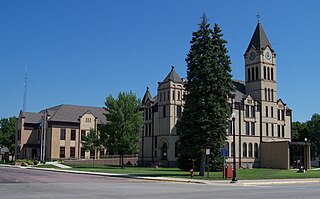
Minnehaha County is a county on the eastern border of the state of South Dakota. As of the 2020 census, the population was 197,214, making it the state's most populous county. It contains over 20% of the state's population. Its county seat is Sioux Falls, South Dakota's most populous city. The county was created in 1862 and organized in 1868. Its name was derived from the Sioux word Mnihaha, meaning "rapid water," or "waterfall".
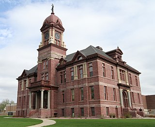
Lincoln County is a county in the U.S. state of South Dakota. As of the 2020 census, the population was 65,161, making it the third most populous county in South Dakota. Its county seat is Canton. The county was named for Abraham Lincoln, 16th President of the United States.

Rock County is a county located in the southwestern corner of the U.S. state of Minnesota. According to the 2020 census, its population was 9,704. The county seat is Luverne. It is located within the Sioux Falls MSA.
Pipestone County is a county in the U.S. state of Minnesota. As of the 2020 census, the population was 9,424. Its county seat is Pipestone.

Lyon County is the most northwesterly county of the U.S. state of Iowa. As of the 2020 census, the population was 11,934. The county seat is Rock Rapids.
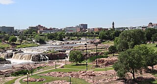
The Big Sioux River is a tributary of the Missouri River in eastern South Dakota and northwestern Iowa in the United States. It flows generally southwardly for 419 mi (674 km), and its watershed is 9,006 sq mi (23,330 km2). The United States Board on Geographic Names settled on "Big Sioux River" as the stream's name in 1931. The river was named after the Lakota people which was known by them as Tehankasandata, or Thick Wooded River.
Rowena is an unincorporated community and a census-designated place (CDP) in Minnehaha County, South Dakota, United States. The population of the CDP was 68 at the 2020 census. It is located along South Dakota Highway 42.

Siouxland is a vernacular region that encompasses the entire Big Sioux River drainage basin in the U.S. states of South Dakota, Minnesota, Nebraska and Iowa. The demonym for a resident of Siouxland is Siouxlander.
Lyons is an unincorporated community and census-designated place (CDP) in Minnehaha County, South Dakota, United States. The CDP had a population of 70 at the 2020 census. Lyons has been assigned the ZIP code of 57041.
Booge is an unincorporated community in Red Rock Township, Minnehaha County, South Dakota, United States. The community sits on a major route of the Burlington Northern and Santa Fe Railway, and it is a half-way point between Garretson, South Dakota and Manley, Minnesota.
Benclare is an unincorporated community in the extreme southeastern corner of Minnehaha County, South Dakota, United States.
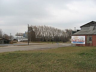
Ellis is an unincorporated community in south-central Minnehaha County, South Dakota, United States. Ellis is located approximately one mile west of the Sioux Falls city limits on Ellis Road, or 1.5 miles (2.4 km) north of South Dakota Highway 42. The Ellis & Eastern Railroad is based in Ellis, running 14.5 miles (23.3 km) to Brandon to the east. In 1995, the two largest commodities carried by trains were non-metallic minerals and chemicals, mostly for factories near Sioux Falls. The community is considered a part of the Sioux Falls metropolitan area.
Saltfleet Township is a geographic township in Hamilton, Ontario, Canada, on the south shore of Lake Ontario.
Morefield is an unincorporated community in central Minnehaha County in Sverdrup Township, South Dakota, United States. Morefield is 2 miles (3 km) northeast of Crooks, along an abandoned Chicago, Milwaukee, St. Paul and Pacific rail line that ran from Renner to Madison. It is also 3 miles (5 km) north of the Renner/Crooks exit on Interstate 29 on County road 133.
East Sioux Falls was a city located in southeastern Minnehaha County, South Dakota located about 6 miles east of Sioux Falls along South Dakota Highway 42 on the Big Sioux River.
Germantown Township is a township in Turner County, South Dakota, United States. As of the 2010 census, its population was 358.

Beaver Creek is a stream in Rock County, Minnesota and Minnehaha County, South Dakota. It is a tributary of Split Rock Creek.
Brandon Township is a township in Minnehaha County, in the U.S. state of South Dakota.
Humboldt Township is a township in Minnehaha County, in the U.S. state of South Dakota.
Buffalo Creek is a stream in the U.S. state of South Dakota.
References
- ↑ U.S. Geological Survey Geographic Names Information System: Lyons Township, Minnehaha County, South Dakota
- ↑ Federal Writers' Project (1940). South Dakota place-names, v.1-3. University of South Dakota. p. 49.
Municipalities and communities of Minnehaha County, South Dakota, United States | ||
|---|---|---|
| Cities |  | |
| Towns | ||
| CDPs | ||
| Former cities | ||
| Other communities | ||
| Townships | ||
| Footnotes | ‡This populated place also has portions in an adjacent county or counties | |
43°43′03″N96°49′52″W / 43.71750°N 96.83111°W
| | This South Dakota state location article is a stub. You can help Wikipedia by expanding it. |