Humboldt, South Dakota

Last updated

Humboldt, South Dakota
Humboldt, South Dakota 5.jpg
Motto: 
"Small Town With A Big Heart"
Minnehaha County South Dakota Incorporated and Unincorporated areas Humboldt Highlighted.svg
Location in Minnehaha County and the state of South Dakota
Coordinates: 43°38′41″N97°04′28″W / 43.64472°N 97.07444°W / 43.64472; -97.07444
CountryUnited States
State South Dakota
County Minnehaha
Incorporated1891 [1]
Area
[2]
  Total0.63 sq mi (1.64 km2)
  Land0.62 sq mi (1.60 km2)
  Water0.01 sq mi (0.04 km2)
Elevation
[3]
1,703 ft (519 m)
Population
 (2020) [4]
  Total579
  Density935.38/sq mi (361.13/km2)
Time zone UTC−6 (Central (CST))
  Summer (DST) UTC−5 (CDT)
ZIP code
57035
Area code 605
FIPS code 46-30900
GNIS feature ID1267431 [3]
Website humboldt.govoffice.com

Humboldt is a town in Minnehaha County, South Dakota, United States. The population was 579 at the 2020 census. [5]

Contents

History

The first settlement at Humboldt was made in 1877. [6] The town was named from its location in Humboldt Township. [7] A post office called Humboldt has been in operation since 1889. [8]

Geography

According to the United States Census Bureau, the town has a total area of 0.63 square miles (1.63 km2), of which 0.62 square miles (1.61 km2) is land and 0.01 square miles (0.03 km2) is water. [9]

Lost Lake lies two miles north of the town, while Beaver Lake lies one mile east of town.

Humboldt is accessible via exit 379, off Interstate 90, marking the halfway point on the longest interstate in the United States [10]

Demographics

Historical population
CensusPop.Note
1920 445
1930 428−3.8%
1940 417−2.6%
1950 4507.9%
1960 446−0.9%
1970 411−7.8%
1980 48718.5%
1990 468−3.9%
2000 52111.3%
2010 58913.1%
2020 579−1.7%
U.S. Decennial Census [11] [4]

2010 census

At the 2010 census there were 589 people, 227 households, and 160 families living in the town. The population density was 950.0 inhabitants per square mile (366.8/km2). There were 247 housing units at an average density of 398.4 per square mile (153.8/km2). The racial makeup of the town was 95.8% White, 0.2% African American, 1.4% Native American, 1.0% from other races, and 1.7% from two or more races. Hispanic or Latino of any race were 1.5%. [12]

Of the 227 households 39.2% had children under the age of 18 living with them, 55.1% were married couples living together, 9.7% had a female householder with no husband present, 5.7% had a male householder with no wife present, and 29.5% were non-families. 22.9% of households were one person and 8.8% were one person aged 65 or older. The average household size was 2.59 and the average family size was 3.04.

The median age in the town was 33.3 years. 30.2% of residents were under the age of 18; 6.8% were between the ages of 18 and 24; 28.1% were from 25 to 44; 21.1% were from 45 to 64; and 13.9% were 65 or older. The gender makeup of the town was 52.5% male and 47.5% female.

2000 census

At the 2000 census, there were 521 people, 200 households, and 148 families living in the town. The population density was 831.0 inhabitants per square mile (320.9/km2). There were 210 housing units at an average density of 335.0 per square mile (129.3/km2). The racial makeup of the town was 96.74% White, 1.73% Native American, 0.58% Asian, 0.19% from other races, and 0.77% from two or more races. Hispanic or Latino of any race were 0.19% of the population.

Of the 200 households 42.0% had children under the age of 18 living with them, 62.0% were married couples living together, 7.0% had a female householder with no husband present, and 26.0% were non-families. 25.5% of households were one person and 15.0% were one person aged 65 or older. The average household size was 2.61 and the average family size was 3.09.

The age distribution was 31.7% under the age of 18, 6.7% from 18 to 24, 31.1% from 25 to 44, 15.9% from 45 to 64, and 14.6% 65 or older. The median age was 32 years. For every 100 females, there were 98.9 males. For every 100 females age 18 and over, there were 100.0 males.

The median household income was $39,250 and the median family income was $45,000. Males had a median income of $27,426 versus $22,083 for females. The per capita income for the town was $16,455. About 5.8% of families and 6.1% of the population were below the poverty line, including 8.2% of those under age 18 and 5.1% of those age 65 or over.

Notable people

Related Research Articles

<span class="mw-page-title-main">Dakota City, Iowa</span> City in Iowa, United States

Dakota City is a city in and the county seat of Humboldt County, Iowa, United States. The population was 759 at the time of the 2020 census. Dakota City shares its western border with the much larger city of Humboldt. It is the least populous county seat in Iowa.

<span class="mw-page-title-main">Tabor, South Dakota</span> Town in South Dakota, United States

Tabor is a town in Bon Homme County, South Dakota, United States. The population was 407 at the 2020 census.

<span class="mw-page-title-main">Tyndall, South Dakota</span> City in South Dakota, United States

Tyndall is a city in and the county seat of Bon Homme County, South Dakota, United States. The population was 1,057 at the 2020 census.

<span class="mw-page-title-main">Groton, South Dakota</span> City in South Dakota, United States

Groton is a city in southeastern Brown County, South Dakota, United States. The population was 1,380 at the 2020 census.

<span class="mw-page-title-main">Warner, South Dakota</span> Town in South Dakota, United States

Warner is a town in Brown County, South Dakota, United States. The population was 485 at the 2020 census.

<span class="mw-page-title-main">Willow Lake, South Dakota</span> City in South Dakota, United States

Willow Lake is a city in Clark County, South Dakota, United States. The population was 255 at the 2020 census.

<span class="mw-page-title-main">Eden, South Dakota</span> Town in South Dakota, United States

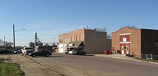
Eden is a town in Marshall County, South Dakota, United States. The population was 94 at the 2020 census.

<span class="mw-page-title-main">Baltic, South Dakota</span> City in South Dakota, United States

Baltic is a city on the Big Sioux River in northern Minnehaha County, South Dakota, United States. The population was 1,246 at the 2020 census.

<span class="mw-page-title-main">Crooks, South Dakota</span> City in South Dakota, United States

Crooks is a city in Minnehaha County, South Dakota, United States and is a suburb of Sioux Falls. The population was 1,362 at the 2020 census. Crooks was named New Hope until 1904. The town's present name honors W. A. Crooks, a local politician.

<span class="mw-page-title-main">Dell Rapids, South Dakota</span> City in South Dakota, United States

Dell Rapids is a city in Minnehaha County, South Dakota, United States. The population was 3,996 at the 2020 census. It is known as "The Little City with the Big Attractions."

<span class="mw-page-title-main">Garretson, South Dakota</span> City in South Dakota, United States

Garretson is a city in Minnehaha County, South Dakota, United States. The city had a population of 1,228 at the 2020 census.

<span class="mw-page-title-main">Hartford, South Dakota</span> City in South Dakota, United States

Hartford is a suburban American city in Minnehaha County, South Dakota, a few miles northwest of Sioux Falls. Its population was 3,354 at the 2020 census.

<span class="mw-page-title-main">Sherman, South Dakota</span> Town in South Dakota, United States

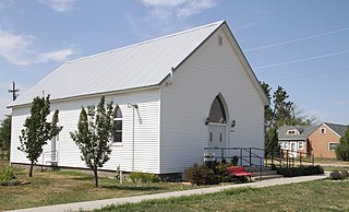
Sherman is a town in Minnehaha County, South Dakota, United States. The population was 81 at the 2020 census.

<span class="mw-page-title-main">Quinn, South Dakota</span> Town in South Dakota, United States

Quinn is a town in Pennington County, South Dakota, United States. The population was 63 at the 2020 census. The town is the home of the Badlands Observatory, located in the former community hospital, built in 1950.

<span class="mw-page-title-main">Wall, South Dakota</span> Town in South Dakota, United States

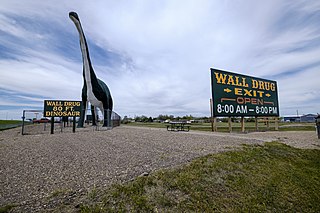
Wall is a town in Pennington County, South Dakota, United States. The population was 699 at the 2020 census.

<span class="mw-page-title-main">Woonsocket, South Dakota</span> City in South Dakota, United States

Woonsocket is a city in Sanborn County, South Dakota. The population was 631 at the 2020 census. It is the county seat of Sanborn County.

<span class="mw-page-title-main">Redfield, South Dakota</span> City in South Dakota, United States

Redfield is a city in and the county seat of Spink County, South Dakota, United States. The population was 2,214 at the 2020 census. The city was named for J. B. Redfield, a railroad official.

<span class="mw-page-title-main">Tulare, South Dakota</span> Town in South Dakota, United States

Tulare is a town in Spink County, South Dakota, United States. The population was 211 at the 2020 census.

<span class="mw-page-title-main">Viborg, South Dakota</span> City in South Dakota, United States

Viborg is a city in Turner County, South Dakota, United States. The population was 814 at the 2020 census.

<span class="mw-page-title-main">Glenham, South Dakota</span> Town in South Dakota, United States

Glenham is a town in Walworth County, South Dakota, United States. The population was 112 at the 2020 census.

References

  1. "SD Towns" (PDF). South Dakota State Historical Society. Archived from the original (PDF) on February 10, 2010. Retrieved February 13, 2010.
  2. "ArcGIS REST Services Directory". United States Census Bureau. Retrieved October 15, 2022.
  3. 1 2 U.S. Geological Survey Geographic Names Information System: Humboldt, South Dakota
  4. 1 2 "Census Population API". United States Census Bureau. Retrieved October 15, 2022.
  5. "U.S. Census Bureau: Humboldt town, South Dakota". www.census.gov. United States Census Bureau. Retrieved February 21, 2022.
  6. Federal Writers' Project (1940). South Dakota place-names, v.1-3. University of South Dakota. p. 43.
  7. Chicago and North Western Railway Company (1908). A History of the Origin of the Place Names Connected with the Chicago & North Western and Chicago, St. Paul, Minneapolis & Omaha Railways. p. 179.
  8. "Minnehaha County". Jim Forte Postal History. Retrieved April 4, 2015.
  9. "US Gazetteer files 2010". United States Census Bureau. Archived from the original on July 2, 2012. Retrieved June 21, 2012.
  10. Adderly, Kevin (June 28, 2017). "Table 1: Main Routes of the Dwight D. Eisenhower National System of Interstate and Defense Highways as of December 31, 2014". Route Log and Finder List. Federal Highway Administration. Archived from the original on July 3, 2017. Retrieved July 2, 2020.
  11. United States Census Bureau. "Census of Population and Housing" . Retrieved September 23, 2013.
  12. "U.S. Census website". United States Census Bureau . Retrieved June 21, 2012.
  13. (Ret.), Senator Larry Pressler. "Biography – U.S. Senator Larry Pressler – 2016". www.larrypressler.com. Retrieved April 20, 2018.