
North Spearfish is a census-designated place (CDP) in Lawrence County, South Dakota, United States. The population was 2,366 at the 2020 census.
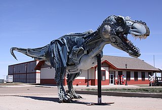
Faith is a city in the northeastern corner of Meade County, South Dakota, United States. The population was 367 at the 2020 census. The most complete Tyrannosaurus rex skeleton known, Sue, was discovered approximately 15 miles (24 km) northeast of Faith in August 1990.

White Rock is a town in Roberts County, South Dakota, United States, along the Bois de Sioux River. The population was 6 at the 2020 census. White Rock is the most northeastern community in South Dakota, being along the Minnesota border and one mile south of North Dakota.

Oglala is a census-designated place (CDP) in West Oglala Lakota Unorganized Territory equivalent, Oglala Lakota County, South Dakota, United States. The population was 1,282 at the 2020 census. Its location is in the northwest of the Pine Ridge Indian Reservation.

Hamill is a rural hamlet in Tripp County, South Dakota, United States. The population was 14 at the 2020 census. There is a post office at Hamill, also two churches and a community hall; otherwise, no businesses or services.
Chester is an unincorporated community and census-designated place (CDP) in Lake County, South Dakota, United States. The population was 257 as of the 2020 census. Chester has been assigned the ZIP code of 57016.
Saint Onge is an unincorporated community and census-designated place (CDP) in Lawrence County, South Dakota, United States. As of the 2020 census, the population was 170.
Winfred is an unincorporated community and census-designated place (CDP) in Lake County, South Dakota, United States, approximately 12 miles (19 km) west of Madison. The population was 38 as of the 2020 census. Winfred has been assigned the ZIP code of 57076.
Shindler is an unincorporated community and census-designated place (CDP) in Lincoln County, South Dakota, United States. The population was 607 at the 2020 census.
Lake Poinsett is a census-designated place (CDP) in Hamlin and Brookings counties in South Dakota, United States. The population was 501 at the 2020 census.
Crocker is an unincorporated community and census-designated place (CDP) in Clark County, South Dakota, United States. The population was 19 at the 2020 census.
Anderson, also known as Anderson Subdivision, is an unincorporated community and census-designated place in Minnehaha County, South Dakota, United States. Its population was 388 as of the 2020 census. The community is east of Sioux Falls.
Meadow View Addition is an unincorporated community and census-designated place in Minnehaha County, South Dakota, United States. Its population was 531 as of the 2020 census. The community is located on South Dakota Highway 115, north of Sioux Falls.
Pine Lakes Addition is an unincorporated community and census-designated place in Minnehaha County, South Dakota, United States. Its population was 306 as of the 2020 census. The community is east of Sioux Falls.
Blucksberg Mountain is an unincorporated community and census-designated place in Meade County, South Dakota, United States. Its population was 467 as of the 2020 census. Interstate 90 passes through the community.
Lake Madison is an unincorporated community and census-designated place in Lake County, South Dakota, United States. Its population was 829 as of the 2020 census. The community is located on the shores of Lake Madison.
Corn Creek is an unincorporated community and census-designated place in Mellette County, South Dakota, United States. Its population was 113 as of the 2020 census. The community is located near the intersection of South Dakota Highway 44 and South Dakota Highway 63.
Long Hollow is an unincorporated community and census-designated place in Roberts County, South Dakota, United States. Its population was 265 as of the 2020 census.
Soldier Creek is an unincorporated community and census-designated place in Todd County, South Dakota, United States. Its population was 205 as of the 2020 census. U.S. Route 18 passes through the community.
Brant Lake South is a census-designated place (CDP) in Lake County, South Dakota, United States. The population was 140 at the 2020 census. It was established after the 2010 census.


