Fort Thompson, South Dakota

Last updated

Fort Thompson, South Dakota
CDP
Fort Thompson Mounds.jpg
Buffalo County South Dakota Incorporated and Unincorporated areas Fort Thompson Highlighted.svg
Location in Buffalo County and the state of South Dakota
Coordinates: 44°03′10″N99°24′48″W / 44.05278°N 99.41333°W / 44.05278; -99.41333
CountryUnited States
State South Dakota
County Buffalo
Incorporated1889 [1]
Area
[2]
  Total12.60 sq mi (32.63 km2)
  Land10.38 sq mi (26.88 km2)
  Water2.22 sq mi (5.75 km2)
Elevation
[3]
1,437 ft (438 m)
Population
 (2020) [4]
  Total1,224
  Density117.95/sq mi (45.54/km2)
Time zone UTC−6 (Central (CST))
  Summer (DST) UTC−5 (CDT)
ZIP code
57339
Area code 605
FIPS code 46-22340 [5]
GNIS feature ID2393006 [3]

Fort Thompson is a census-designated place (CDP) in Buffalo County, South Dakota, United States. The population was 1,282 at the 2010 census, making it the largest settlement on the Crow Creek Reservation.

Contents

Fort Thompson was named in honor of Clark W. Thompson, superintendent of Indian Affairs. [6]

The Big Bend Dam, located near Fort Thompson, July 1998 USACE Fort Thompson Big Bend Dam.jpg
The Big Bend Dam, located near Fort Thompson, July 1998

Geography

According to the United States Census Bureau, the CDP has a total area of 12.6 square miles (33 km2), of which 10.3 square miles (27 km2) is land and 2.3 square miles (6.0 km2) (17.98%) is water.

Big Bend Dam is located just south of Ft. Thompson and impounds Lake Sharpe.

Demographics

Historical population
CensusPop.Note
1990 1,088
2000 1,37526.4%
2010 1,282−6.8%
2020 1,224−4.5%
U.S. Decennial Census [4]

As of the census [5] of 2000, there were 1,375 people, 325 households, and 265 families residing in the CDP. The population density was 133.5 inhabitants per square mile (51.5/km2). There were 355 housing units at an average density of 34.5 per square mile (13.3/km2). The racial makeup of the CDP was 96.36% Native American, 2.62% White, 0.07% African American, and 0.95% from two or more races. Hispanic or Latino of any race were 0.51% of the population.

There were 325 households, out of which 52.9% had children under the age of 18 living with them, 28.0% were married couples living together, 39.1% had a female householder with no husband present, and 18.2% were non-families. 13.8% of all households were made up of individuals, and 4.9% had someone living alone who was 65 years of age or older. The average household size was 4.18 and the average family size was 4.54.

In the CDP, the population was spread out, with 45.0% under the age of 18, 11.5% from 18 to 24, 24.9% from 25 to 44, 14.0% from 45 to 64, and 4.7% who were 65 years of age or older. The median age was 20 years. For every 100 females, there were 104.6 males. For every 100 females age 18 and over, there were 95.3 males.

The median income for a household in the CDP was $9,191, and the median income for a family was $9,191. Males had a median income of $19,375 versus $18,750 for females. The per capita income for the CDP was $4,030. About 64.0% of families and 64.6% of the population were below the poverty line, including 70.1% of those under age 18 and 58.1% of those age 65 or over.

Poverty

With such high rates of poverty, unemployment, and other negative social indicators, the living conditions found in the town and county are often compared to a third world nation. Accounts of the town report rundown neighborhoods with old newspapers, tin foil, or old sheets covering windows of some homes. The latest census figures show that 21% of houses do not have a kitchen or plumbing. The housing stock is largely overcrowded, with cases of 15 to 20 people living in a modest house. [7] [8] 2000 census figures show that more than 21% of houses are overcrowded. A quarter of the residents do not have an automobile and have to walk or bicycle very long distances to work or services in the low density area. [9]

See also

Related Research Articles

<span class="mw-page-title-main">Buffalo County, South Dakota</span> County in South Dakota, United States

Buffalo County is a county in the U.S. state of South Dakota. As of the 2020 census, the population was 1,948. Its county seat is Gann Valley which, at 10 people, is the least populous county seat in the United States. The county was created in 1864, and was organized in 1871 as part of the Dakota Territory.

<span class="mw-page-title-main">Fort Totten, North Dakota</span> CDP in North Dakota, United States

Fort Totten is a census-designated place (CDP) in Benson County, North Dakota, United States. The population was 1,243 at the 2010 census. Fort Totten is located within the Spirit Lake Reservation and is the site of tribal headquarters. The reservation has a total population estimated at 6,000. Although not formally incorporated as a city, Fort Totten has the largest population of any community in Benson County.

<span class="mw-page-title-main">Cannon Ball, North Dakota</span> CDP in Standing Rock Indian Reservation, United States

Cannon Ball is a census-designated place (CDP) on the Standing Rock Indian Reservation and in Sioux County, North Dakota, United States. It is located in the northeastern part of Sioux County, having developed at the confluence of the Cannonball River and Lake Oahe of the Missouri River. The population was 875 at the 2010 census.

<span class="mw-page-title-main">Aurora Center, South Dakota</span> CDP in South Dakota, United States

Aurora Center is a census-designated place (CDP) in Aurora County, South Dakota, United States. The population was 22 at the 2020 census.

<span class="mw-page-title-main">Storla, South Dakota</span> CDP in South Dakota, United States

Storla is a census-designated place (CDP) in Aurora County, South Dakota, United States. It was established by the United States Census Bureau for its use with the 2020 United States Census. The population of the CDP was given as 6 in the census. The hamlet of Storla is included within the CDP boundaries.

<span class="mw-page-title-main">Loomis, South Dakota</span> CDP in South Dakota, United States

Loomis is a census-designated place (CDP) in Davison County, South Dakota, United States. The population was 33 at the 2020 census. It is part of the Mitchell, South Dakota Micropolitan Statistical Area.

<span class="mw-page-title-main">North Eagle Butte, South Dakota</span> Census-designated place in South Dakota, United States

North Eagle Butte is a census-designated place (CDP) in Dewey County, South Dakota, United States, along the 45th parallel. The population was 1,879 at the 2020 census.

<span class="mw-page-title-main">Whitehorse, South Dakota</span> CDP in South Dakota, United States

Whitehorse is a census-designated place (CDP) in Dewey County, South Dakota, United States. The population was 106 at the 2020 census.

<span class="mw-page-title-main">New Holland, South Dakota</span> CDP in South Dakota, United States

New Holland is a census-designated place (CDP) in Douglas County, South Dakota, United States. The population was 77 at the 2020 census.

<span class="mw-page-title-main">St. Charles, South Dakota</span> CDP in South Dakota, United States

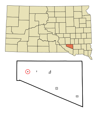
St. Charles or Saint Charles is a census-designated place (CDP) in Gregory County, South Dakota, United States. The population was 15 at the 2020 census.

<span class="mw-page-title-main">Kaylor, South Dakota</span> CDP in South Dakota, United States

Kaylor is a census-designated place (CDP) in Hutchinson County, South Dakota, United States. The population was 30 at the 2020 census.

<span class="mw-page-title-main">Milltown, South Dakota</span> CDP in South Dakota, United States

Milltown is a census-designated place (CDP) in Hutchinson County, South Dakota, United States. The population was 8 at the 2020 census.

<span class="mw-page-title-main">Okaton, South Dakota</span> CDP in South Dakota, United States

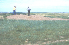
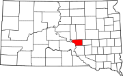
Okaton is a hamlet in Jones County, South Dakota, United States. As of the 2020 census, the population was 31. There are only a few homes there, no businesses or services.

<span class="mw-page-title-main">Ashland Heights, South Dakota</span> CDP in South Dakota, United States

Ashland Heights is a census-designated place (CDP) and unincorporated community in Pennington County, South Dakota, United States. The population was 678 at the 2020 census.

<span class="mw-page-title-main">Colonial Pine Hills, South Dakota</span> CDP in South Dakota, United States

Colonial Pine Hills is a census-designated place (CDP) and unincorporated community in Pennington County, South Dakota, United States. The population was 1,903 at the 2020 census.

<span class="mw-page-title-main">Green Valley, South Dakota</span> CDP in South Dakota, United States

Green Valley is a census-designated place (CDP) and unincorporated community in Pennington County, South Dakota, United States. The population was 1,051 at the 2020 census.

<span class="mw-page-title-main">Oglala, South Dakota</span> CDP in South Dakota, United States

Oglala is a census-designated place (CDP) in West Oglala Lakota Unorganized Territory equivalent, Oglala Lakota County, South Dakota, United States. The population was 1,282 at the 2020 census. Its location is in the northwest of the Pine Ridge Indian Reservation.

<span class="mw-page-title-main">Antelope, South Dakota</span> CDP in South Dakota, United States

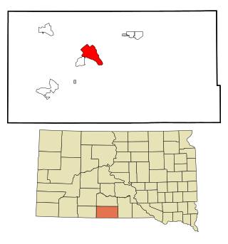
Antelope is a census-designated place (CDP) in Todd County, South Dakota, United States. The population was 830 at the 2020 census.

<span class="mw-page-title-main">Rosebud, South Dakota</span> CDP in South Dakota, United States

Rosebud also Sicanġu is a census-designated place (CDP) in Todd County, South Dakota, United States. The population was 1,455 at the 2020 census.

<span class="mw-page-title-main">White Horse, South Dakota</span> CDP in South Dakota, United States

White Horse also Šuŋgská oyáŋke is a census-designated place (CDP) in Todd County, South Dakota, United States. The population was 234 at the 2020 census.

References

  1. "SD Towns" (PDF). South Dakota State Historical Society. Archived from the original (PDF) on February 10, 2010. Retrieved February 12, 2010.
  2. "ArcGIS REST Services Directory". United States Census Bureau. Retrieved October 15, 2022.
  3. 1 2 U.S. Geological Survey Geographic Names Information System: Fort Thompson, South Dakota
  4. 1 2 "Census Population API". United States Census Bureau. Retrieved October 15, 2022.
  5. 1 2 "U.S. Census website". United States Census Bureau . Retrieved January 31, 2008.
  6. Federal Writers' Project (1940). South Dakota place-names, v.1-3. American guide series. University of South Dakota. p. 38.
  7. Peterson, Greg (September 20, 2007). ""Crushing Poverty" - Humanitarian Day at Fort Thompson, SD Sept. 30, 2007 helps poorest Si". portland independent media center. Archived from the original on January 24, 2021.
  8. Hetland, Cara (October 1, 2002). "South Dakota has nation's poorest county". Minnesota Public Radio. Archived from the original on December 6, 2022.
  9. "South Dakota has nation's poorest county" . Retrieved August 6, 2023.

Commons-logo.svg Media related to Fort Thompson, South Dakota at Wikimedia Commons